Quick filters:
Old map of turkey Stock Photos and Images
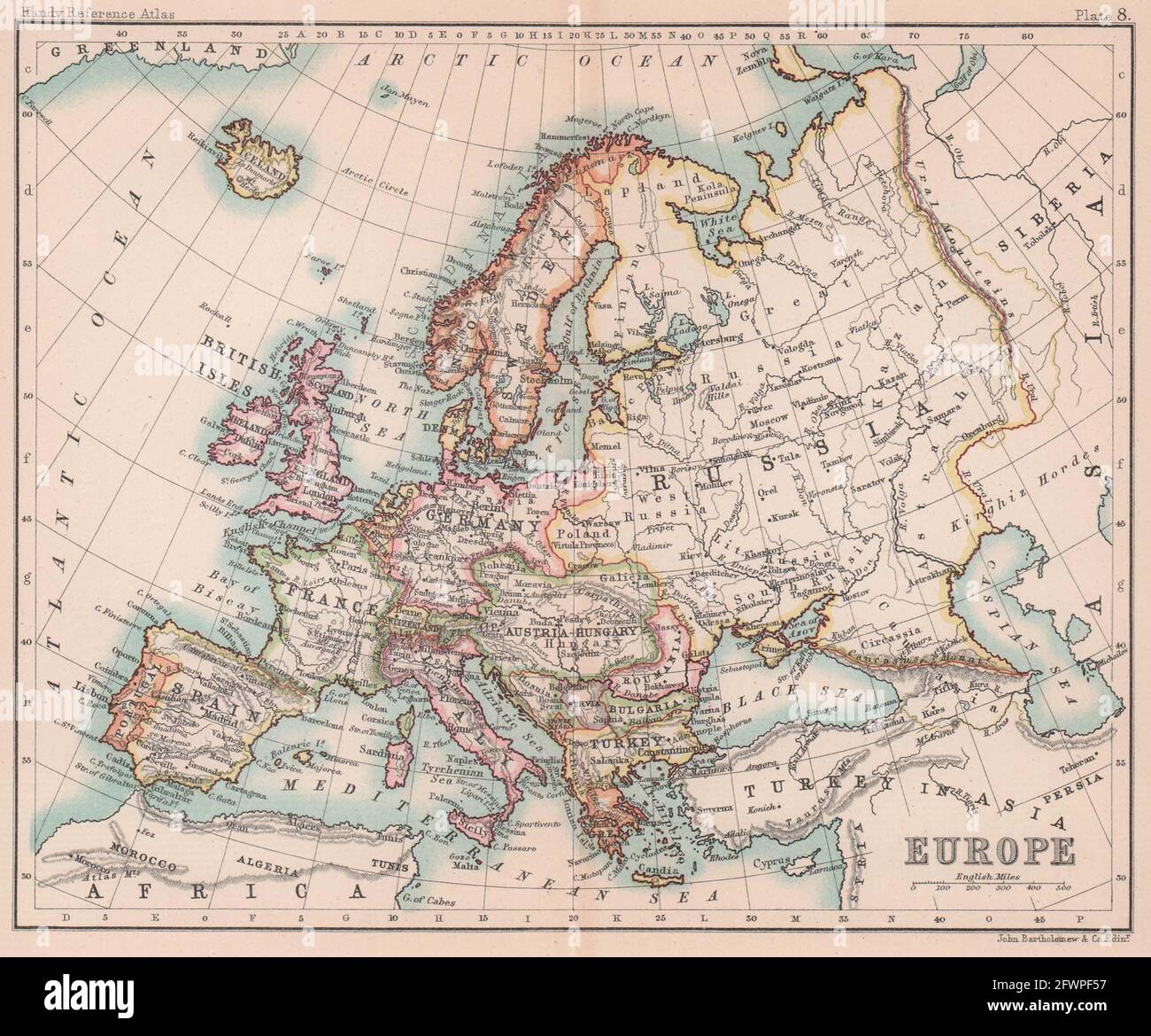 Europe political. Austria-Hungary. Turkey in Europe. BARTHOLOMEW 1893 old map Stock Photohttps://www.alamy.com/image-license-details/?v=1https://www.alamy.com/europe-political-austria-hungary-turkey-in-europe-bartholomew-1893-old-map-image428910083.html
RF2FWPF57–Europe political. Austria-Hungary. Turkey in Europe. BARTHOLOMEW 1893 old map
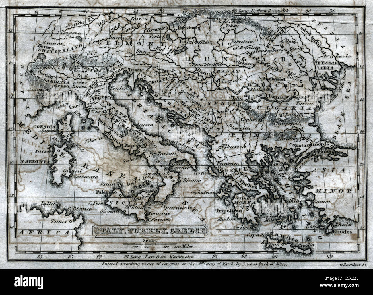 Italy, Turkey, Greece - Antiquarian Black and White Map from 'The Second Book of History' Stock Photohttps://www.alamy.com/image-license-details/?v=1https://www.alamy.com/stock-photo-italy-turkey-greece-antiquarian-black-and-white-map-from-the-second-38066397.html
RFC5X225–Italy, Turkey, Greece - Antiquarian Black and White Map from 'The Second Book of History'
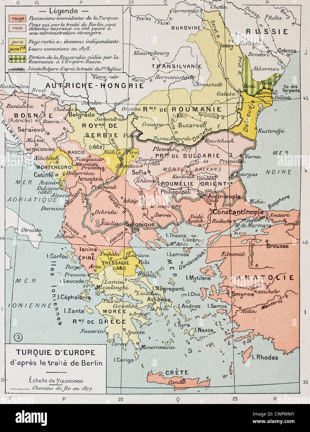 European Turkey after Treaty of Berlin (1878) old map Stock Photohttps://www.alamy.com/image-license-details/?v=1https://www.alamy.com/stock-photo-european-turkey-after-treaty-of-berlin-1878-old-map-50290267.html
RFCWPWMY–European Turkey after Treaty of Berlin (1878) old map
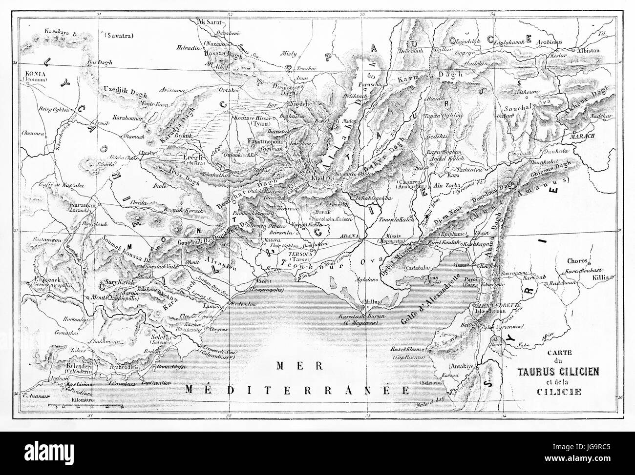 Old map of Cilicia and Taurus mountains region, Turkey. Created by Vullemin, Erhard and Bonaparte, published on Le Tour du Monde, Paris, 1861 Stock Photohttps://www.alamy.com/image-license-details/?v=1https://www.alamy.com/stock-photo-old-map-of-cilicia-and-taurus-mountains-region-turkey-created-by-vullemin-147733381.html
RFJG9RC5–Old map of Cilicia and Taurus mountains region, Turkey. Created by Vullemin, Erhard and Bonaparte, published on Le Tour du Monde, Paris, 1861
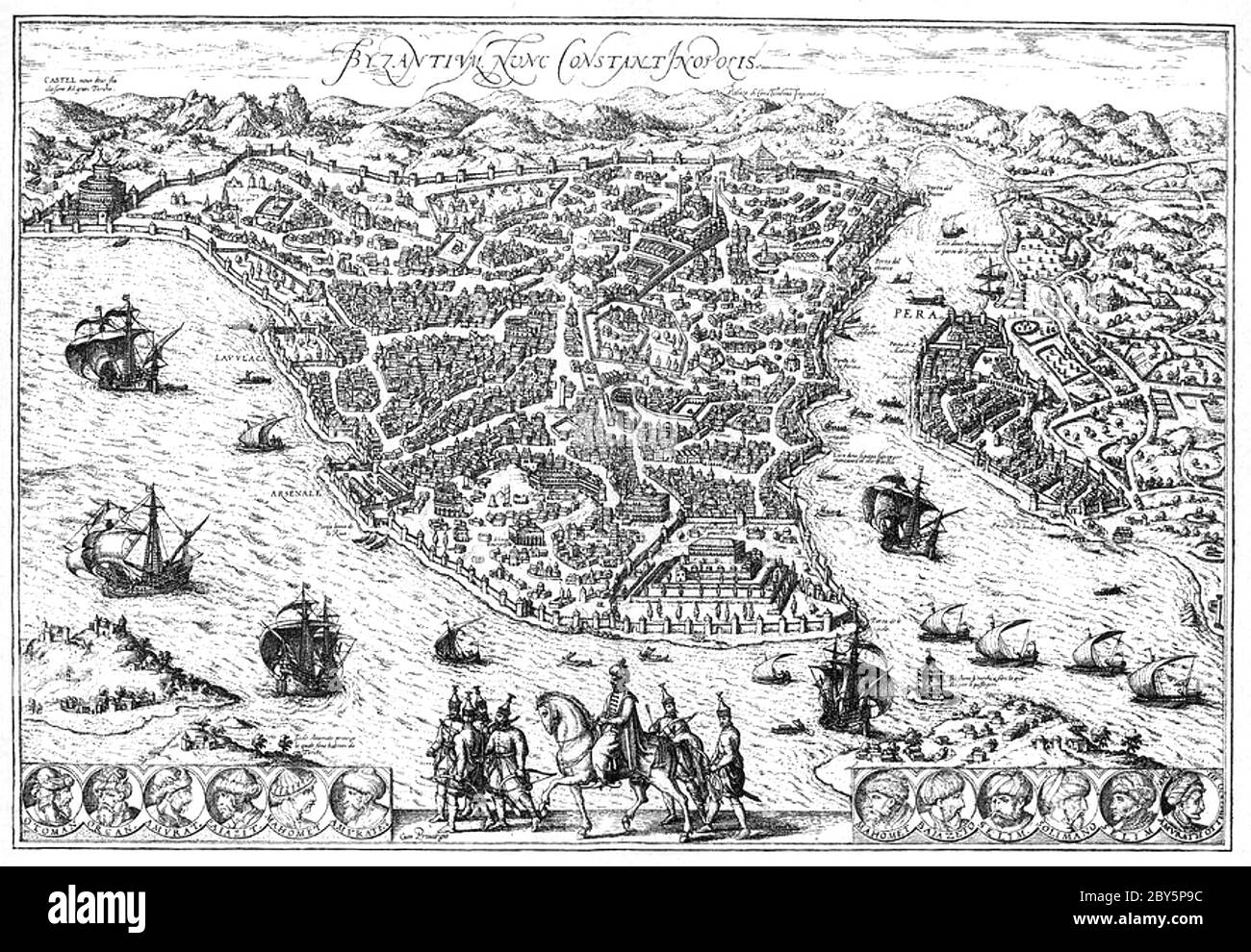 ISTANBUL (Constantinople) in a 1576 map Stock Photohttps://www.alamy.com/image-license-details/?v=1https://www.alamy.com/istanbul-constantinople-in-a-1576-map-image360930344.html
RM2BY5P9C–ISTANBUL (Constantinople) in a 1576 map
 Turkey map in old green paper isolated on white background. Stock Photohttps://www.alamy.com/image-license-details/?v=1https://www.alamy.com/stock-photo-turkey-map-in-old-green-paper-isolated-on-white-background-49088569.html
RMCRT4Y5–Turkey map in old green paper isolated on white background.
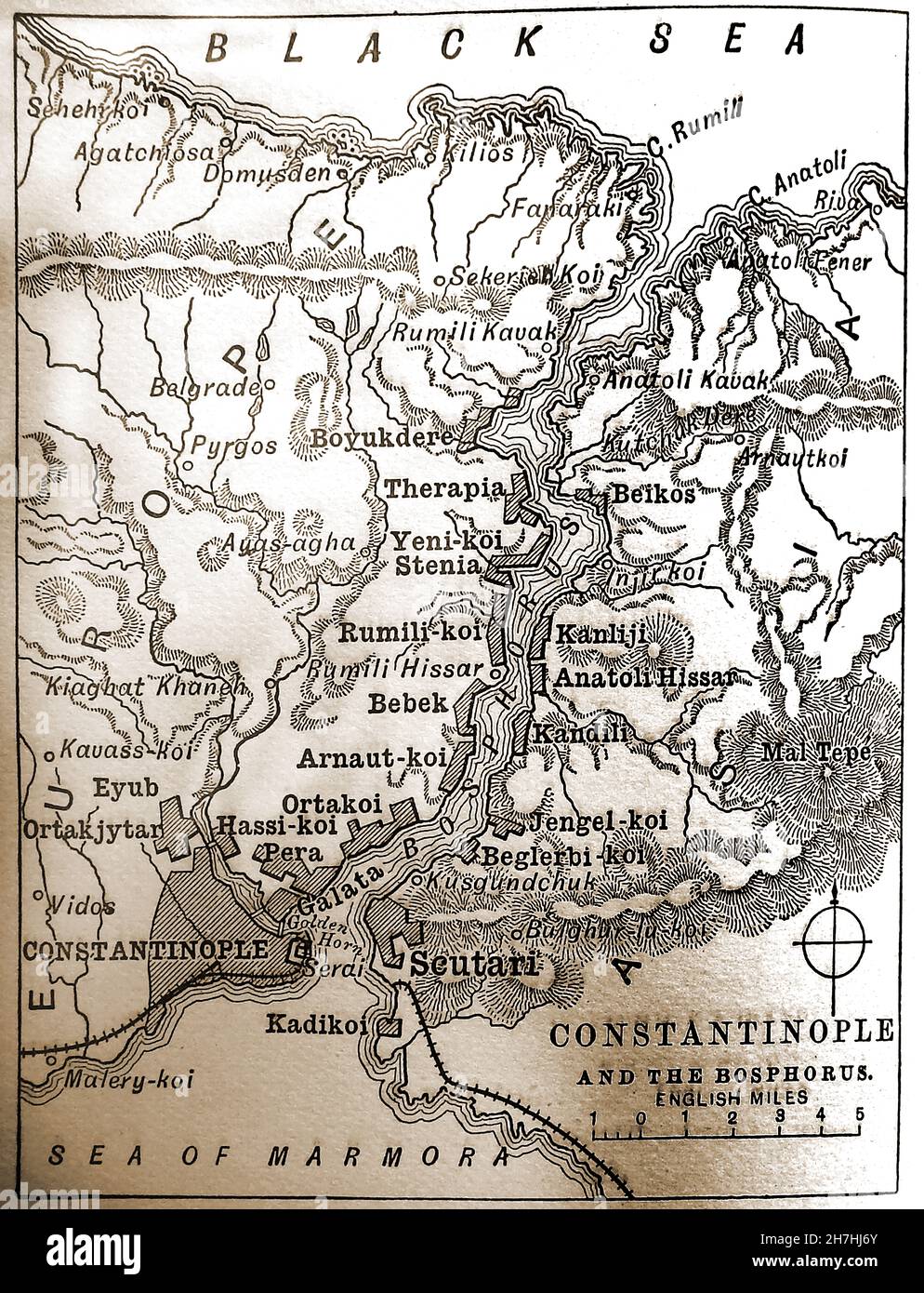 1896 map of Constantinople (Istanbul) & the Bosphorus Stock Photohttps://www.alamy.com/image-license-details/?v=1https://www.alamy.com/1896-map-of-constantinople-istanbul-the-bosphorus-image452159651.html
RM2H7HJ6Y–1896 map of Constantinople (Istanbul) & the Bosphorus
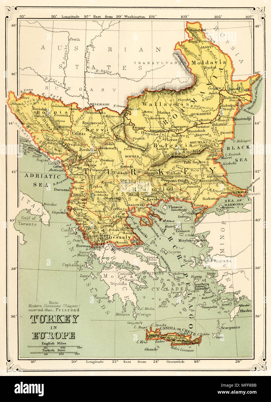 Map of Turkey in Europe, 1870s. Printed color lithograph Stock Photohttps://www.alamy.com/image-license-details/?v=1https://www.alamy.com/map-of-turkey-in-europe-1870s-printed-color-lithograph-image181659391.html
RMMFF8BB–Map of Turkey in Europe, 1870s. Printed color lithograph
 Old map of Anatolia, Turkey. Old XIX century engraved from Le Tour du Monde 1864 Stock Photohttps://www.alamy.com/image-license-details/?v=1https://www.alamy.com/old-map-of-anatolia-turkey-old-xix-century-engraved-from-le-tour-du-monde-1864-image382086169.html
RM2D5HEPH–Old map of Anatolia, Turkey. Old XIX century engraved from Le Tour du Monde 1864
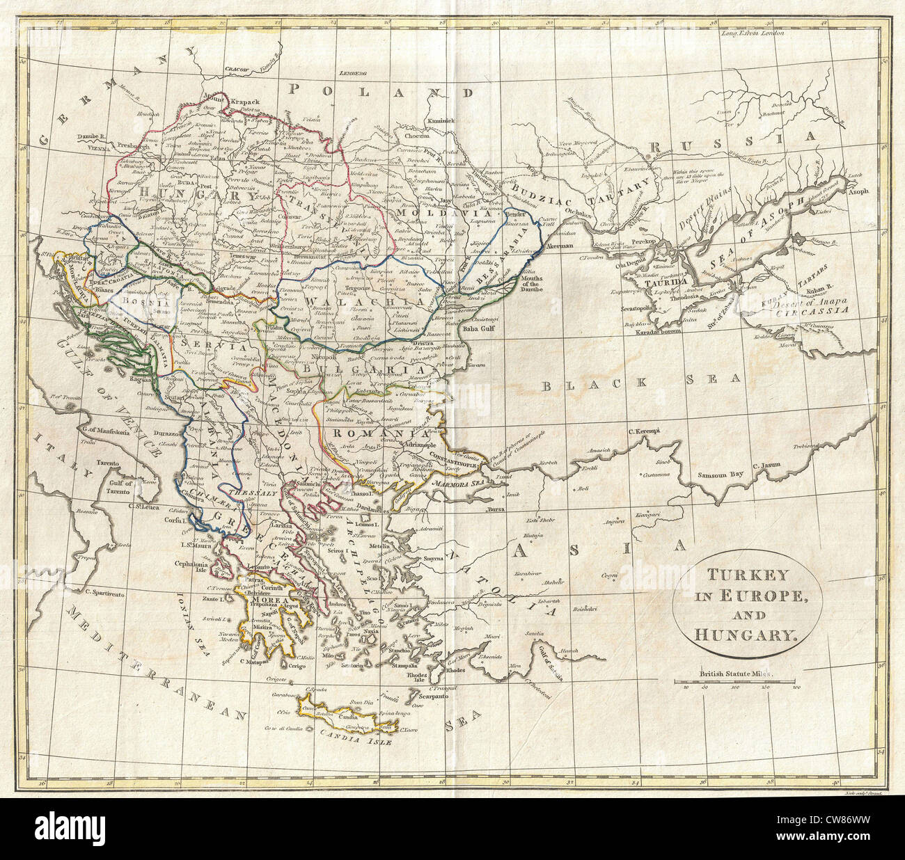 1799 Clement Cruttwell Map of Turkey in Europe Stock Photohttps://www.alamy.com/image-license-details/?v=1https://www.alamy.com/stock-photo-1799-clement-cruttwell-map-of-turkey-in-europe-49968181.html
RMCW86WW–1799 Clement Cruttwell Map of Turkey in Europe
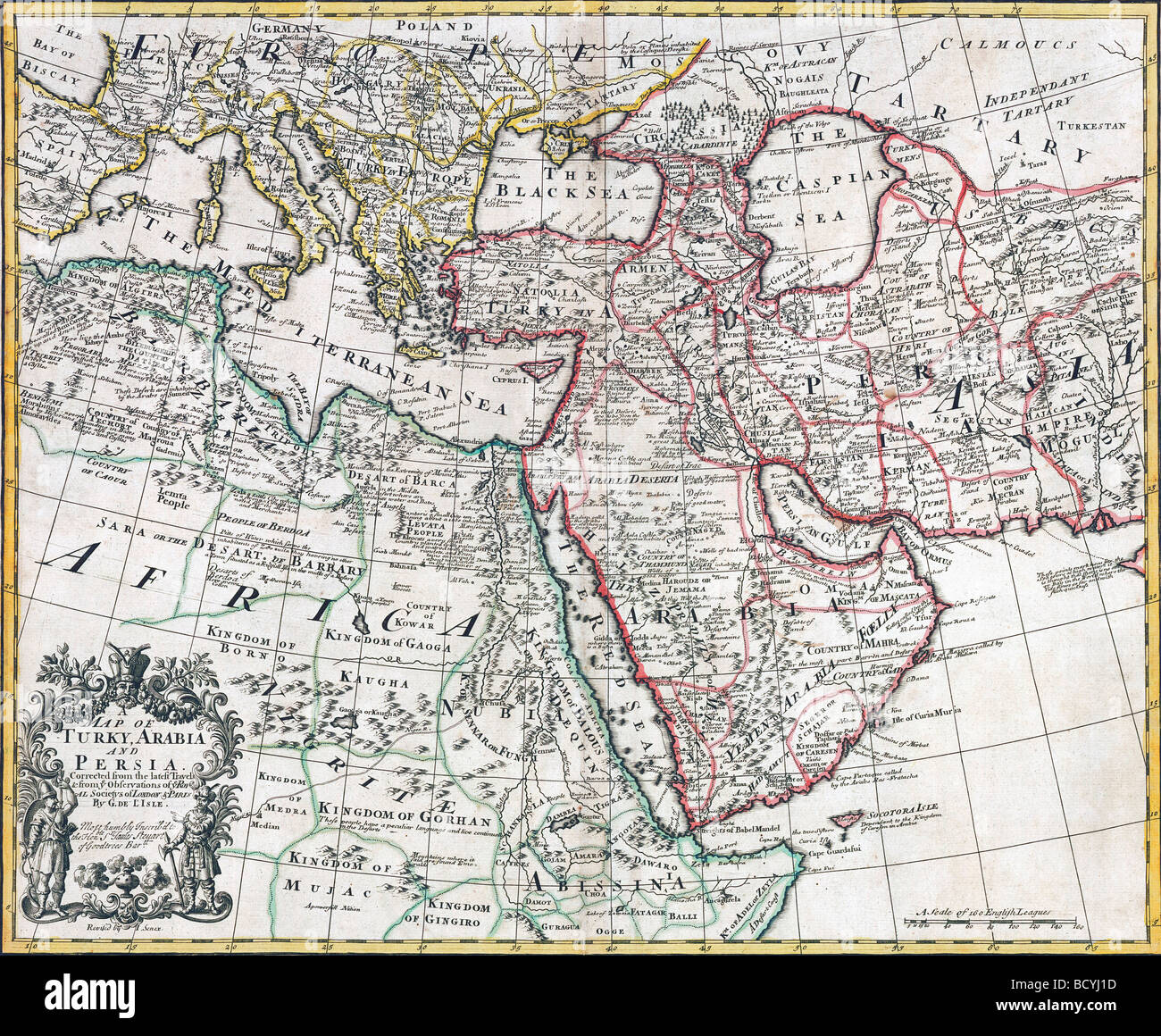 Map of Turkey, Arabia and Persia, 1721. Stock Photohttps://www.alamy.com/image-license-details/?v=1https://www.alamy.com/stock-photo-map-of-turkey-arabia-and-persia-1721-25193097.html
RMBCYJ1D–Map of Turkey, Arabia and Persia, 1721.
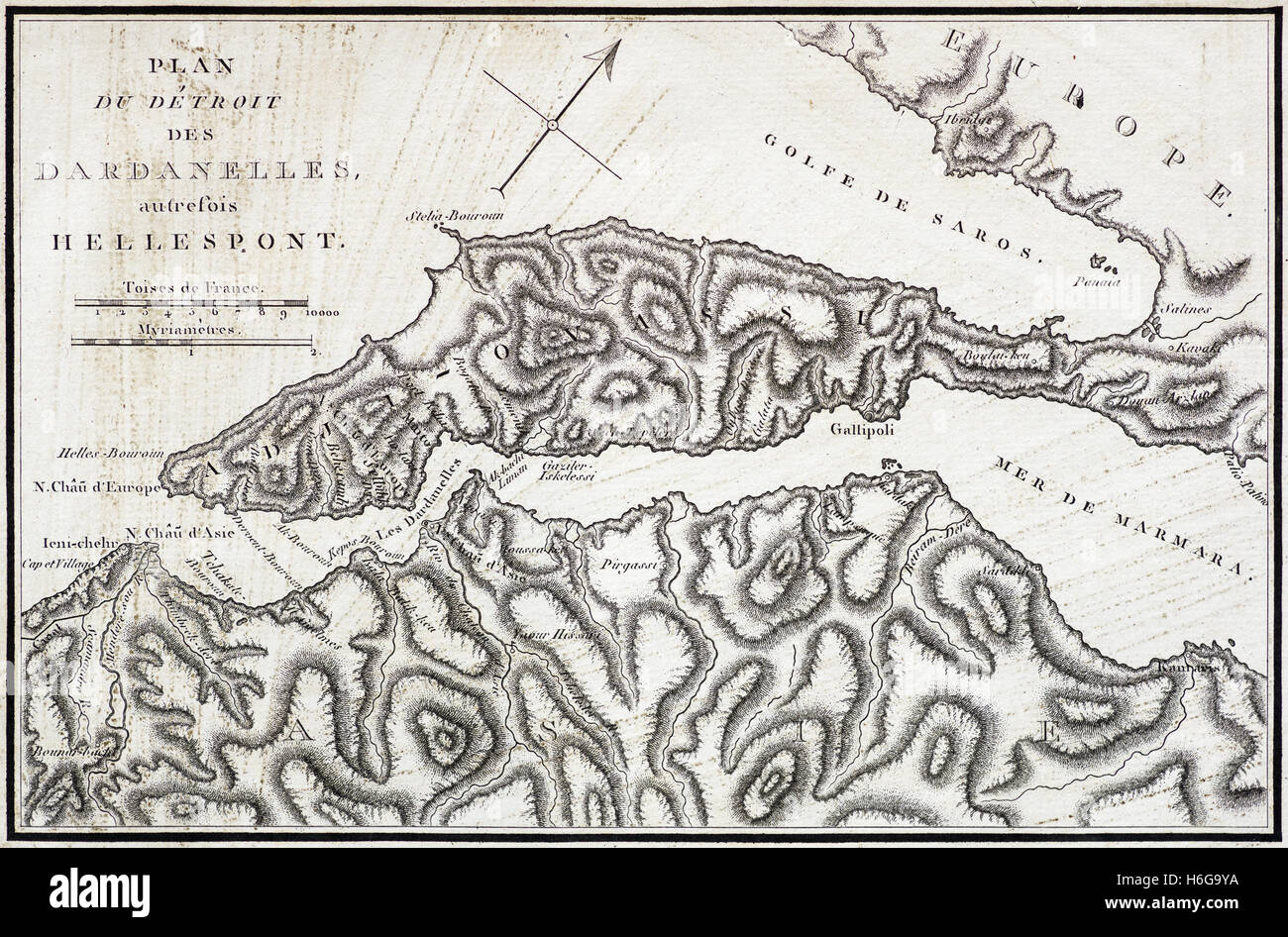 vintage French map of the Dardanelles and Hellespont from an 1802 book Stock Photohttps://www.alamy.com/image-license-details/?v=1https://www.alamy.com/stock-photo-vintage-french-map-of-the-dardanelles-and-hellespont-from-an-1802-124519566.html
RFH6G9YA–vintage French map of the Dardanelles and Hellespont from an 1802 book
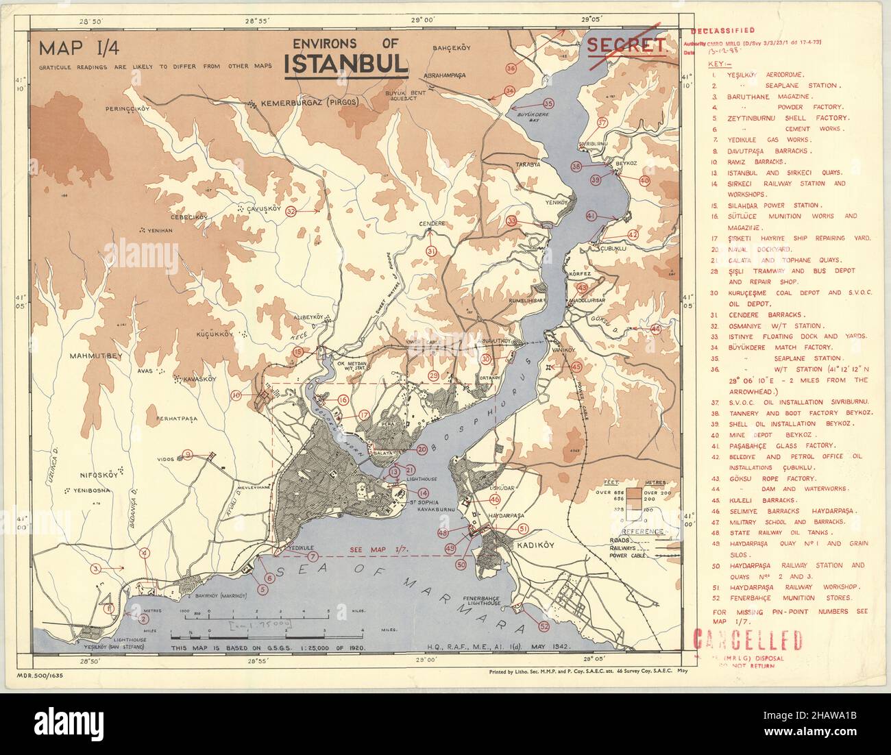 Constantinople Map, Map of Constantinople, Old Constantinople Map, Retro Constantinople Map, Vintage Constantinople Map, Old Istanbul Map, Turkey Map Stock Photohttps://www.alamy.com/image-license-details/?v=1https://www.alamy.com/constantinople-map-map-of-constantinople-old-constantinople-map-retro-constantinople-map-vintage-constantinople-map-old-istanbul-map-turkey-map-image454172807.html
RF2HAWA1B–Constantinople Map, Map of Constantinople, Old Constantinople Map, Retro Constantinople Map, Vintage Constantinople Map, Old Istanbul Map, Turkey Map
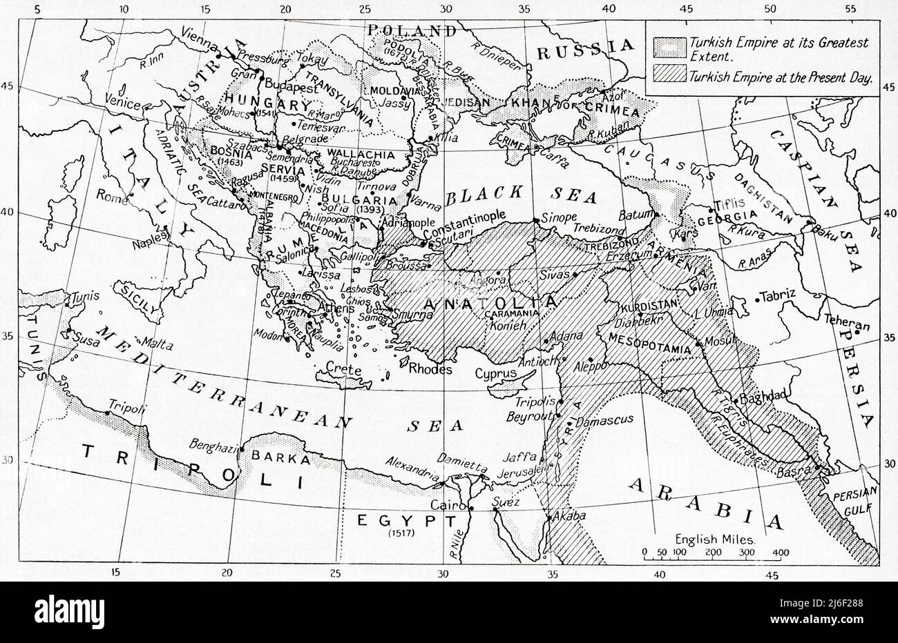 Map of Turkey at the outbreak of WWI. Stock Photohttps://www.alamy.com/image-license-details/?v=1https://www.alamy.com/map-of-turkey-at-the-outbreak-of-wwi-image468698952.html
RM2J6F288–Map of Turkey at the outbreak of WWI.
 A beautiful woodcut from 1493 of the town of Nicea (now Iznik) in Turkey. This illustration comes from the Nuremberg Chronicle, which is an enyclodpedia of world events, mythology and christian history. This extra-ordinary work was one of the earliest books ever printed and the first to successfully integrate text and images. Stock Photohttps://www.alamy.com/image-license-details/?v=1https://www.alamy.com/a-beautiful-woodcut-from-1493-of-the-town-of-nicea-now-iznik-in-turkey-this-illustration-comes-from-the-nuremberg-chronicle-which-is-an-enyclodpedia-of-world-events-mythology-and-christian-history-this-extra-ordinary-work-was-one-of-the-earliest-books-ever-printed-and-the-first-to-successfully-integrate-text-and-images-image598932343.html
RM2WPBM8R–A beautiful woodcut from 1493 of the town of Nicea (now Iznik) in Turkey. This illustration comes from the Nuremberg Chronicle, which is an enyclodpedia of world events, mythology and christian history. This extra-ordinary work was one of the earliest books ever printed and the first to successfully integrate text and images.
 Beautiful vintage hand drawn map illustrations of Turkey from old book. Can be used as poster or decorative element for interior design. Stock Photohttps://www.alamy.com/image-license-details/?v=1https://www.alamy.com/beautiful-vintage-hand-drawn-map-illustrations-of-turkey-from-old-book-can-be-used-as-poster-or-decorative-element-for-interior-design-image244439272.html
RFT5K4P0–Beautiful vintage hand drawn map illustrations of Turkey from old book. Can be used as poster or decorative element for interior design.
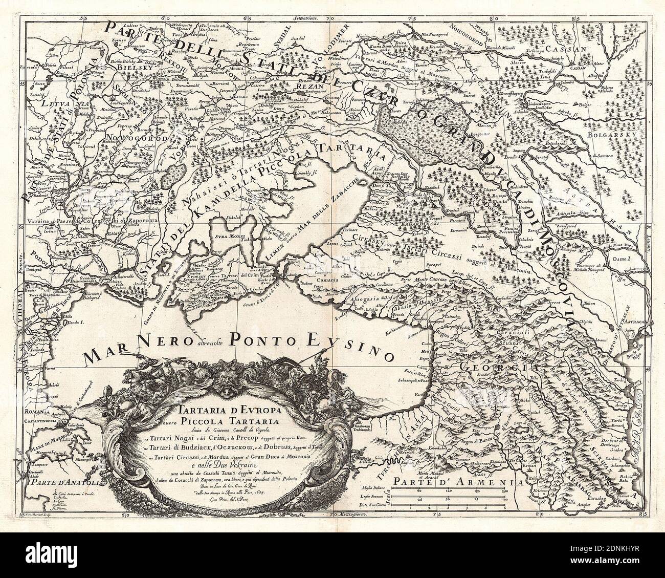 Map of the Eastern part of Europe (Ukraine, Crimea, Caucasus, Russia). 'Tartaria d Evropa ouero Piccola Tartaria'. Map of 1684. Stock Photohttps://www.alamy.com/image-license-details/?v=1https://www.alamy.com/map-of-the-eastern-part-of-europe-ukraine-crimea-caucasus-russia-tartaria-d-evropa-ouero-piccola-tartaria-map-of-1684-image391967067.html
RM2DNKHYR–Map of the Eastern part of Europe (Ukraine, Crimea, Caucasus, Russia). 'Tartaria d Evropa ouero Piccola Tartaria'. Map of 1684.
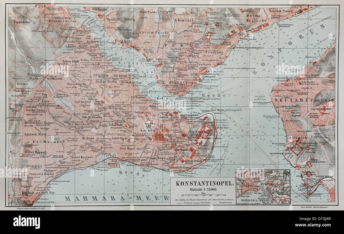 Vintage map of Constantinople (today Istanbul) at the end of 19th century Stock Photohttps://www.alamy.com/image-license-details/?v=1https://www.alamy.com/stock-photo-vintage-map-of-constantinople-today-istanbul-at-the-end-of-19th-century-52260175.html
RFD10JAR–Vintage map of Constantinople (today Istanbul) at the end of 19th century
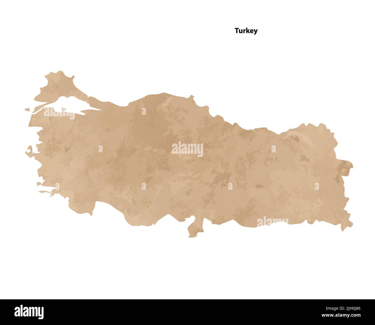 Old vintage paper textured map of Turkey Country - Vector illustration Stock Vectorhttps://www.alamy.com/image-license-details/?v=1https://www.alamy.com/old-vintage-paper-textured-map-of-turkey-country-vector-illustration-image475143430.html
RF2JH0J86–Old vintage paper textured map of Turkey Country - Vector illustration
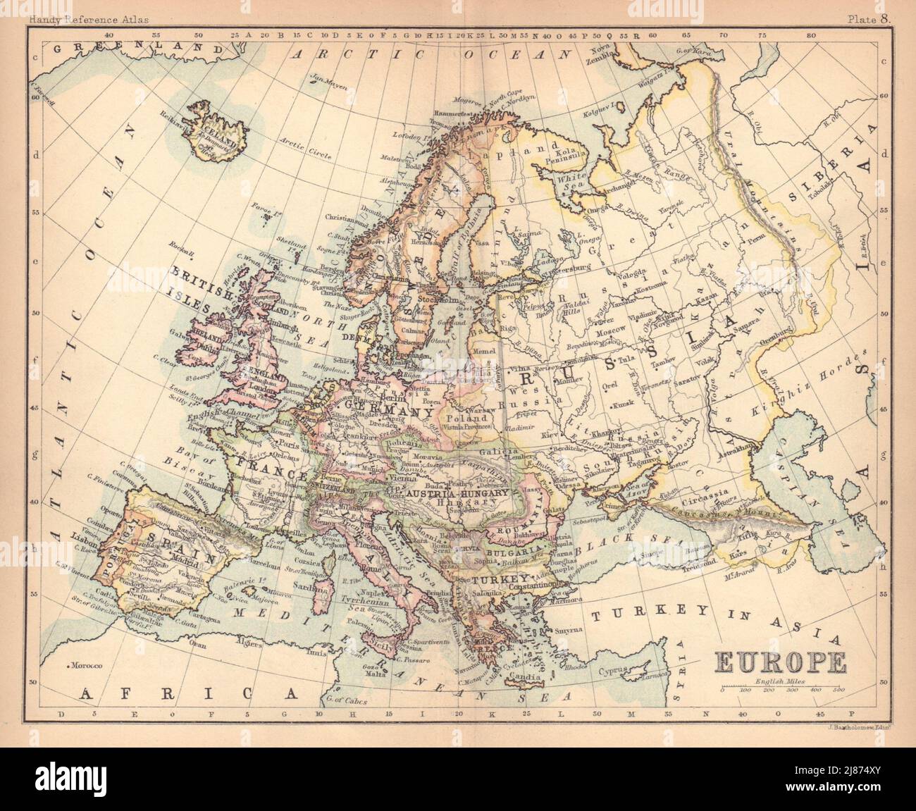 Europe political. Austria-Hungary. Turkey in Europe. BARTHOLOMEW 1888 old map Stock Photohttps://www.alamy.com/image-license-details/?v=1https://www.alamy.com/europe-political-austria-hungary-turkey-in-europe-bartholomew-1888-old-map-image469754739.html
RF2J874XY–Europe political. Austria-Hungary. Turkey in Europe. BARTHOLOMEW 1888 old map
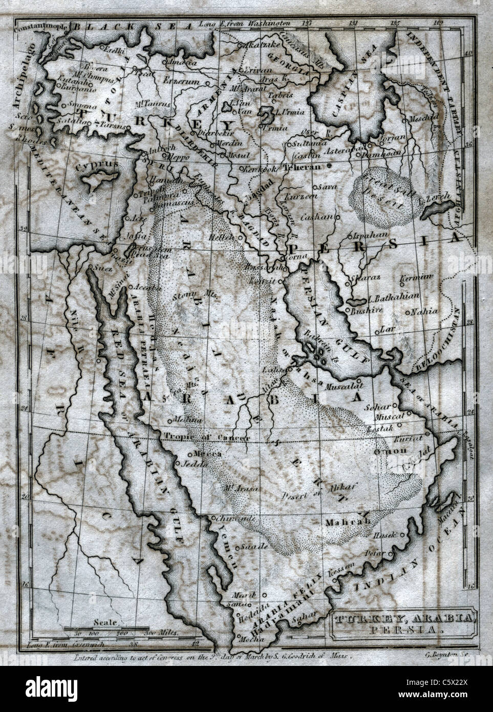 Turkey, Arabia, Persia - Antiquarian Black and White Map from 'The Second Book of History' Stock Photohttps://www.alamy.com/image-license-details/?v=1https://www.alamy.com/stock-photo-turkey-arabia-persia-antiquarian-black-and-white-map-from-the-second-38066418.html
RFC5X22X–Turkey, Arabia, Persia - Antiquarian Black and White Map from 'The Second Book of History'
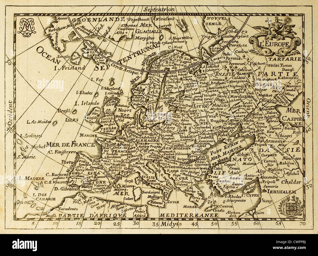 Old map of Europe Stock Photohttps://www.alamy.com/image-license-details/?v=1https://www.alamy.com/stock-photo-old-map-of-europe-50287654.html
RFCWPPBJ–Old map of Europe
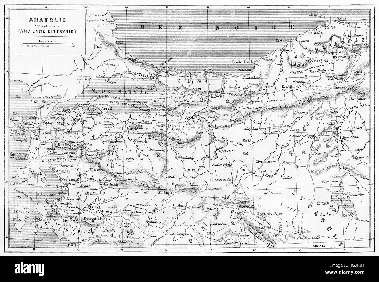 Anatolia old map. Created by Vuillemin, Erhard and Bonaparte, published on Le Tour du Monde, Paris, 1861 Stock Photohttps://www.alamy.com/image-license-details/?v=1https://www.alamy.com/stock-photo-anatolia-old-map-created-by-vuillemin-erhard-and-bonaparte-published-147733288.html
RFJG9R8T–Anatolia old map. Created by Vuillemin, Erhard and Bonaparte, published on Le Tour du Monde, Paris, 1861
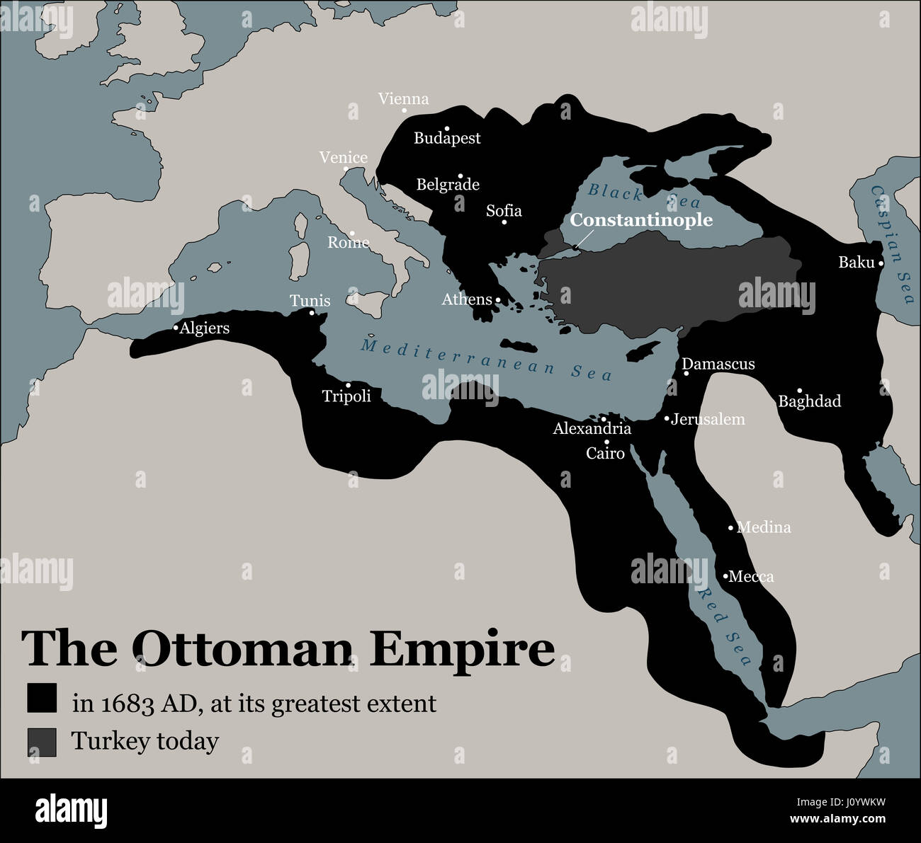 Turkey today and the Ottoman Empire at its greatest extent in 1683 - history map of its territory expansion and military acquisition. Stock Photohttps://www.alamy.com/image-license-details/?v=1https://www.alamy.com/stock-photo-turkey-today-and-the-ottoman-empire-at-its-greatest-extent-in-1683-138295805.html
RFJ0YWKW–Turkey today and the Ottoman Empire at its greatest extent in 1683 - history map of its territory expansion and military acquisition.
 Old green map of Turkey in textured green paper, isolated on white background. Stock Photohttps://www.alamy.com/image-license-details/?v=1https://www.alamy.com/stock-photo-old-green-map-of-turkey-in-textured-green-paper-isolated-on-white-48611538.html
RMCR2CEA–Old green map of Turkey in textured green paper, isolated on white background.
 1794, d'Anville Map of Turkey, Iraq and Palestine Stock Photohttps://www.alamy.com/image-license-details/?v=1https://www.alamy.com/stock-image-1794-danville-map-of-turkey-iraq-and-palestine-162567961.html
RMKCDH2H–1794, d'Anville Map of Turkey, Iraq and Palestine
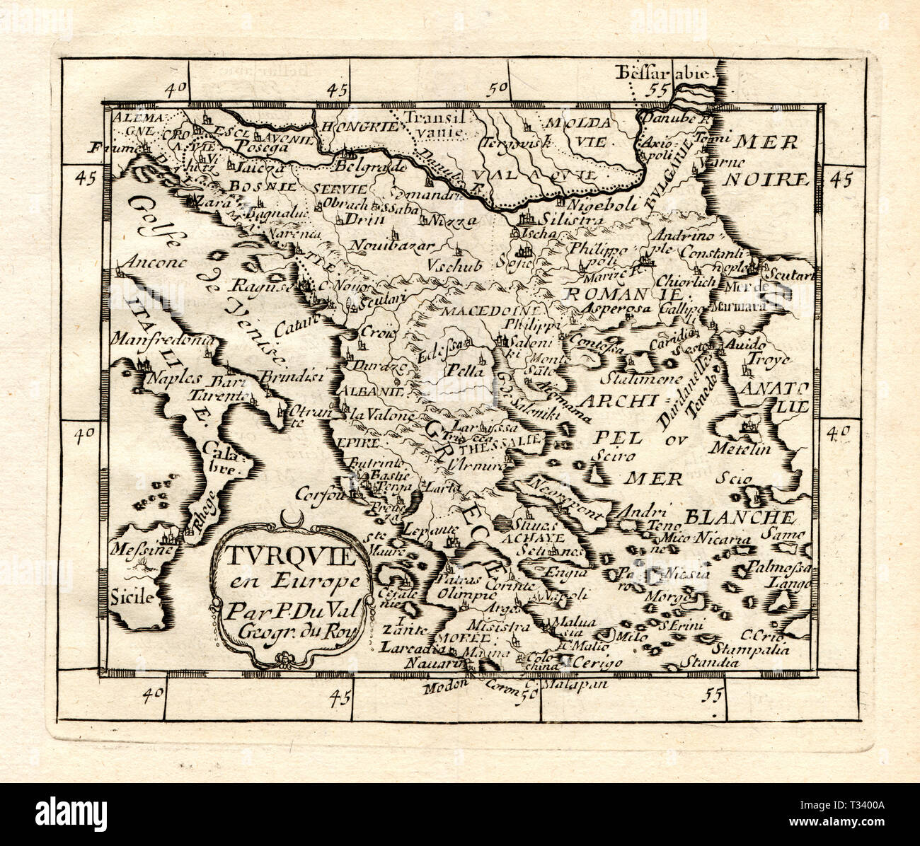 Antique Map of Turkey in Europe, Greece, Macedonia, Romania, Italy, Bosnia and Serbia by Pierre Duval, published in Paris, 1682 Stock Photohttps://www.alamy.com/image-license-details/?v=1https://www.alamy.com/antique-map-of-turkey-in-europe-greece-macedonia-romania-italy-bosnia-and-serbia-by-pierre-duval-published-in-paris-1682-image242876938.html
RFT3400A–Antique Map of Turkey in Europe, Greece, Macedonia, Romania, Italy, Bosnia and Serbia by Pierre Duval, published in Paris, 1682
![Original title: Map of Persia, Turkey in Asia, Afghanistan, Beloochistan ; Palestine, or the Holy Land [inset]. Map shows political borders and important landmarks. This is a beautifully detailed historic, enhanced reproduction of a 1863 map. It is framed by a floral border. Insert map shows the 'Holy Land.' Stock Photo Original title: Map of Persia, Turkey in Asia, Afghanistan, Beloochistan ; Palestine, or the Holy Land [inset]. Map shows political borders and important landmarks. This is a beautifully detailed historic, enhanced reproduction of a 1863 map. It is framed by a floral border. Insert map shows the 'Holy Land.' Stock Photo](https://c8.alamy.com/comp/2FNWCC0/original-title-map-of-persia-turkey-in-asia-afghanistan-beloochistan-palestine-or-the-holy-land-inset-map-shows-political-borders-and-important-landmarks-this-is-a-beautifully-detailed-historic-enhanced-reproduction-of-a-1863-map-it-is-framed-by-a-floral-border-insert-map-shows-the-holy-land-2FNWCC0.jpg) Original title: Map of Persia, Turkey in Asia, Afghanistan, Beloochistan ; Palestine, or the Holy Land [inset]. Map shows political borders and important landmarks. This is a beautifully detailed historic, enhanced reproduction of a 1863 map. It is framed by a floral border. Insert map shows the 'Holy Land.' Stock Photohttps://www.alamy.com/image-license-details/?v=1https://www.alamy.com/original-title-map-of-persia-turkey-in-asia-afghanistan-beloochistan-palestine-or-the-holy-land-inset-map-shows-political-borders-and-important-landmarks-this-is-a-beautifully-detailed-historic-enhanced-reproduction-of-a-1863-map-it-is-framed-by-a-floral-border-insert-map-shows-the-holy-land-image426515152.html
Original title: Map of Persia, Turkey in Asia, Afghanistan, Beloochistan ; Palestine, or the Holy Land [inset]. Map shows political borders and important landmarks. This is a beautifully detailed historic, enhanced reproduction of a 1863 map. It is framed by a floral border. Insert map shows the 'Holy Land.' Stock Photohttps://www.alamy.com/image-license-details/?v=1https://www.alamy.com/original-title-map-of-persia-turkey-in-asia-afghanistan-beloochistan-palestine-or-the-holy-land-inset-map-shows-political-borders-and-important-landmarks-this-is-a-beautifully-detailed-historic-enhanced-reproduction-of-a-1863-map-it-is-framed-by-a-floral-border-insert-map-shows-the-holy-land-image426515152.htmlRF2FNWCC0–Original title: Map of Persia, Turkey in Asia, Afghanistan, Beloochistan ; Palestine, or the Holy Land [inset]. Map shows political borders and important landmarks. This is a beautifully detailed historic, enhanced reproduction of a 1863 map. It is framed by a floral border. Insert map shows the 'Holy Land.'
 1866 Mitchell Map of Persia, Turkey and Afghanistan (Iran, Iraq) Stock Photohttps://www.alamy.com/image-license-details/?v=1https://www.alamy.com/stock-photo-1866-mitchell-map-of-persia-turkey-and-afghanistan-iran-iraq-49967216.html
RMCW85KC–1866 Mitchell Map of Persia, Turkey and Afghanistan (Iran, Iraq)
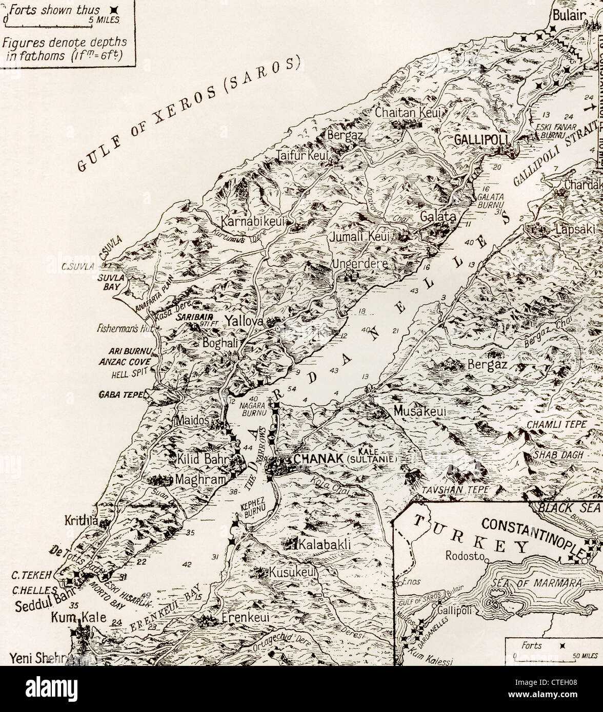 Map of The Dardanelles and Gallipoli, Turkey, 1916. From The Year 1916 Illustrated. Stock Photohttps://www.alamy.com/image-license-details/?v=1https://www.alamy.com/stock-photo-map-of-the-dardanelles-and-gallipoli-turkey-1916-from-the-year-1916-49493144.html
RMCTEH08–Map of The Dardanelles and Gallipoli, Turkey, 1916. From The Year 1916 Illustrated.
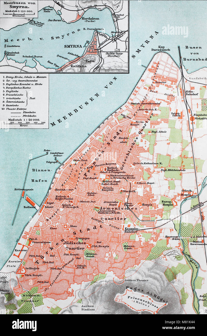 city map from the year 1892: Smyrna, now Izmir, Turkey, digital improved reproduction of an original print from the year 1895 Stock Photohttps://www.alamy.com/image-license-details/?v=1https://www.alamy.com/stock-photo-city-map-from-the-year-1892-smyrna-now-izmir-turkey-digital-improved-177057892.html
RFM81K44–city map from the year 1892: Smyrna, now Izmir, Turkey, digital improved reproduction of an original print from the year 1895
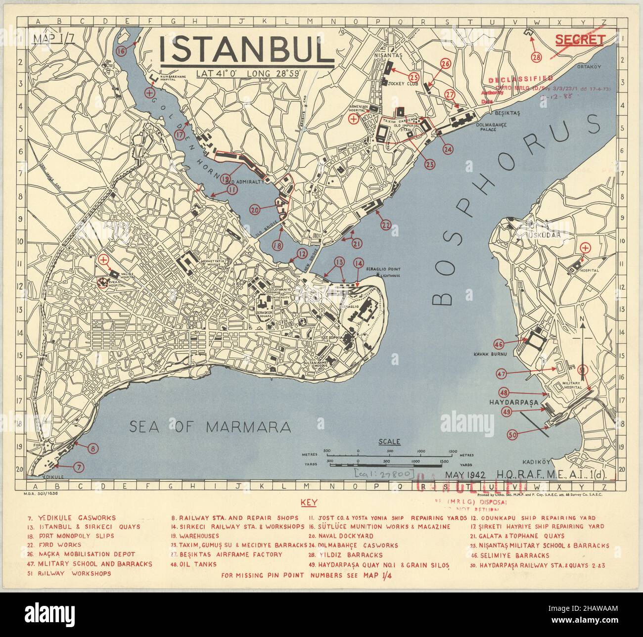 Constantinople Map, Map of Constantinople, Old Constantinople Map, Retro Constantinople Map, Vintage Constantinople Map, Old Istanbul Map, Turkey Map Stock Photohttps://www.alamy.com/image-license-details/?v=1https://www.alamy.com/constantinople-map-map-of-constantinople-old-constantinople-map-retro-constantinople-map-vintage-constantinople-map-old-istanbul-map-turkey-map-image454173068.html
RF2HAWAAM–Constantinople Map, Map of Constantinople, Old Constantinople Map, Retro Constantinople Map, Vintage Constantinople Map, Old Istanbul Map, Turkey Map
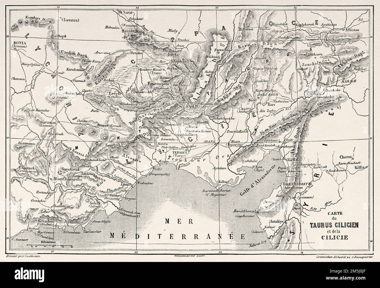 Old map of Cilician Taurus and Cilicia, southern Anatolia, Turkey. Voyage in Cilicia and Taurus Mountains in 1852-1853 by Victor Langlois Stock Photohttps://www.alamy.com/image-license-details/?v=1https://www.alamy.com/old-map-of-cilician-taurus-and-cilicia-southern-anatolia-turkey-voyage-in-cilicia-and-taurus-mountains-in-1852-1853-by-victor-langlois-image502569607.html
RM2M5J0JF–Old map of Cilician Taurus and Cilicia, southern Anatolia, Turkey. Voyage in Cilicia and Taurus Mountains in 1852-1853 by Victor Langlois
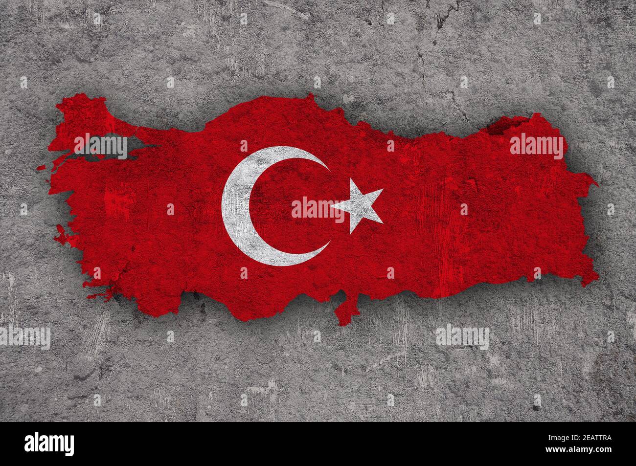 Map and flag of Turkey on weathered concrete Stock Photohttps://www.alamy.com/image-license-details/?v=1https://www.alamy.com/map-and-flag-of-turkey-on-weathered-concrete-image402531342.html
RF2EATTRA–Map and flag of Turkey on weathered concrete
 Beautiful vintage hand drawn map illustrations of Persia and Turkey from old book. Can be used as poster or decorative element for interior design. Stock Photohttps://www.alamy.com/image-license-details/?v=1https://www.alamy.com/beautiful-vintage-hand-drawn-map-illustrations-of-persia-and-turkey-from-old-book-can-be-used-as-poster-or-decorative-element-for-interior-design-image244249163.html
RFT5AE8B–Beautiful vintage hand drawn map illustrations of Persia and Turkey from old book. Can be used as poster or decorative element for interior design.
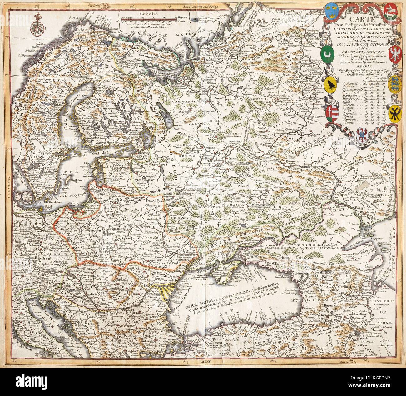 Map For Intelligence Affairs Presents The Turks, Tartars, Hungarians, Poles, the Swedes and Muscovites In Surroundings Of The Black Sea and Baltic Sea. Nicolas De Fer (Paris, 1737) Stock Photohttps://www.alamy.com/image-license-details/?v=1https://www.alamy.com/map-for-intelligence-affairs-presents-the-turks-tartars-hungarians-poles-the-swedes-and-muscovites-in-surroundings-of-the-black-sea-and-baltic-sea-nicolas-de-fer-paris-1737-image234065358.html
RMRGPGN2–Map For Intelligence Affairs Presents The Turks, Tartars, Hungarians, Poles, the Swedes and Muscovites In Surroundings Of The Black Sea and Baltic Sea. Nicolas De Fer (Paris, 1737)
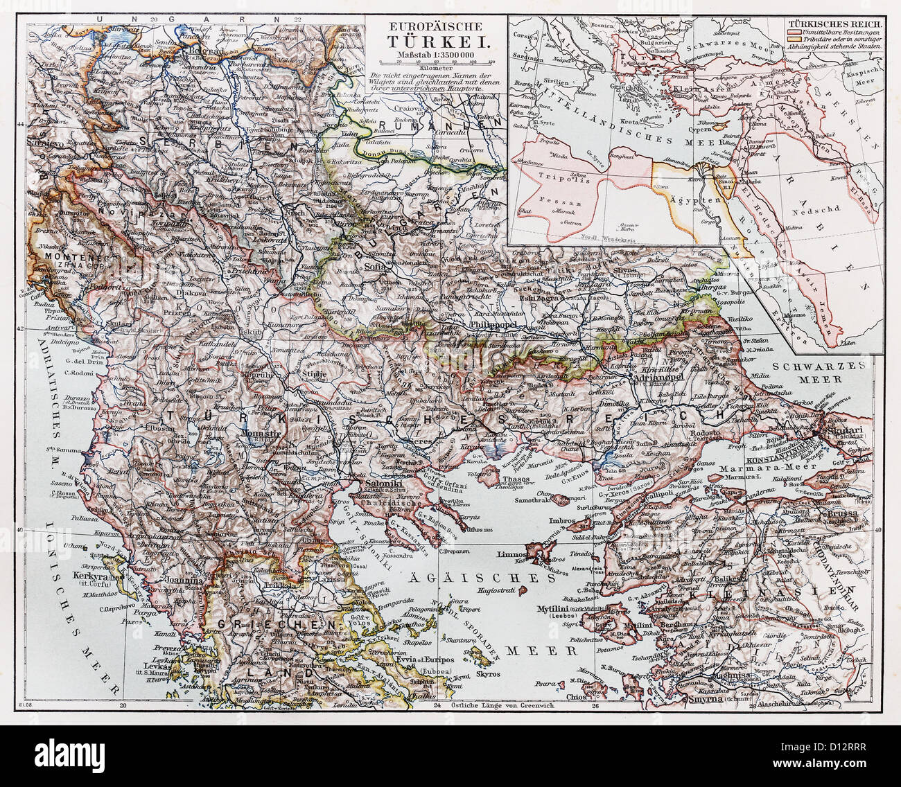 Vintage map of European part of Turkey at the end of 19th century Stock Photohttps://www.alamy.com/image-license-details/?v=1https://www.alamy.com/stock-photo-vintage-map-of-european-part-of-turkey-at-the-end-of-19th-century-52308363.html
RFD12RRR–Vintage map of European part of Turkey at the end of 19th century
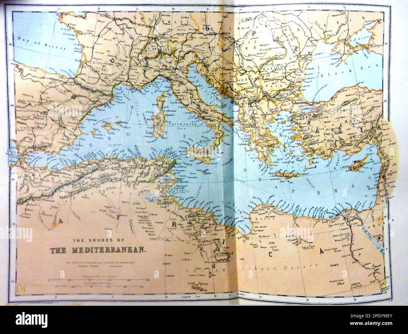 A late 19th century coloured map of the Mediterranean region. Stock Photohttps://www.alamy.com/image-license-details/?v=1https://www.alamy.com/a-late-19th-century-coloured-map-of-the-mediterranean-region-image542124659.html
RM2PDYWEY–A late 19th century coloured map of the Mediterranean region.
 Balkan Peninsula. Greece Turkey in Europe Roumania. BARTHOLOMEW 1893 old map Stock Photohttps://www.alamy.com/image-license-details/?v=1https://www.alamy.com/balkan-peninsula-greece-turkey-in-europe-roumania-bartholomew-1893-old-map-image428910058.html
RF2FWPF4A–Balkan Peninsula. Greece Turkey in Europe Roumania. BARTHOLOMEW 1893 old map
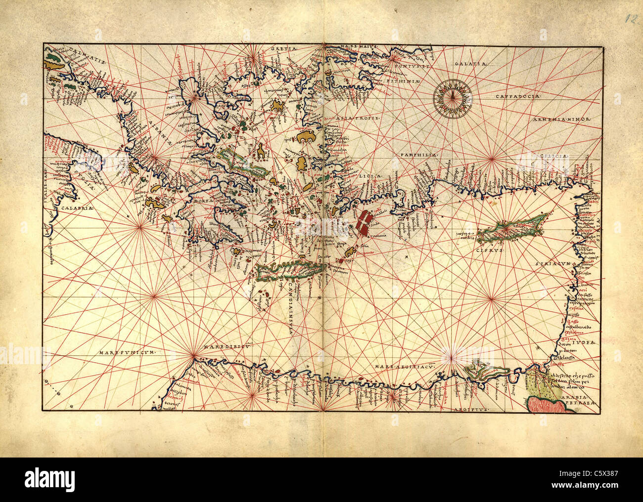 Eastern Mediterranean, Greece, Turkey - Antiquarian Map or Portolan Chart from 16th Century Portolan Atlas Stock Photohttps://www.alamy.com/image-license-details/?v=1https://www.alamy.com/stock-photo-eastern-mediterranean-greece-turkey-antiquarian-map-or-portolan-chart-38067351.html
RFC5X387–Eastern Mediterranean, Greece, Turkey - Antiquarian Map or Portolan Chart from 16th Century Portolan Atlas
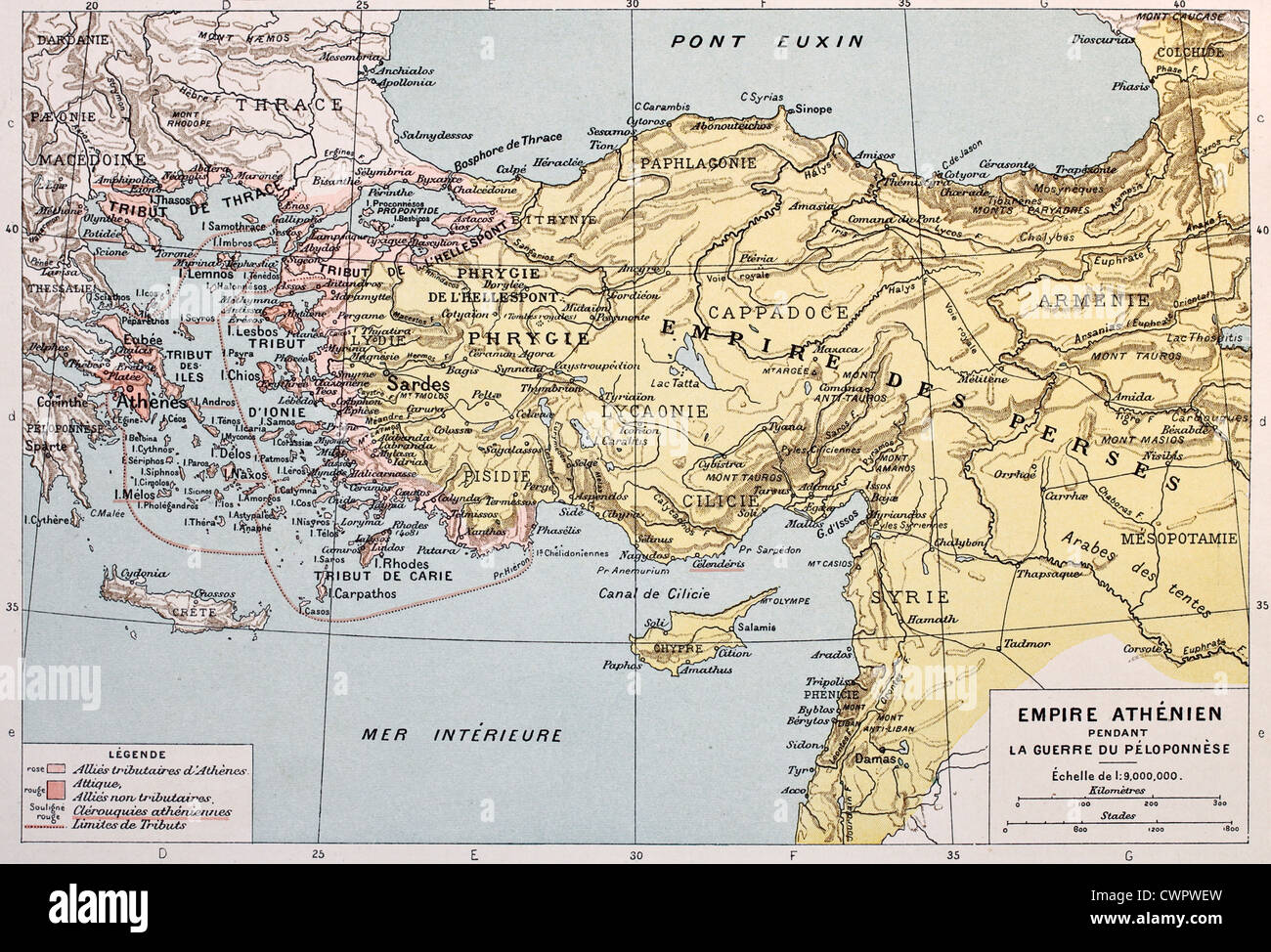 Athenian empire old map Stock Photohttps://www.alamy.com/image-license-details/?v=1https://www.alamy.com/stock-photo-athenian-empire-old-map-50290097.html
RFCWPWEW–Athenian empire old map
 Turkey Map Painting Unfolding Old Paper Scroll 3D Stock Photohttps://www.alamy.com/image-license-details/?v=1https://www.alamy.com/stock-photo-turkey-map-painting-unfolding-old-paper-scroll-3d-93916398.html
RFFCP792–Turkey Map Painting Unfolding Old Paper Scroll 3D
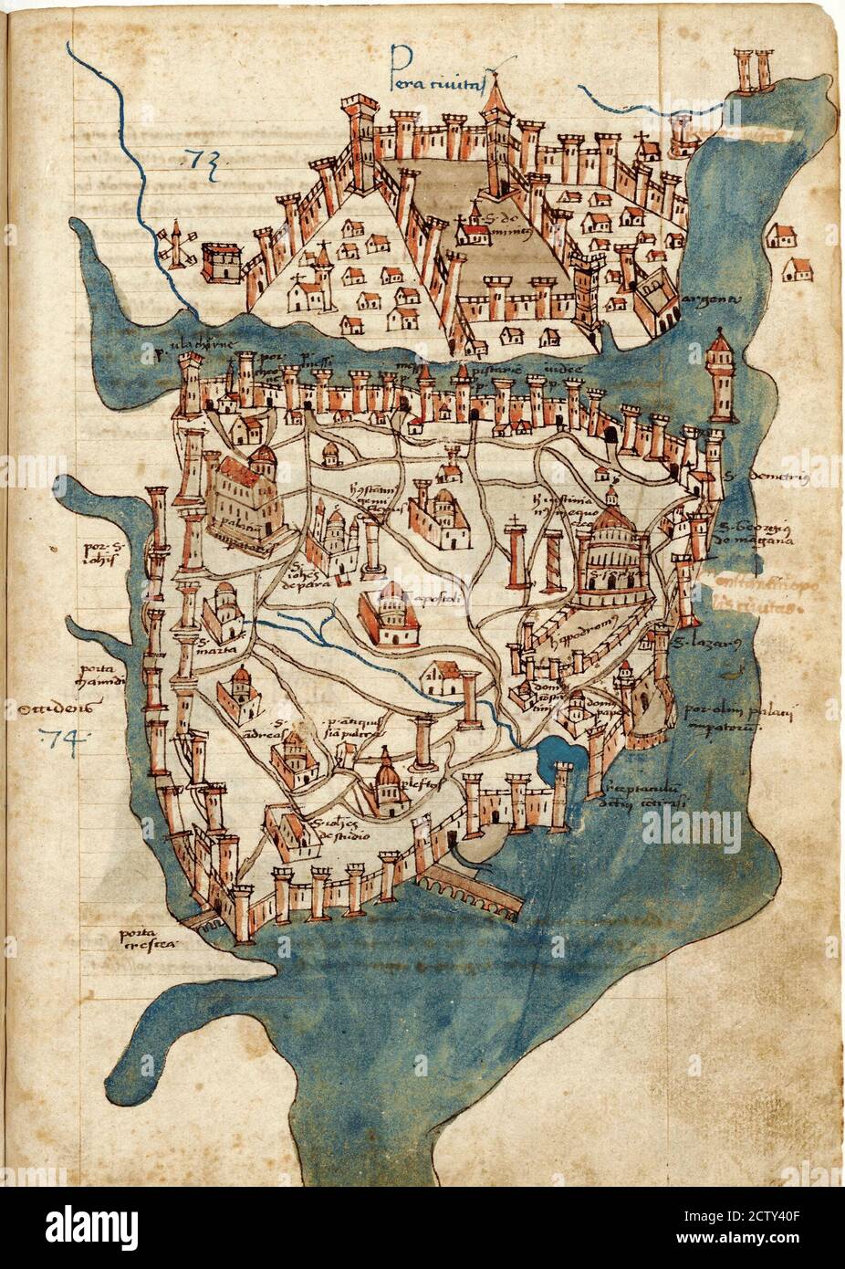 Ancient map of Constantinople city from rare book by Cristoforo Buondelmonti printed in 1475. Old paper page with image of Constantinople, capital of Stock Photohttps://www.alamy.com/image-license-details/?v=1https://www.alamy.com/ancient-map-of-constantinople-city-from-rare-book-by-cristoforo-buondelmonti-printed-in-1475-old-paper-page-with-image-of-constantinople-capital-of-image376765327.html
RF2CTY40F–Ancient map of Constantinople city from rare book by Cristoforo Buondelmonti printed in 1475. Old paper page with image of Constantinople, capital of
 Textured map of Turkey map with brown rock or stone texture, isolated on white background with clipping path. Stock Photohttps://www.alamy.com/image-license-details/?v=1https://www.alamy.com/stock-photo-textured-map-of-turkey-map-with-brown-rock-or-stone-texture-isolated-49745626.html
RMCTX31E–Textured map of Turkey map with brown rock or stone texture, isolated on white background with clipping path.
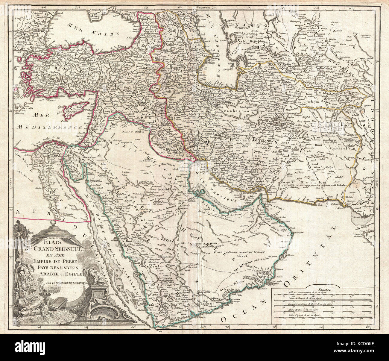 1753, Vaugondy Map of Persia, Arabia and Turkey Stock Photohttps://www.alamy.com/image-license-details/?v=1https://www.alamy.com/stock-image-1753-vaugondy-map-of-persia-arabia-and-turkey-162567650.html
RMKCDGKE–1753, Vaugondy Map of Persia, Arabia and Turkey
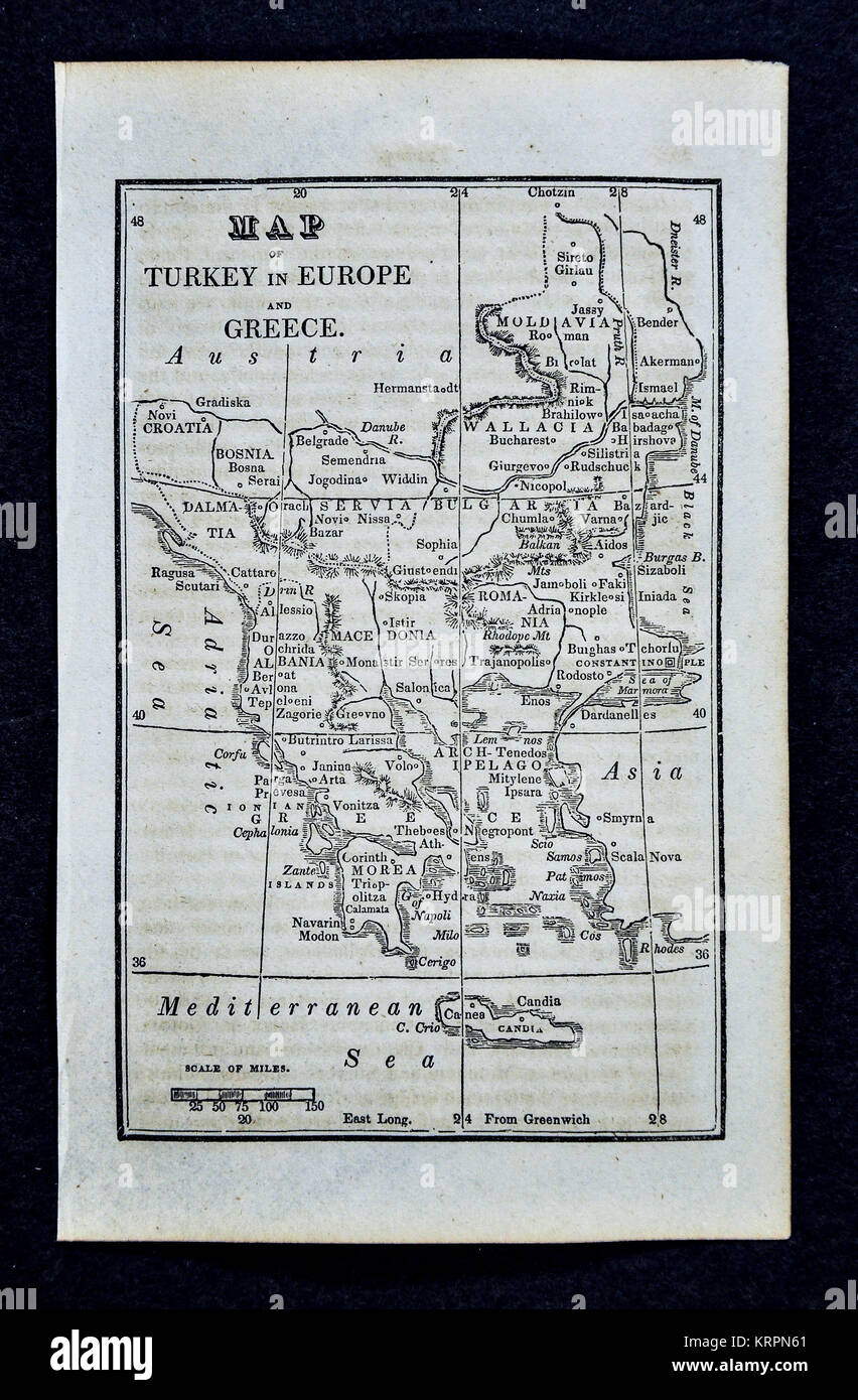 1830 Nathan Hale Map - Turkey in Europe - Constantinople Istanbul Greece Athens Crete Stock Photohttps://www.alamy.com/image-license-details/?v=1https://www.alamy.com/stock-image-1830-nathan-hale-map-turkey-in-europe-constantinople-istanbul-greece-169529977.html
RFKRPN61–1830 Nathan Hale Map - Turkey in Europe - Constantinople Istanbul Greece Athens Crete
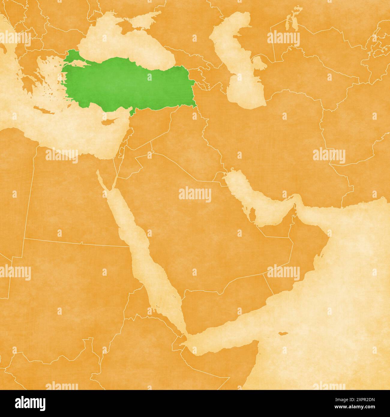 Turkey on an ocher retro map of Middle East (Western Asia) on old vintage paper. Stock Photohttps://www.alamy.com/image-license-details/?v=1https://www.alamy.com/turkey-on-an-ocher-retro-map-of-middle-east-western-asia-on-old-vintage-paper-image616392161.html
RF2XPR2DN–Turkey on an ocher retro map of Middle East (Western Asia) on old vintage paper.
 1801 Cary Map of Turkey in Europe, Greece, and the Balkan Stock Photohttps://www.alamy.com/image-license-details/?v=1https://www.alamy.com/stock-photo-1801-cary-map-of-turkey-in-europe-greece-and-the-balkan-50539576.html
RMCX67MT–1801 Cary Map of Turkey in Europe, Greece, and the Balkan
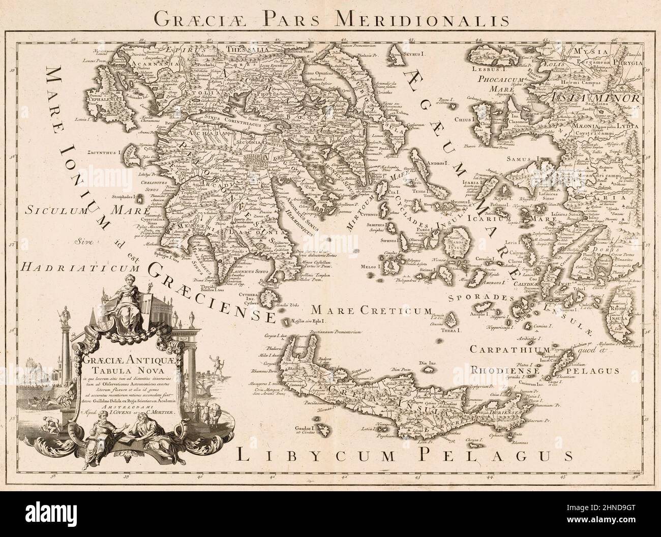 Graeciae pars meridionalis. Graeciae antiquae tabula nova. Southern Greece. A New Map of Ancient Greece. Parts of Asian Turkey are also shown. After a map by French cartographer Guillaume Delisle, also spelled Guillaume de l'Isle, 1675 - 1726. Stock Photohttps://www.alamy.com/image-license-details/?v=1https://www.alamy.com/graeciae-pars-meridionalis-graeciae-antiquae-tabula-nova-southern-greece-a-new-map-of-ancient-greece-parts-of-asian-turkey-are-also-shown-after-a-map-by-french-cartographer-guillaume-delisle-also-spelled-guillaume-de-lisle-1675-1726-image460670248.html
RM2HND9GT–Graeciae pars meridionalis. Graeciae antiquae tabula nova. Southern Greece. A New Map of Ancient Greece. Parts of Asian Turkey are also shown. After a map by French cartographer Guillaume Delisle, also spelled Guillaume de l'Isle, 1675 - 1726.
 Vintage Colton Map: Turkey in Asia. and the Caucasian Province of Russia, Published 1865. Published by J.H. Colton Stock Photohttps://www.alamy.com/image-license-details/?v=1https://www.alamy.com/vintage-colton-map-turkey-in-asia-and-the-caucasian-province-of-russia-published-1865-published-by-jh-colton-image601457731.html
RM2WXEND7–Vintage Colton Map: Turkey in Asia. and the Caucasian Province of Russia, Published 1865. Published by J.H. Colton
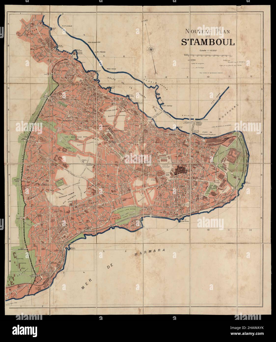 Constantinople Map, Map of Constantinople, Old Constantinople Map, Retro Constantinople Map, Vintage Constantinople Map, Old Istanbul Map, Turkey Map Stock Photohttps://www.alamy.com/image-license-details/?v=1https://www.alamy.com/constantinople-map-map-of-constantinople-old-constantinople-map-retro-constantinople-map-vintage-constantinople-map-old-istanbul-map-turkey-map-image454173543.html
RF2HAWAYK–Constantinople Map, Map of Constantinople, Old Constantinople Map, Retro Constantinople Map, Vintage Constantinople Map, Old Istanbul Map, Turkey Map
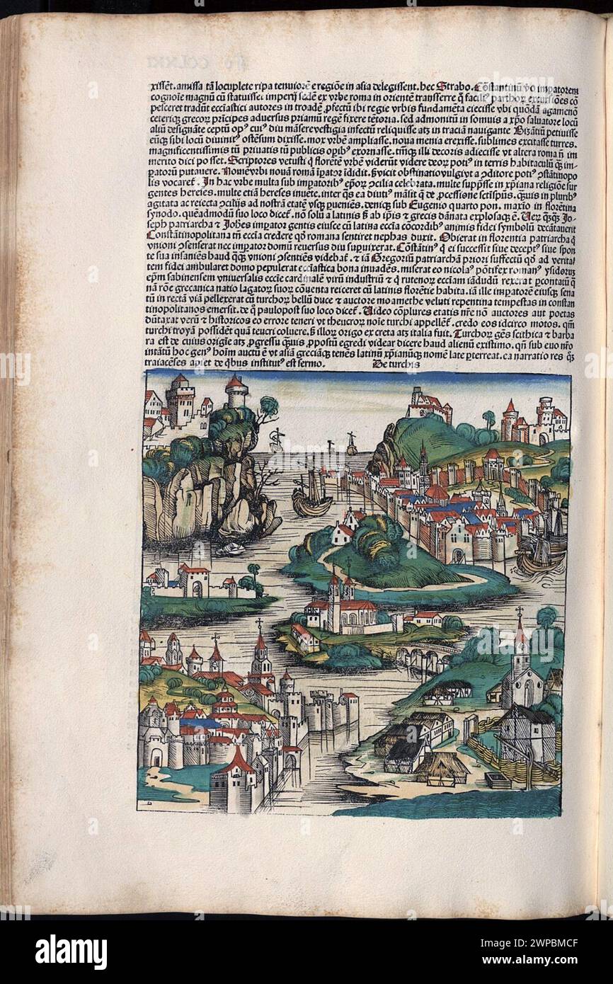 Beautiful woodcut pages from the 1493 Nuremberg Chronicle, which is an enyclodpedia of world events, mythology and christian history. This extra-ordinary work was one of the earliest books ever printed and the first to successfully integrate text and images. These pages show latin text and an engraving representing the country of Turkey. Stock Photohttps://www.alamy.com/image-license-details/?v=1https://www.alamy.com/beautiful-woodcut-pages-from-the-1493-nuremberg-chronicle-which-is-an-enyclodpedia-of-world-events-mythology-and-christian-history-this-extra-ordinary-work-was-one-of-the-earliest-books-ever-printed-and-the-first-to-successfully-integrate-text-and-images-these-pages-show-latin-text-and-an-engraving-representing-the-country-of-turkey-image598932447.html
RM2WPBMCF–Beautiful woodcut pages from the 1493 Nuremberg Chronicle, which is an enyclodpedia of world events, mythology and christian history. This extra-ordinary work was one of the earliest books ever printed and the first to successfully integrate text and images. These pages show latin text and an engraving representing the country of Turkey.
 map of turkey on old linen Stock Photohttps://www.alamy.com/image-license-details/?v=1https://www.alamy.com/map-of-turkey-on-old-linen-image227966974.html
RFR6TP5J–map of turkey on old linen
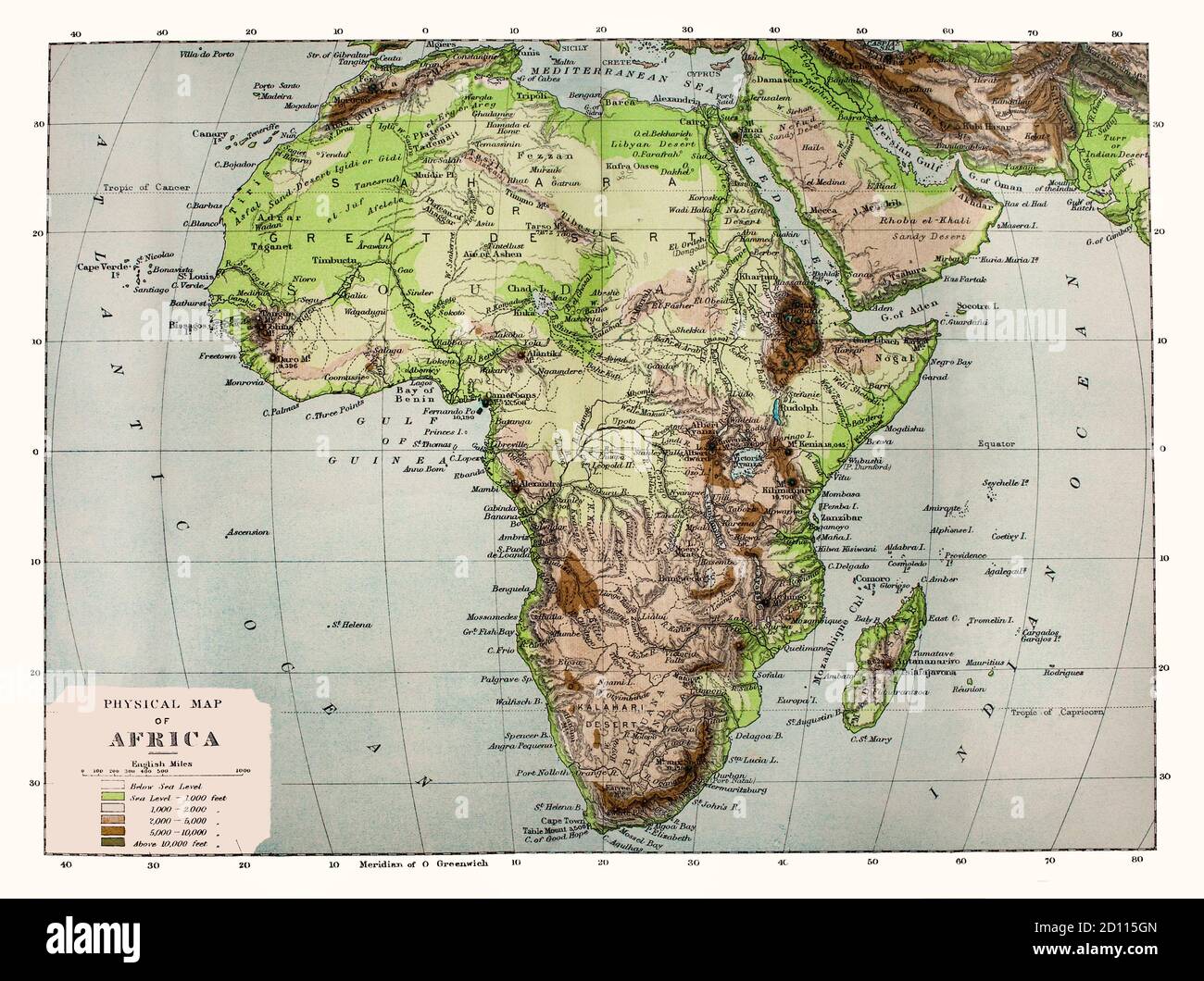 A late 19th Century physical map of Africa, note the names of some locations are no longer in use. Geologically, Africa includes the Arabian Peninsula; the Zagros Mountains of Iran and the Anatolian Plateau of Turkey mark where the African Plate collided with Eurasia. The Afrotropical realm and the Saharo-Arabian desert to its north unite the region biogeographically, and the Afro-Asiatic language family unites the north linguistically. Stock Photohttps://www.alamy.com/image-license-details/?v=1https://www.alamy.com/a-late-19th-century-physical-map-of-africa-note-the-names-of-some-locations-are-no-longer-in-use-geologically-africa-includes-the-arabian-peninsula-the-zagros-mountains-of-iran-and-the-anatolian-plateau-of-turkey-mark-where-the-african-plate-collided-with-eurasia-the-afrotropical-realm-and-the-saharo-arabian-desert-to-its-north-unite-the-region-biogeographically-and-the-afro-asiatic-language-family-unites-the-north-linguistically-image379269093.html
RM2D115GN–A late 19th Century physical map of Africa, note the names of some locations are no longer in use. Geologically, Africa includes the Arabian Peninsula; the Zagros Mountains of Iran and the Anatolian Plateau of Turkey mark where the African Plate collided with Eurasia. The Afrotropical realm and the Saharo-Arabian desert to its north unite the region biogeographically, and the Afro-Asiatic language family unites the north linguistically.
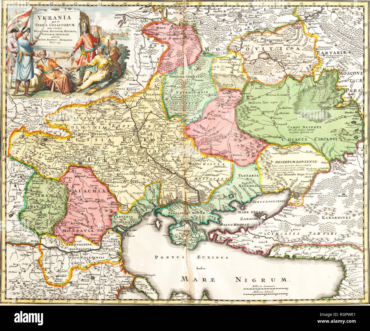 Ukraine, which is the land of cossacks, with neighboring Walachia, Moldova. Johann Baptiste Homann (Nuremberg, 1720). Stock Photohttps://www.alamy.com/image-license-details/?v=1https://www.alamy.com/ukraine-which-is-the-land-of-cossacks-with-neighboring-walachia-moldova-johann-baptiste-homann-nuremberg-1720-image234072217.html
RMRGPWE1–Ukraine, which is the land of cossacks, with neighboring Walachia, Moldova. Johann Baptiste Homann (Nuremberg, 1720).
 Old Map of Showing the Journeys of Saint Paul in Holy Bible Stock Photohttps://www.alamy.com/image-license-details/?v=1https://www.alamy.com/old-map-of-showing-the-journeys-of-saint-paul-in-holy-bible-image597081991.html
RM2WKBC4R–Old Map of Showing the Journeys of Saint Paul in Holy Bible
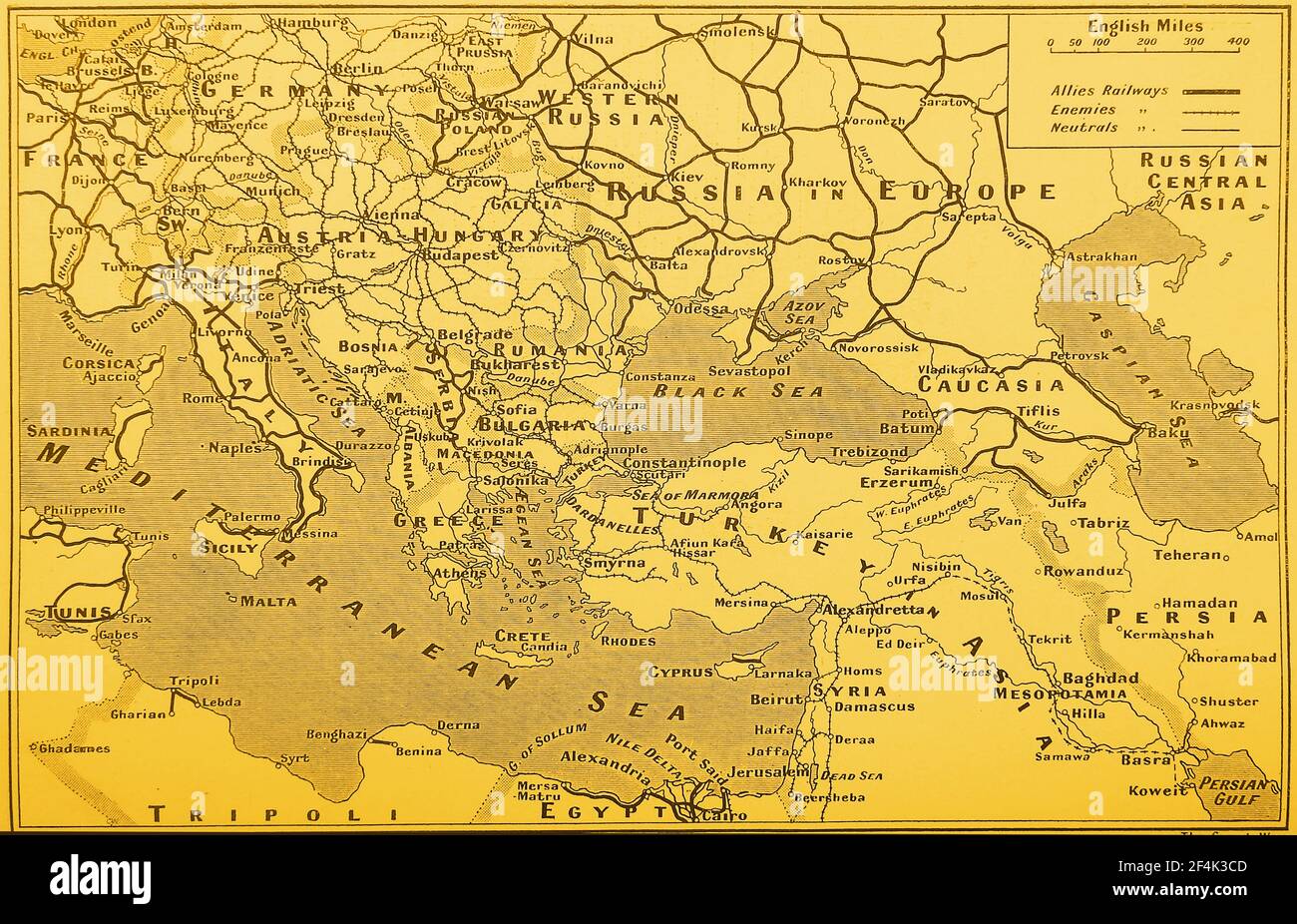 WWI - Map of the rail transport system in Europe showing the railways of the Allies, enemies and other railways. Stock Photohttps://www.alamy.com/image-license-details/?v=1https://www.alamy.com/wwi-map-of-the-rail-transport-system-in-europe-showing-the-railways-of-the-allies-enemies-and-other-railways-image415927245.html
RM2F4K3CD–WWI - Map of the rail transport system in Europe showing the railways of the Allies, enemies and other railways.
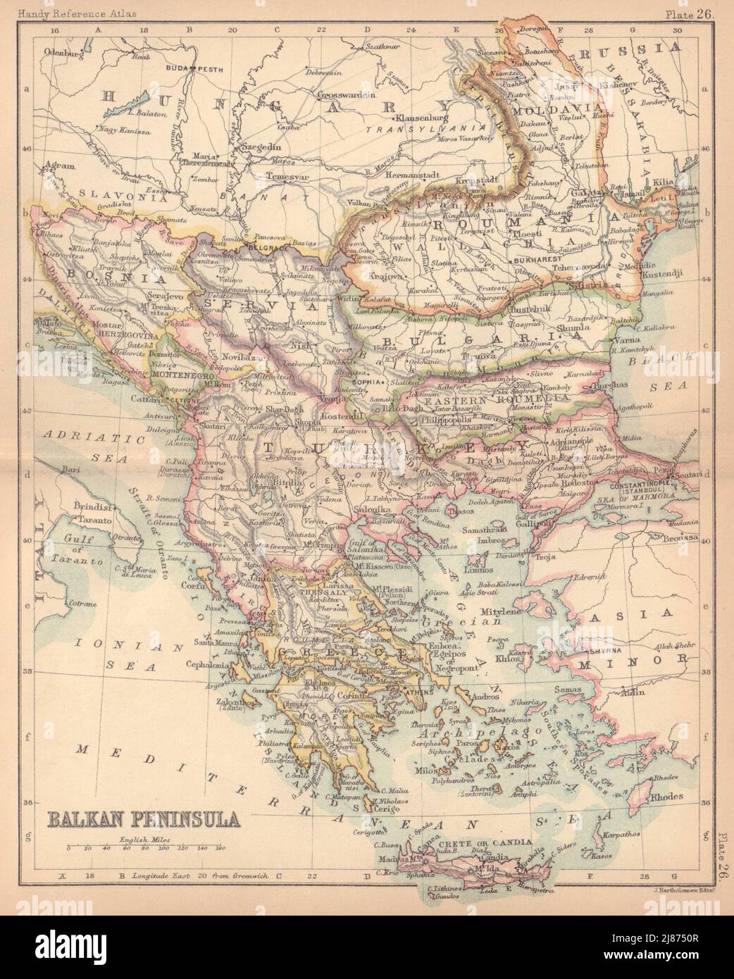 Balkan Peninsula. Greece Turkey in Europe Roumania. BARTHOLOMEW 1888 old map Stock Photohttps://www.alamy.com/image-license-details/?v=1https://www.alamy.com/balkan-peninsula-greece-turkey-in-europe-roumania-bartholomew-1888-old-map-image469754791.html
RF2J8750R–Balkan Peninsula. Greece Turkey in Europe Roumania. BARTHOLOMEW 1888 old map
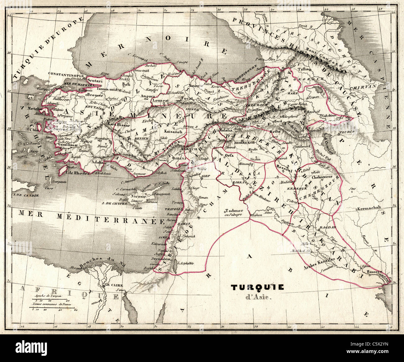 Turquie d'Asie (Turkey in Asia) Antiquarian Map from 'Atlas Universel de Geographie Ancienne and Moderne' by cartographer C. V. Monin Stock Photohttps://www.alamy.com/image-license-details/?v=1https://www.alamy.com/stock-photo-turquie-dasie-turkey-in-asia-antiquarian-map-from-atlas-universel-38067113.html
RFC5X2YN–Turquie d'Asie (Turkey in Asia) Antiquarian Map from 'Atlas Universel de Geographie Ancienne and Moderne' by cartographer C. V. Monin
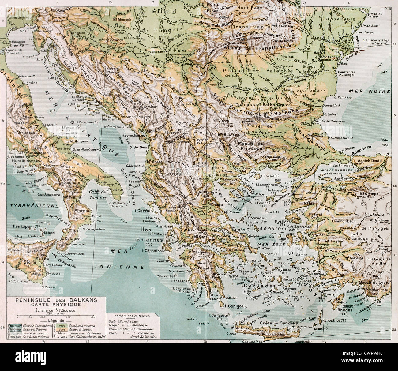 Old Balcan peninsula physical map Stock Photohttps://www.alamy.com/image-license-details/?v=1https://www.alamy.com/stock-photo-old-balcan-peninsula-physical-map-50290156.html
RFCWPWH0–Old Balcan peninsula physical map
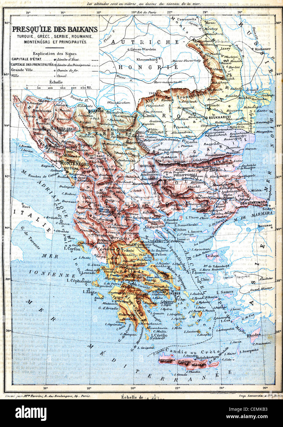 The map of Balkan Peninsula (Turkey, Greece, Serbia, Romania and Montenegro) with signs and their explanation. Stock Photohttps://www.alamy.com/image-license-details/?v=1https://www.alamy.com/stock-photo-the-map-of-balkan-peninsula-turkey-greece-serbia-romania-and-montenegro-43480167.html
RFCEMKB3–The map of Balkan Peninsula (Turkey, Greece, Serbia, Romania and Montenegro) with signs and their explanation.
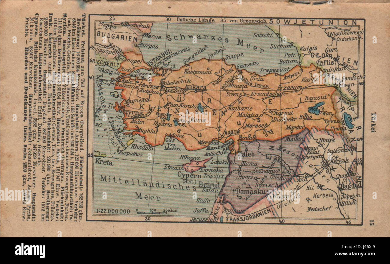 Old german map of Turkey Stock Photohttps://www.alamy.com/image-license-details/?v=1https://www.alamy.com/stock-photo-old-german-map-of-turkey-140294177.html
RMJ46XJ9–Old german map of Turkey
 Textured map of Turkey map with brown rock or stone texture, isolated on white background with clipping path. Stock Photohttps://www.alamy.com/image-license-details/?v=1https://www.alamy.com/stock-photo-textured-map-of-turkey-map-with-brown-rock-or-stone-texture-isolated-49474050.html
RMCTDMJA–Textured map of Turkey map with brown rock or stone texture, isolated on white background with clipping path.
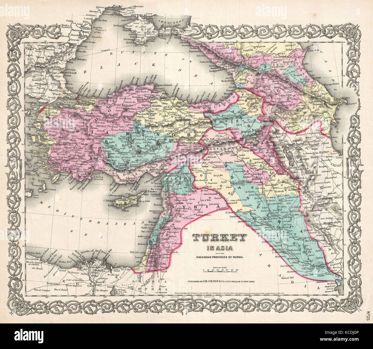 1855, Colton Map of Turkey, Iraq, and Syria Stock Photohttps://www.alamy.com/image-license-details/?v=1https://www.alamy.com/stock-image-1855-colton-map-of-turkey-iraq-and-syria-162568694.html
RMKCDJ0P–1855, Colton Map of Turkey, Iraq, and Syria
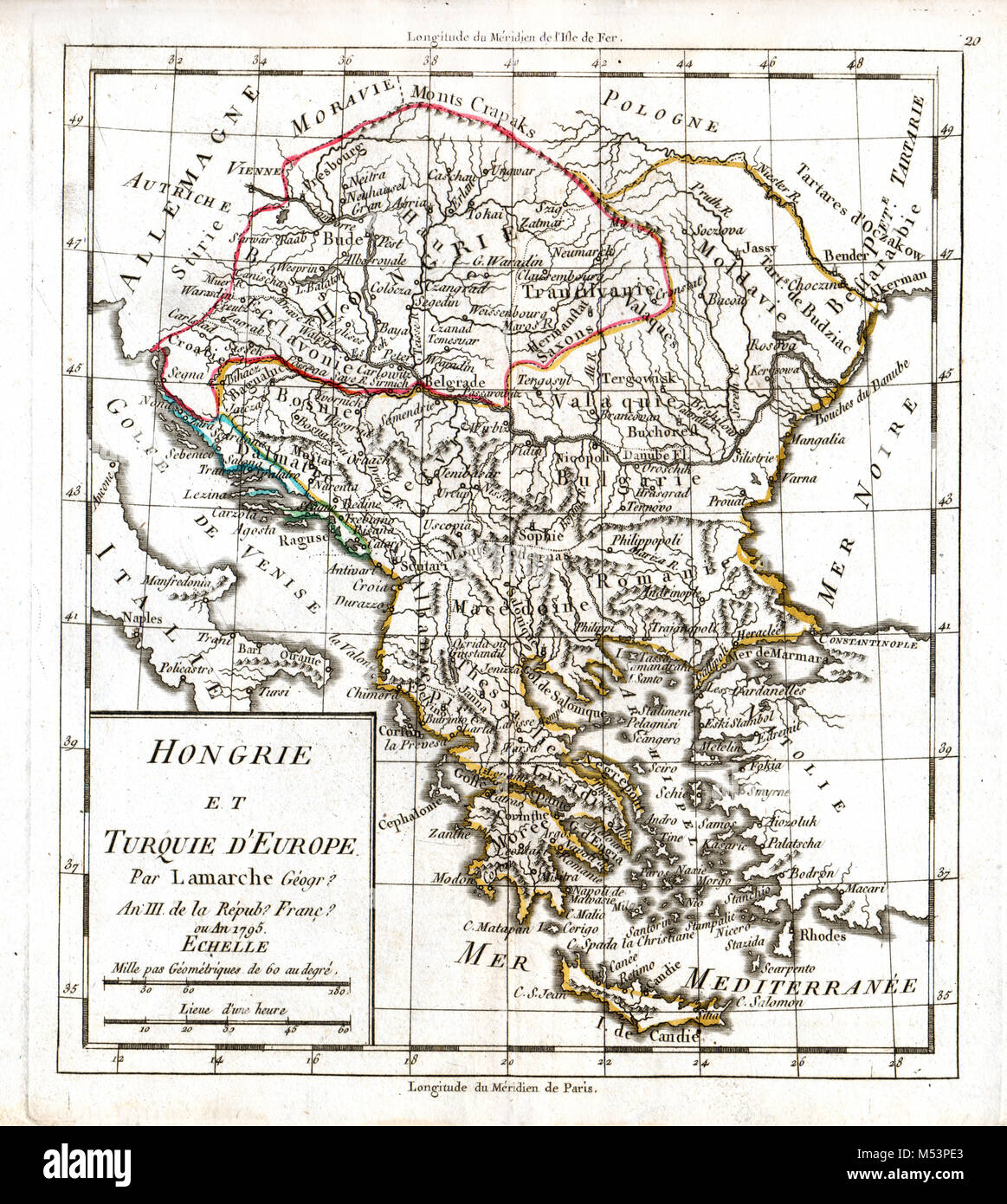 1830 Delamarche Atlas Map Greece Turkey Bulgaria Macedonia Romania Hungary Transylvania Balkans Europe Stock Photohttps://www.alamy.com/image-license-details/?v=1https://www.alamy.com/stock-photo-1830-delamarche-atlas-map-greece-turkey-bulgaria-macedonia-romania-175260459.html
RFM53PE3–1830 Delamarche Atlas Map Greece Turkey Bulgaria Macedonia Romania Hungary Transylvania Balkans Europe
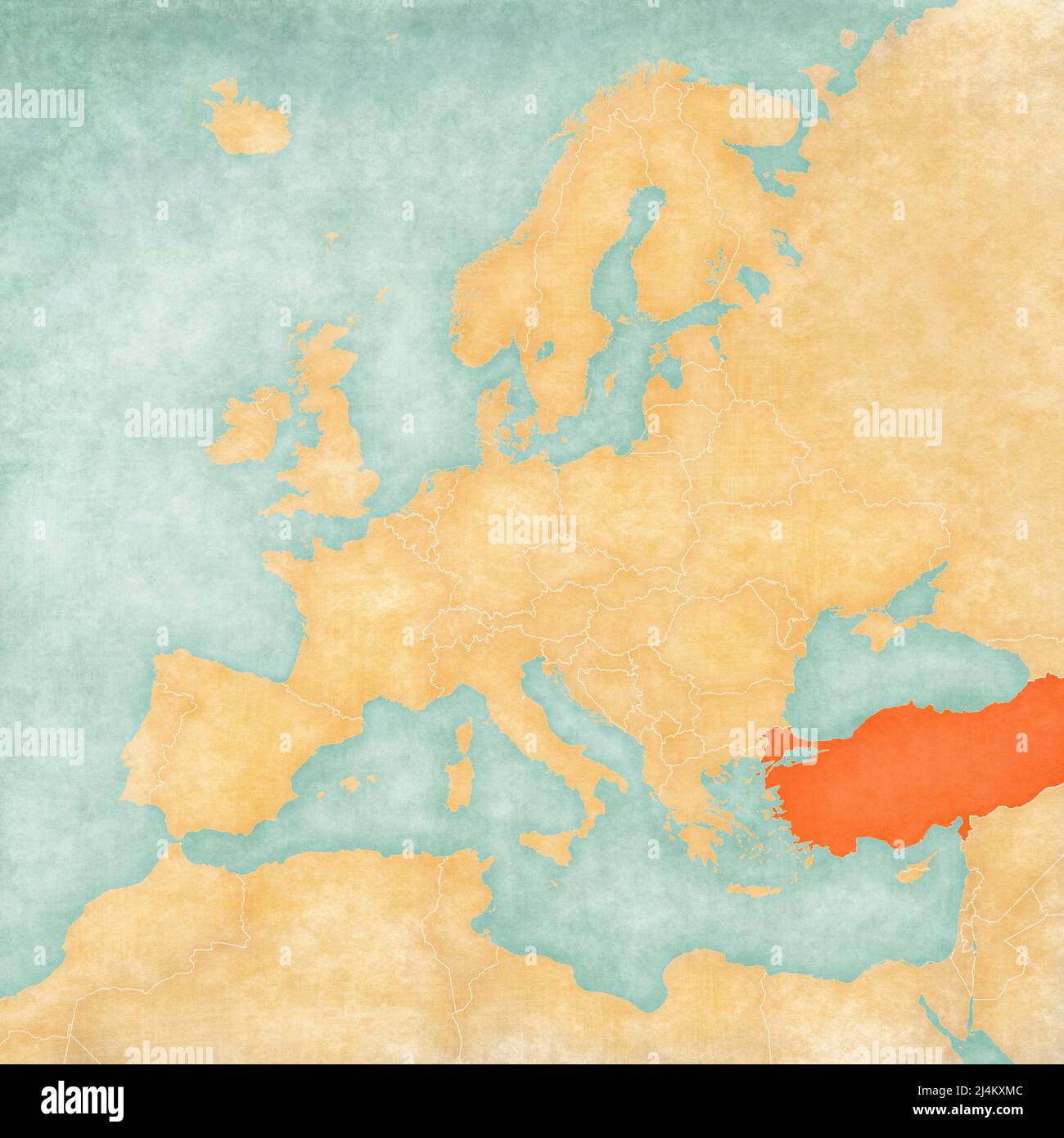 Turkey on the map of Europe in soft grunge and vintage style, like old paper with watercolor painting. Stock Photohttps://www.alamy.com/image-license-details/?v=1https://www.alamy.com/turkey-on-the-map-of-europe-in-soft-grunge-and-vintage-style-like-old-paper-with-watercolor-painting-image467576604.html
RF2J4KXMC–Turkey on the map of Europe in soft grunge and vintage style, like old paper with watercolor painting.
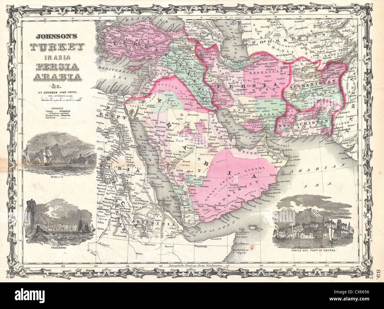 1862 Johnson Map of Arabia, Persia and Turkey in Asia Stock Photohttps://www.alamy.com/image-license-details/?v=1https://www.alamy.com/stock-photo-1862-johnson-map-of-arabia-persia-and-turkey-in-asia-50538354.html
RMCX6656–1862 Johnson Map of Arabia, Persia and Turkey in Asia
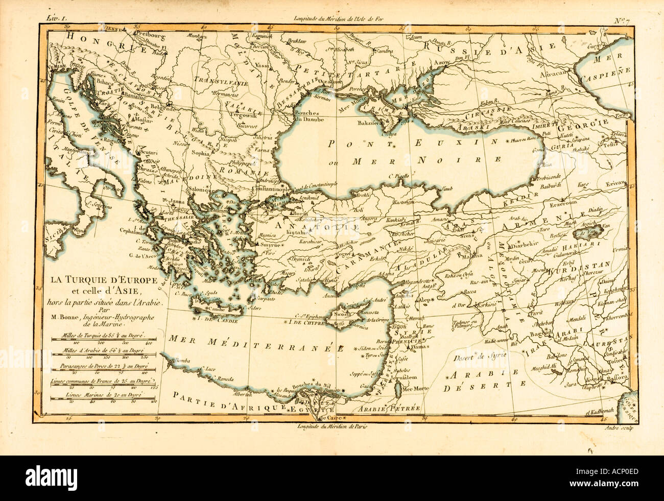 Map of Turkey and Middle East circa 1760 Stock Photohttps://www.alamy.com/image-license-details/?v=1https://www.alamy.com/map-of-turkey-and-middle-east-circa-1760-image2449644.html
RMACP0ED–Map of Turkey and Middle East circa 1760
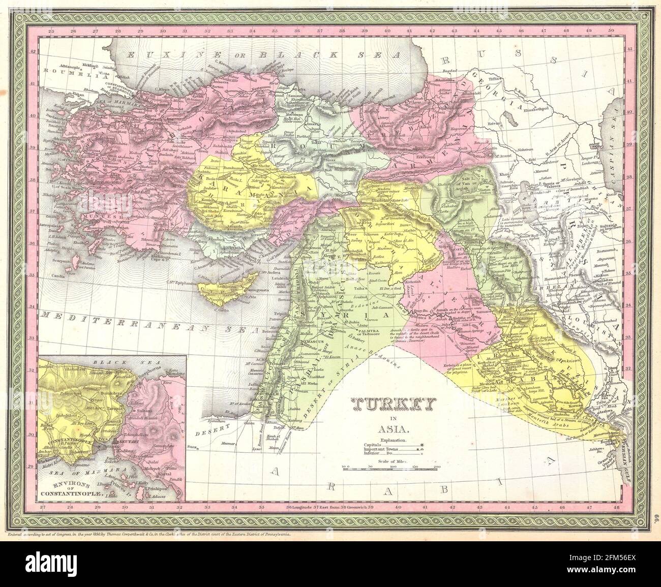 Vintage copper engraved map of Turkey from 19th century. All maps are beautifully colored and illustrated showing the world at the time. Stock Photohttps://www.alamy.com/image-license-details/?v=1https://www.alamy.com/vintage-copper-engraved-map-of-turkey-from-19th-century-all-maps-are-beautifully-colored-and-illustrated-showing-the-world-at-the-time-image425456834.html
RF2FM56EX–Vintage copper engraved map of Turkey from 19th century. All maps are beautifully colored and illustrated showing the world at the time.
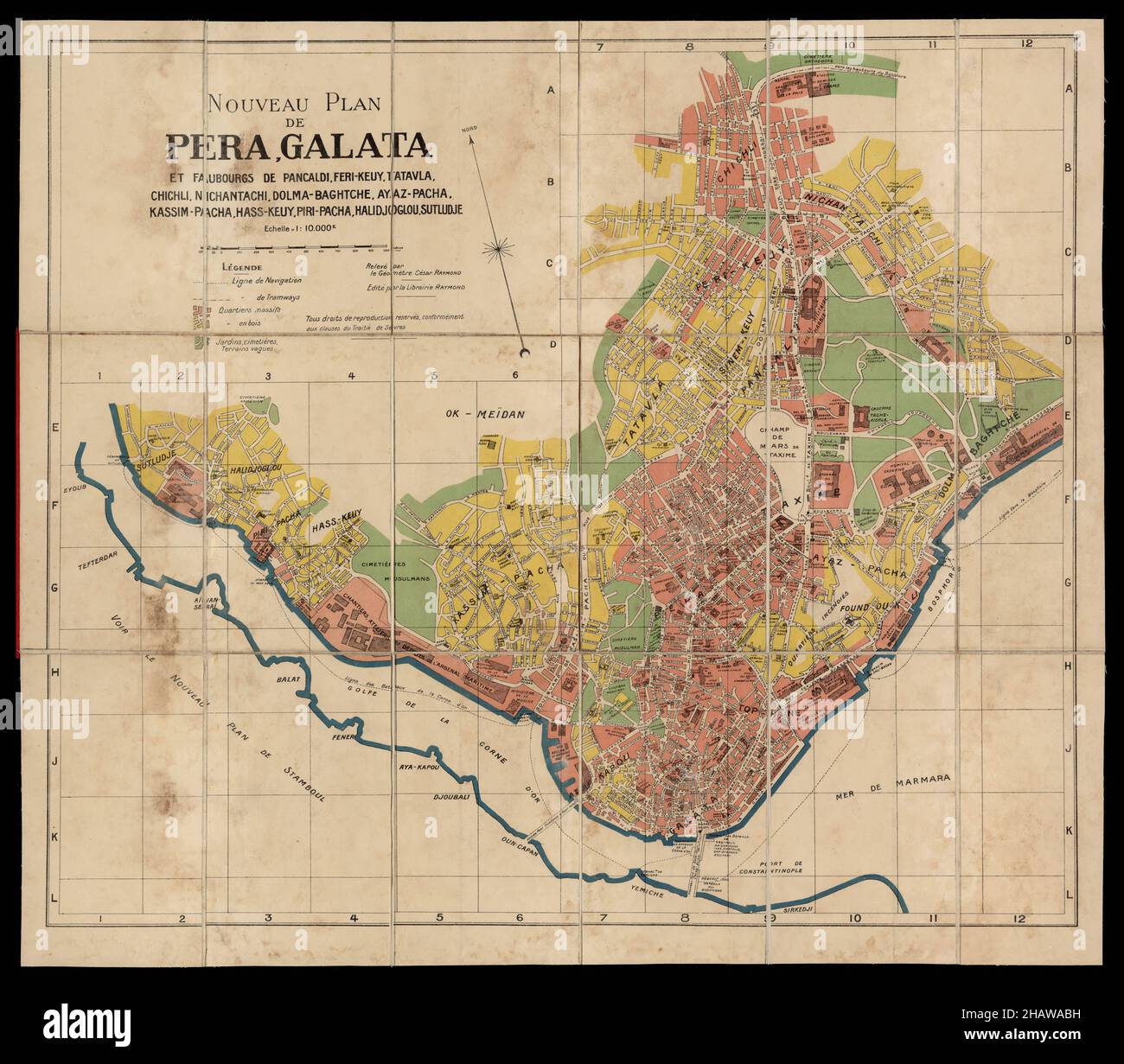 Constantinople Map, Map of Constantinople, Old Constantinople Map, Retro Constantinople Map, Vintage Constantinople Map, Old Istanbul Map, Turkey Map Stock Photohttps://www.alamy.com/image-license-details/?v=1https://www.alamy.com/constantinople-map-map-of-constantinople-old-constantinople-map-retro-constantinople-map-vintage-constantinople-map-old-istanbul-map-turkey-map-image454173093.html
RF2HAWABH–Constantinople Map, Map of Constantinople, Old Constantinople Map, Retro Constantinople Map, Vintage Constantinople Map, Old Istanbul Map, Turkey Map
 A beautiful woodcut from 1493 of the town of Constantinopel (Constantinople now Istanbul) in Turkey. This illustration comes from the Nuremberg Chronicle, which is an enyclodpedia of world events, mythology and christian history. This extra-ordinary work was one of the earliest books ever printed and the first to successfully integrate text and images. Stock Photohttps://www.alamy.com/image-license-details/?v=1https://www.alamy.com/a-beautiful-woodcut-from-1493-of-the-town-of-constantinopel-constantinople-now-istanbul-in-turkey-this-illustration-comes-from-the-nuremberg-chronicle-which-is-an-enyclodpedia-of-world-events-mythology-and-christian-history-this-extra-ordinary-work-was-one-of-the-earliest-books-ever-printed-and-the-first-to-successfully-integrate-text-and-images-image598932243.html
RM2WPBM57–A beautiful woodcut from 1493 of the town of Constantinopel (Constantinople now Istanbul) in Turkey. This illustration comes from the Nuremberg Chronicle, which is an enyclodpedia of world events, mythology and christian history. This extra-ordinary work was one of the earliest books ever printed and the first to successfully integrate text and images.
 map of turkey on old linen Stock Photohttps://www.alamy.com/image-license-details/?v=1https://www.alamy.com/map-of-turkey-on-old-linen-image227795757.html
RFR6GYPN–map of turkey on old linen
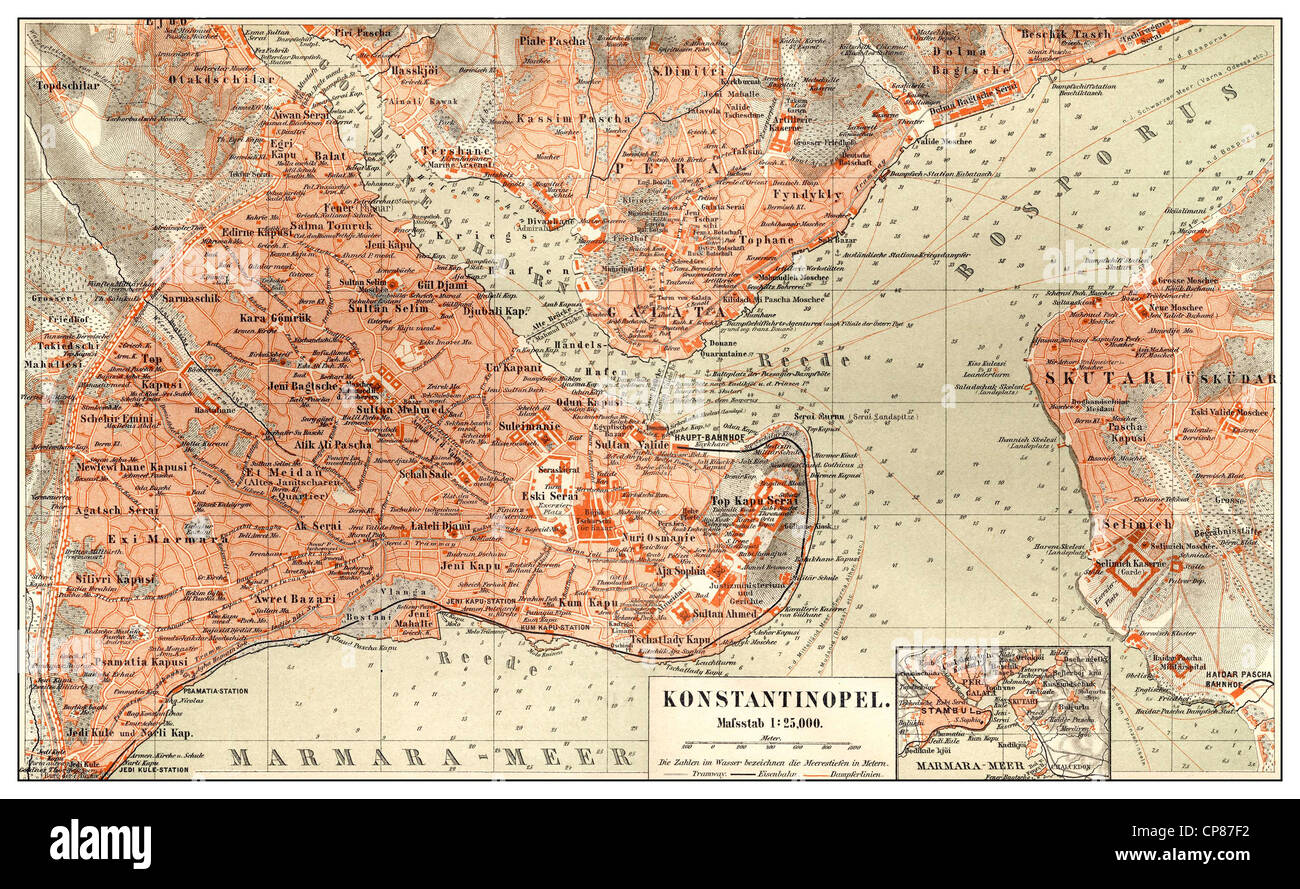 Historic map of Constantinople, Istanbul, Turkey, 19th Century, Historische, zeichnerische Darstellung, Landkarte, Stadtplan von Stock Photohttps://www.alamy.com/image-license-details/?v=1https://www.alamy.com/stock-photo-historic-map-of-constantinople-istanbul-turkey-19th-century-historische-48124694.html
RMCP87F2–Historic map of Constantinople, Istanbul, Turkey, 19th Century, Historische, zeichnerische Darstellung, Landkarte, Stadtplan von
 The Landscapes of Perecope and Nogai Tartares (Tatars), Circasses. Piter Van der Aa (Leiden, 1707). Stock Photohttps://www.alamy.com/image-license-details/?v=1https://www.alamy.com/the-landscapes-of-perecope-and-nogai-tartares-tatars-circasses-piter-van-der-aa-leiden-1707-image234032202.html
RMRGN2CX–The Landscapes of Perecope and Nogai Tartares (Tatars), Circasses. Piter Van der Aa (Leiden, 1707).
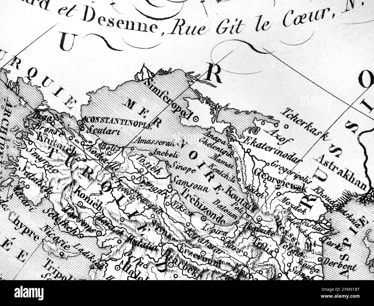 Old Map Black Sea region Stock Photohttps://www.alamy.com/image-license-details/?v=1https://www.alamy.com/old-map-black-sea-region-image632065052.html
RF2YM91BT–Old Map Black Sea region
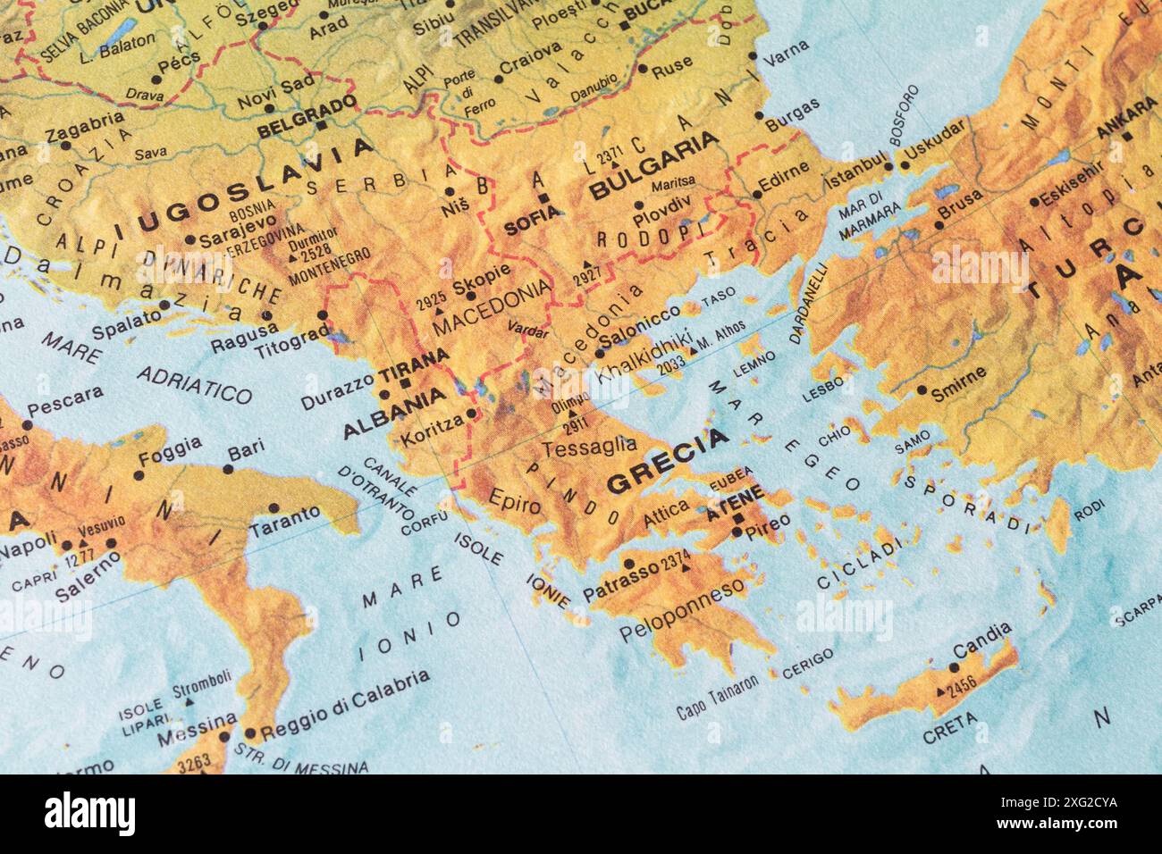 Old map of Southern Europe and Balkans with ex Jugoslavia, Albania, Greece, Bulgary and Turkey Stock Photohttps://www.alamy.com/image-license-details/?v=1https://www.alamy.com/old-map-of-southern-europe-and-balkans-with-ex-jugoslavia-albania-greece-bulgary-and-turkey-image612251454.html
RM2XG2CYA–Old map of Southern Europe and Balkans with ex Jugoslavia, Albania, Greece, Bulgary and Turkey
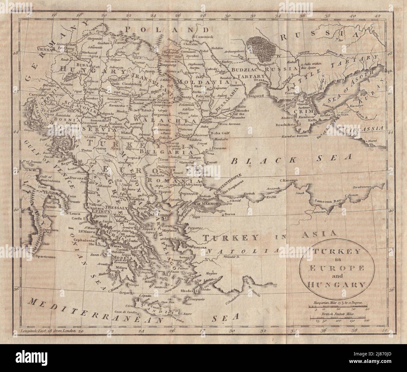 Turkey in Europe and Hungary. Balkans Greece Ukraine. WALKER 1805 old map Stock Photohttps://www.alamy.com/image-license-details/?v=1https://www.alamy.com/turkey-in-europe-and-hungary-balkans-greece-ukraine-walker-1805-old-map-image469751365.html
RF2J870JD–Turkey in Europe and Hungary. Balkans Greece Ukraine. WALKER 1805 old map
 Turquie D'Europe (Turkey in Europe) Antiquarian Map from 'Atlas Universel de Geographie Ancienne and Moderne' by cartographer C. V. Monin Stock Photohttps://www.alamy.com/image-license-details/?v=1https://www.alamy.com/stock-photo-turquie-deurope-turkey-in-europe-antiquarian-map-from-atlas-universel-38066964.html
RFC5X2PC–Turquie D'Europe (Turkey in Europe) Antiquarian Map from 'Atlas Universel de Geographie Ancienne and Moderne' by cartographer C. V. Monin
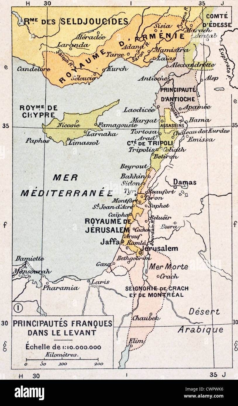 Medieval Eastern Mediterranean old map Stock Photohttps://www.alamy.com/image-license-details/?v=1https://www.alamy.com/stock-photo-medieval-eastern-mediterranean-old-map-50290218.html
RFCWPWK6–Medieval Eastern Mediterranean old map
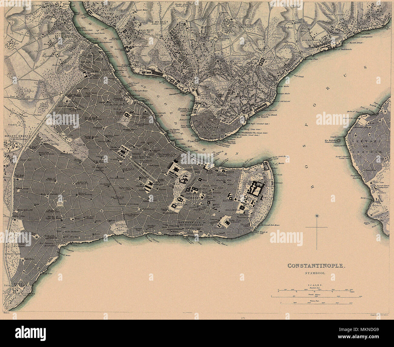 Map of Constantinople 1840 Stock Photohttps://www.alamy.com/image-license-details/?v=1https://www.alamy.com/map-of-constantinople-1840-image184253785.html
RMMKNDG9–Map of Constantinople 1840
![Original title: 'Map of the Austrian Empire, Italian States, Turkey in Europe, and Greece; Maltese Islands [inset].' Map publication date was 1863. This is a beautifully detailed historic map reproduction showing political borders and important landmarks.Note that longitude is given from both Greenwich and Washington, D.C. Shows political boundaries, cities, and seas. Stock Photo Original title: 'Map of the Austrian Empire, Italian States, Turkey in Europe, and Greece; Maltese Islands [inset].' Map publication date was 1863. This is a beautifully detailed historic map reproduction showing political borders and important landmarks.Note that longitude is given from both Greenwich and Washington, D.C. Shows political boundaries, cities, and seas. Stock Photo](https://c8.alamy.com/comp/2FKT607/original-title-map-of-the-austrian-empire-italian-states-turkey-in-europe-and-greece-maltese-islands-inset-map-publication-date-was-1863-this-is-a-beautifully-detailed-historic-map-reproduction-showing-political-borders-and-important-landmarksnote-that-longitude-is-given-from-both-greenwich-and-washington-dc-shows-political-boundaries-cities-and-seas-2FKT607.jpg) Original title: 'Map of the Austrian Empire, Italian States, Turkey in Europe, and Greece; Maltese Islands [inset].' Map publication date was 1863. This is a beautifully detailed historic map reproduction showing political borders and important landmarks.Note that longitude is given from both Greenwich and Washington, D.C. Shows political boundaries, cities, and seas. Stock Photohttps://www.alamy.com/image-license-details/?v=1https://www.alamy.com/original-title-map-of-the-austrian-empire-italian-states-turkey-in-europe-and-greece-maltese-islands-inset-map-publication-date-was-1863-this-is-a-beautifully-detailed-historic-map-reproduction-showing-political-borders-and-important-landmarksnote-that-longitude-is-given-from-both-greenwich-and-washington-dc-shows-political-boundaries-cities-and-seas-image425258855.html
Original title: 'Map of the Austrian Empire, Italian States, Turkey in Europe, and Greece; Maltese Islands [inset].' Map publication date was 1863. This is a beautifully detailed historic map reproduction showing political borders and important landmarks.Note that longitude is given from both Greenwich and Washington, D.C. Shows political boundaries, cities, and seas. Stock Photohttps://www.alamy.com/image-license-details/?v=1https://www.alamy.com/original-title-map-of-the-austrian-empire-italian-states-turkey-in-europe-and-greece-maltese-islands-inset-map-publication-date-was-1863-this-is-a-beautifully-detailed-historic-map-reproduction-showing-political-borders-and-important-landmarksnote-that-longitude-is-given-from-both-greenwich-and-washington-dc-shows-political-boundaries-cities-and-seas-image425258855.htmlRF2FKT607–Original title: 'Map of the Austrian Empire, Italian States, Turkey in Europe, and Greece; Maltese Islands [inset].' Map publication date was 1863. This is a beautifully detailed historic map reproduction showing political borders and important landmarks.Note that longitude is given from both Greenwich and Washington, D.C. Shows political boundaries, cities, and seas.
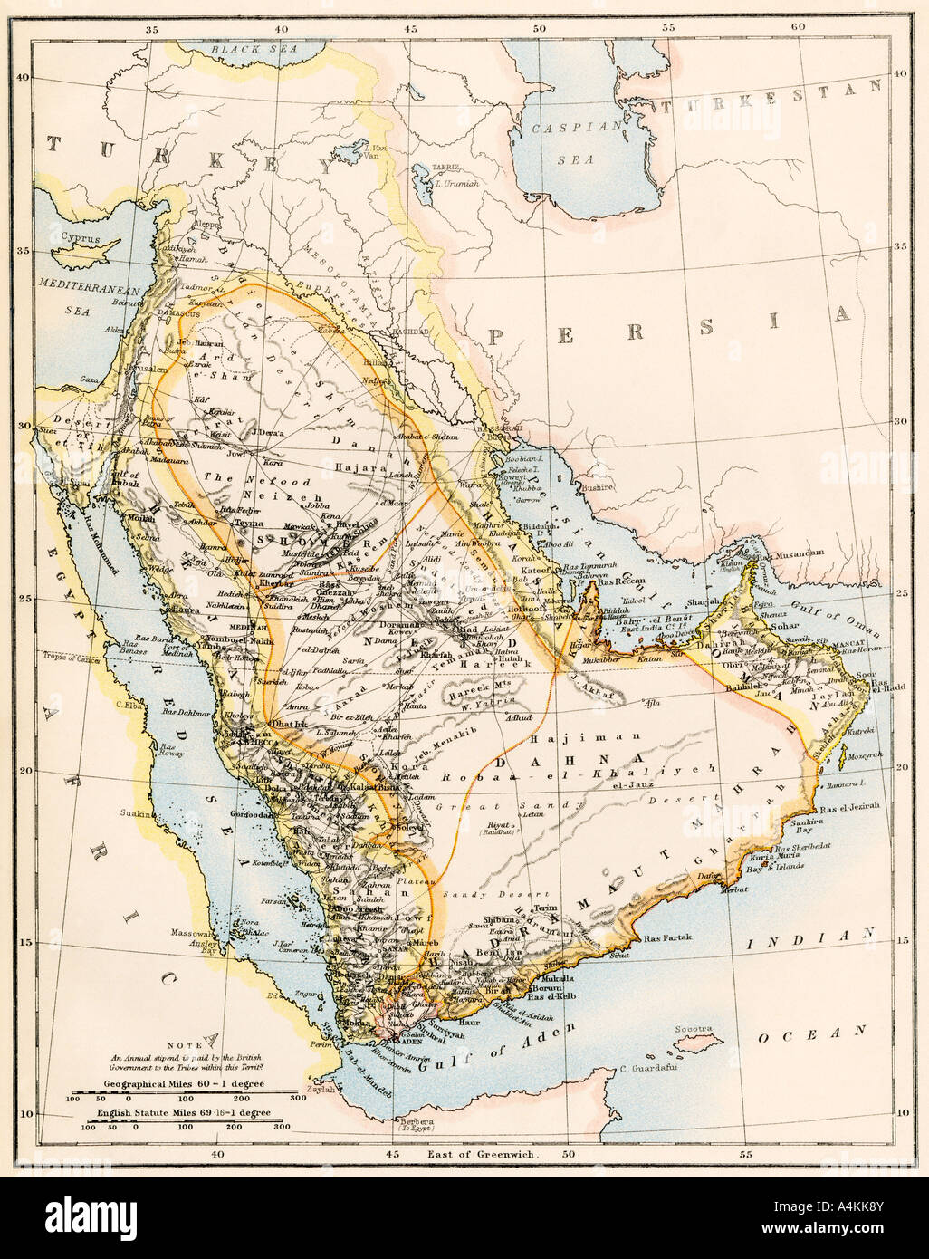 Map of Arabia 1870s. Color lithograph Stock Photohttps://www.alamy.com/image-license-details/?v=1https://www.alamy.com/stock-photo-map-of-arabia-1870s-color-lithograph-11073434.html
RMA4KK8Y–Map of Arabia 1870s. Color lithograph
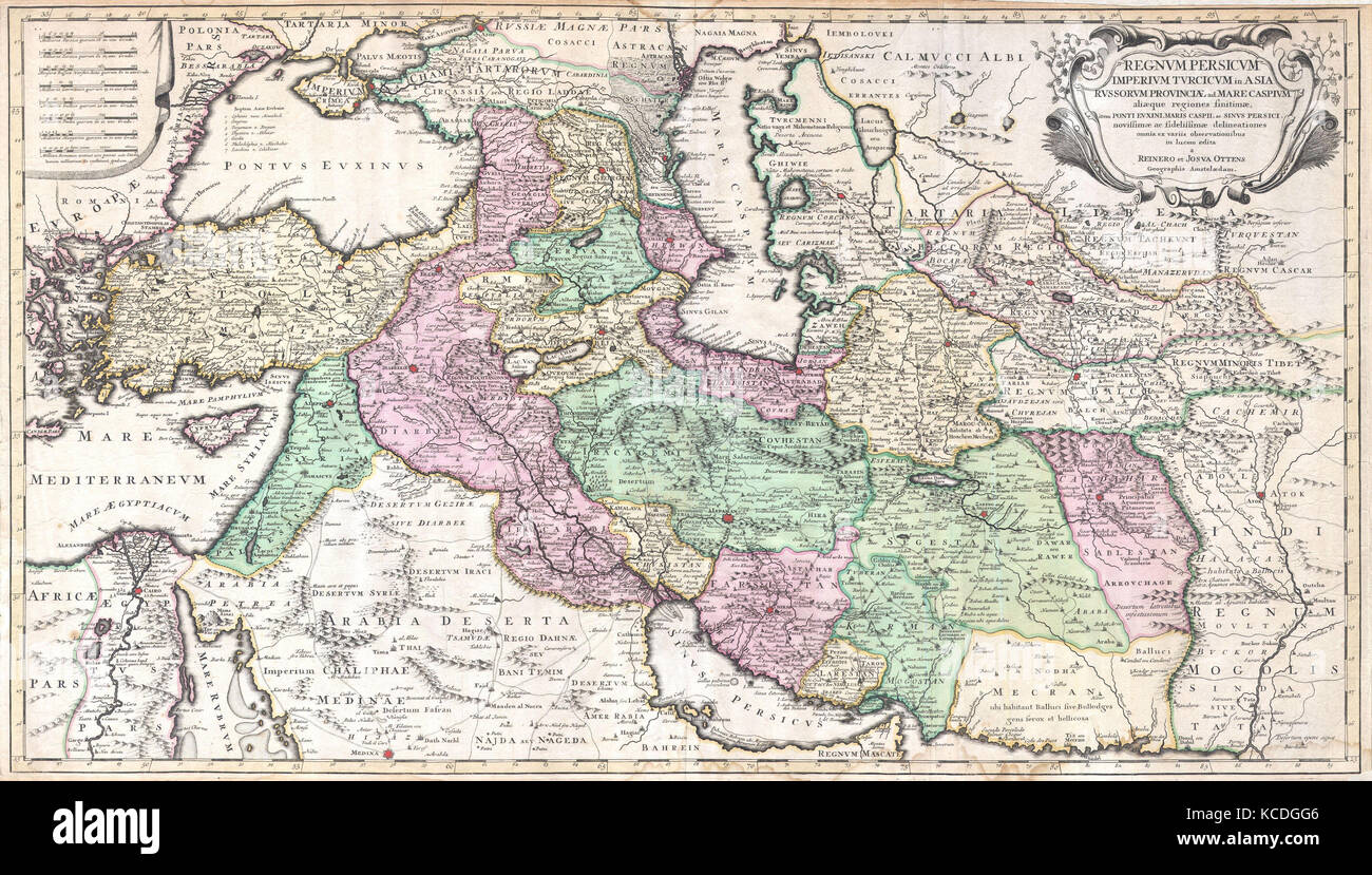 1730, Ottens Map of Persia, Iran, Iraq, Turkey Stock Photohttps://www.alamy.com/image-license-details/?v=1https://www.alamy.com/stock-image-1730-ottens-map-of-persia-iran-iraq-turkey-162567558.html
RMKCDGG6–1730, Ottens Map of Persia, Iran, Iraq, Turkey
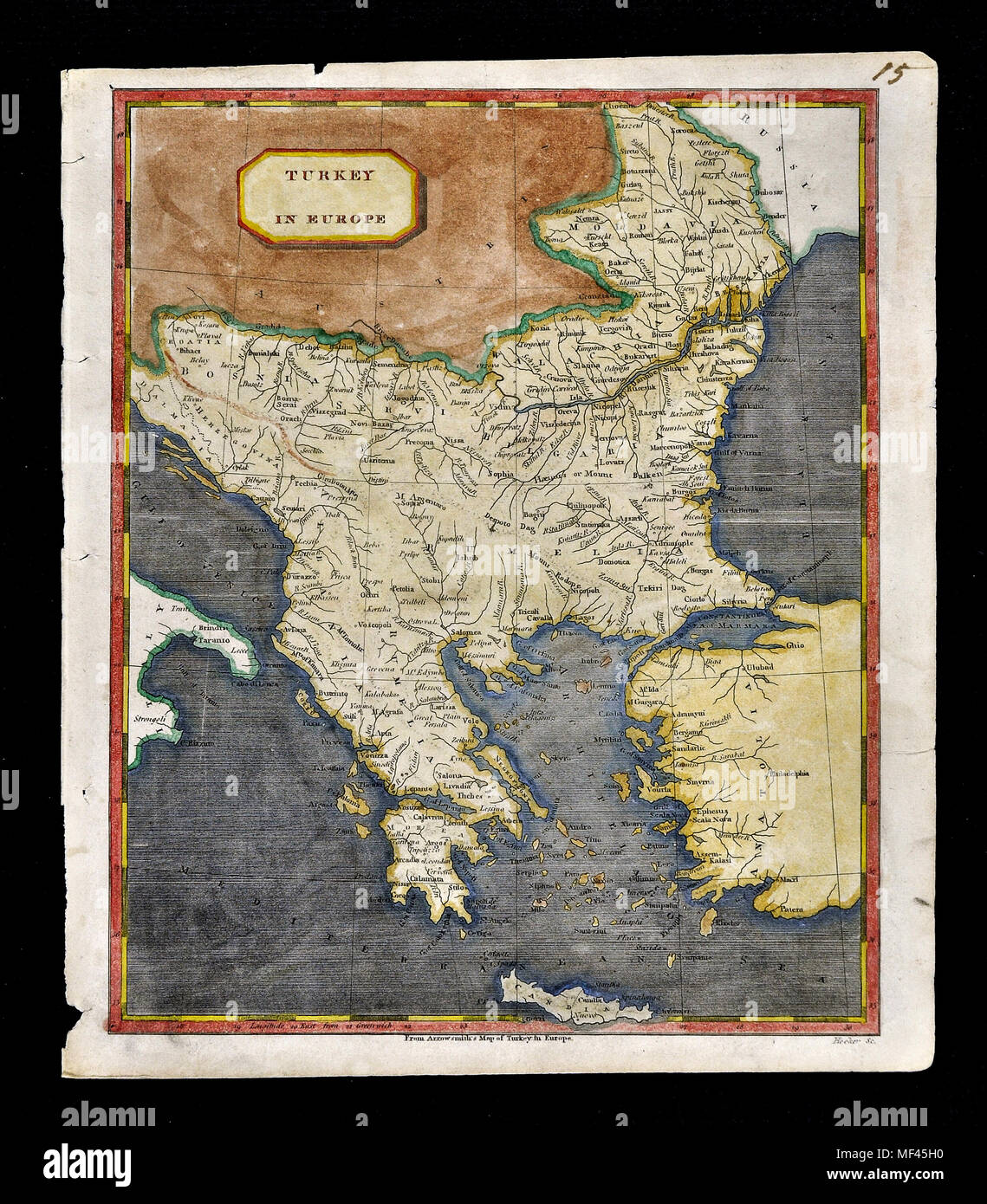 1804 Arrowsmith Map Turkey in Europe Greece Balkans Romania Bulgaria Transylvania Serbia Bosnia Montengegro Stock Photohttps://www.alamy.com/image-license-details/?v=1https://www.alamy.com/1804-arrowsmith-map-turkey-in-europe-greece-balkans-romania-bulgaria-transylvania-serbia-bosnia-montengegro-image181415724.html
RFMF45H0–1804 Arrowsmith Map Turkey in Europe Greece Balkans Romania Bulgaria Transylvania Serbia Bosnia Montengegro
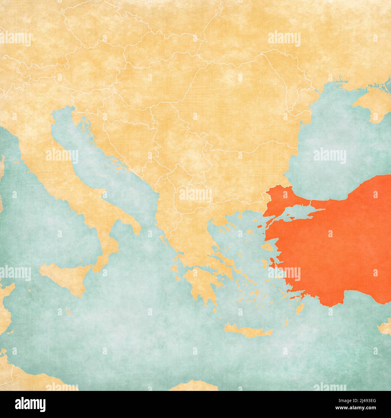 Turkey on the map of Balkans in soft grunge and vintage style, like old paper with watercolor painting. Stock Photohttps://www.alamy.com/image-license-details/?v=1https://www.alamy.com/turkey-on-the-map-of-balkans-in-soft-grunge-and-vintage-style-like-old-paper-with-watercolor-painting-image467338888.html
RF2J493EG–Turkey on the map of Balkans in soft grunge and vintage style, like old paper with watercolor painting.
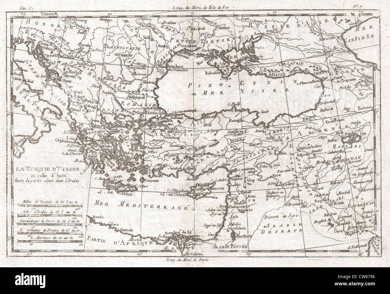 1780 Raynal and Bonne Map of Turkey in Europe and Asia Stock Photohttps://www.alamy.com/image-license-details/?v=1https://www.alamy.com/stock-photo-1780-raynal-and-bonne-map-of-turkey-in-europe-and-asia-49968498.html
RMCW8796–1780 Raynal and Bonne Map of Turkey in Europe and Asia
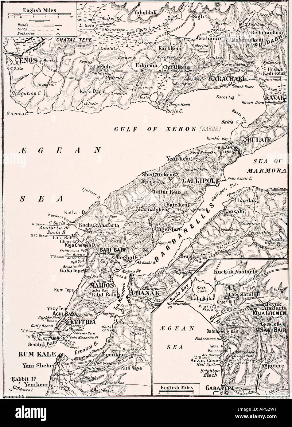 Detailed map of the Gallipoli Peninsula and the Dardanelles, Turkey in 1915 showing British and Allied landing beaches. Stock Photohttps://www.alamy.com/image-license-details/?v=1https://www.alamy.com/stock-photo-detailed-map-of-the-gallipoli-peninsula-and-the-dardanelles-turkey-15781331.html
RMAPG2WT–Detailed map of the Gallipoli Peninsula and the Dardanelles, Turkey in 1915 showing British and Allied landing beaches.
 Vintage copper engraved map of Turkey from 19th century. All maps are beautifully colored and illustrated showing the world at the time. Stock Photohttps://www.alamy.com/image-license-details/?v=1https://www.alamy.com/vintage-copper-engraved-map-of-turkey-from-19th-century-all-maps-are-beautifully-colored-and-illustrated-showing-the-world-at-the-time-image425536148.html
RF2FM8RKG–Vintage copper engraved map of Turkey from 19th century. All maps are beautifully colored and illustrated showing the world at the time.
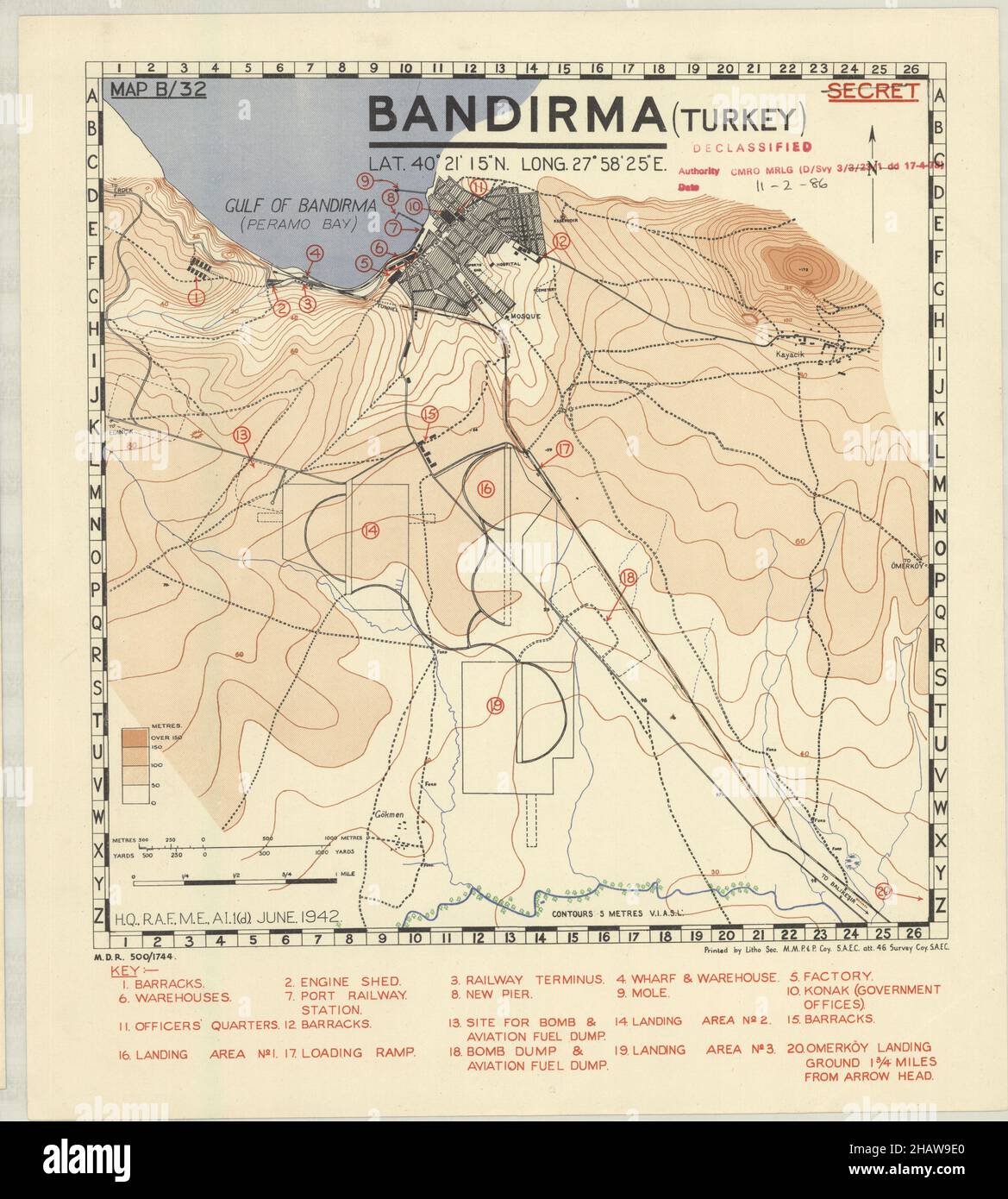 Bandirma Map, Map of Bandirma, Bandirma Post, Bandirma Plan, Bandirma City, Bandirma City Print, Old Bandirma Map, Turkey Map, Map of Turkey, Bandirma Stock Photohttps://www.alamy.com/image-license-details/?v=1https://www.alamy.com/bandirma-map-map-of-bandirma-bandirma-post-bandirma-plan-bandirma-city-bandirma-city-print-old-bandirma-map-turkey-map-map-of-turkey-bandirma-image454172376.html
RF2HAW9E0–Bandirma Map, Map of Bandirma, Bandirma Post, Bandirma Plan, Bandirma City, Bandirma City Print, Old Bandirma Map, Turkey Map, Map of Turkey, Bandirma
 Beautiful woodcut pages from the 1493 Nuremberg Chronicle, which is an enyclodpedia of world events, mythology and christian history. This extra-ordinary work was one of the earliest books ever printed and the first to successfully integrate text and images. These pages show latin text and an engraving of the town of Nicea (now Izmet) in Turkey Stock Photohttps://www.alamy.com/image-license-details/?v=1https://www.alamy.com/beautiful-woodcut-pages-from-the-1493-nuremberg-chronicle-which-is-an-enyclodpedia-of-world-events-mythology-and-christian-history-this-extra-ordinary-work-was-one-of-the-earliest-books-ever-printed-and-the-first-to-successfully-integrate-text-and-images-these-pages-show-latin-text-and-an-engraving-of-the-town-of-nicea-now-izmet-in-turkey-image598932215.html
RM2WPBM47–Beautiful woodcut pages from the 1493 Nuremberg Chronicle, which is an enyclodpedia of world events, mythology and christian history. This extra-ordinary work was one of the earliest books ever printed and the first to successfully integrate text and images. These pages show latin text and an engraving of the town of Nicea (now Izmet) in Turkey
 map and banner of turkey on old linen Stock Photohttps://www.alamy.com/image-license-details/?v=1https://www.alamy.com/map-and-banner-of-turkey-on-old-linen-image227891839.html
RFR6NAA7–map and banner of turkey on old linen
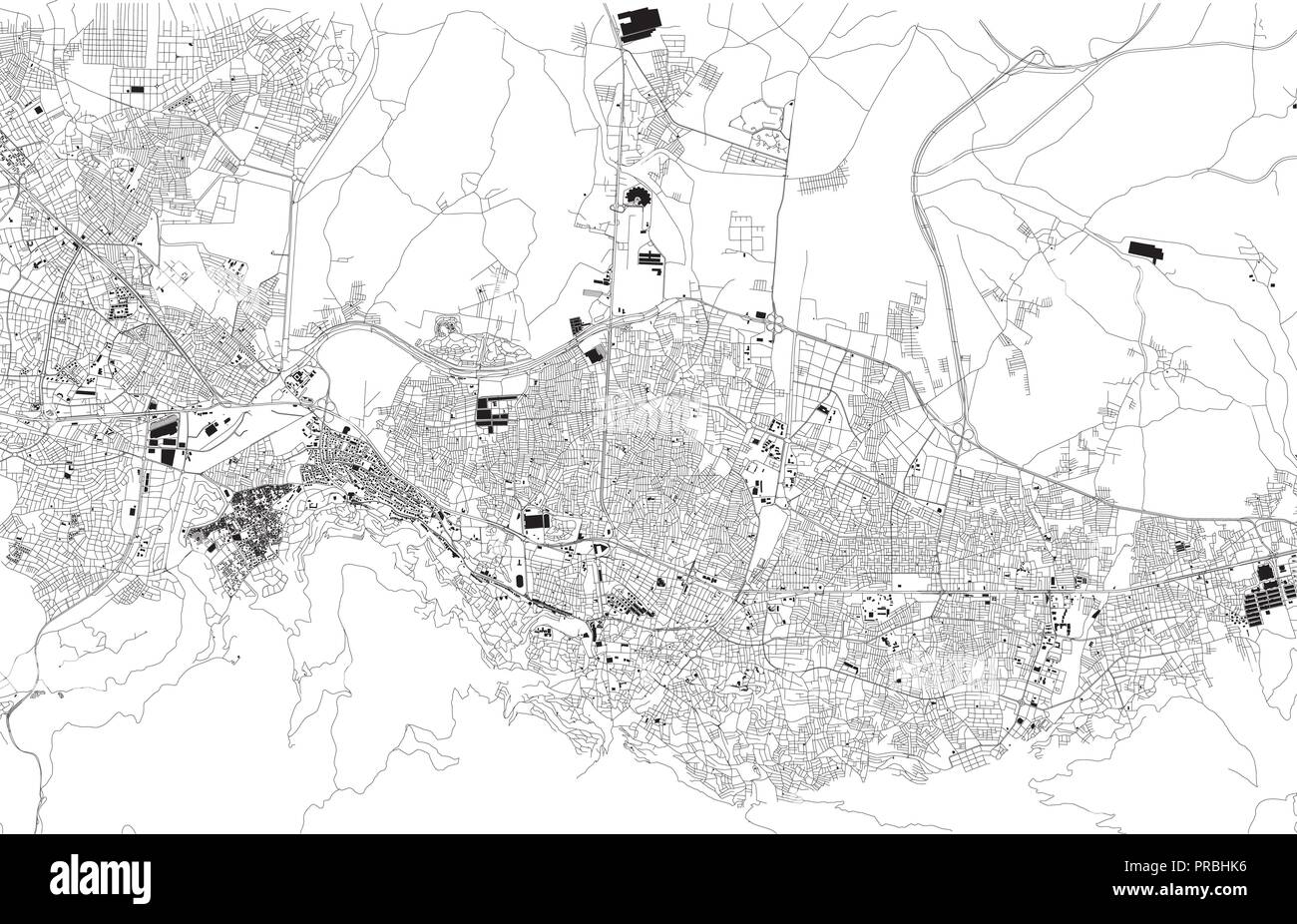 Map of Bursa, Turkey, satellite view, black and white map. Street directory and city map. Asia Stock Vectorhttps://www.alamy.com/image-license-details/?v=1https://www.alamy.com/map-of-bursa-turkey-satellite-view-black-and-white-map-street-directory-and-city-map-asia-image220916842.html
RFPRBHK6–Map of Bursa, Turkey, satellite view, black and white map. Street directory and city map. Asia
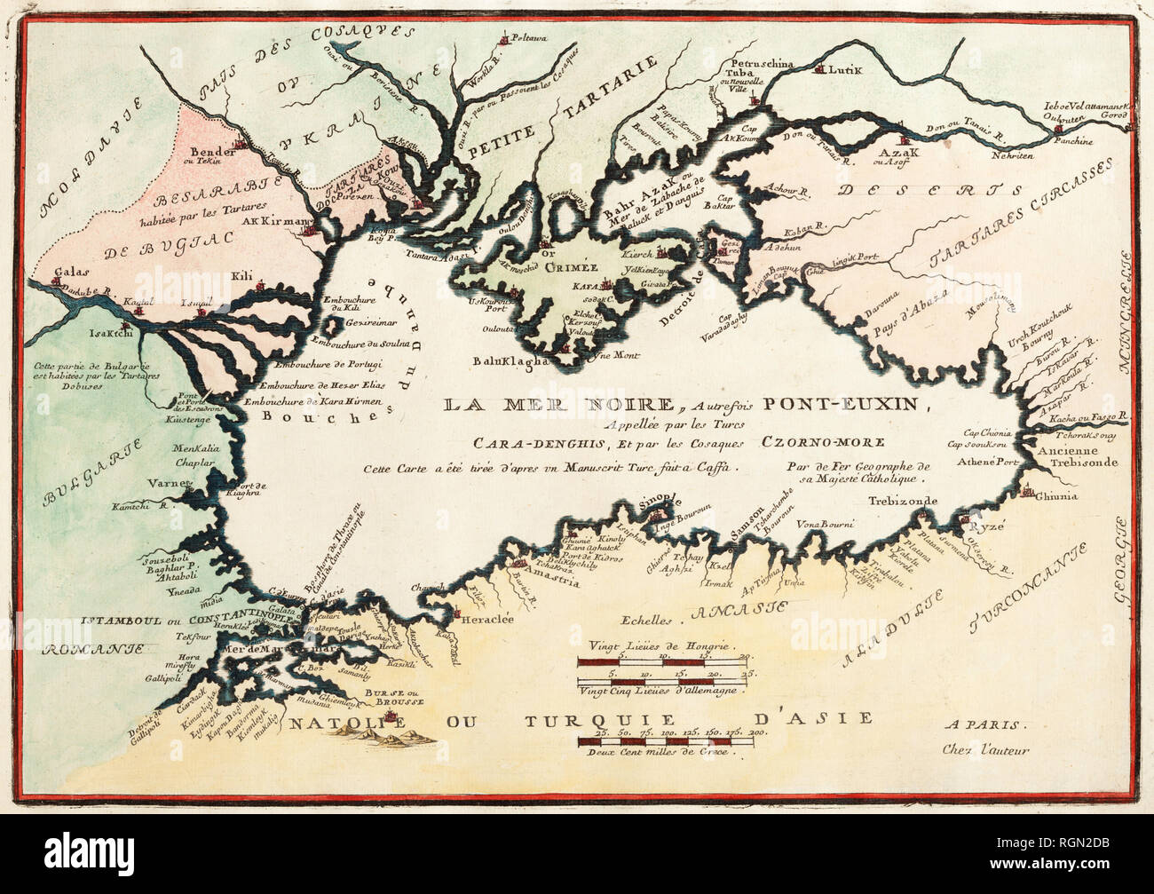 The Black Sea Formerly Pont-Euxin, Cara-Denghis. Nicolas de Fer (Paris, 1705). Stock Photohttps://www.alamy.com/image-license-details/?v=1https://www.alamy.com/the-black-sea-formerly-pont-euxin-cara-denghis-nicolas-de-fer-paris-1705-image234032215.html
RMRGN2DB–The Black Sea Formerly Pont-Euxin, Cara-Denghis. Nicolas de Fer (Paris, 1705).
 Old Map Black Sea region Stock Photohttps://www.alamy.com/image-license-details/?v=1https://www.alamy.com/old-map-black-sea-region-image632065051.html
RF2YM91BR–Old Map Black Sea region
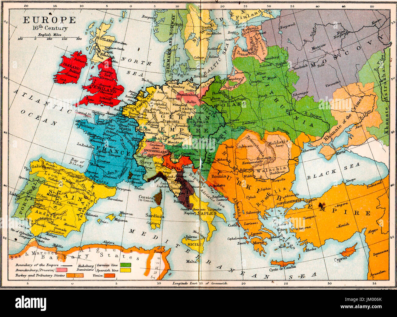 Old school atlas map- Europe in 16th century Stock Photohttps://www.alamy.com/image-license-details/?v=1https://www.alamy.com/stock-photo-old-school-atlas-map-europe-in-16th-century-149976251.html
RMJM006K–Old school atlas map- Europe in 16th century
 Istanbul city sketch plan & Dardanelles. Turkey. BARTHOLOMEW 1949 old map Stock Photohttps://www.alamy.com/image-license-details/?v=1https://www.alamy.com/istanbul-city-sketch-plan-dardanelles-turkey-bartholomew-1949-old-map-image428910485.html
RF2FWPFKH–Istanbul city sketch plan & Dardanelles. Turkey. BARTHOLOMEW 1949 old map
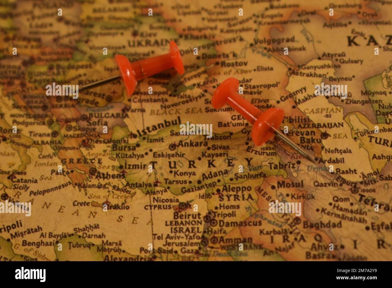 Vintage map of Turkey with a two pins Stock Photohttps://www.alamy.com/image-license-details/?v=1https://www.alamy.com/vintage-map-of-turkey-with-a-two-pins-image503625117.html
RM2M7A2Y9–Vintage map of Turkey with a two pins
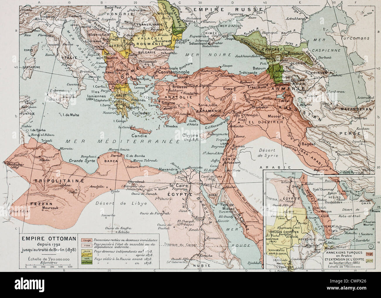 Ottoman Empire historical development old map Stock Photohttps://www.alamy.com/image-license-details/?v=1https://www.alamy.com/stock-photo-ottoman-empire-historical-development-old-map-50290526.html
RFCWPX26–Ottoman Empire historical development old map
 Maps of Old European Cities in Exhibition of Piri Reis in Tophane ,Istanbul,Turkey Stock Photohttps://www.alamy.com/image-license-details/?v=1https://www.alamy.com/maps-of-old-european-cities-in-exhibition-of-piri-reis-in-tophane-image60461933.html
RMDEA7PN–Maps of Old European Cities in Exhibition of Piri Reis in Tophane ,Istanbul,Turkey
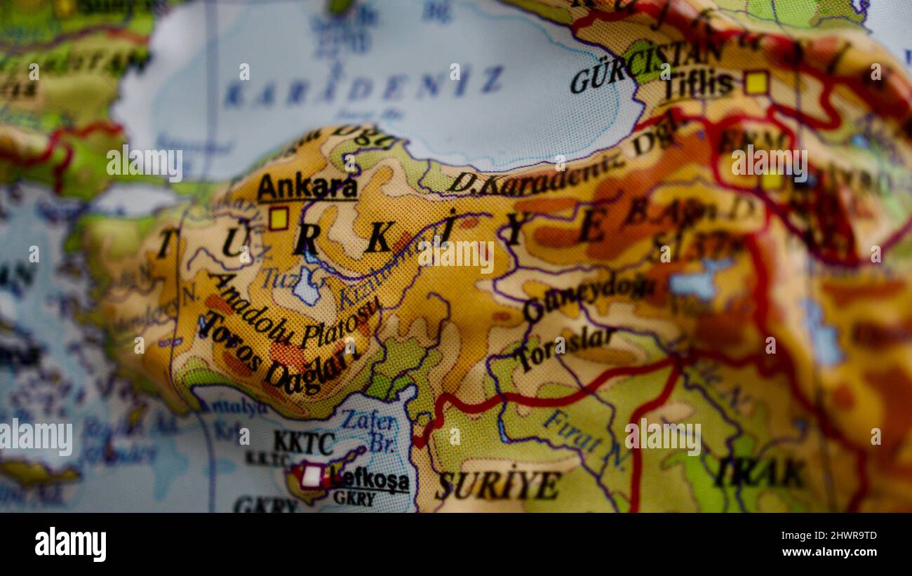 Turkey country on embossed map. Topographic and physical map. Close-up embossed map of Turkey. Stock Photohttps://www.alamy.com/image-license-details/?v=1https://www.alamy.com/turkey-country-on-embossed-map-topographic-and-physical-map-close-up-embossed-map-of-turkey-image463348605.html
RF2HWR9TD–Turkey country on embossed map. Topographic and physical map. Close-up embossed map of Turkey.