Quick filters:
Yorktown virginia map Stock Photos and Images
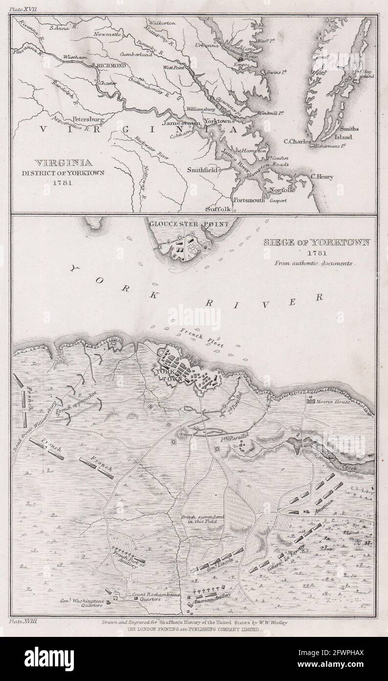 Siege of Yorktown 1781. Virginia environs of Yorktown. WOOLLEY 1863 old map Stock Photohttps://www.alamy.com/image-license-details/?v=1https://www.alamy.com/siege-of-yorktown-1781-virginia-environs-of-yorktown-woolley-1863-old-map-image428911810.html
RF2FWPHAX–Siege of Yorktown 1781. Virginia environs of Yorktown. WOOLLEY 1863 old map
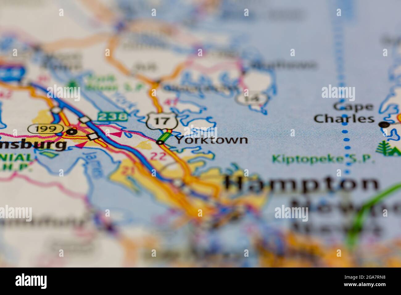 Yorktown Virginia shown on a road map or Geography map Stock Photohttps://www.alamy.com/image-license-details/?v=1https://www.alamy.com/yorktown-virginia-shown-on-a-road-map-or-geography-map-image436578052.html
RM2GA7RN8–Yorktown Virginia shown on a road map or Geography map
 VIRGINIA: Plan of Yorktown, c1880 antique map Stock Photohttps://www.alamy.com/image-license-details/?v=1https://www.alamy.com/stock-photo-virginia-plan-of-yorktown-c1880-antique-map-103214014.html
RFFYWPEP–VIRGINIA: Plan of Yorktown, c1880 antique map
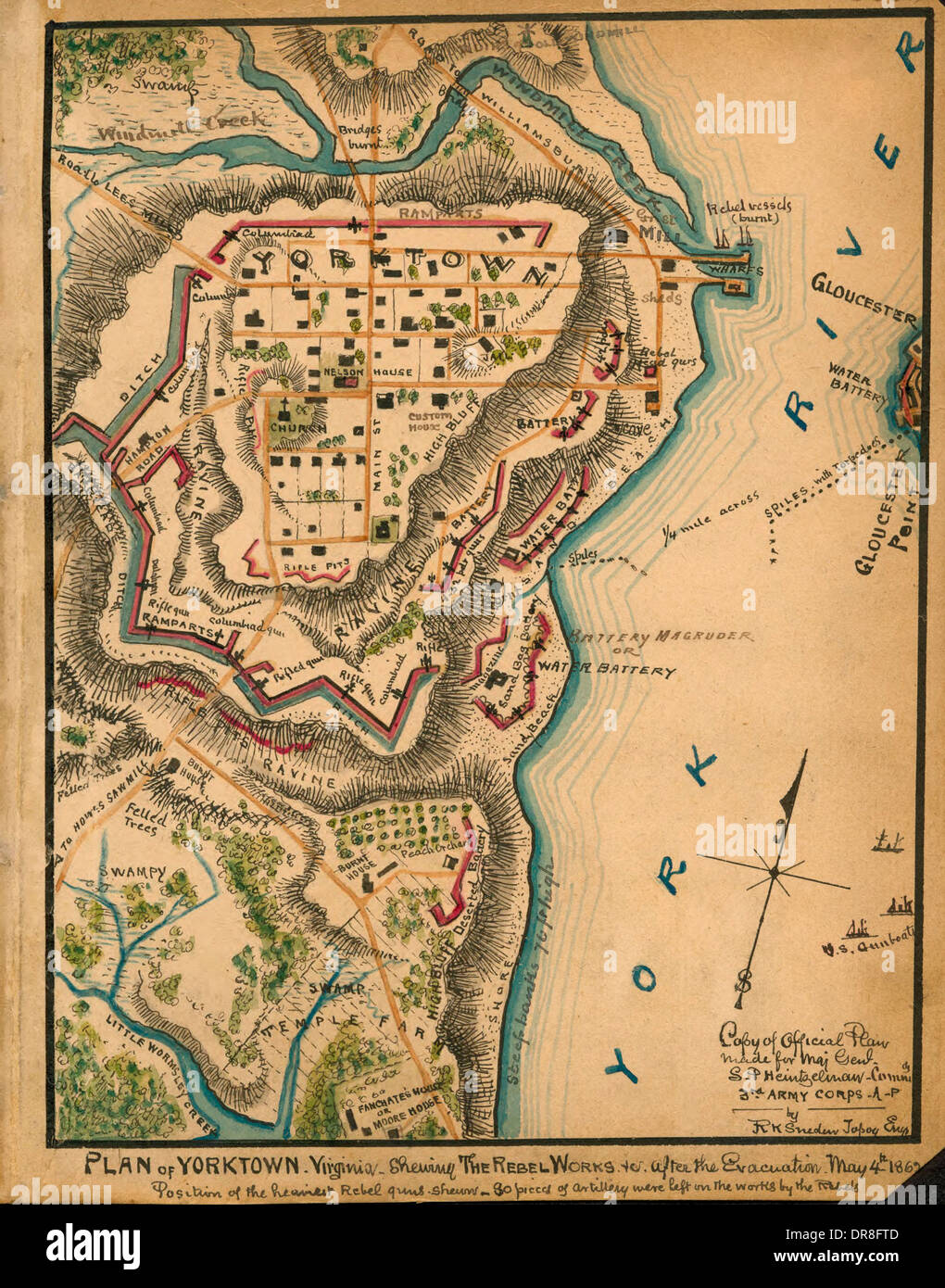 Plan of Yorktown, Virginia : showing the Rebel works after the evacuation, May 4th, 1862. USA Civil War Stock Photohttps://www.alamy.com/image-license-details/?v=1https://www.alamy.com/plan-of-yorktown-virginia-showing-the-rebel-works-after-the-evacuation-image65956253.html
RMDR8FTD–Plan of Yorktown, Virginia : showing the Rebel works after the evacuation, May 4th, 1862. USA Civil War
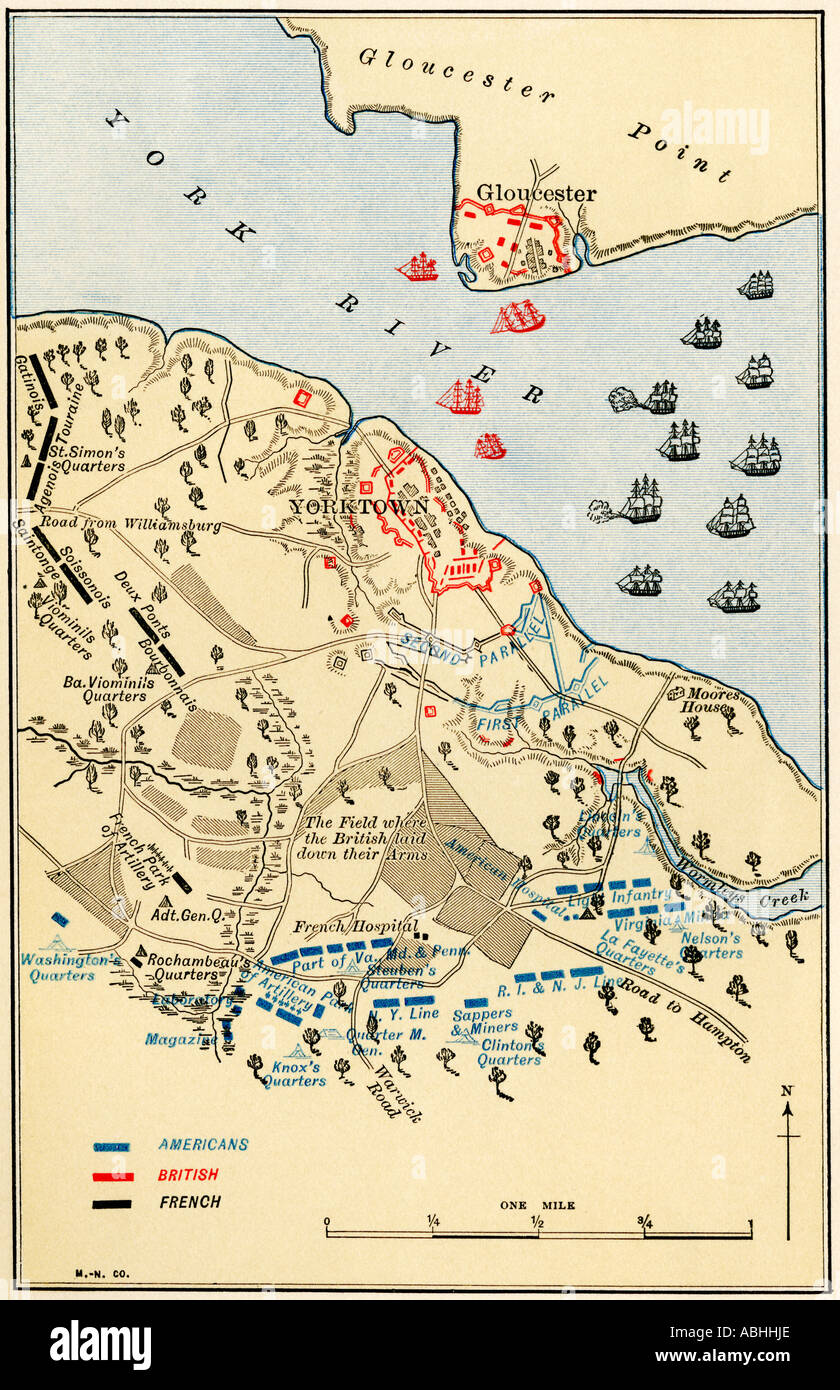 Map of the Battle of Yorktown where the British were defeated by the American and French alliance in the Revolutionary War. Color lithograph Stock Photohttps://www.alamy.com/image-license-details/?v=1https://www.alamy.com/map-of-the-battle-of-yorktown-where-the-british-were-defeated-by-the-image7370221.html
RMABHHJE–Map of the Battle of Yorktown where the British were defeated by the American and French alliance in the Revolutionary War. Color lithograph
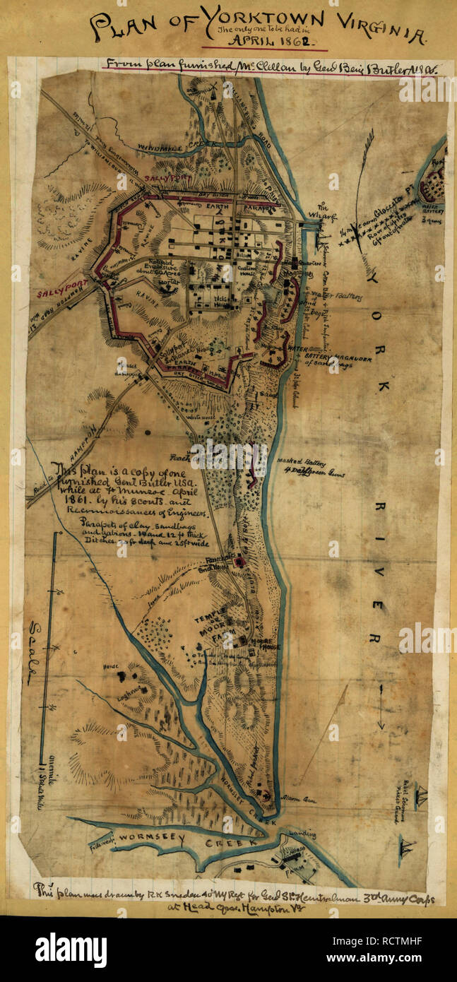 Plan of Yorktown, Virginia ... April, 1862. Shows the area of the York River coastline from Windmill Creek to Wormsley Creek with particular attention to the landforms and defenses around Yorktown and the layout of streets and buildings within the town itself. American Civil War Stock Photohttps://www.alamy.com/image-license-details/?v=1https://www.alamy.com/plan-of-yorktown-virginia-april-1862-shows-the-area-of-the-york-river-coastline-from-windmill-creek-to-wormsley-creek-with-particular-attention-to-the-landforms-and-defenses-around-yorktown-and-the-layout-of-streets-and-buildings-within-the-town-itself-american-civil-war-image231653675.html
RMRCTMHF–Plan of Yorktown, Virginia ... April, 1862. Shows the area of the York River coastline from Windmill Creek to Wormsley Creek with particular attention to the landforms and defenses around Yorktown and the layout of streets and buildings within the town itself. American Civil War
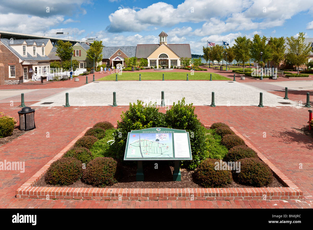 Yorktown, VA - Sep 2009 - Directory guide in courtyard of Riverwalk Landing on the York River in Historic Yorktown, Virginia Stock Photohttps://www.alamy.com/image-license-details/?v=1https://www.alamy.com/stock-photo-yorktown-va-sep-2009-directory-guide-in-courtyard-of-riverwalk-landing-30264624.html
RMBN6JRC–Yorktown, VA - Sep 2009 - Directory guide in courtyard of Riverwalk Landing on the York River in Historic Yorktown, Virginia
 great valley map Yorktown Virginia Stock Photohttps://www.alamy.com/image-license-details/?v=1https://www.alamy.com/stock-image-great-valley-map-yorktown-virginia-165424709.html
RMKH3MW9–great valley map Yorktown Virginia
 Yorktown, York County, US, United States, Virginia, N 37 14' 18'', S 76 30' 32'', map, Cartascapes Map published in 2024. Explore Cartascapes, a map revealing Earth's diverse landscapes, cultures, and ecosystems. Journey through time and space, discovering the interconnectedness of our planet's past, present, and future. Stock Photohttps://www.alamy.com/image-license-details/?v=1https://www.alamy.com/yorktown-york-county-us-united-states-virginia-n-37-14-18-s-76-30-32-map-cartascapes-map-published-in-2024-explore-cartascapes-a-map-revealing-earths-diverse-landscapes-cultures-and-ecosystems-journey-through-time-and-space-discovering-the-interconnectedness-of-our-planets-past-present-and-future-image621455465.html
RM2Y31MP1–Yorktown, York County, US, United States, Virginia, N 37 14' 18'', S 76 30' 32'', map, Cartascapes Map published in 2024. Explore Cartascapes, a map revealing Earth's diverse landscapes, cultures, and ecosystems. Journey through time and space, discovering the interconnectedness of our planet's past, present, and future.
 Plan of Union and Rebel position at Yorktown Virginia, USA Civil War 1862 Stock Photohttps://www.alamy.com/image-license-details/?v=1https://www.alamy.com/stock-photo-plan-of-union-and-rebel-position-at-yorktown-virginia-usa-civil-war-71717491.html
RME4K0AY–Plan of Union and Rebel position at Yorktown Virginia, USA Civil War 1862
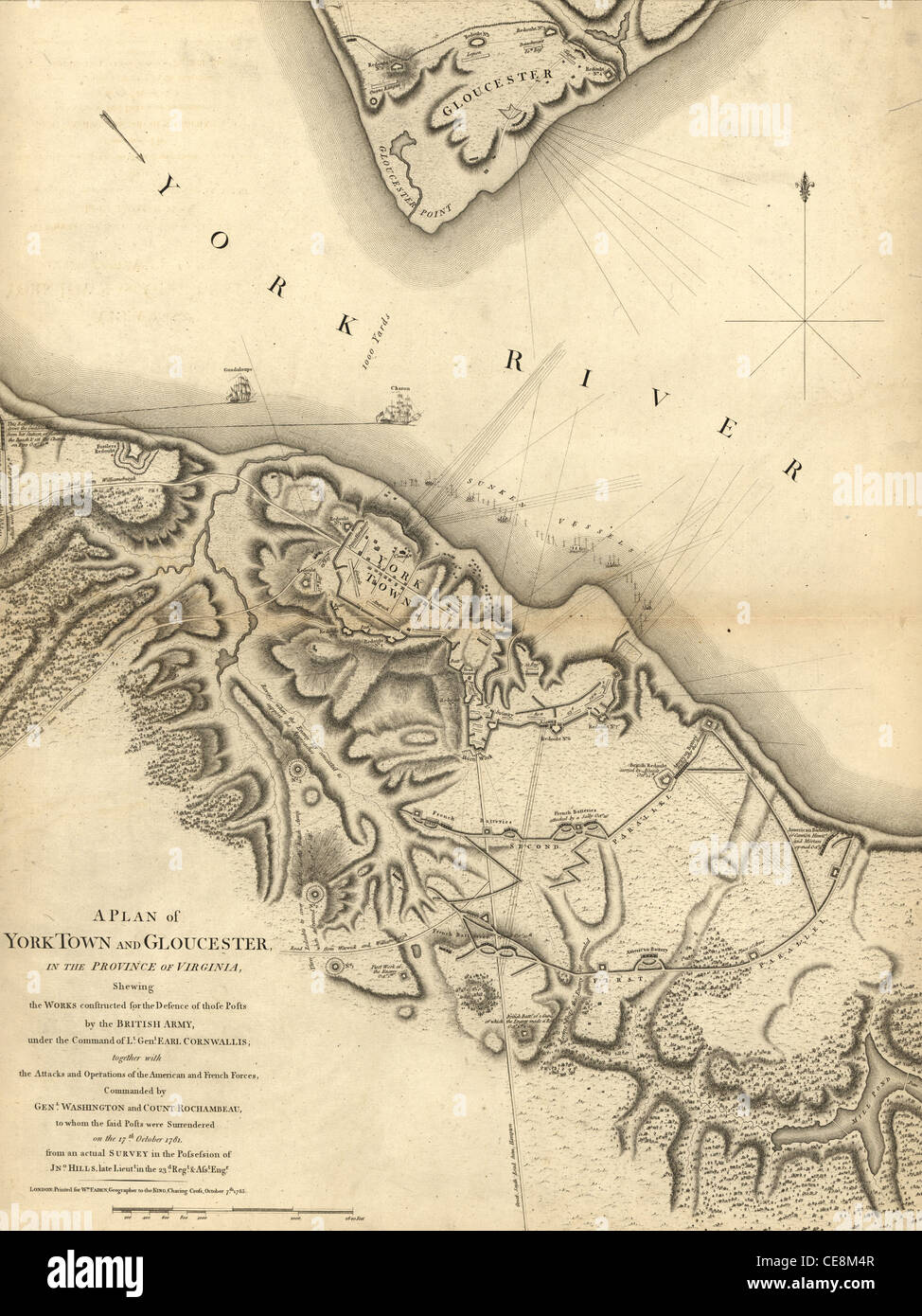
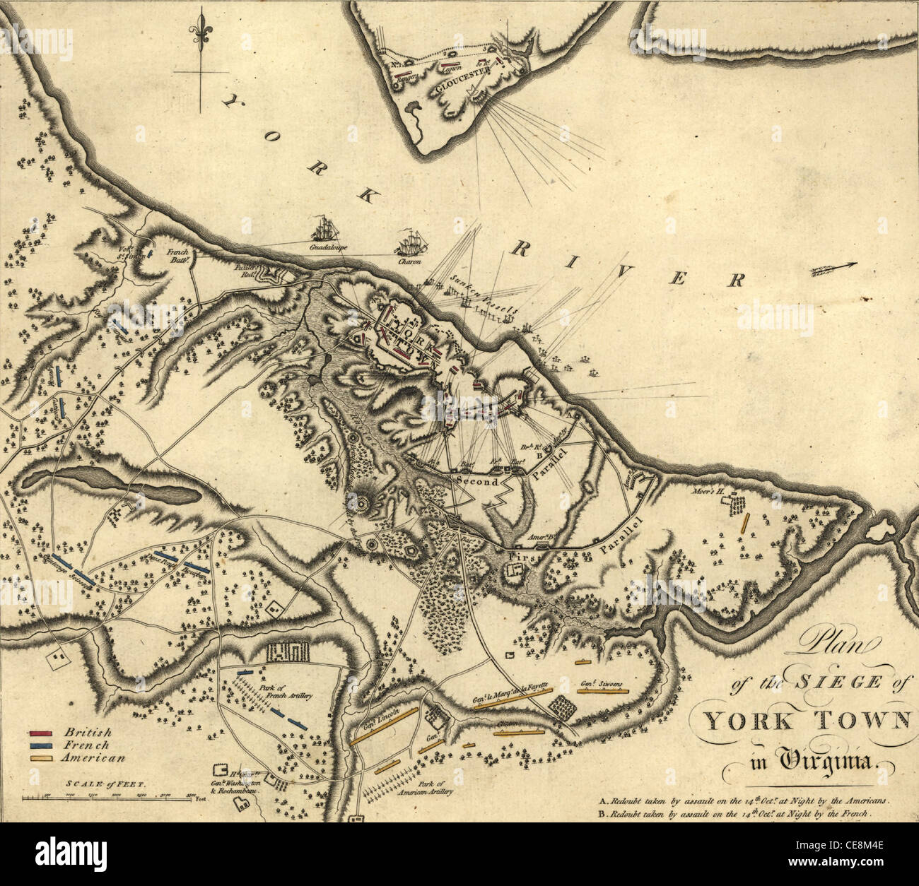
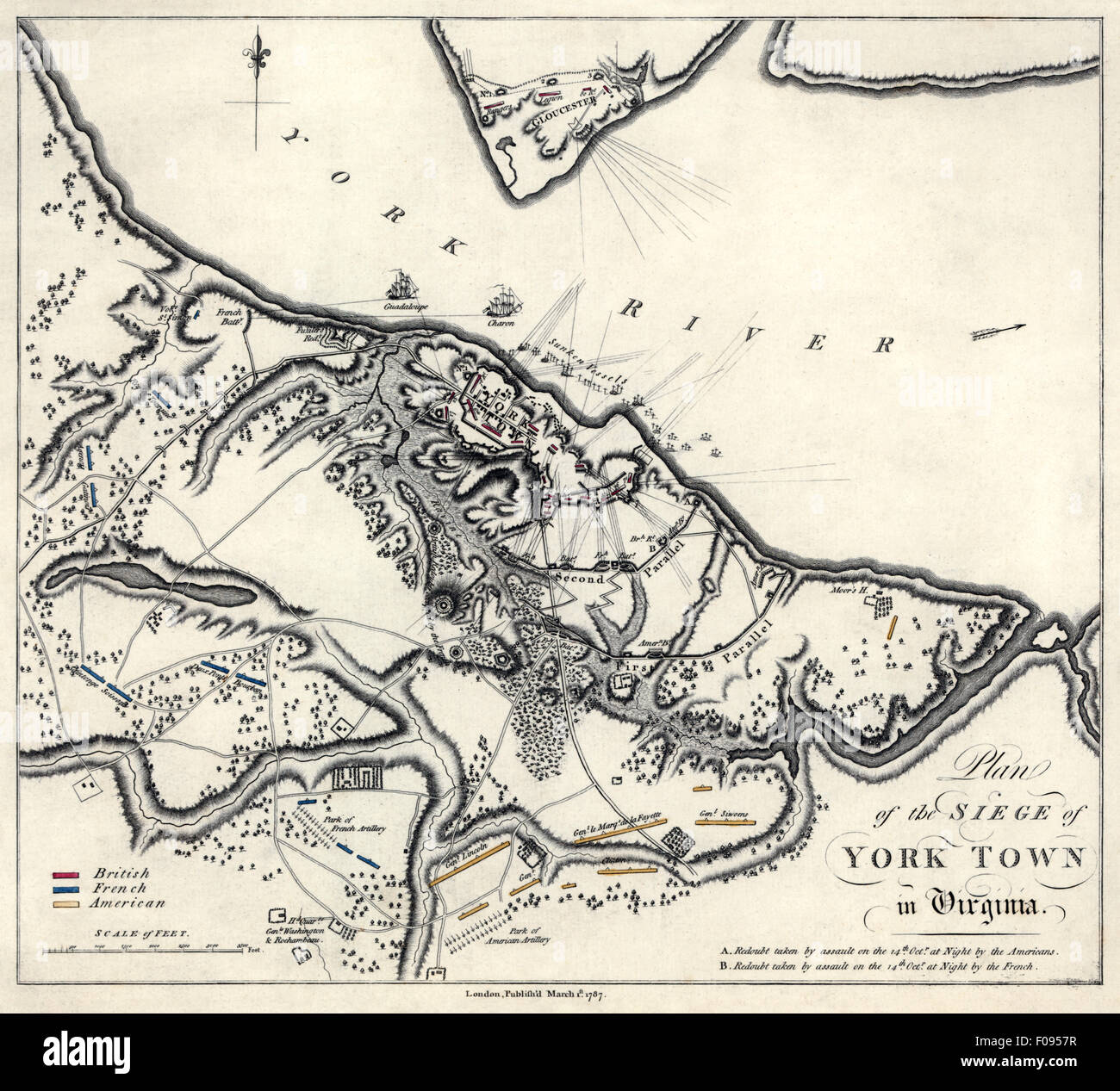 Plan of siege of Yorktown in Virginia showing positions of British, French and American armies in early October 1781. Also shown are HMS Guadeloupe and HMS Charon on the York River before their destruction. Stock Photohttps://www.alamy.com/image-license-details/?v=1https://www.alamy.com/stock-photo-plan-of-siege-of-yorktown-in-virginia-showing-positions-of-british-86253547.html
RMF0957R–Plan of siege of Yorktown in Virginia showing positions of British, French and American armies in early October 1781. Also shown are HMS Guadeloupe and HMS Charon on the York River before their destruction.
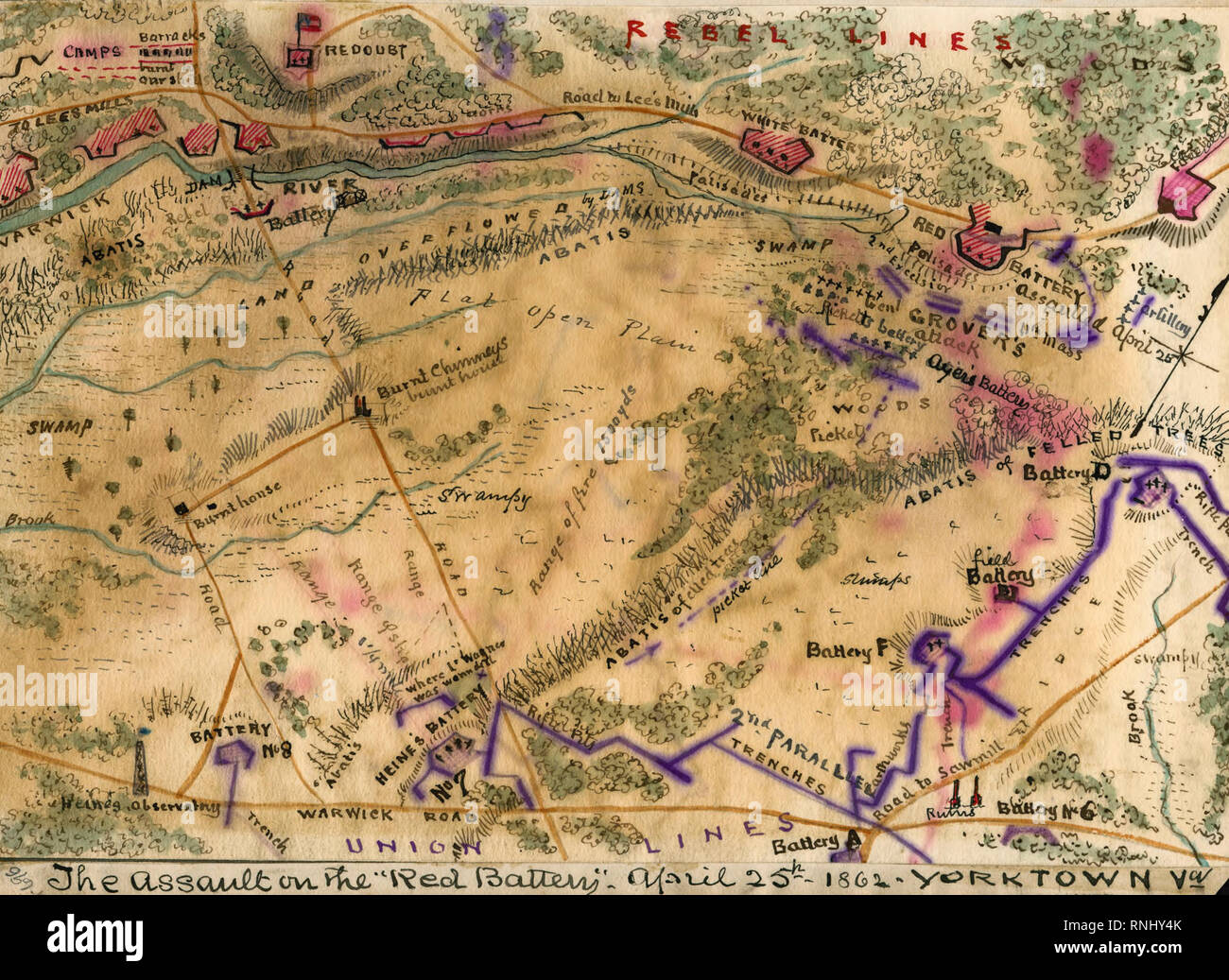 The assault on the 'Red Battery,' April 25th, 1862 Yorktown, Virginia - Shows the area between the Warwick River to the west and the Warwick Road to the east as McClellan's forces attacked Confederate batteries on the Peninsula south of Yorktown, Virginia Stock Photohttps://www.alamy.com/image-license-details/?v=1https://www.alamy.com/the-assault-on-the-red-battery-april-25th-1862-yorktown-virginia-shows-the-area-between-the-warwick-river-to-the-west-and-the-warwick-road-to-the-east-as-mcclellans-forces-attacked-confederate-batteries-on-the-peninsula-south-of-yorktown-virginia-image237037043.html
RMRNHY4K–The assault on the 'Red Battery,' April 25th, 1862 Yorktown, Virginia - Shows the area between the Warwick River to the west and the Warwick Road to the east as McClellan's forces attacked Confederate batteries on the Peninsula south of Yorktown, Virginia
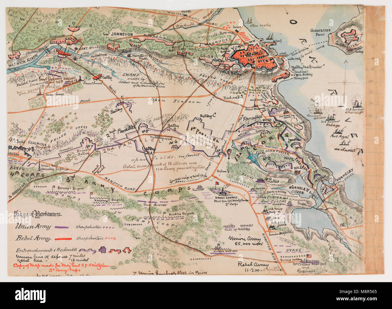 Map of Siege of Yorktown Stock Photohttps://www.alamy.com/image-license-details/?v=1https://www.alamy.com/stock-photo-map-of-siege-of-yorktown-177529917.html
RMM8R565–Map of Siege of Yorktown
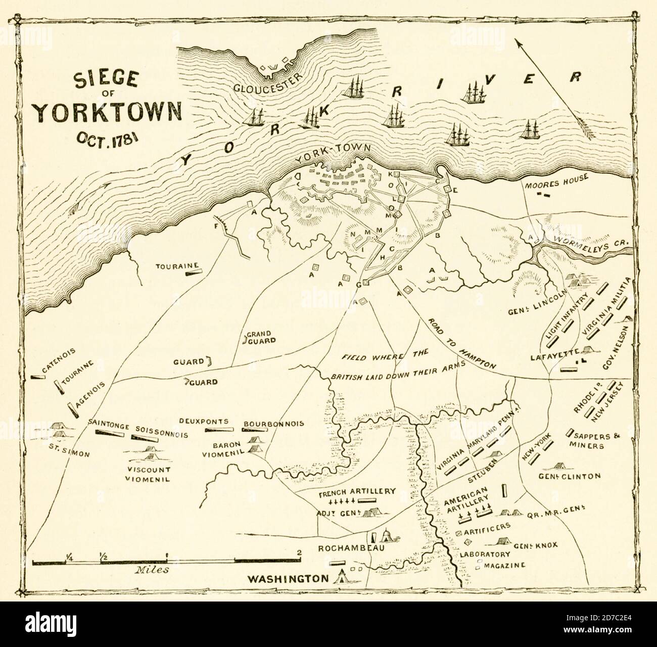 Siege of Yorktown Oct 1781. The Siege of Yorktown (also known as the Battle of Yorktown, the surrender at Yorktown, or the German Battle) ended on October 19, 1781, at Yorktown, Virginia. It was a decisive victory by a combined force of American Continental Army troops led by General George Washington and French Army troops led by the Comte de Rochambeau over a British army commanded by British peer and Lieutenant General Charles Cornwallis. Stock Photohttps://www.alamy.com/image-license-details/?v=1https://www.alamy.com/siege-of-yorktown-oct-1781-thesiege-of-yorktown-also-known-as-thebattle-of-yorktown-thesurrender-at-yorktown-or-thegerman-battle-ended-on-october-19-1781-atyorktown-virginia-it-was-a-decisive-victory-by-a-combined-force-of-americancontinental-armytroops-led-by-generalgeorge-washingtonandfrench-army-troopsled-by-thecomte-de-rochambeauover-abritish-armycommanded-by-british-peer-and-lieutenant-generalcharles-cornwallis-image383196076.html
RF2D7C2E4–Siege of Yorktown Oct 1781. The Siege of Yorktown (also known as the Battle of Yorktown, the surrender at Yorktown, or the German Battle) ended on October 19, 1781, at Yorktown, Virginia. It was a decisive victory by a combined force of American Continental Army troops led by General George Washington and French Army troops led by the Comte de Rochambeau over a British army commanded by British peer and Lieutenant General Charles Cornwallis.
 1700s 1770s 1781 MAP OF HAMPTON ROADS SHOWING PLACEMENTS DURING THE SEIGE OF YORKTOWN AMERICAN WAR OF INDEPENDENCE Stock Photohttps://www.alamy.com/image-license-details/?v=1https://www.alamy.com/stock-photo-1700s-1770s-1781-map-of-hampton-roads-showing-placements-during-the-58975002.html
RMDBXF62–1700s 1770s 1781 MAP OF HAMPTON ROADS SHOWING PLACEMENTS DURING THE SEIGE OF YORKTOWN AMERICAN WAR OF INDEPENDENCE
 USA, Virginia, Yorktown Victory Center, Continental Army encampment, field desk Stock Photohttps://www.alamy.com/image-license-details/?v=1https://www.alamy.com/stock-photo-usa-virginia-yorktown-victory-center-continental-army-encampment-field-139316356.html
RMJ2JBC4–USA, Virginia, Yorktown Victory Center, Continental Army encampment, field desk
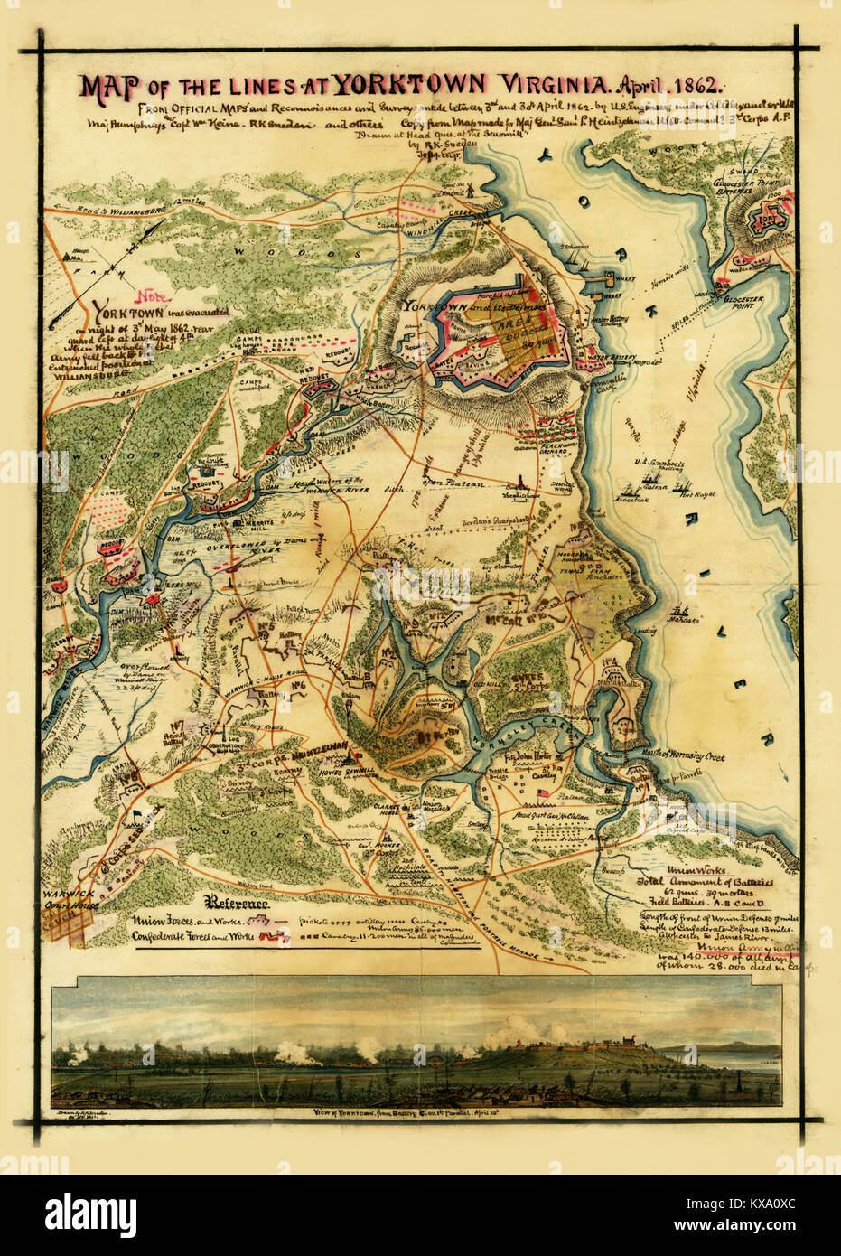 Yorktown, Virginia, April 1862 Stock Photohttps://www.alamy.com/image-license-details/?v=1https://www.alamy.com/stock-photo-yorktown-virginia-april-1862-171094628.html
RMKXA0XC–Yorktown, Virginia, April 1862
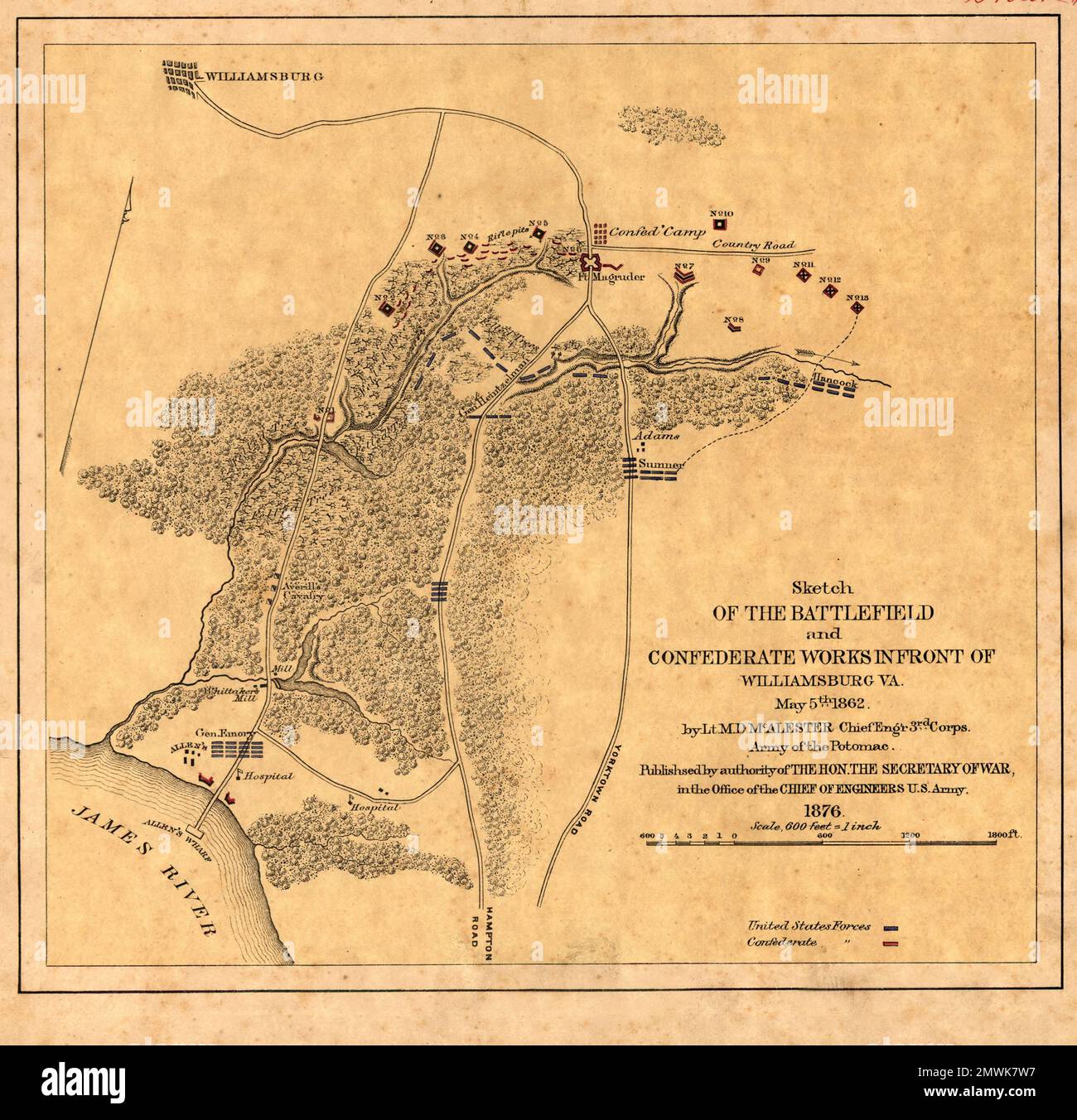 The Battle of Williamsburg (also known as the Battle of Fort Magruder) took place on May 5, 1862 at Williamsburg, Virginia as part of the Peninsula Campaign of the American Civil War. After the Confederate retreat from the Siege of Yorktown, the Union division of Brigadier General Joseph Hooker encountered the Confederate army near Williamsburg. The battle was inconclusive and the Confederate army continued its withdrawal during the night in the direction of Richmond, Virginia. This image shows an official map of the battle published 14 years after the battle. Stock Photohttps://www.alamy.com/image-license-details/?v=1https://www.alamy.com/the-battle-of-williamsburg-also-known-as-the-battle-of-fort-magruder-took-place-on-may-5-1862-at-williamsburg-virginia-as-part-of-the-peninsula-campaign-of-the-american-civil-war-after-the-confederate-retreat-from-the-siege-of-yorktown-the-union-division-of-brigadier-general-joseph-hooker-encountered-the-confederate-army-near-williamsburg-the-battle-was-inconclusive-and-the-confederate-army-continued-its-withdrawal-during-the-night-in-the-direction-of-richmond-virginia-this-image-shows-an-official-map-of-the-battle-published-14-years-after-the-battle-image514890355.html
RM2MWK7W7–The Battle of Williamsburg (also known as the Battle of Fort Magruder) took place on May 5, 1862 at Williamsburg, Virginia as part of the Peninsula Campaign of the American Civil War. After the Confederate retreat from the Siege of Yorktown, the Union division of Brigadier General Joseph Hooker encountered the Confederate army near Williamsburg. The battle was inconclusive and the Confederate army continued its withdrawal during the night in the direction of Richmond, Virginia. This image shows an official map of the battle published 14 years after the battle.
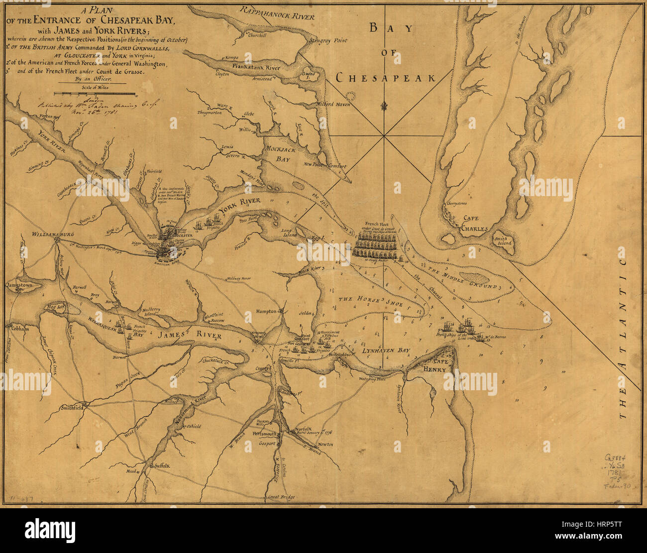 Battle Positions, Siege of Yorktown Stock Photohttps://www.alamy.com/image-license-details/?v=1https://www.alamy.com/stock-photo-battle-positions-siege-of-yorktown-135097224.html
RMHRP5TT–Battle Positions, Siege of Yorktown
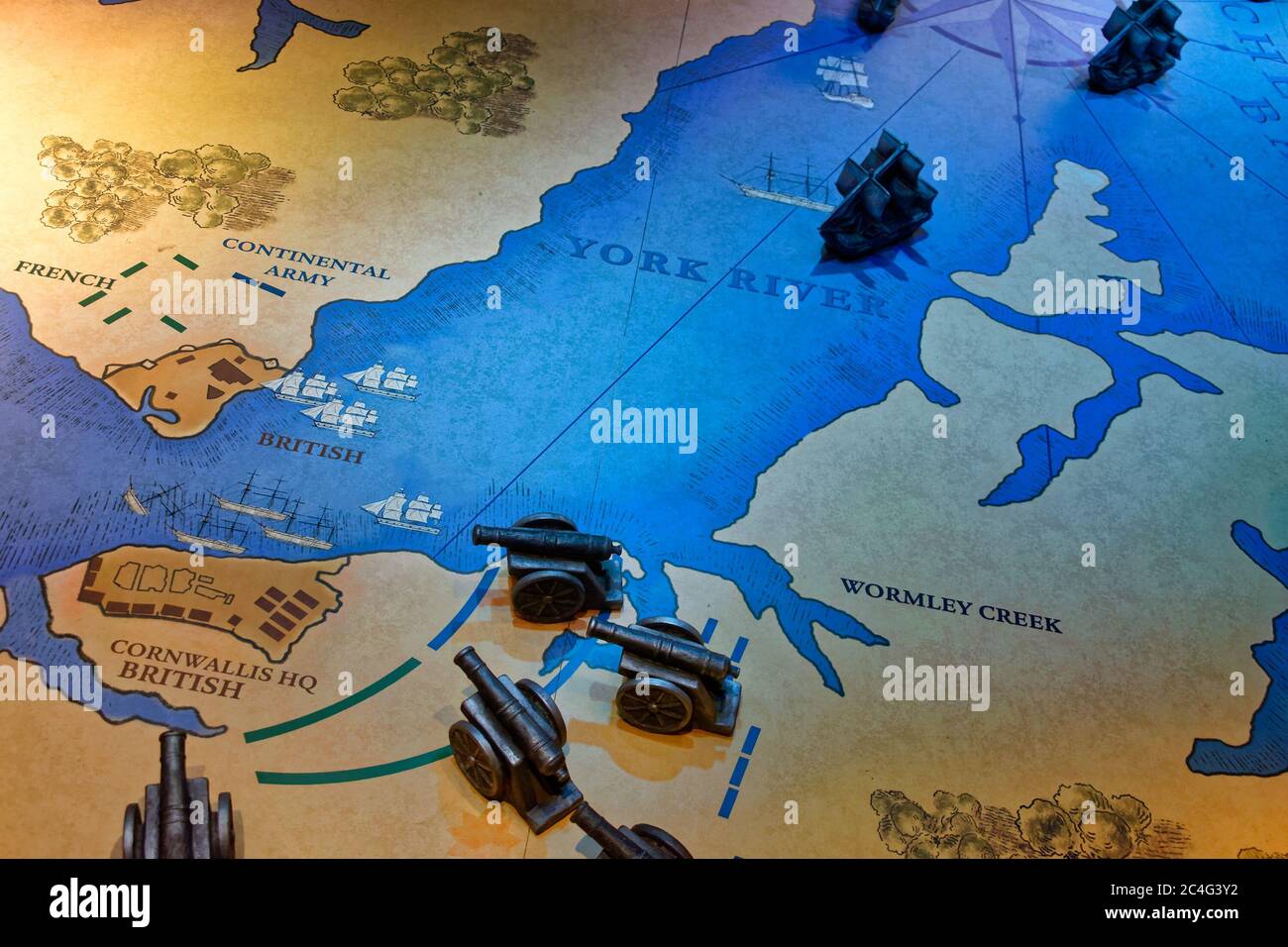 Map of the Siege of Yorktown (1781), also known as the Battle of Yorktown, the last major land battle of the American Revolutionary War. Stock Photohttps://www.alamy.com/image-license-details/?v=1https://www.alamy.com/map-of-the-siege-of-yorktown-1781-also-known-as-the-battle-of-yorktown-the-last-major-land-battle-of-the-american-revolutionary-war-image364230694.html
RF2C4G3Y2–Map of the Siege of Yorktown (1781), also known as the Battle of Yorktown, the last major land battle of the American Revolutionary War.
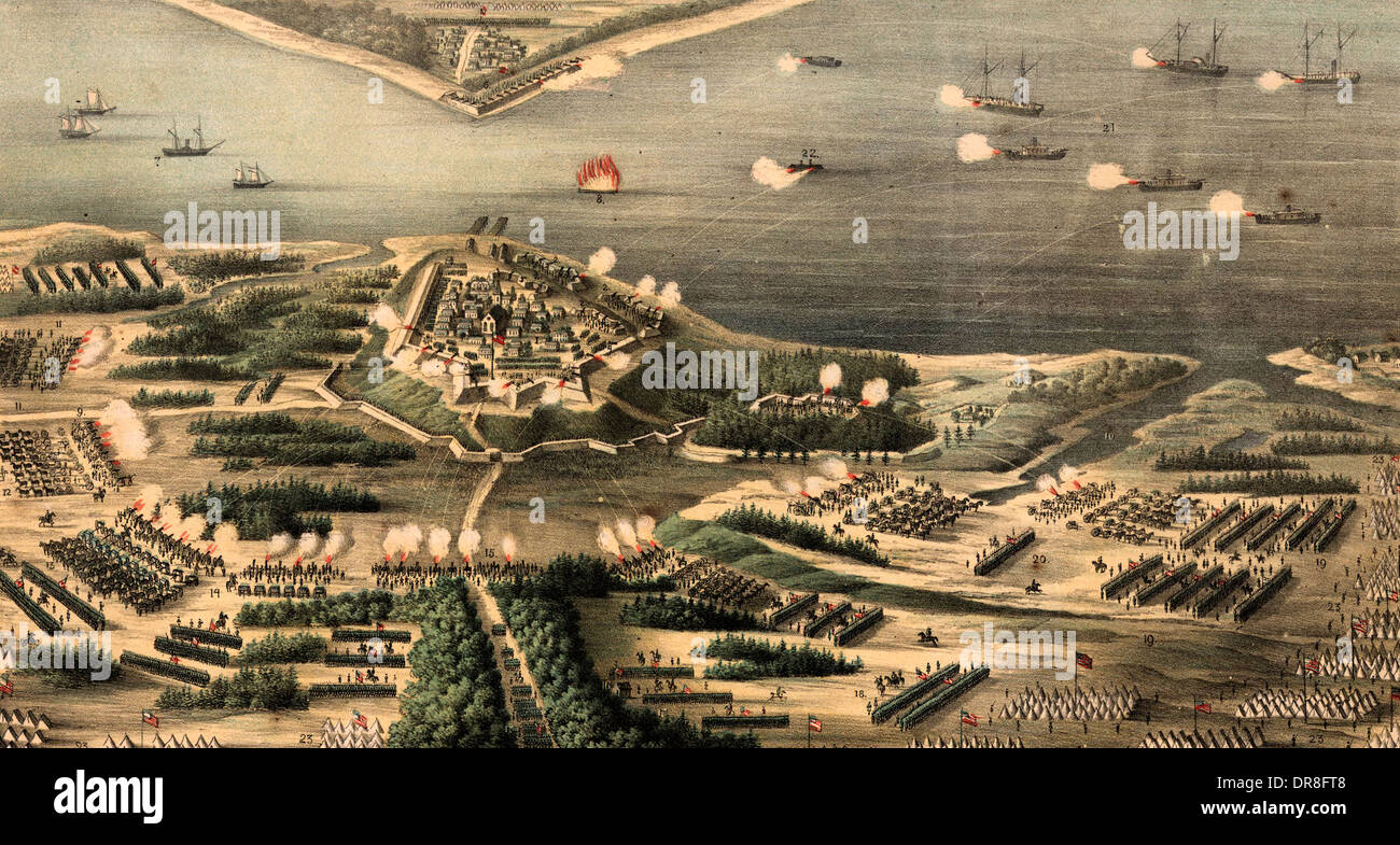 The siege of Yorktown, April 1862 during USA Civil War Stock Photohttps://www.alamy.com/image-license-details/?v=1https://www.alamy.com/the-siege-of-yorktown-april-1862-during-usa-civil-war-image65956248.html
RMDR8FT8–The siege of Yorktown, April 1862 during USA Civil War
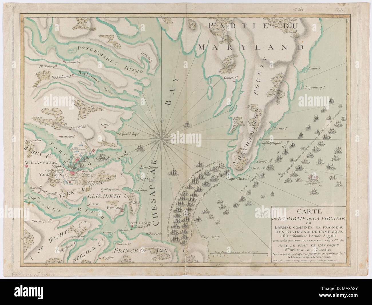 Carte de la partie de la Virginie, 1781 Stock Photohttps://www.alamy.com/image-license-details/?v=1https://www.alamy.com/carte-de-la-partie-de-la-virginie-1781-image178829587.html
RMMAXAXY–Carte de la partie de la Virginie, 1781
![Newspaper clipping of map sketch drawn by Gunn showing the positions of Union and Confederate forces during a fight on April 26, 1862, at Yorktown, Virginia. Title: Thomas Butler Gunn Diaries: Volume 19, page 158, April 26, 1862 [newspaper clipping] . 26 April 1862. Gunn, Thomas Butler, 1826-1903 Stock Photo Newspaper clipping of map sketch drawn by Gunn showing the positions of Union and Confederate forces during a fight on April 26, 1862, at Yorktown, Virginia. Title: Thomas Butler Gunn Diaries: Volume 19, page 158, April 26, 1862 [newspaper clipping] . 26 April 1862. Gunn, Thomas Butler, 1826-1903 Stock Photo](https://c8.alamy.com/comp/MAKT2E/newspaper-clipping-of-map-sketch-drawn-by-gunn-showing-the-positions-of-union-and-confederate-forces-during-a-fight-on-april-26-1862-at-yorktown-virginia-title-thomas-butler-gunn-diaries-volume-19-page-158-april-26-1862-newspaper-clipping-26-april-1862-gunn-thomas-butler-1826-1903-MAKT2E.jpg) Newspaper clipping of map sketch drawn by Gunn showing the positions of Union and Confederate forces during a fight on April 26, 1862, at Yorktown, Virginia. Title: Thomas Butler Gunn Diaries: Volume 19, page 158, April 26, 1862 [newspaper clipping] . 26 April 1862. Gunn, Thomas Butler, 1826-1903 Stock Photohttps://www.alamy.com/image-license-details/?v=1https://www.alamy.com/newspaper-clipping-of-map-sketch-drawn-by-gunn-showing-the-positions-of-union-and-confederate-forces-during-a-fight-on-april-26-1862-at-yorktown-virginia-title-thomas-butler-gunn-diaries-volume-19-page-158-april-26-1862-newspaper-clipping-26-april-1862-gunn-thomas-butler-1826-1903-image178686214.html
Newspaper clipping of map sketch drawn by Gunn showing the positions of Union and Confederate forces during a fight on April 26, 1862, at Yorktown, Virginia. Title: Thomas Butler Gunn Diaries: Volume 19, page 158, April 26, 1862 [newspaper clipping] . 26 April 1862. Gunn, Thomas Butler, 1826-1903 Stock Photohttps://www.alamy.com/image-license-details/?v=1https://www.alamy.com/newspaper-clipping-of-map-sketch-drawn-by-gunn-showing-the-positions-of-union-and-confederate-forces-during-a-fight-on-april-26-1862-at-yorktown-virginia-title-thomas-butler-gunn-diaries-volume-19-page-158-april-26-1862-newspaper-clipping-26-april-1862-gunn-thomas-butler-1826-1903-image178686214.htmlRMMAKT2E–Newspaper clipping of map sketch drawn by Gunn showing the positions of Union and Confederate forces during a fight on April 26, 1862, at Yorktown, Virginia. Title: Thomas Butler Gunn Diaries: Volume 19, page 158, April 26, 1862 [newspaper clipping] . 26 April 1862. Gunn, Thomas Butler, 1826-1903
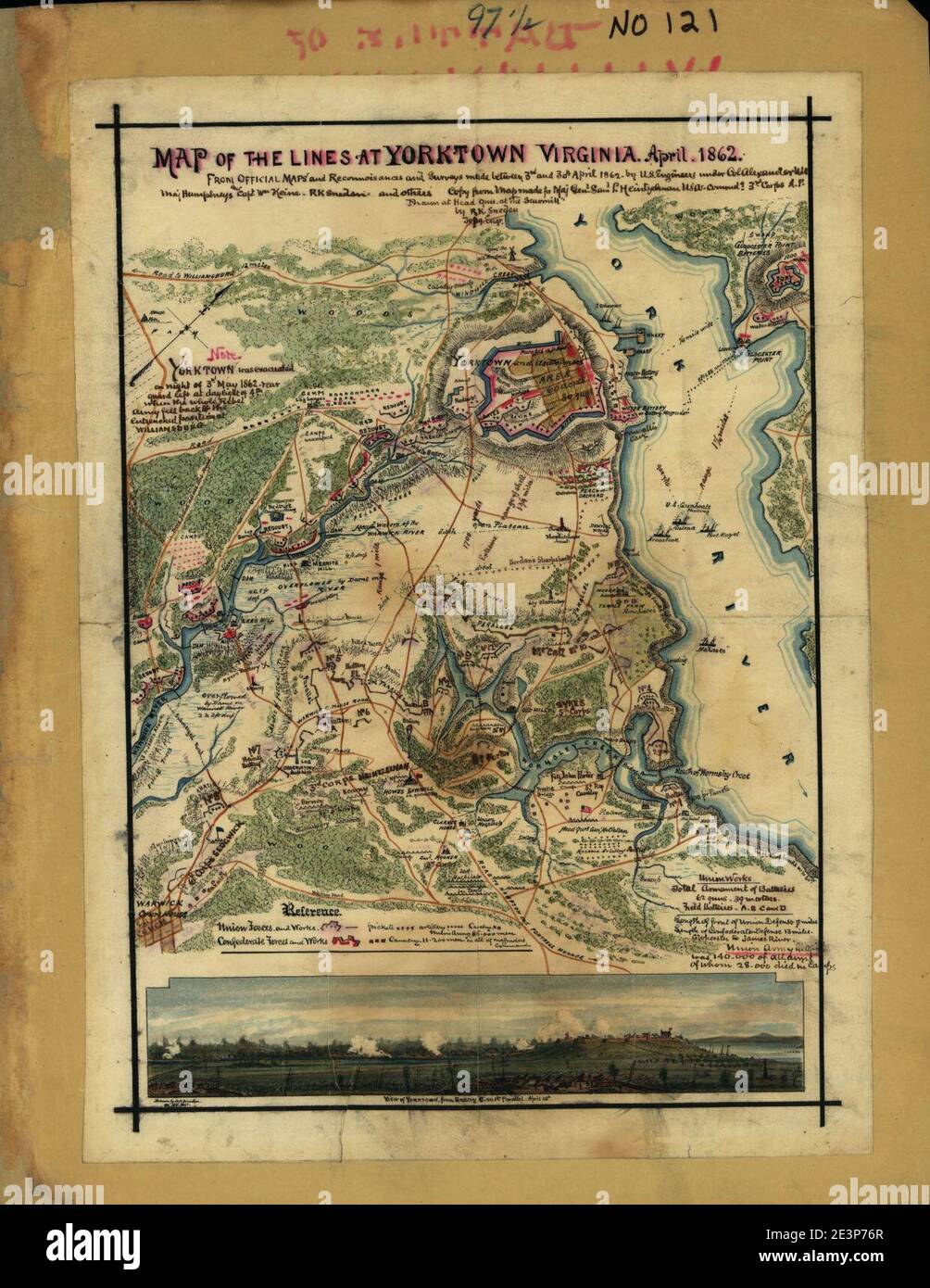 Map of the lines at Yorktown, Virginia, April 1862. Stock Photohttps://www.alamy.com/image-license-details/?v=1https://www.alamy.com/map-of-the-lines-at-yorktown-virginia-april-1862-image398171055.html
RM2E3P76R–Map of the lines at Yorktown, Virginia, April 1862.
 . Preliminary Chart of York River Virginia from Entrance to Kings Creek. English: An attractive hand colored 1857 U.S. Coast Survey nautical chart or map of Virginia’s York River. Covers the course of the York River from its entrance at the Chesapeake Bay to King Creek. Offers countless depth soundings, sailing instructions, and navigational notes, as well as considerable inland detail. Identifies Yorktown, Gloucester Point, and a number of other important sites. The York River was an important theater in the American Revolutionary war and it is here, at Yorktown, where the British formally s Stock Photohttps://www.alamy.com/image-license-details/?v=1https://www.alamy.com/preliminary-chart-of-york-river-virginia-from-entrance-to-kings-creek-english-an-attractive-hand-colored-1857-us-coast-survey-nautical-chart-or-map-of-virginias-york-river-covers-the-course-of-the-york-river-from-its-entrance-at-the-chesapeake-bay-to-king-creek-offers-countless-depth-soundings-sailing-instructions-and-navigational-notes-as-well-as-considerable-inland-detail-identifies-yorktown-gloucester-point-and-a-number-of-other-important-sites-the-york-river-was-an-important-theater-in-the-american-revolutionary-war-and-it-is-here-at-yorktown-where-the-british-formally-s-image188898043.html
RMMY91AK–. Preliminary Chart of York River Virginia from Entrance to Kings Creek. English: An attractive hand colored 1857 U.S. Coast Survey nautical chart or map of Virginia’s York River. Covers the course of the York River from its entrance at the Chesapeake Bay to King Creek. Offers countless depth soundings, sailing instructions, and navigational notes, as well as considerable inland detail. Identifies Yorktown, Gloucester Point, and a number of other important sites. The York River was an important theater in the American Revolutionary war and it is here, at Yorktown, where the British formally s
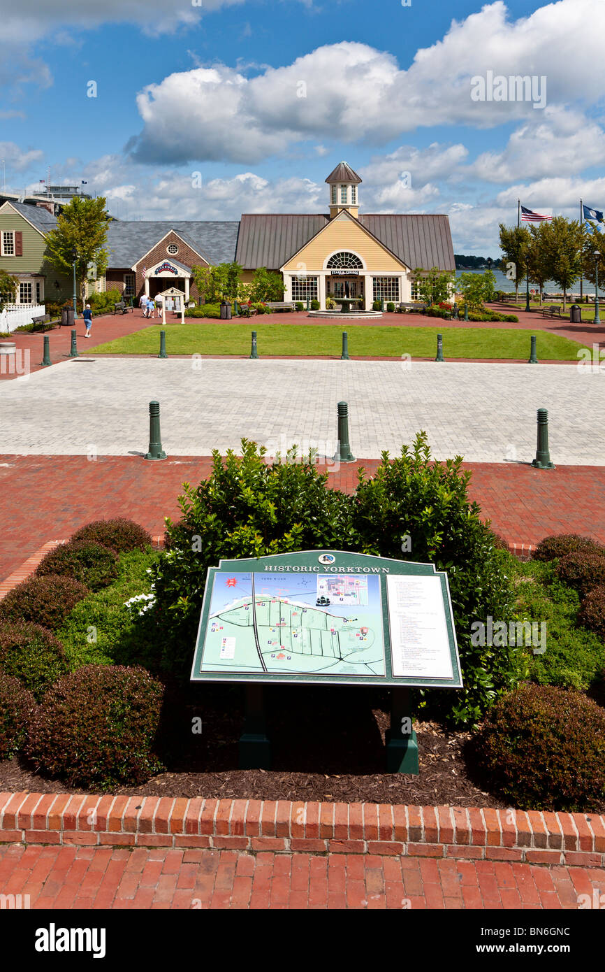 Yorktown, VA - Sep 2009 - Directory guide in courtyard of Riverwalk Landing on the York River in Historic Yorktown, Virginia Stock Photohttps://www.alamy.com/image-license-details/?v=1https://www.alamy.com/stock-photo-yorktown-va-sep-2009-directory-guide-in-courtyard-of-riverwalk-landing-30263000.html
RMBN6GNC–Yorktown, VA - Sep 2009 - Directory guide in courtyard of Riverwalk Landing on the York River in Historic Yorktown, Virginia
 Historic Yorktown John Smith trail map Stock Photohttps://www.alamy.com/image-license-details/?v=1https://www.alamy.com/stock-image-historic-yorktown-john-smith-trail-map-165424713.html
RMKH3MWD–Historic Yorktown John Smith trail map
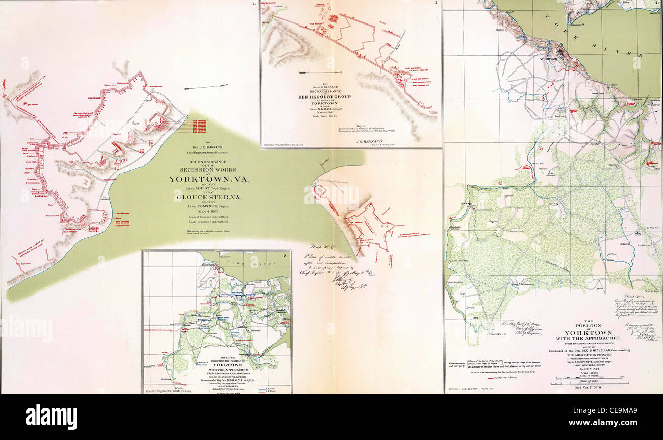 Stock Photohttps://www.alamy.com/image-license-details/?v=1https://www.alamy.com/stock-photo--43239457.html
RMCE9MA9–
 Yorktown, York County, US, United States, Virginia, N 37 14' 18'', S 76 30' 32'', map, Cartascapes Map published in 2024. Explore Cartascapes, a map revealing Earth's diverse landscapes, cultures, and ecosystems. Journey through time and space, discovering the interconnectedness of our planet's past, present, and future. Stock Photohttps://www.alamy.com/image-license-details/?v=1https://www.alamy.com/yorktown-york-county-us-united-states-virginia-n-37-14-18-s-76-30-32-map-cartascapes-map-published-in-2024-explore-cartascapes-a-map-revealing-earths-diverse-landscapes-cultures-and-ecosystems-journey-through-time-and-space-discovering-the-interconnectedness-of-our-planets-past-present-and-future-image620861743.html
RM2Y22KDK–Yorktown, York County, US, United States, Virginia, N 37 14' 18'', S 76 30' 32'', map, Cartascapes Map published in 2024. Explore Cartascapes, a map revealing Earth's diverse landscapes, cultures, and ecosystems. Journey through time and space, discovering the interconnectedness of our planet's past, present, and future.
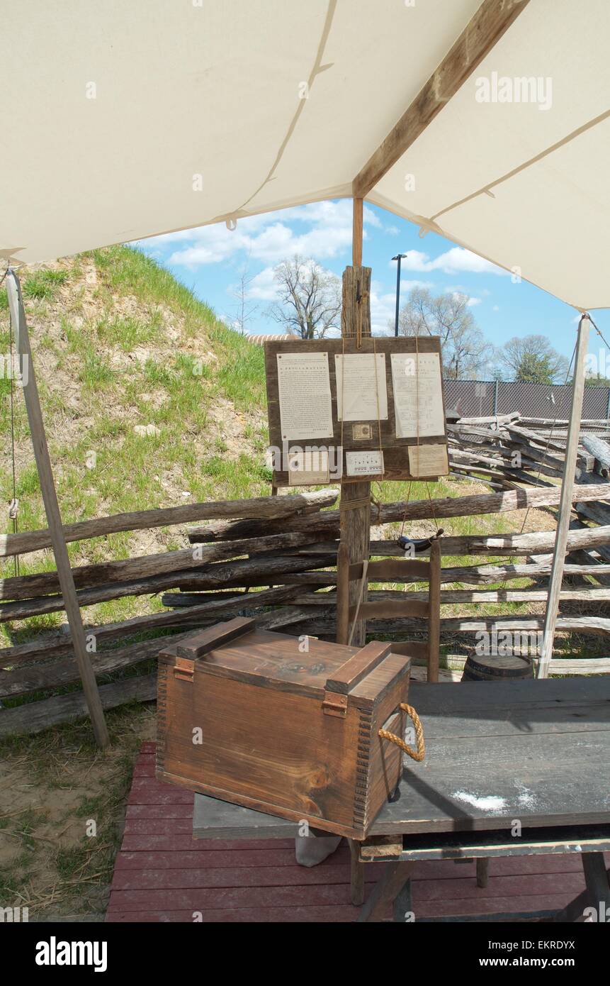 Revolutionary War recruitment Center at Yorktown Virginia Stock Photohttps://www.alamy.com/image-license-details/?v=1https://www.alamy.com/stock-photo-revolutionary-war-recruitment-center-at-yorktown-virginia-81035806.html
RMEKRDYX–Revolutionary War recruitment Center at Yorktown Virginia
 Cannons in Yorktown, Virginia Stock Photohttps://www.alamy.com/image-license-details/?v=1https://www.alamy.com/stock-photo-cannons-in-yorktown-virginia-139524334.html
RMJ2YTKX–Cannons in Yorktown, Virginia
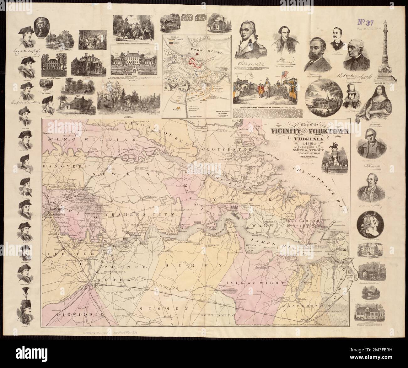 Map of the vicinity of Yorktown, Virginia, 1881 , Yorktown Va., Maps, Yorktown Va., History, Siege, 1781, Maps, Virginia, Maps, United States, History, Revolution, 1775-1783, Maps Norman B. Leventhal Map Center Collection Stock Photohttps://www.alamy.com/image-license-details/?v=1https://www.alamy.com/map-of-the-vicinity-of-yorktown-virginia-1881-yorktown-va-maps-yorktown-va-history-siege-1781-maps-virginia-maps-united-states-history-revolution-1775-1783-maps-norman-b-leventhal-map-center-collection-image501285557.html
RM2M3FERH–Map of the vicinity of Yorktown, Virginia, 1881 , Yorktown Va., Maps, Yorktown Va., History, Siege, 1781, Maps, Virginia, Maps, United States, History, Revolution, 1775-1783, Maps Norman B. Leventhal Map Center Collection
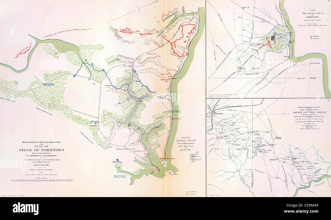
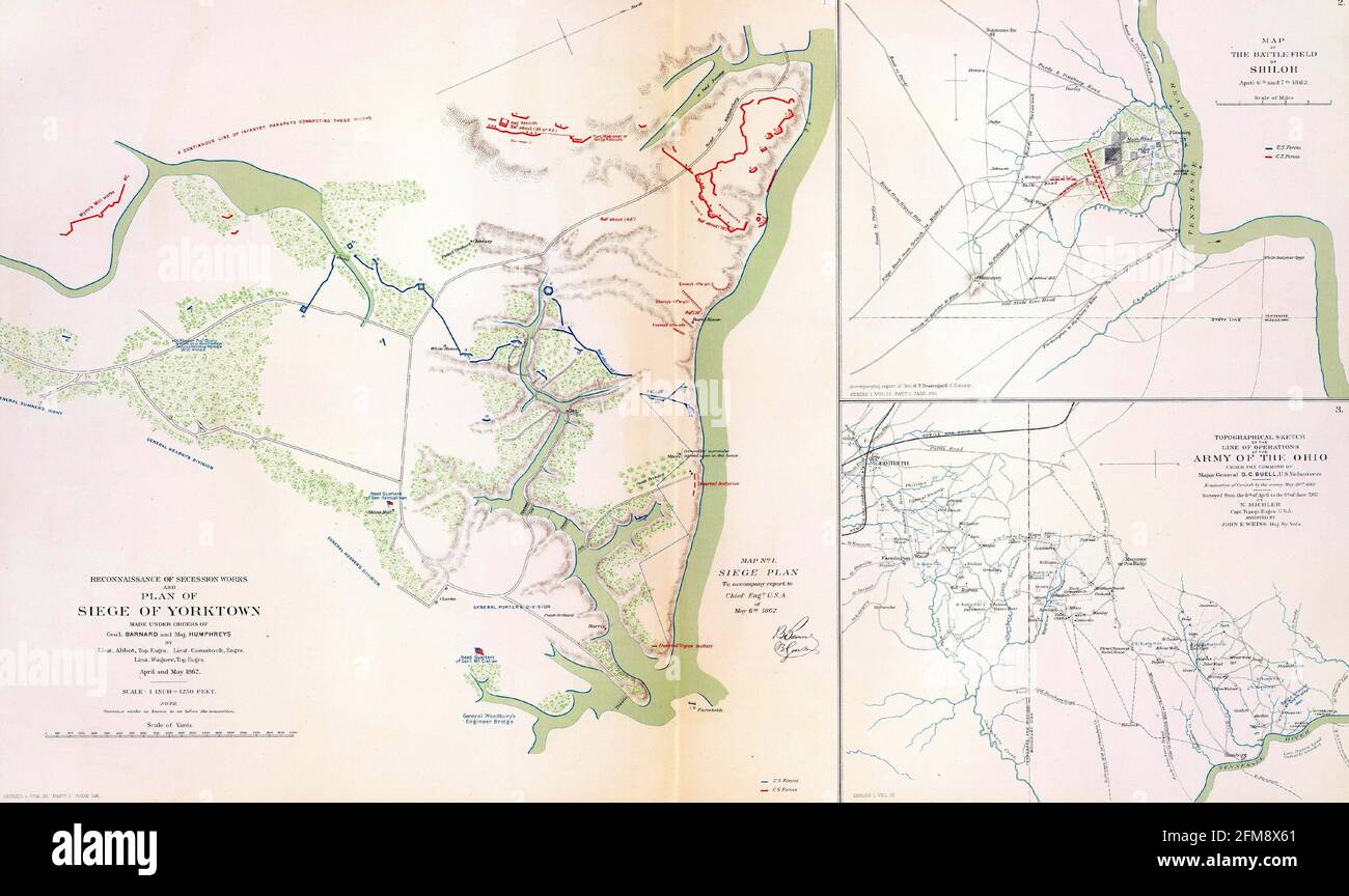 Closeup shot of the maps of the battlefields and siege of Yorktown, Virginia in 1862 Stock Photohttps://www.alamy.com/image-license-details/?v=1https://www.alamy.com/closeup-shot-of-the-maps-of-the-battlefields-and-siege-of-yorktown-virginia-in-1862-image425538121.html
RF2FM8X61–Closeup shot of the maps of the battlefields and siege of Yorktown, Virginia in 1862
 Plan of Yorktown, showing disposition of American, French and British forces. Drawn by Juliana 12th June 1782 & John Hoyman, Lieut. Inscribed as copy. PLANS of military operations, in North America, etc. 1716-1783. Source: Add. 15535. Stock Photohttps://www.alamy.com/image-license-details/?v=1https://www.alamy.com/plan-of-yorktown-showing-disposition-of-american-french-and-british-forces-drawn-by-juliana-12th-june-1782-john-hoyman-lieut-inscribed-as-copy-plans-of-military-operations-in-north-america-etc-1716-1783-source-add-15535-image227126895.html
RMR5EEJR–Plan of Yorktown, showing disposition of American, French and British forces. Drawn by Juliana 12th June 1782 & John Hoyman, Lieut. Inscribed as copy. PLANS of military operations, in North America, etc. 1716-1783. Source: Add. 15535.
![Campaigns of the Army of the Potomac [electronic resource]: a critical history of operations in Virginia, Maryland and Pennsylvania, from the commencement to the close of the war 1861-5 . l, at battle of CedarCreek, 501 ; credit due to at battleof Cedar Creek, 503. Yellow Tavern, Sheridans victorv at,459. York River Railroad, supply line aban-doned by McClellan, 154. York and Pamunky rivers, McClellanen route by, 120. York River, Franklin s ascension of, inpursuit of Johnston, 117. Yorktown, McClellans advance arrivedat, and Lees Mills, 101 ; descrip-tion and map of Confederate posi-tions, 101 Stock Photo Campaigns of the Army of the Potomac [electronic resource]: a critical history of operations in Virginia, Maryland and Pennsylvania, from the commencement to the close of the war 1861-5 . l, at battle of CedarCreek, 501 ; credit due to at battleof Cedar Creek, 503. Yellow Tavern, Sheridans victorv at,459. York River Railroad, supply line aban-doned by McClellan, 154. York and Pamunky rivers, McClellanen route by, 120. York River, Franklin s ascension of, inpursuit of Johnston, 117. Yorktown, McClellans advance arrivedat, and Lees Mills, 101 ; descrip-tion and map of Confederate posi-tions, 101 Stock Photo](https://c8.alamy.com/comp/2AKPT76/campaigns-of-the-army-of-the-potomac-electronic-resource-a-critical-history-of-operations-in-virginia-maryland-and-pennsylvania-from-the-commencement-to-the-close-of-the-war-1861-5-l-at-battle-of-cedarcreek-501-credit-due-to-at-battleof-cedar-creek-503-yellow-tavern-sheridans-victorv-at459-york-river-railroad-supply-line-aban-doned-by-mcclellan-154-york-and-pamunky-rivers-mcclellanen-route-by-120-york-river-franklin-s-ascension-of-inpursuit-of-johnston-117-yorktown-mcclellans-advance-arrivedat-and-lees-mills-101-descrip-tion-and-map-of-confederate-posi-tions-101-2AKPT76.jpg) Campaigns of the Army of the Potomac [electronic resource]: a critical history of operations in Virginia, Maryland and Pennsylvania, from the commencement to the close of the war 1861-5 . l, at battle of CedarCreek, 501 ; credit due to at battleof Cedar Creek, 503. Yellow Tavern, Sheridans victorv at,459. York River Railroad, supply line aban-doned by McClellan, 154. York and Pamunky rivers, McClellanen route by, 120. York River, Franklin s ascension of, inpursuit of Johnston, 117. Yorktown, McClellans advance arrivedat, and Lees Mills, 101 ; descrip-tion and map of Confederate posi-tions, 101 Stock Photohttps://www.alamy.com/image-license-details/?v=1https://www.alamy.com/campaigns-of-the-army-of-the-potomac-electronic-resource-a-critical-history-of-operations-in-virginia-maryland-and-pennsylvania-from-the-commencement-to-the-close-of-the-war-1861-5-l-at-battle-of-cedarcreek-501-credit-due-to-at-battleof-cedar-creek-503-yellow-tavern-sheridans-victorv-at459-york-river-railroad-supply-line-aban-doned-by-mcclellan-154-york-and-pamunky-rivers-mcclellanen-route-by-120-york-river-franklin-s-ascension-of-inpursuit-of-johnston-117-yorktown-mcclellans-advance-arrivedat-and-lees-mills-101-descrip-tion-and-map-of-confederate-posi-tions-101-image339177418.html
Campaigns of the Army of the Potomac [electronic resource]: a critical history of operations in Virginia, Maryland and Pennsylvania, from the commencement to the close of the war 1861-5 . l, at battle of CedarCreek, 501 ; credit due to at battleof Cedar Creek, 503. Yellow Tavern, Sheridans victorv at,459. York River Railroad, supply line aban-doned by McClellan, 154. York and Pamunky rivers, McClellanen route by, 120. York River, Franklin s ascension of, inpursuit of Johnston, 117. Yorktown, McClellans advance arrivedat, and Lees Mills, 101 ; descrip-tion and map of Confederate posi-tions, 101 Stock Photohttps://www.alamy.com/image-license-details/?v=1https://www.alamy.com/campaigns-of-the-army-of-the-potomac-electronic-resource-a-critical-history-of-operations-in-virginia-maryland-and-pennsylvania-from-the-commencement-to-the-close-of-the-war-1861-5-l-at-battle-of-cedarcreek-501-credit-due-to-at-battleof-cedar-creek-503-yellow-tavern-sheridans-victorv-at459-york-river-railroad-supply-line-aban-doned-by-mcclellan-154-york-and-pamunky-rivers-mcclellanen-route-by-120-york-river-franklin-s-ascension-of-inpursuit-of-johnston-117-yorktown-mcclellans-advance-arrivedat-and-lees-mills-101-descrip-tion-and-map-of-confederate-posi-tions-101-image339177418.htmlRM2AKPT76–Campaigns of the Army of the Potomac [electronic resource]: a critical history of operations in Virginia, Maryland and Pennsylvania, from the commencement to the close of the war 1861-5 . l, at battle of CedarCreek, 501 ; credit due to at battleof Cedar Creek, 503. Yellow Tavern, Sheridans victorv at,459. York River Railroad, supply line aban-doned by McClellan, 154. York and Pamunky rivers, McClellanen route by, 120. York River, Franklin s ascension of, inpursuit of Johnston, 117. Yorktown, McClellans advance arrivedat, and Lees Mills, 101 ; descrip-tion and map of Confederate posi-tions, 101
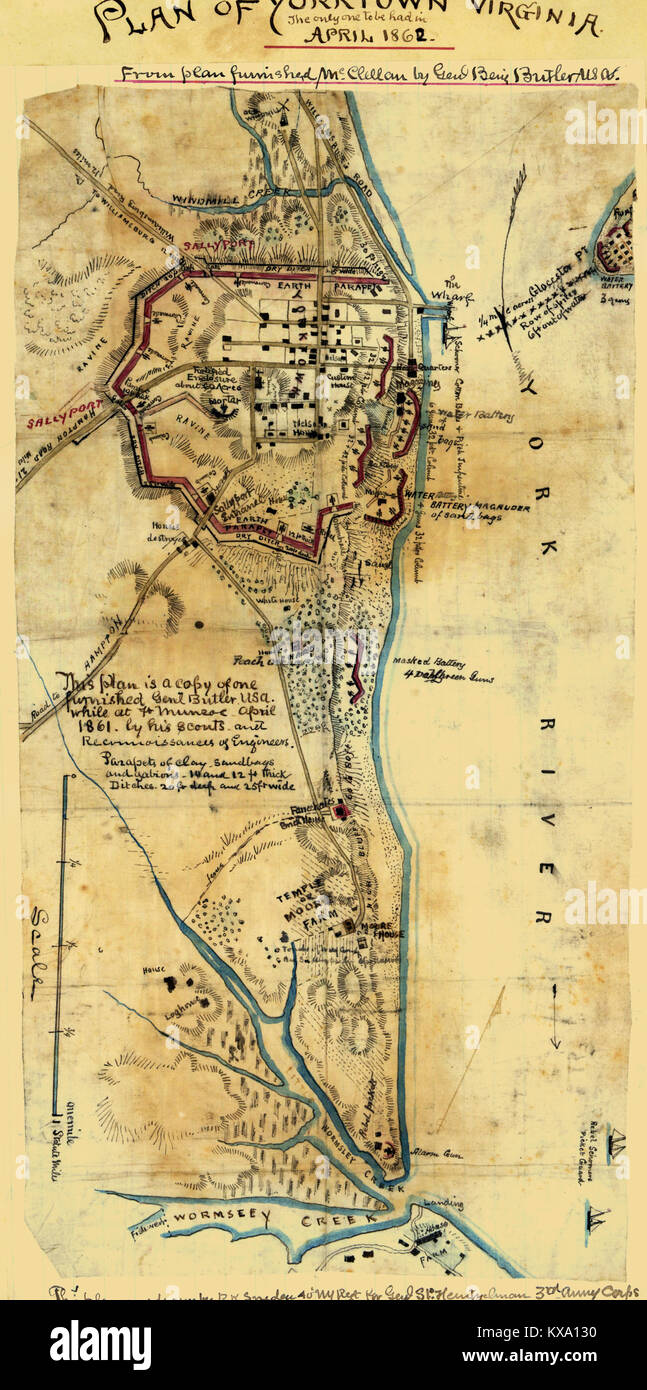 Plan of Yorktown, Virginia ... April, 1862. Stock Photohttps://www.alamy.com/image-license-details/?v=1https://www.alamy.com/stock-photo-plan-of-yorktown-virginia-april-1862-171094756.html
RMKXA130–Plan of Yorktown, Virginia ... April, 1862.
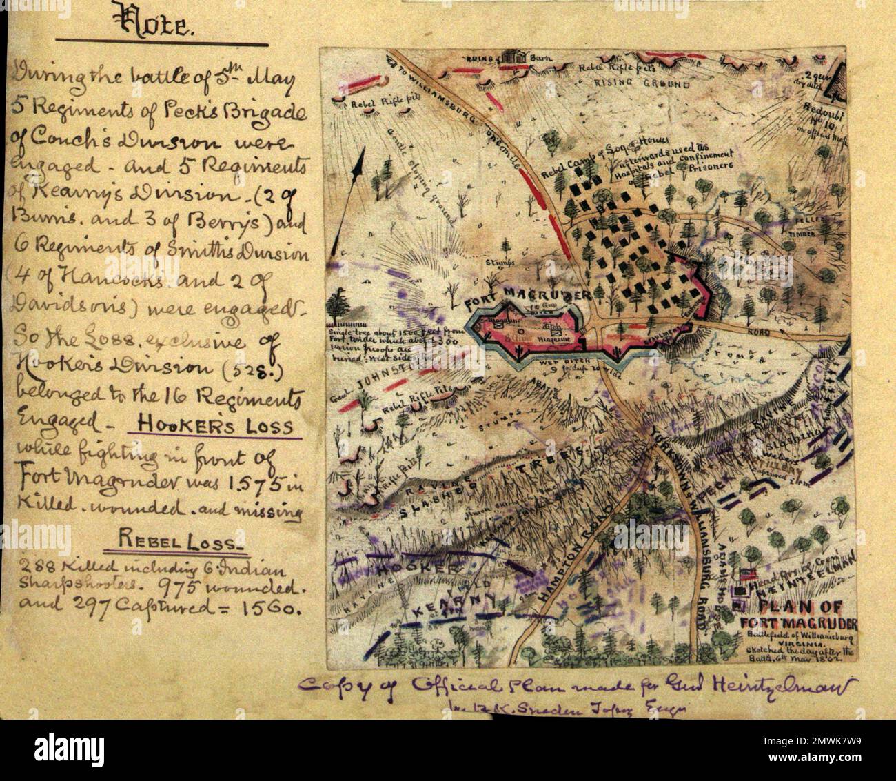 The Battle of Williamsburg (also known as the Battle of Fort Magruder) took place on May 5, 1862 at Williamsburg, Virginia as part of the Peninsula Campaign of the American Civil War. After the Confederate retreat from the Siege of Yorktown, the Union division of Brigadier General Joseph Hooker encountered the Confederate army near Williamsburg. The battle was inconclusive and the Confederate army continued its withdrawal during the night in the direction of Richmond, Virginia. This image shows a map of the battle sketched the day after the battle 6th May 1862 Stock Photohttps://www.alamy.com/image-license-details/?v=1https://www.alamy.com/the-battle-of-williamsburg-also-known-as-the-battle-of-fort-magruder-took-place-on-may-5-1862-at-williamsburg-virginia-as-part-of-the-peninsula-campaign-of-the-american-civil-war-after-the-confederate-retreat-from-the-siege-of-yorktown-the-union-division-of-brigadier-general-joseph-hooker-encountered-the-confederate-army-near-williamsburg-the-battle-was-inconclusive-and-the-confederate-army-continued-its-withdrawal-during-the-night-in-the-direction-of-richmond-virginia-this-image-shows-a-map-of-the-battle-sketched-the-day-after-the-battle-6th-may-1862-image514890357.html
RM2MWK7W9–The Battle of Williamsburg (also known as the Battle of Fort Magruder) took place on May 5, 1862 at Williamsburg, Virginia as part of the Peninsula Campaign of the American Civil War. After the Confederate retreat from the Siege of Yorktown, the Union division of Brigadier General Joseph Hooker encountered the Confederate army near Williamsburg. The battle was inconclusive and the Confederate army continued its withdrawal during the night in the direction of Richmond, Virginia. This image shows a map of the battle sketched the day after the battle 6th May 1862
 York County, Commonwealth of Virginia (U.S. county, United States of America, USA, U.S., US) map vector illustration, scribble sketch Charles River ma Stock Vectorhttps://www.alamy.com/image-license-details/?v=1https://www.alamy.com/york-county-commonwealth-of-virginia-us-county-united-states-of-america-usa-us-us-map-vector-illustration-scribble-sketch-charles-river-ma-image418891800.html
RF2F9E4NC–York County, Commonwealth of Virginia (U.S. county, United States of America, USA, U.S., US) map vector illustration, scribble sketch Charles River ma
 Civil War Maps 0695 Map of country between Yorktown and Williamsburg in Virginia Rebuild and Repair Stock Photohttps://www.alamy.com/image-license-details/?v=1https://www.alamy.com/civil-war-maps-0695-map-of-country-between-yorktown-and-williamsburg-in-virginia-rebuild-and-repair-image261792891.html
RMW5WKE3–Civil War Maps 0695 Map of country between Yorktown and Williamsburg in Virginia Rebuild and Repair
 Image taken from page 122 of 'Yorktown Centennial Handbook. Historical and topographical guide to the Yorktown peninsula, etc' Image taken from page 122 of 'Yorktown Centennial Handbook Historical Stock Photohttps://www.alamy.com/image-license-details/?v=1https://www.alamy.com/stock-photo-image-taken-from-page-122-of-yorktown-centennial-handbook-historical-130120104.html
RMHFKDEG–Image taken from page 122 of 'Yorktown Centennial Handbook. Historical and topographical guide to the Yorktown peninsula, etc' Image taken from page 122 of 'Yorktown Centennial Handbook Historical
 Map of eastern portion of Virginia - Fortress Monroe, Norfolk, Yorktown, Petersburg, Richmond etc. Stock Photohttps://www.alamy.com/image-license-details/?v=1https://www.alamy.com/map-of-eastern-portion-of-virginia-fortress-monroe-norfolk-yorktown-petersburg-richmond-etc-image398191644.html
RM2E3R5E4–Map of eastern portion of Virginia - Fortress Monroe, Norfolk, Yorktown, Petersburg, Richmond etc.
 . Preliminary Chart of York River Virginia from Entrance to Kings Creek. English: An attractive hand colored 1857 U.S. Coast Survey nautical chart or map of Virginia’s York River. Covers the course of the York River from its entrance at the Chesapeake Bay to King Creek. Offers countless depth soundings, sailing instructions, and navigational notes, as well as considerable inland detail. Identifies Yorktown, Gloucester Point, and a number of other important sites. The York River was an important theater in the American Revolutionary war and it is here, at Yorktown, where the British formally s Stock Photohttps://www.alamy.com/image-license-details/?v=1https://www.alamy.com/preliminary-chart-of-york-river-virginia-from-entrance-to-kings-creek-english-an-attractive-hand-colored-1857-us-coast-survey-nautical-chart-or-map-of-virginias-york-river-covers-the-course-of-the-york-river-from-its-entrance-at-the-chesapeake-bay-to-king-creek-offers-countless-depth-soundings-sailing-instructions-and-navigational-notes-as-well-as-considerable-inland-detail-identifies-yorktown-gloucester-point-and-a-number-of-other-important-sites-the-york-river-was-an-important-theater-in-the-american-revolutionary-war-and-it-is-here-at-yorktown-where-the-british-formally-s-image187622006.html
RMMW6WNX–. Preliminary Chart of York River Virginia from Entrance to Kings Creek. English: An attractive hand colored 1857 U.S. Coast Survey nautical chart or map of Virginia’s York River. Covers the course of the York River from its entrance at the Chesapeake Bay to King Creek. Offers countless depth soundings, sailing instructions, and navigational notes, as well as considerable inland detail. Identifies Yorktown, Gloucester Point, and a number of other important sites. The York River was an important theater in the American Revolutionary war and it is here, at Yorktown, where the British formally s
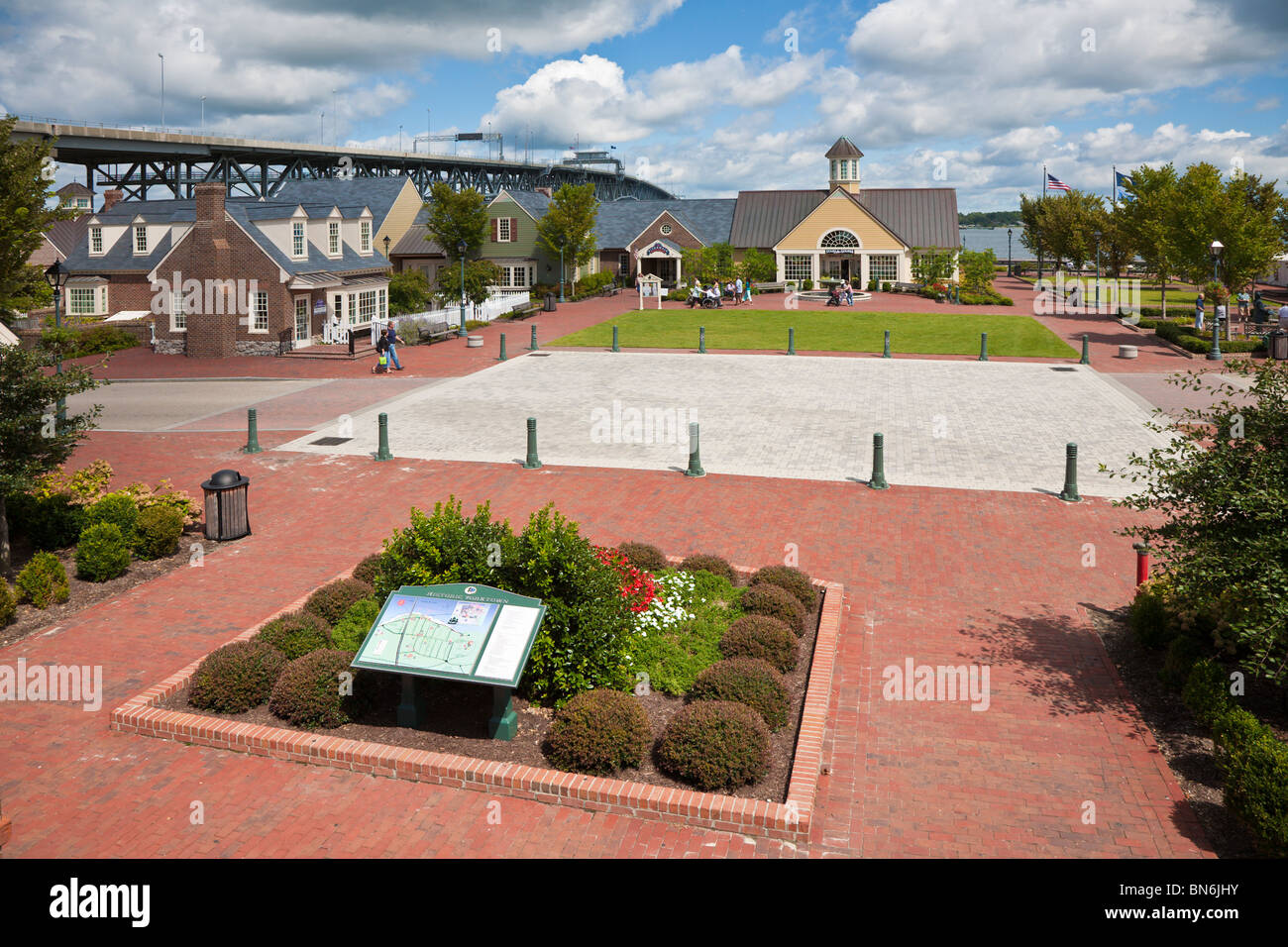 Yorktown, VA - Sep 2009 - Directory guide in courtyard of Riverwalk Landing on the York River in Historic Yorktown, Virginia Stock Photohttps://www.alamy.com/image-license-details/?v=1https://www.alamy.com/stock-photo-yorktown-va-sep-2009-directory-guide-in-courtyard-of-riverwalk-landing-30264471.html
RMBN6JHY–Yorktown, VA - Sep 2009 - Directory guide in courtyard of Riverwalk Landing on the York River in Historic Yorktown, Virginia
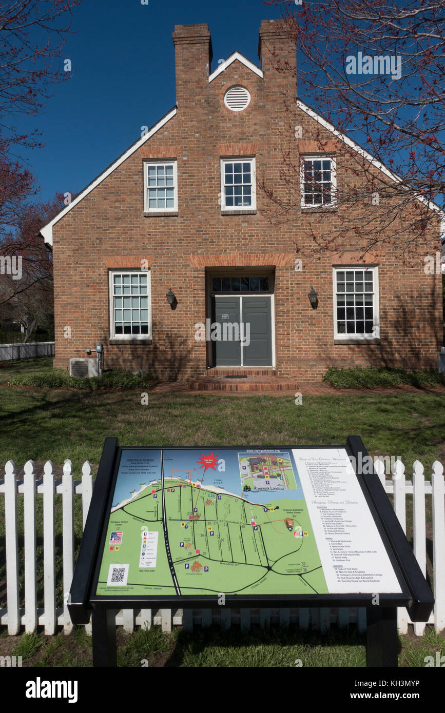 Yorktown Historical society building Virginia Stock Photohttps://www.alamy.com/image-license-details/?v=1https://www.alamy.com/stock-image-yorktown-historical-society-building-virginia-165424778.html
RMKH3MYP–Yorktown Historical society building Virginia
 Stock Photohttps://www.alamy.com/image-license-details/?v=1https://www.alamy.com/stock-photo--43239452.html
RMCE9MA4–
 Yorktown, Virginia, map 1965, 1:24000, United States of America by Timeless Maps, data U.S. Geological Survey Stock Photohttps://www.alamy.com/image-license-details/?v=1https://www.alamy.com/yorktown-virginia-map-1965-124000-united-states-of-america-by-timeless-maps-data-us-geological-survey-image407017596.html
RM2EJ572M–Yorktown, Virginia, map 1965, 1:24000, United States of America by Timeless Maps, data U.S. Geological Survey
 Maps of the battlefield and siege of Yorktown in 1862 from Atlas to Accompany the Official Records of the Union & Confederate Armies, 1861 - 1865 Stock Photohttps://www.alamy.com/image-license-details/?v=1https://www.alamy.com/maps-of-the-battlefield-and-siege-of-yorktown-in-1862-from-atlas-to-accompany-the-official-records-of-the-union-confederate-armies-1861-1865-image384364873.html
RM2D9998W–Maps of the battlefield and siege of Yorktown in 1862 from Atlas to Accompany the Official Records of the Union & Confederate Armies, 1861 - 1865
 Confederate fortification at Yorktown, Virginia Stock Photohttps://www.alamy.com/image-license-details/?v=1https://www.alamy.com/stock-photo-confederate-fortification-at-yorktown-virginia-139700316.html
RMJ37W50–Confederate fortification at Yorktown, Virginia
 Plan d'York en Virginie, avec les attaques et les campemens de l'Armée combinée de France êt d'Amérique Soulés, François, 1748-1809. Cartographic. Maps, Atlases. 1787. Lionel Pincus and Princess Firyal Map Division. United States , History , Revolution, 1775-1783, Virginia, Yorktown (Va.) , History , Siege, 1781 Stock Photohttps://www.alamy.com/image-license-details/?v=1https://www.alamy.com/plan-dyork-en-virginie-avec-les-attaques-et-les-campemens-de-larme-combine-de-france-t-damrique-souls-franois-1748-1809-cartographic-maps-atlases-1787-lionel-pincus-and-princess-firyal-map-division-united-states-history-revolution-1775-1783-virginia-yorktown-va-history-siege-1781-image484369053.html
RM2K40WJN–Plan d'York en Virginie, avec les attaques et les campemens de l'Armée combinée de France êt d'Amérique Soulés, François, 1748-1809. Cartographic. Maps, Atlases. 1787. Lionel Pincus and Princess Firyal Map Division. United States , History , Revolution, 1775-1783, Virginia, Yorktown (Va.) , History , Siege, 1781
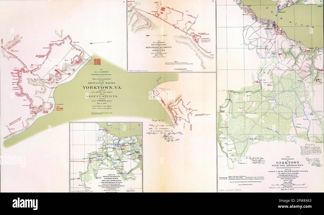 Closeup shot of the maps of the battlefields and siege of Yorktown, Virginia in 1862 Stock Photohttps://www.alamy.com/image-license-details/?v=1https://www.alamy.com/closeup-shot-of-the-maps-of-the-battlefields-and-siege-of-yorktown-virginia-in-1862-image425538123.html
RF2FM8X63–Closeup shot of the maps of the battlefields and siege of Yorktown, Virginia in 1862
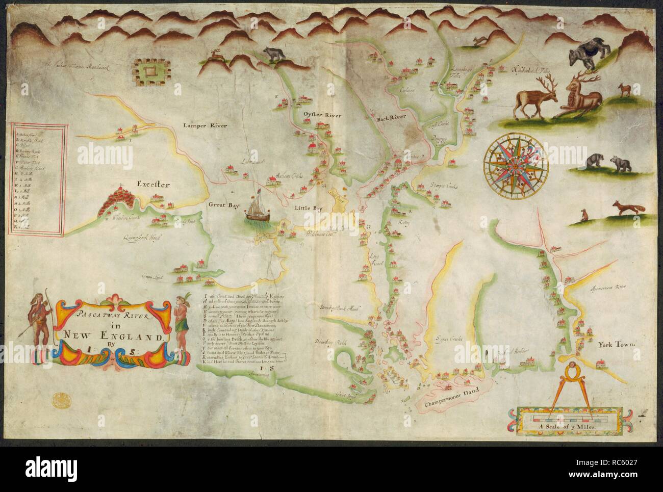 Pascatway River. A colored map of Pascatway River, in New England,. ca. 1670-1680. A map of the Pascatway River in New England. Image taken from A colored map of Pascatway River, in New England, by J.S.; drawn on vellum, on a scale of 1 inch to a mile possibly by John Scott ... Source: Maps.K.Top.120.27,. Language: English. Stock Photohttps://www.alamy.com/image-license-details/?v=1https://www.alamy.com/pascatway-river-a-colored-map-of-pascatway-river-in-new-england-ca-1670-1680-a-map-of-the-pascatway-river-in-new-england-image-taken-from-a-colored-map-of-pascatway-river-in-new-england-by-js-drawn-on-vellum-on-a-scale-of-1-inch-to-a-mile-possibly-by-john-scott-source-mapsktop12027-language-english-image231242431.html
RMRC6027–Pascatway River. A colored map of Pascatway River, in New England,. ca. 1670-1680. A map of the Pascatway River in New England. Image taken from A colored map of Pascatway River, in New England, by J.S.; drawn on vellum, on a scale of 1 inch to a mile possibly by John Scott ... Source: Maps.K.Top.120.27,. Language: English.
 Stock Photohttps://www.alamy.com/image-license-details/?v=1https://www.alamy.com/stock-photo--43217351.html
RMCE8M4R–
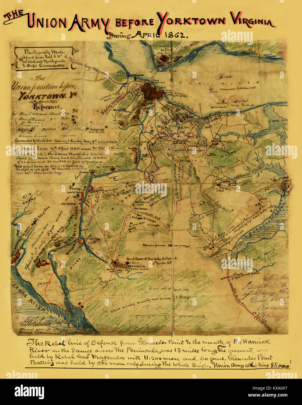 Yorktown, Virginia, April 1862 Stock Photohttps://www.alamy.com/image-license-details/?v=1https://www.alamy.com/stock-photo-yorktown-virginia-april-1862-171094623.html
RMKXA0X7–Yorktown, Virginia, April 1862
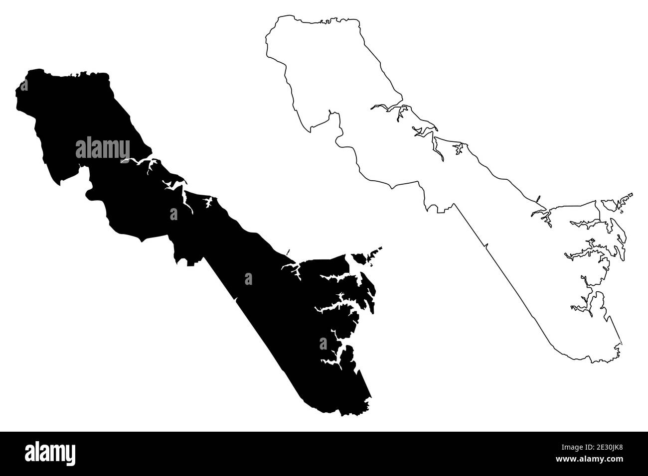 York County, Commonwealth of Virginia (U.S. county, United States of America, USA, U.S., US) map vector illustration, scribble sketch Charles River ma Stock Vectorhttps://www.alamy.com/image-license-details/?v=1https://www.alamy.com/york-county-commonwealth-of-virginia-us-county-united-states-of-america-usa-us-us-map-vector-illustration-scribble-sketch-charles-river-ma-image397697084.html
RF2E30JK8–York County, Commonwealth of Virginia (U.S. county, United States of America, USA, U.S., US) map vector illustration, scribble sketch Charles River ma
 Civil War Maps 0695 Map of country between Yorktown and Williamsburg in Virginia Inverted Rebuild and Repair Stock Photohttps://www.alamy.com/image-license-details/?v=1https://www.alamy.com/civil-war-maps-0695-map-of-country-between-yorktown-and-williamsburg-in-virginia-inverted-rebuild-and-repair-image261792889.html
RMW5WKE1–Civil War Maps 0695 Map of country between Yorktown and Williamsburg in Virginia Inverted Rebuild and Repair
 Image taken from page 128 of 'Yorktown Centennial Handbook. Historical and topographical guide to the Yorktown peninsula, etc' Image taken from page 128 of 'Yorktown Centennial Handbook Historical Stock Photohttps://www.alamy.com/image-license-details/?v=1https://www.alamy.com/stock-photo-image-taken-from-page-128-of-yorktown-centennial-handbook-historical-130121882.html
RMHFKFP2–Image taken from page 128 of 'Yorktown Centennial Handbook. Historical and topographical guide to the Yorktown peninsula, etc' Image taken from page 128 of 'Yorktown Centennial Handbook Historical
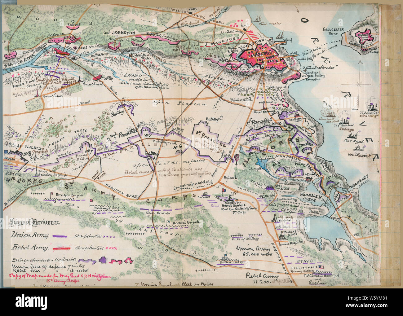 Civil War Maps 1593 Siege of Yorktown Virginia Rebuild and Repair Stock Photohttps://www.alamy.com/image-license-details/?v=1https://www.alamy.com/civil-war-maps-1593-siege-of-yorktown-virginia-rebuild-and-repair-image261837409.html
RMW5YM81–Civil War Maps 1593 Siege of Yorktown Virginia Rebuild and Repair
 . Preliminary Chart of York River Virginia from Entrance to Kings Creek. English: An attractive hand colored 1857 U.S. Coast Survey nautical chart or map of Virginia’s York River. Covers the course of the York River from its entrance at the Chesapeake Bay to King Creek. Offers countless depth soundings, sailing instructions, and navigational notes, as well as considerable inland detail. Identifies Yorktown, Gloucester Point, and a number of other important sites. The York River was an important theater in the American Revolutionary war and it is here, at Yorktown, where the British formally s Stock Photohttps://www.alamy.com/image-license-details/?v=1https://www.alamy.com/preliminary-chart-of-york-river-virginia-from-entrance-to-kings-creek-english-an-attractive-hand-colored-1857-us-coast-survey-nautical-chart-or-map-of-virginias-york-river-covers-the-course-of-the-york-river-from-its-entrance-at-the-chesapeake-bay-to-king-creek-offers-countless-depth-soundings-sailing-instructions-and-navigational-notes-as-well-as-considerable-inland-detail-identifies-yorktown-gloucester-point-and-a-number-of-other-important-sites-the-york-river-was-an-important-theater-in-the-american-revolutionary-war-and-it-is-here-at-yorktown-where-the-british-formally-s-image188134339.html
RMMX277F–. Preliminary Chart of York River Virginia from Entrance to Kings Creek. English: An attractive hand colored 1857 U.S. Coast Survey nautical chart or map of Virginia’s York River. Covers the course of the York River from its entrance at the Chesapeake Bay to King Creek. Offers countless depth soundings, sailing instructions, and navigational notes, as well as considerable inland detail. Identifies Yorktown, Gloucester Point, and a number of other important sites. The York River was an important theater in the American Revolutionary war and it is here, at Yorktown, where the British formally s
 Yorktown, Virginia - Sep 2009 - Directory tourist guide at Riverwalk Landing in Historic Yorktown, Virginia Stock Photohttps://www.alamy.com/image-license-details/?v=1https://www.alamy.com/stock-photo-yorktown-virginia-sep-2009-directory-tourist-guide-at-riverwalk-landing-30264340.html
RMBN6JD8–Yorktown, Virginia - Sep 2009 - Directory tourist guide at Riverwalk Landing in Historic Yorktown, Virginia
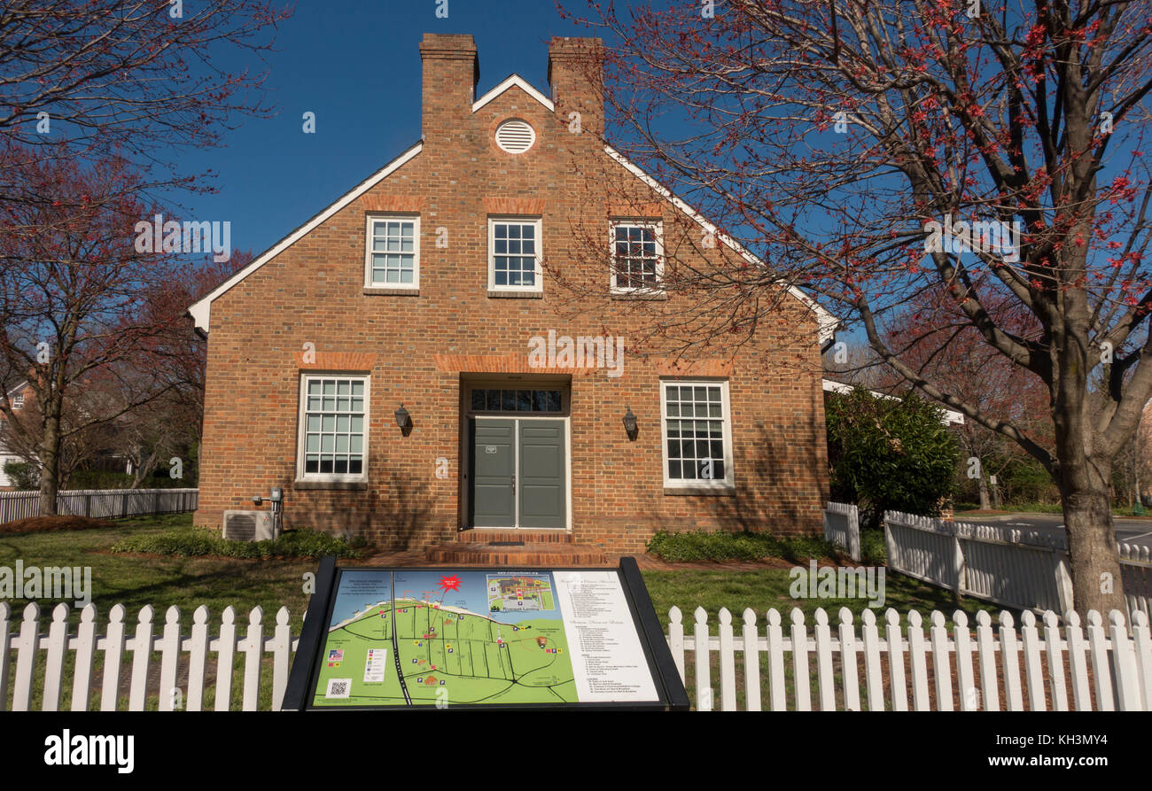 Yorktown Historical society building Virginia Stock Photohttps://www.alamy.com/image-license-details/?v=1https://www.alamy.com/stock-image-yorktown-historical-society-building-virginia-165424760.html
RMKH3MY4–Yorktown Historical society building Virginia
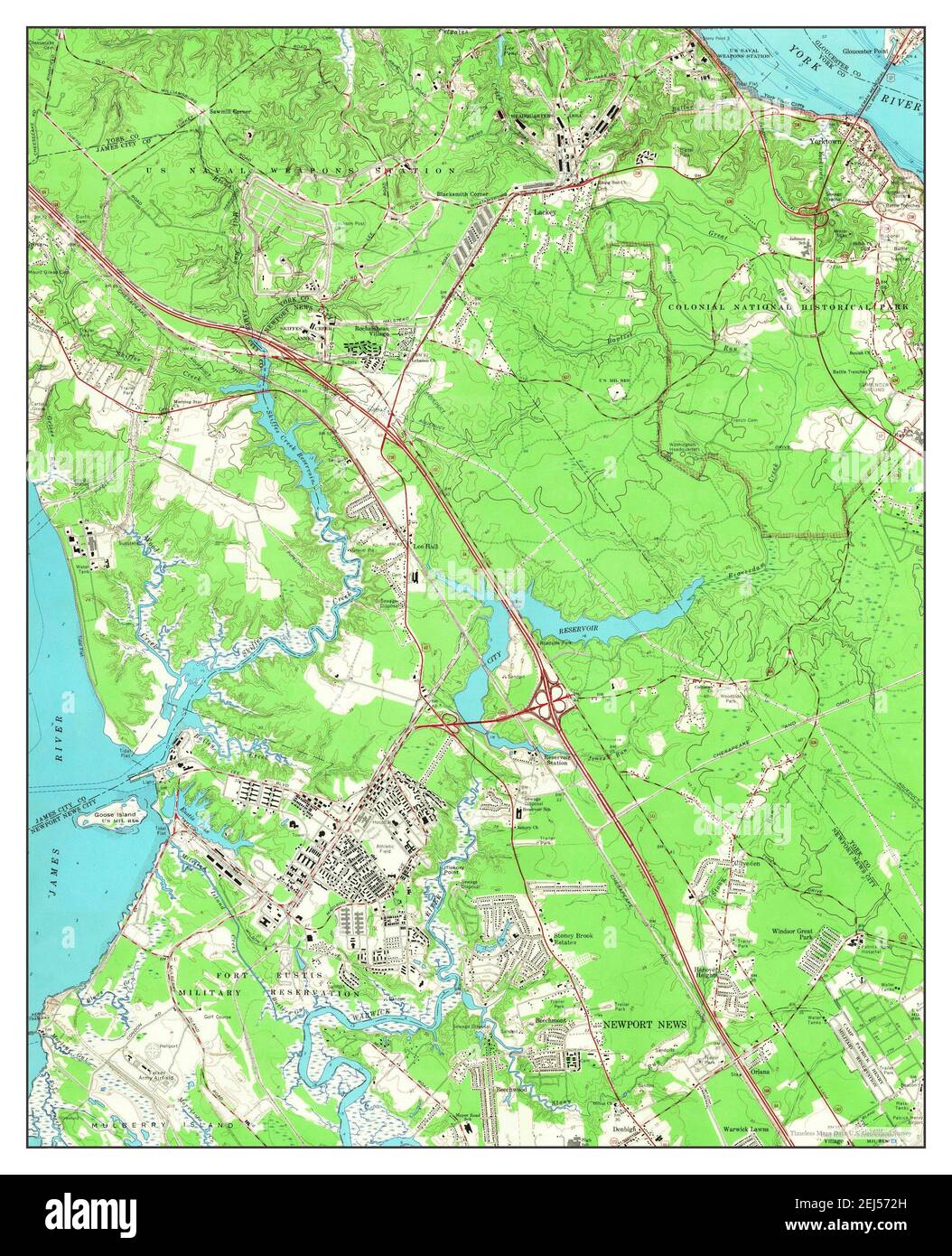 Yorktown, Virginia, map 1965, 1:24000, United States of America by Timeless Maps, data U.S. Geological Survey Stock Photohttps://www.alamy.com/image-license-details/?v=1https://www.alamy.com/yorktown-virginia-map-1965-124000-united-states-of-america-by-timeless-maps-data-us-geological-survey-image407017593.html
RM2EJ572H–Yorktown, Virginia, map 1965, 1:24000, United States of America by Timeless Maps, data U.S. Geological Survey
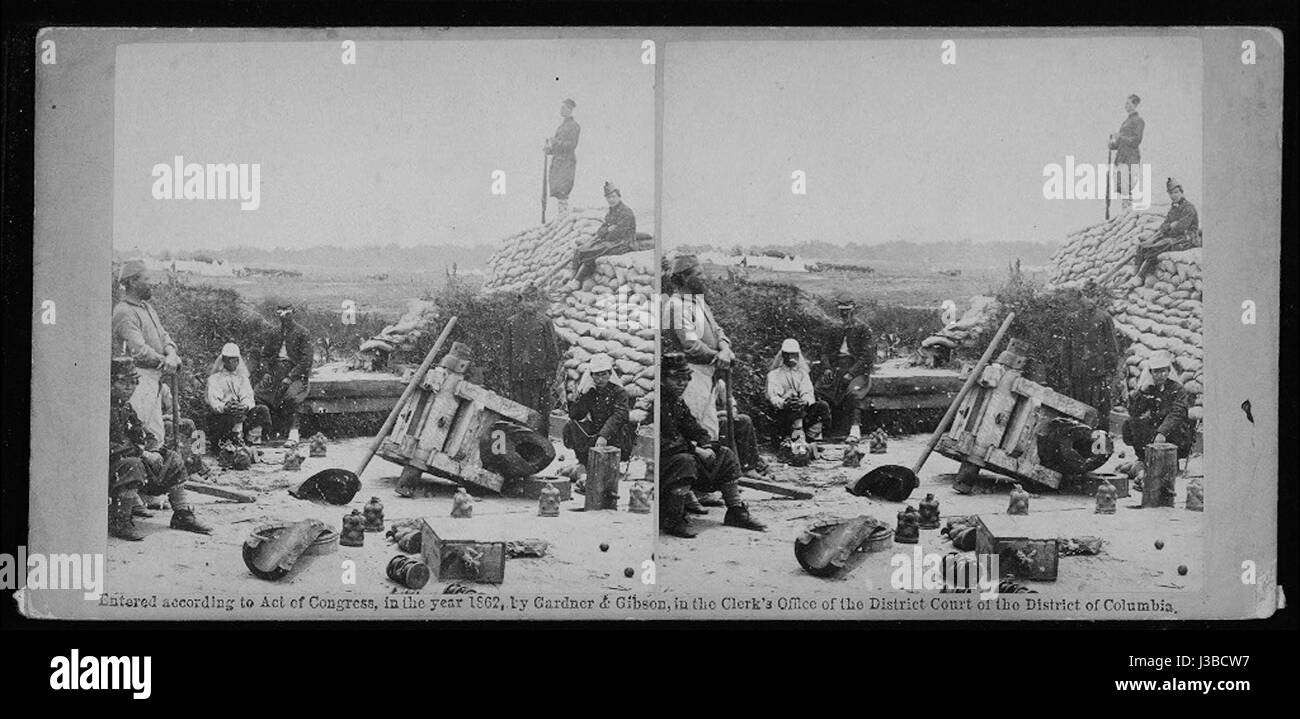 Exploded cannon in Yorktown, Virginia Stock Photohttps://www.alamy.com/image-license-details/?v=1https://www.alamy.com/stock-photo-exploded-cannon-in-yorktown-virginia-139778499.html
RMJ3BCW7–Exploded cannon in Yorktown, Virginia
 Map of the vicinity of Yorktown, Virginia, 1881. Centennial map showing east-central Virginia from Richmond to the mouth of Chesapeake Bay. Identifies locations of Civil War Battles. Inset map shows positions of opposing forces at 1781 siege of Yorktown. Second inset is version of John Trumbull view of the Yorktown surrender. Map bordered by portraits of Revolutionary War figures and views of historic buildings of the period.... , Virginia , York ,county , Yorktown Stock Photohttps://www.alamy.com/image-license-details/?v=1https://www.alamy.com/map-of-the-vicinity-of-yorktown-virginia-1881-centennial-map-showing-east-central-virginia-from-richmond-to-the-mouth-of-chesapeake-bay-identifies-locations-of-civil-war-battles-inset-map-shows-positions-of-opposing-forces-at-1781-siege-of-yorktown-second-inset-is-version-of-john-trumbull-view-of-the-yorktown-surrender-map-bordered-by-portraits-of-revolutionary-war-figures-and-views-of-historic-buildings-of-the-period-virginia-york-county-yorktown-image502711259.html
RM2M5TD9F–Map of the vicinity of Yorktown, Virginia, 1881. Centennial map showing east-central Virginia from Richmond to the mouth of Chesapeake Bay. Identifies locations of Civil War Battles. Inset map shows positions of opposing forces at 1781 siege of Yorktown. Second inset is version of John Trumbull view of the Yorktown surrender. Map bordered by portraits of Revolutionary War figures and views of historic buildings of the period.... , Virginia , York ,county , Yorktown
 Stock Photohttps://www.alamy.com/image-license-details/?v=1https://www.alamy.com/stock-photo--43217342.html
RMCE8M4E–
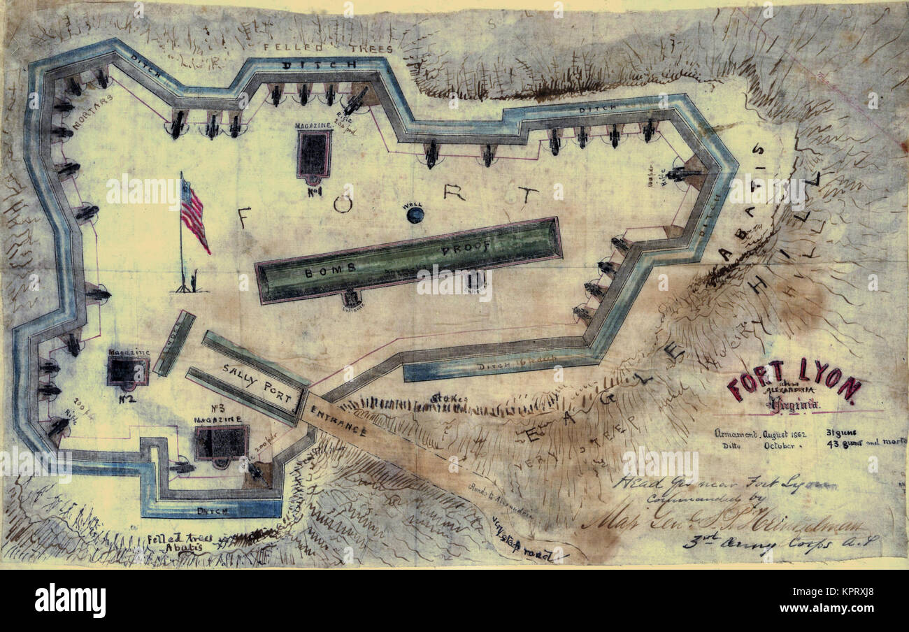 Plan of Yorktown, Virginia ... April, 1862. Stock Photohttps://www.alamy.com/image-license-details/?v=1https://www.alamy.com/stock-image-plan-of-yorktown-virginia-april-1862-168941536.html
RMKPRXJ8–Plan of Yorktown, Virginia ... April, 1862.
 York County, Commonwealth of Virginia (U.S. county, United States of America, USA, U.S., US) map vector illustration, scribble sketch Charles River ma Stock Vectorhttps://www.alamy.com/image-license-details/?v=1https://www.alamy.com/york-county-commonwealth-of-virginia-us-county-united-states-of-america-usa-us-us-map-vector-illustration-scribble-sketch-charles-river-ma-image432238705.html
RF2G364TH–York County, Commonwealth of Virginia (U.S. county, United States of America, USA, U.S., US) map vector illustration, scribble sketch Charles River ma
![Image taken from page 219 of 'Battles and Leaders of the Civil War, being for the most part contributions by Union and Confederate officers, based upon “the Century War Series.” Edited by R. U. J. and C. C. B., etc. [Illustrated.]' Image taken from page 219 of 'Battles and Leaders of Stock Photo Image taken from page 219 of 'Battles and Leaders of the Civil War, being for the most part contributions by Union and Confederate officers, based upon “the Century War Series.” Edited by R. U. J. and C. C. B., etc. [Illustrated.]' Image taken from page 219 of 'Battles and Leaders of Stock Photo](https://c8.alamy.com/comp/HFJ9BH/image-taken-from-page-219-of-battles-and-leaders-of-the-civil-war-HFJ9BH.jpg) Image taken from page 219 of 'Battles and Leaders of the Civil War, being for the most part contributions by Union and Confederate officers, based upon “the Century War Series.” Edited by R. U. J. and C. C. B., etc. [Illustrated.]' Image taken from page 219 of 'Battles and Leaders of Stock Photohttps://www.alamy.com/image-license-details/?v=1https://www.alamy.com/stock-photo-image-taken-from-page-219-of-battles-and-leaders-of-the-civil-war-130094933.html
Image taken from page 219 of 'Battles and Leaders of the Civil War, being for the most part contributions by Union and Confederate officers, based upon “the Century War Series.” Edited by R. U. J. and C. C. B., etc. [Illustrated.]' Image taken from page 219 of 'Battles and Leaders of Stock Photohttps://www.alamy.com/image-license-details/?v=1https://www.alamy.com/stock-photo-image-taken-from-page-219-of-battles-and-leaders-of-the-civil-war-130094933.htmlRMHFJ9BH–Image taken from page 219 of 'Battles and Leaders of the Civil War, being for the most part contributions by Union and Confederate officers, based upon “the Century War Series.” Edited by R. U. J. and C. C. B., etc. [Illustrated.]' Image taken from page 219 of 'Battles and Leaders of
 Civil War Maps 1593 Siege of Yorktown Virginia Inverted Rebuild and Repair Stock Photohttps://www.alamy.com/image-license-details/?v=1https://www.alamy.com/civil-war-maps-1593-siege-of-yorktown-virginia-inverted-rebuild-and-repair-image261837336.html
RMW5YM5C–Civil War Maps 1593 Siege of Yorktown Virginia Inverted Rebuild and Repair
 Civil War Maps 1657 Sketch of the lines at Yorktown Virginia April 30th 1862 Rebuild and Repair Stock Photohttps://www.alamy.com/image-license-details/?v=1https://www.alamy.com/civil-war-maps-1657-sketch-of-the-lines-at-yorktown-virginia-april-30th-1862-rebuild-and-repair-image261839690.html
RMW5YR5E–Civil War Maps 1657 Sketch of the lines at Yorktown Virginia April 30th 1862 Rebuild and Repair
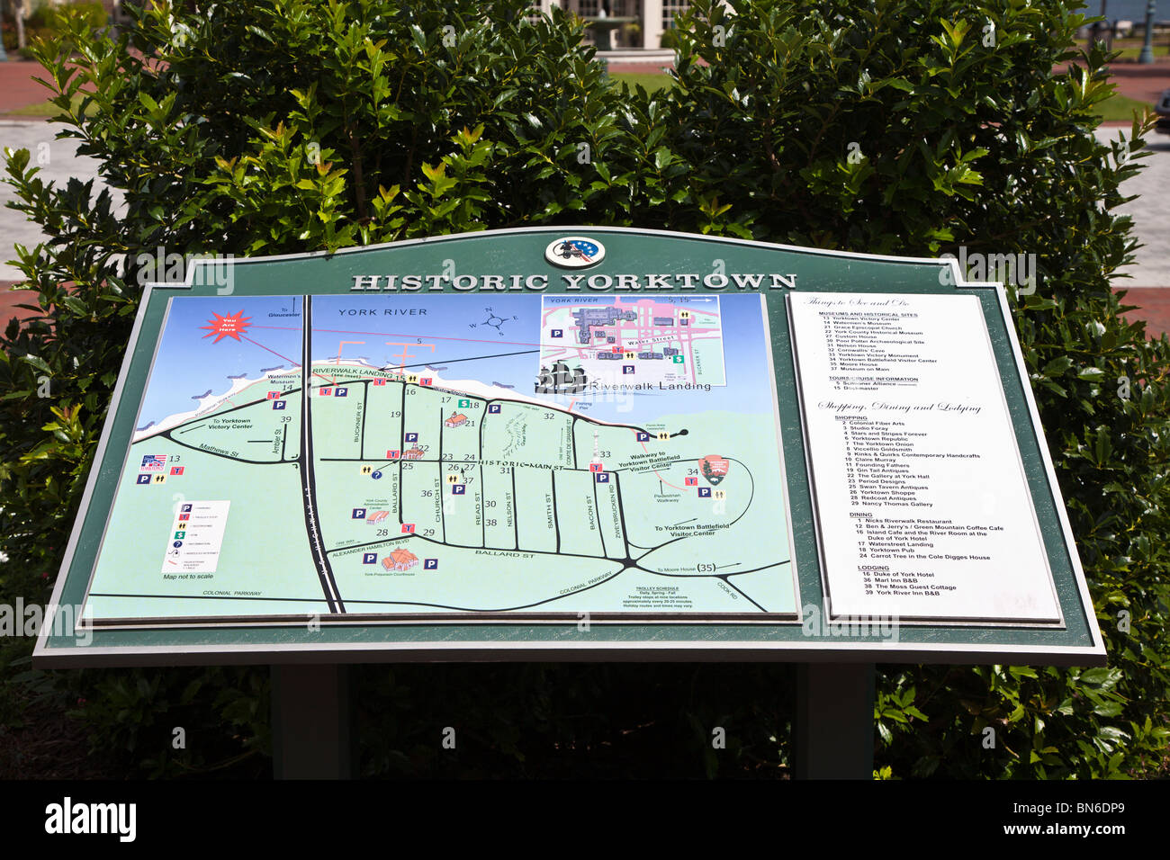 Yorktown, VA - Sep 2009 - Directory of Historic Yorktown at Riverwalk Landing in Historic Yorktown, Virginia Stock Photohttps://www.alamy.com/image-license-details/?v=1https://www.alamy.com/stock-photo-yorktown-va-sep-2009-directory-of-historic-yorktown-at-riverwalk-landing-30260673.html
RMBN6DP9–Yorktown, VA - Sep 2009 - Directory of Historic Yorktown at Riverwalk Landing in Historic Yorktown, Virginia
 old custom house Yorktown Virginia Stock Photohttps://www.alamy.com/image-license-details/?v=1https://www.alamy.com/stock-image-old-custom-house-yorktown-virginia-165424764.html
RMKH3MY8–old custom house Yorktown Virginia
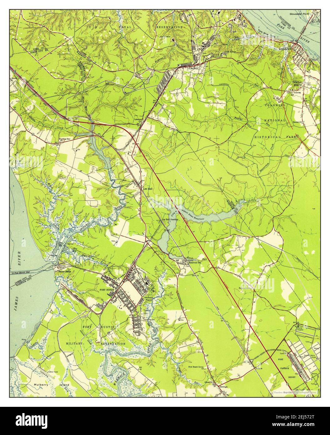 Yorktown, Virginia, map 1950, 1:24000, United States of America by Timeless Maps, data U.S. Geological Survey Stock Photohttps://www.alamy.com/image-license-details/?v=1https://www.alamy.com/yorktown-virginia-map-1950-124000-united-states-of-america-by-timeless-maps-data-us-geological-survey-image407017600.html
RM2EJ572T–Yorktown, Virginia, map 1950, 1:24000, United States of America by Timeless Maps, data U.S. Geological Survey
 Yorktown, Virginia (NYPL b12349153 417913) Stock Photohttps://www.alamy.com/image-license-details/?v=1https://www.alamy.com/stock-photo-yorktown-virginia-nypl-b12349153-417913-140713865.html
RMJ4X1Y5–Yorktown, Virginia (NYPL b12349153 417913)
 Civil War Maps 1657 Sketch of the lines at Yorktown Virginia April 30th 1862 Inverted Rebuild and Repair Stock Photohttps://www.alamy.com/image-license-details/?v=1https://www.alamy.com/civil-war-maps-1657-sketch-of-the-lines-at-yorktown-virginia-april-30th-1862-inverted-rebuild-and-repair-image261839667.html
RMW5YR4K–Civil War Maps 1657 Sketch of the lines at Yorktown Virginia April 30th 1862 Inverted Rebuild and Repair
 Yorktown, VA - Sep 2009 - Directory guide in courtyard of Riverwalk Landing on the York River in Historic Yorktown, Virginia Stock Photohttps://www.alamy.com/image-license-details/?v=1https://www.alamy.com/stock-photo-yorktown-va-sep-2009-directory-guide-in-courtyard-of-riverwalk-landing-30263114.html
RMBN6GWE–Yorktown, VA - Sep 2009 - Directory guide in courtyard of Riverwalk Landing on the York River in Historic Yorktown, Virginia
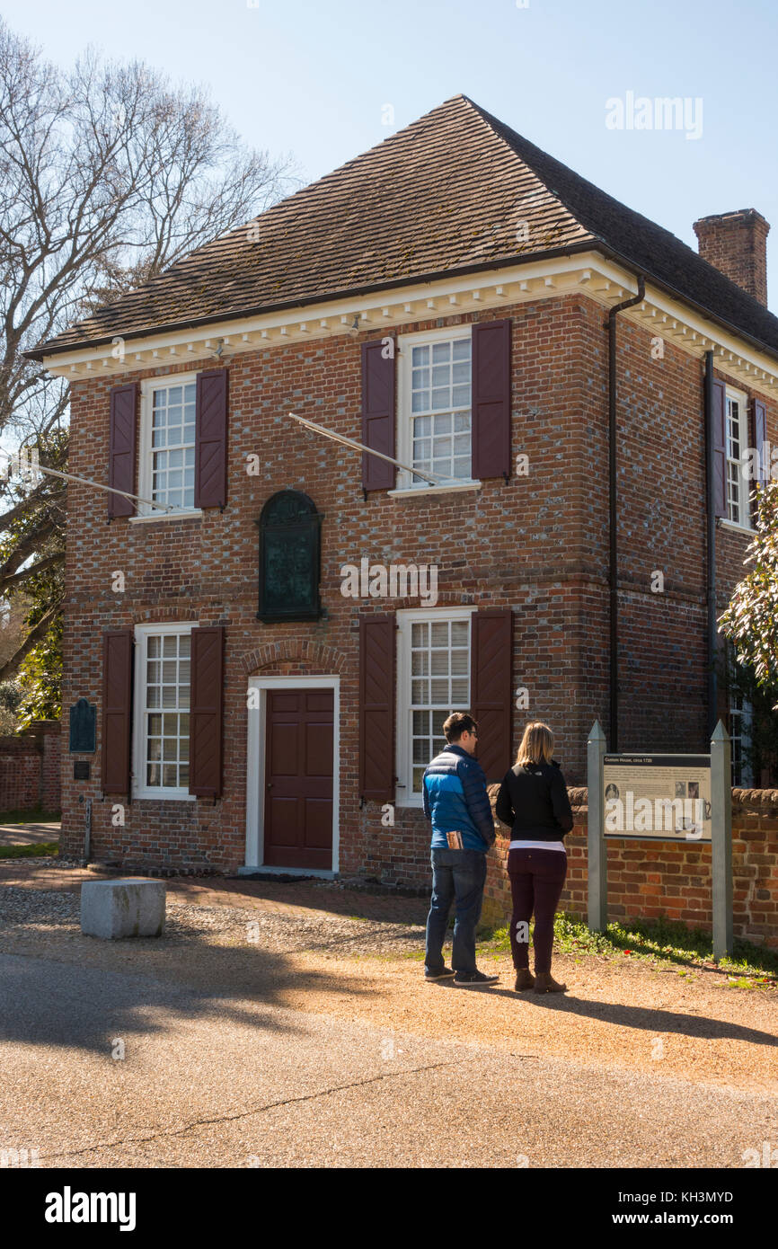 old custom house Yorktown Virginia Stock Photohttps://www.alamy.com/image-license-details/?v=1https://www.alamy.com/stock-image-old-custom-house-yorktown-virginia-165424769.html
RMKH3MYD–old custom house Yorktown Virginia
 Yorktown, Virginia, map 1907, 1:62500, United States of America by Timeless Maps, data U.S. Geological Survey Stock Photohttps://www.alamy.com/image-license-details/?v=1https://www.alamy.com/yorktown-virginia-map-1907-162500-united-states-of-america-by-timeless-maps-data-us-geological-survey-image414276404.html
RM2F1YWNT–Yorktown, Virginia, map 1907, 1:62500, United States of America by Timeless Maps, data U.S. Geological Survey
 Yorktown, Virginia (NYPL NYPG96-F24-421298) Stock Photohttps://www.alamy.com/image-license-details/?v=1https://www.alamy.com/stock-photo-yorktown-virginia-nypl-nypg96-f24-421298-148512927.html
RMJHH9N3–Yorktown, Virginia (NYPL NYPG96-F24-421298)
 Hartley, Thomas. Yorktown, Virginia. To Jonathan Dayton (NYPL b11868620-5386689) Stock Photohttps://www.alamy.com/image-license-details/?v=1https://www.alamy.com/stock-photo-hartley-thomas-yorktown-virginia-to-jonathan-dayton-nypl-b11868620-148496148.html
RMJHGG9T–Hartley, Thomas. Yorktown, Virginia. To Jonathan Dayton (NYPL b11868620-5386689)
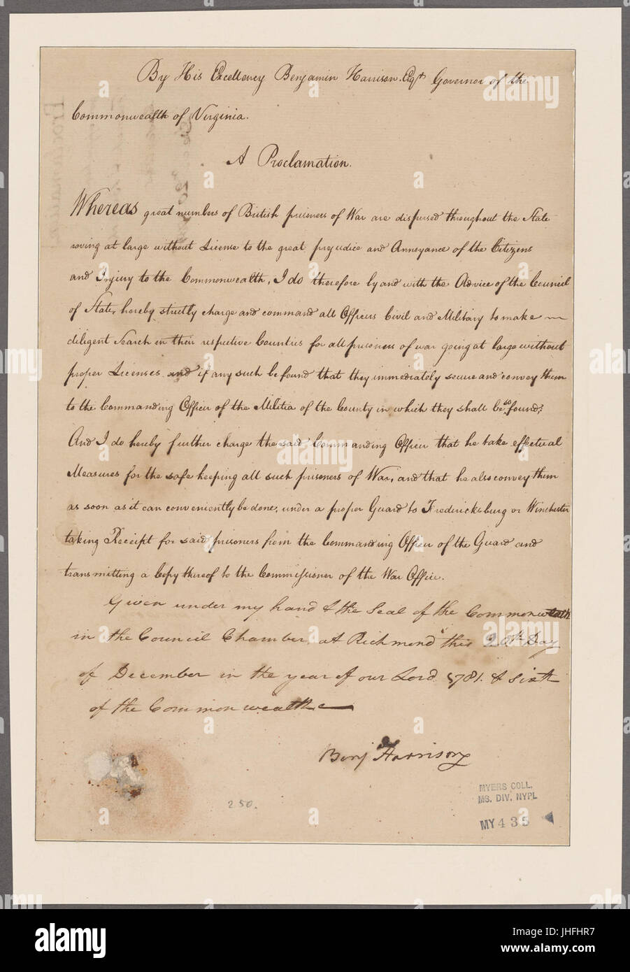 Hartley, Thomas. Yorktown, Virginia. To Jonathan Dayton (NYPL b11868620-5351611) Stock Photohttps://www.alamy.com/image-license-details/?v=1https://www.alamy.com/stock-photo-hartley-thomas-yorktown-virginia-to-jonathan-dayton-nypl-b11868620-148475355.html
RMJHFHR7–Hartley, Thomas. Yorktown, Virginia. To Jonathan Dayton (NYPL b11868620-5351611)
 Civil War Maps 1423 Plan of Yorktown Virginia showing the Rebel works after the evacuation May 4th 1862 Rebuild and Repair Stock Photohttps://www.alamy.com/image-license-details/?v=1https://www.alamy.com/civil-war-maps-1423-plan-of-yorktown-virginia-showing-the-rebel-works-after-the-evacuation-may-4th-1862-rebuild-and-repair-image261833322.html
RMW5YF22–Civil War Maps 1423 Plan of Yorktown Virginia showing the Rebel works after the evacuation May 4th 1862 Rebuild and Repair
 Yorktown, VA - Sep 2009 - Directory guide in courtyard of Riverwalk Landing on the York River in Historic Yorktown, Virginia Stock Photohttps://www.alamy.com/image-license-details/?v=1https://www.alamy.com/stock-photo-yorktown-va-sep-2009-directory-guide-in-courtyard-of-riverwalk-landing-30264789.html
RMBN6K19–Yorktown, VA - Sep 2009 - Directory guide in courtyard of Riverwalk Landing on the York River in Historic Yorktown, Virginia
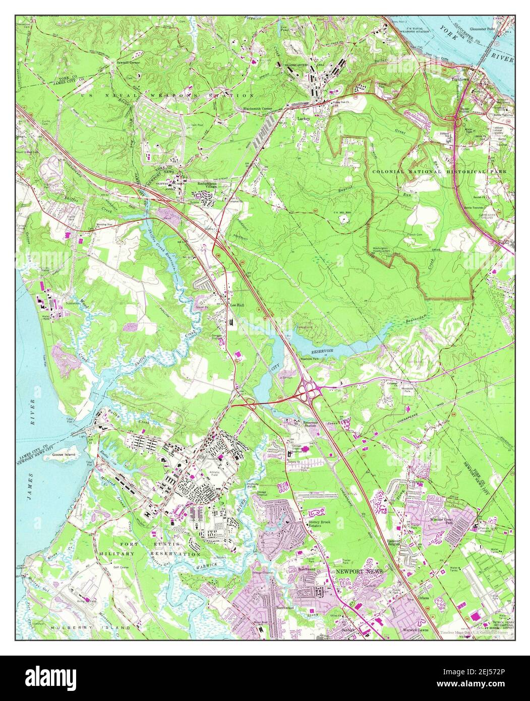 Yorktown, Virginia, map 1965, 1:24000, United States of America by Timeless Maps, data U.S. Geological Survey Stock Photohttps://www.alamy.com/image-license-details/?v=1https://www.alamy.com/yorktown-virginia-map-1965-124000-united-states-of-america-by-timeless-maps-data-us-geological-survey-image407017598.html
RM2EJ572P–Yorktown, Virginia, map 1965, 1:24000, United States of America by Timeless Maps, data U.S. Geological Survey
 Hartley, Thomas. Yorktown, Virginia. To Jonathan Dayton (NYPL b11868620-5351612) Stock Photohttps://www.alamy.com/image-license-details/?v=1https://www.alamy.com/stock-photo-hartley-thomas-yorktown-virginia-to-jonathan-dayton-nypl-b11868620-148475354.html
RMJHFHR6–Hartley, Thomas. Yorktown, Virginia. To Jonathan Dayton (NYPL b11868620-5351612)
 Thilman, Paul. To Col. Nelson. With View of Yorktown, Virginia (NYPL b11868620-5339279) Stock Photohttps://www.alamy.com/image-license-details/?v=1https://www.alamy.com/stock-photo-thilman-paul-to-col-nelson-with-view-of-yorktown-virginia-nypl-b11868620-148476906.html
RMJHFKPJ–Thilman, Paul. To Col. Nelson. With View of Yorktown, Virginia (NYPL b11868620-5339279)
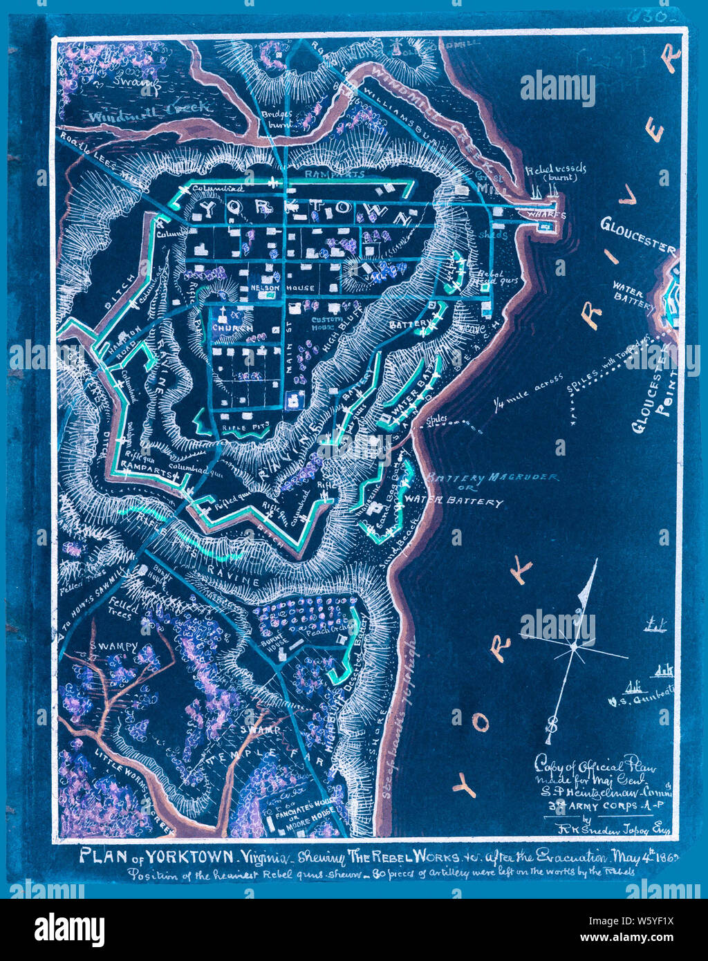 Civil War Maps 1423 Plan of Yorktown Virginia showing the Rebel works after the evacuation May 4th 1862 Inverted Rebuild and Repair Stock Photohttps://www.alamy.com/image-license-details/?v=1https://www.alamy.com/civil-war-maps-1423-plan-of-yorktown-virginia-showing-the-rebel-works-after-the-evacuation-may-4th-1862-inverted-rebuild-and-repair-image261833318.html
RMW5YF1X–Civil War Maps 1423 Plan of Yorktown Virginia showing the Rebel works after the evacuation May 4th 1862 Inverted Rebuild and Repair
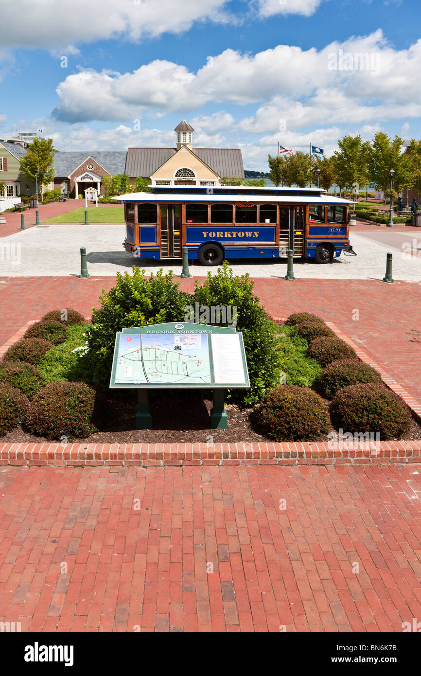 Yorktown, VA - Sep 2009 - Free trolley bus for tourists at Riverwalk Landing on the York River in Historic Yorktown, Virginia Stock Photohttps://www.alamy.com/image-license-details/?v=1https://www.alamy.com/stock-photo-yorktown-va-sep-2009-free-trolley-bus-for-tourists-at-riverwalk-landing-30264959.html
RMBN6K7B–Yorktown, VA - Sep 2009 - Free trolley bus for tourists at Riverwalk Landing on the York River in Historic Yorktown, Virginia
 Yorktown, Virginia, map 1984, 1:24000, United States of America by Timeless Maps, data U.S. Geological Survey Stock Photohttps://www.alamy.com/image-license-details/?v=1https://www.alamy.com/yorktown-virginia-map-1984-124000-united-states-of-america-by-timeless-maps-data-us-geological-survey-image407017613.html
RM2EJ5739–Yorktown, Virginia, map 1984, 1:24000, United States of America by Timeless Maps, data U.S. Geological Survey
 Thilman, Paul. To Col. Nelson. With View of Yorktown, Virginia (NYPL b11868620-5339278) Stock Photohttps://www.alamy.com/image-license-details/?v=1https://www.alamy.com/stock-photo-thilman-paul-to-col-nelson-with-view-of-yorktown-virginia-nypl-b11868620-148476908.html
RMJHFKPM–Thilman, Paul. To Col. Nelson. With View of Yorktown, Virginia (NYPL b11868620-5339278)
 Hon. William Nelson, of Yorktown, Virginia, president of the dominion of Virginia (NYPL Hades-286804-EM3826) Stock Photohttps://www.alamy.com/image-license-details/?v=1https://www.alamy.com/stock-photo-hon-william-nelson-of-yorktown-virginia-president-of-the-dominion-148511807.html
RMJHH893–Hon. William Nelson, of Yorktown, Virginia, president of the dominion of Virginia (NYPL Hades-286804-EM3826)
 York Hall, Captain George Preston Blow house, Route 1005 and Main Street, Yorktown, York County, Virginia. Guest house in Memory Garden Stock Photohttps://www.alamy.com/image-license-details/?v=1https://www.alamy.com/stock-photo-york-hall-captain-george-preston-blow-house-route-1005-and-main-street-147447993.html
RMJFTRBN–York Hall, Captain George Preston Blow house, Route 1005 and Main Street, Yorktown, York County, Virginia. Guest house in Memory Garden
 Yorktown, VA - Sep 2009 - Free trolley bus for tourists at Riverwalk Landing on the York River in Historic Yorktown, Virginia Stock Photohttps://www.alamy.com/image-license-details/?v=1https://www.alamy.com/stock-photo-yorktown-va-sep-2009-free-trolley-bus-for-tourists-at-riverwalk-landing-30265009.html
RMBN6K95–Yorktown, VA - Sep 2009 - Free trolley bus for tourists at Riverwalk Landing on the York River in Historic Yorktown, Virginia
 Yorktown, Virginia, map 1907, 1:62500, United States of America by Timeless Maps, data U.S. Geological Survey Stock Photohttps://www.alamy.com/image-license-details/?v=1https://www.alamy.com/yorktown-virginia-map-1907-162500-united-states-of-america-by-timeless-maps-data-us-geological-survey-image414276381.html
RM2F1YWN1–Yorktown, Virginia, map 1907, 1:62500, United States of America by Timeless Maps, data U.S. Geological Survey
 Yorktown, Virginia, map 1957, 1:24000, United States of America by Timeless Maps, data U.S. Geological Survey Stock Photohttps://www.alamy.com/image-license-details/?v=1https://www.alamy.com/yorktown-virginia-map-1957-124000-united-states-of-america-by-timeless-maps-data-us-geological-survey-image407017654.html
RM2EJ574P–Yorktown, Virginia, map 1957, 1:24000, United States of America by Timeless Maps, data U.S. Geological Survey
 Yorktown, Virginia, map 1943, 1:62500, United States of America by Timeless Maps, data U.S. Geological Survey Stock Photohttps://www.alamy.com/image-license-details/?v=1https://www.alamy.com/yorktown-virginia-map-1943-162500-united-states-of-america-by-timeless-maps-data-us-geological-survey-image414276413.html
RM2F1YWP5–Yorktown, Virginia, map 1943, 1:62500, United States of America by Timeless Maps, data U.S. Geological Survey
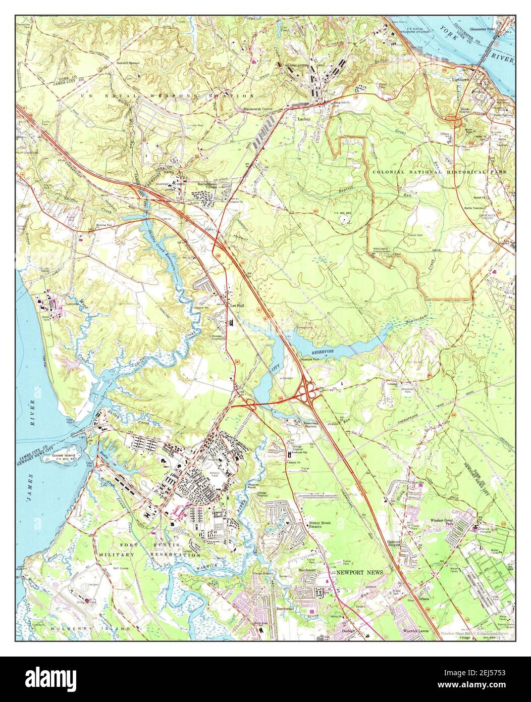 Yorktown, Virginia, map 1965, 1:24000, United States of America by Timeless Maps, data U.S. Geological Survey Stock Photohttps://www.alamy.com/image-license-details/?v=1https://www.alamy.com/yorktown-virginia-map-1965-124000-united-states-of-america-by-timeless-maps-data-us-geological-survey-image407017663.html
RM2EJ5753–Yorktown, Virginia, map 1965, 1:24000, United States of America by Timeless Maps, data U.S. Geological Survey
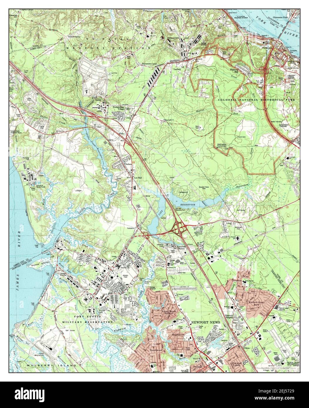 Yorktown, Virginia, map 1984, 1:24000, United States of America by Timeless Maps, data U.S. Geological Survey Stock Photohttps://www.alamy.com/image-license-details/?v=1https://www.alamy.com/yorktown-virginia-map-1984-124000-united-states-of-america-by-timeless-maps-data-us-geological-survey-image407017585.html
RM2EJ5729–Yorktown, Virginia, map 1984, 1:24000, United States of America by Timeless Maps, data U.S. Geological Survey
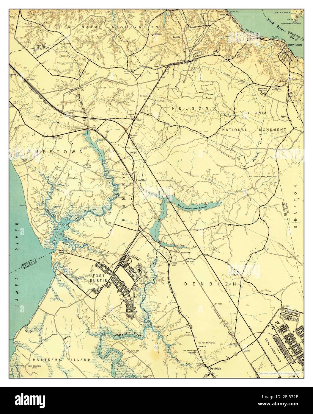 Yorktown, Virginia, map 1944, 1:24000, United States of America by Timeless Maps, data U.S. Geological Survey Stock Photohttps://www.alamy.com/image-license-details/?v=1https://www.alamy.com/yorktown-virginia-map-1944-124000-united-states-of-america-by-timeless-maps-data-us-geological-survey-image407017590.html
RM2EJ572E–Yorktown, Virginia, map 1944, 1:24000, United States of America by Timeless Maps, data U.S. Geological Survey
 Yorktown, Virginia, map 1907, 1:62500, United States of America by Timeless Maps, data U.S. Geological Survey Stock Photohttps://www.alamy.com/image-license-details/?v=1https://www.alamy.com/yorktown-virginia-map-1907-162500-united-states-of-america-by-timeless-maps-data-us-geological-survey-image414276392.html
RM2F1YWNC–Yorktown, Virginia, map 1907, 1:62500, United States of America by Timeless Maps, data U.S. Geological Survey
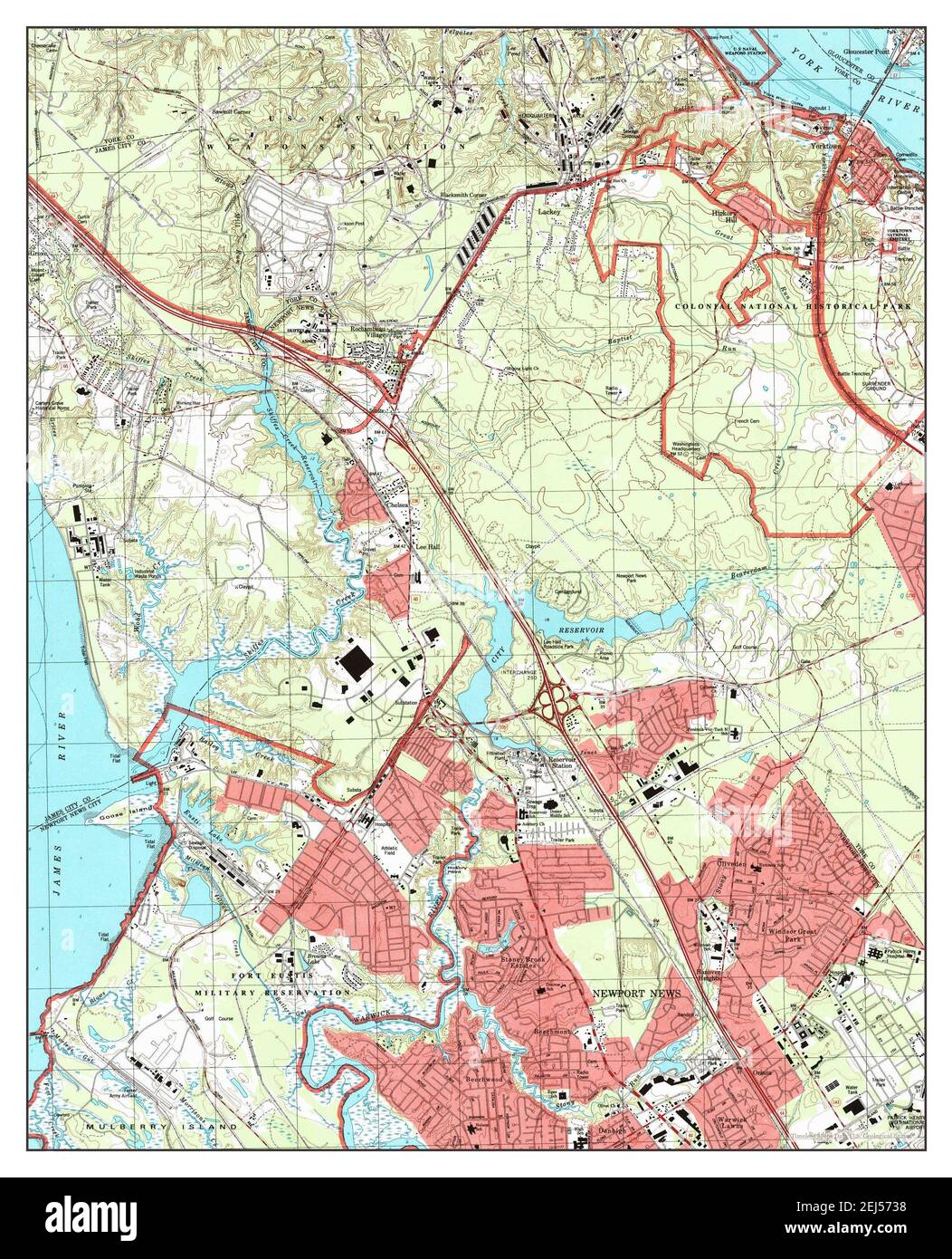 Yorktown, Virginia, map 1994, 1:24000, United States of America by Timeless Maps, data U.S. Geological Survey Stock Photohttps://www.alamy.com/image-license-details/?v=1https://www.alamy.com/yorktown-virginia-map-1994-124000-united-states-of-america-by-timeless-maps-data-us-geological-survey-image407017612.html
RM2EJ5738–Yorktown, Virginia, map 1994, 1:24000, United States of America by Timeless Maps, data U.S. Geological Survey