London map 19th century Stock Photos and Images
(17,780)See london map 19th century stock video clipsQuick filters:
London map 19th century Stock Photos and Images
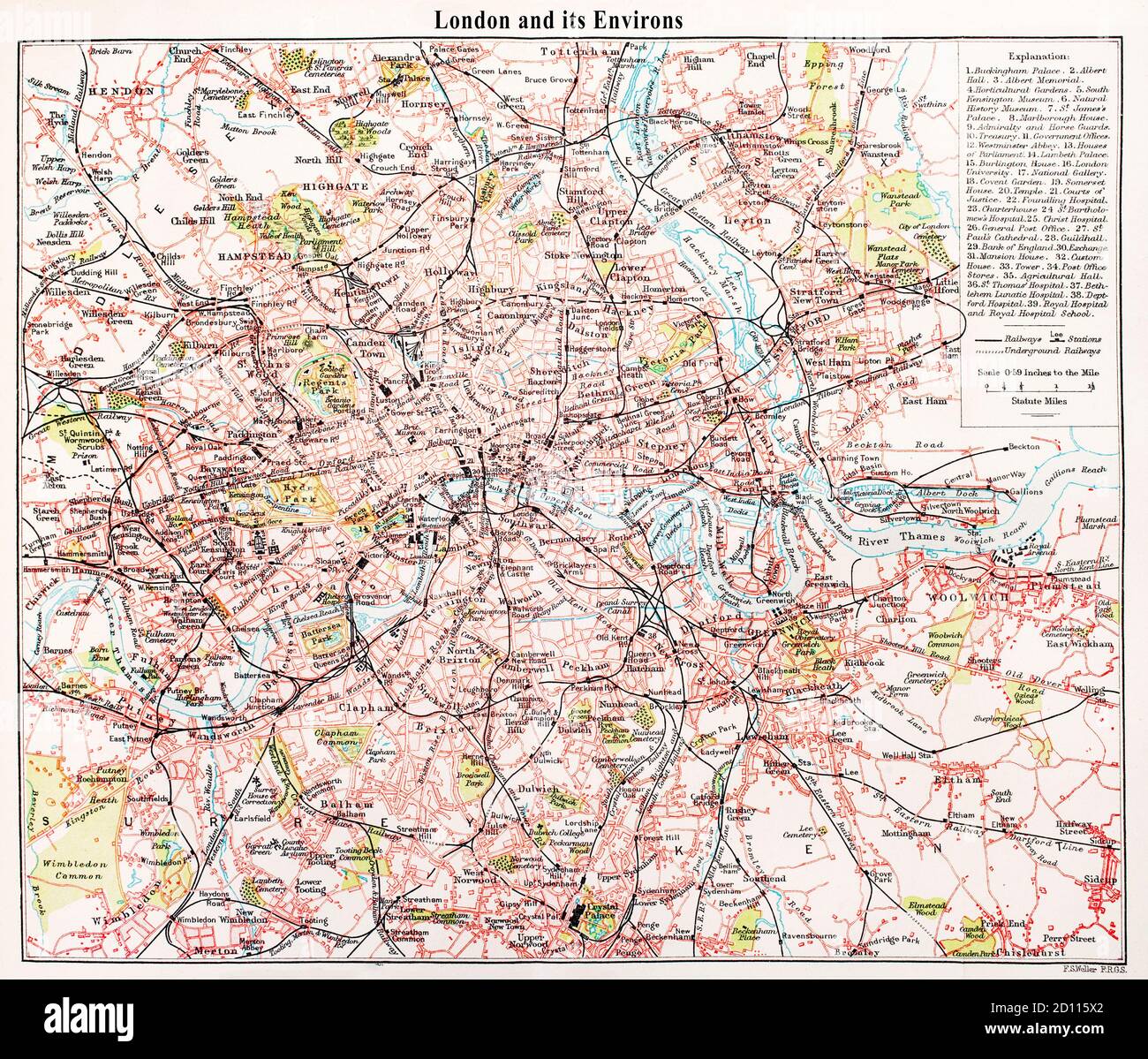 A late 19th Century map of London and its environs. Stock Photohttps://www.alamy.com/image-license-details/?v=1https://www.alamy.com/a-late-19th-century-map-of-london-and-its-environs-image379269354.html
RM2D115X2–A late 19th Century map of London and its environs.
 CITY OF LONDON. WYLD'S PLAN + 19th century street improvements, 1944 old map Stock Photohttps://www.alamy.com/image-license-details/?v=1https://www.alamy.com/stock-photo-city-of-london-wylds-plan-19th-century-street-improvements-1944-old-94507285.html
RFFDN505–CITY OF LONDON. WYLD'S PLAN + 19th century street improvements, 1944 old map
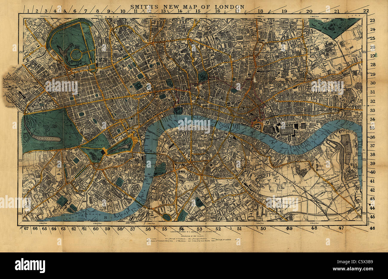 Smith's New Map of London, 1860 Stock Photohttps://www.alamy.com/image-license-details/?v=1https://www.alamy.com/stock-photo-smiths-new-map-of-london-1860-38067437.html
RFC5X3B9–Smith's New Map of London, 1860
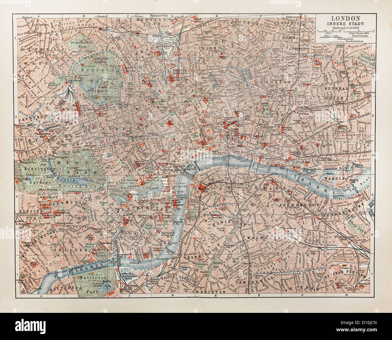 Vintage map of London at the end of 19th century Stock Photohttps://www.alamy.com/image-license-details/?v=1https://www.alamy.com/stock-photo-vintage-map-of-london-at-the-end-of-19th-century-52260229.html
RFD10JCN–Vintage map of London at the end of 19th century
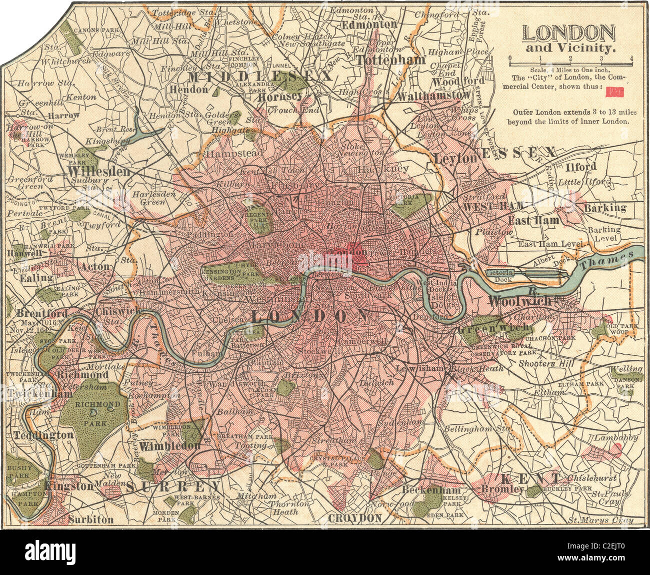 Map of London Stock Photohttps://www.alamy.com/image-license-details/?v=1https://www.alamy.com/stock-photo-map-of-london-35972160.html
RMC2EJT0–Map of London
 Historical drawing from the 19th century, map of London, England, 1575 Stock Photohttps://www.alamy.com/image-license-details/?v=1https://www.alamy.com/stock-photo-historical-drawing-from-the-19th-century-map-of-london-england-1575-48133794.html
RFCP8K42–Historical drawing from the 19th century, map of London, England, 1575
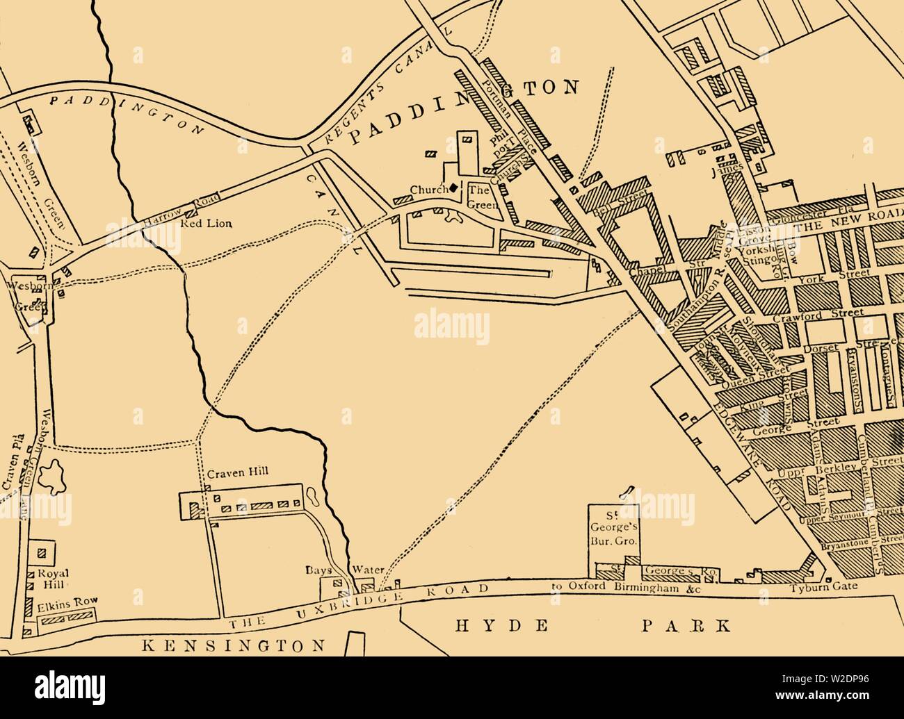 'Map of Paddington, in 1815', (c1876). Creator: Unknown. Stock Photohttps://www.alamy.com/image-license-details/?v=1https://www.alamy.com/map-of-paddington-in-1815-c1876-creator-unknown-image259687714.html
RMW2DP96–'Map of Paddington, in 1815', (c1876). Creator: Unknown.
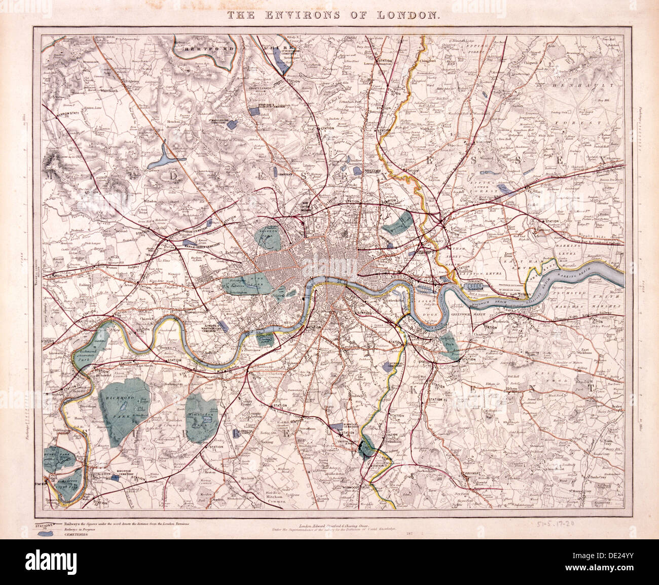 Map of London, c1860. Artist: Benjamin Rees Davies Stock Photohttps://www.alamy.com/image-license-details/?v=1https://www.alamy.com/map-of-london-c1860-artist-benjamin-rees-davies-image60284111.html
RMDE24YY–Map of London, c1860. Artist: Benjamin Rees Davies
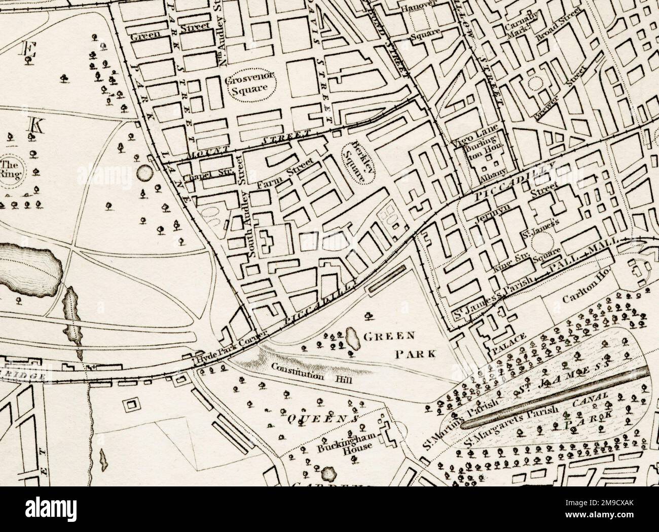 19th century Map of Mayfair, London (Extract) Stock Photohttps://www.alamy.com/image-license-details/?v=1https://www.alamy.com/19th-century-map-of-mayfair-london-extract-image504916683.html
RM2M9CXAK–19th century Map of Mayfair, London (Extract)
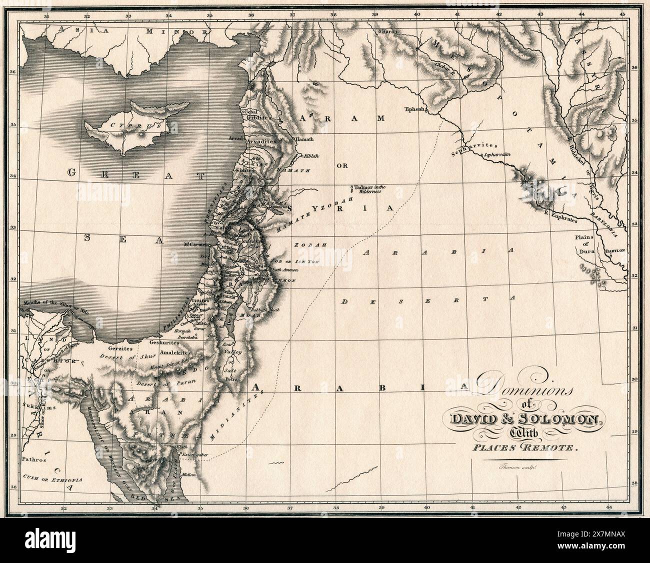 19th century map showing the Dominions of David and Solomon and places remote. Published for the Society for Promoting Christian Knowledge by Messrs. Rivington's, St.Paul's Church Yard, London, September 1814. Stock Photohttps://www.alamy.com/image-license-details/?v=1https://www.alamy.com/19th-century-map-showing-the-dominions-of-david-and-solomon-and-places-remote-published-for-the-society-for-promoting-christian-knowledge-by-messrs-rivingtons-stpauls-church-yard-london-september-1814-image607121282.html
RM2X7MNAX–19th century map showing the Dominions of David and Solomon and places remote. Published for the Society for Promoting Christian Knowledge by Messrs. Rivington's, St.Paul's Church Yard, London, September 1814.
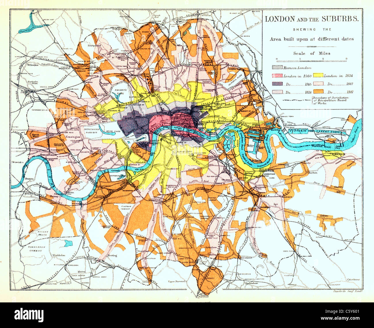 Map of London and Suburbs, circa 1880s, with colour coded areas indicating the growth of the city from Roman times to the 1880s Stock Photohttps://www.alamy.com/image-license-details/?v=1https://www.alamy.com/stock-photo-map-of-london-and-suburbs-circa-1880s-with-colour-coded-areas-indicating-38091425.html
RMC5Y601–Map of London and Suburbs, circa 1880s, with colour coded areas indicating the growth of the city from Roman times to the 1880s
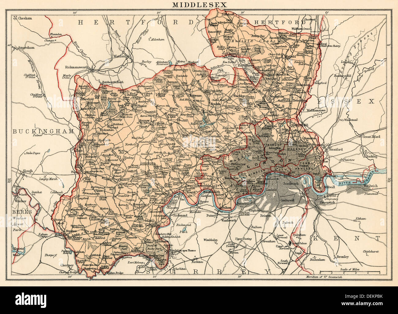 Map of Middlesex, England, 1870s. Color lithograph Stock Photohttps://www.alamy.com/image-license-details/?v=1https://www.alamy.com/map-of-middlesex-england-1870s-color-lithograph-image60670951.html
RMDEKPBK–Map of Middlesex, England, 1870s. Color lithograph
 Vintage 1854 engraving of a 3D map the Tower of London. Stock Photohttps://www.alamy.com/image-license-details/?v=1https://www.alamy.com/vintage-1854-engraving-of-a-3d-map-the-tower-of-london-image576563438.html
RM2TE0MFA–Vintage 1854 engraving of a 3D map the Tower of London.
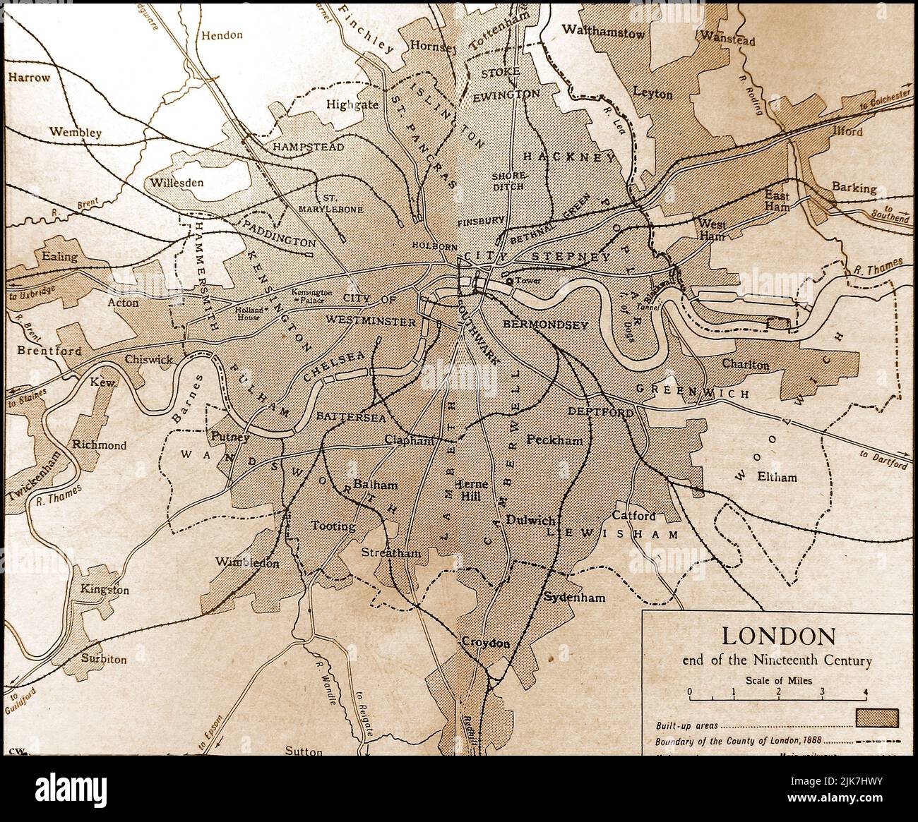 An old map showing the City of London at the end of the 1800s Stock Photohttps://www.alamy.com/image-license-details/?v=1https://www.alamy.com/an-old-map-showing-the-city-of-london-at-the-end-of-the-1800s-image476526119.html
RM2JK7HWY–An old map showing the City of London at the end of the 1800s
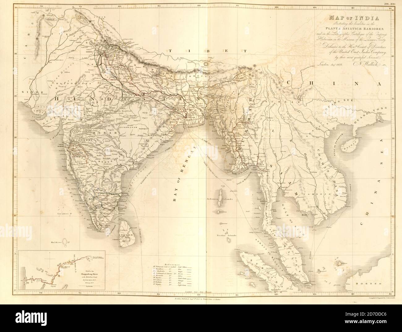 19th century map of India and Indochina From Plantae Asiaticae rariores, or, Descriptions and figures of a select number of unpublished East Indian plants Volume III by Nathaniel Wolff Wallich. Published in London in 1832 Stock Photohttps://www.alamy.com/image-license-details/?v=1https://www.alamy.com/19th-century-map-of-india-and-indochina-from-plantae-asiaticae-rariores-or-descriptions-and-figures-of-a-select-number-of-unpublished-east-indian-plants-volume-iii-by-nathaniel-wolff-wallich-published-in-london-in-1832-image383226598.html
RF2D7DDC6–19th century map of India and Indochina From Plantae Asiaticae rariores, or, Descriptions and figures of a select number of unpublished East Indian plants Volume III by Nathaniel Wolff Wallich. Published in London in 1832
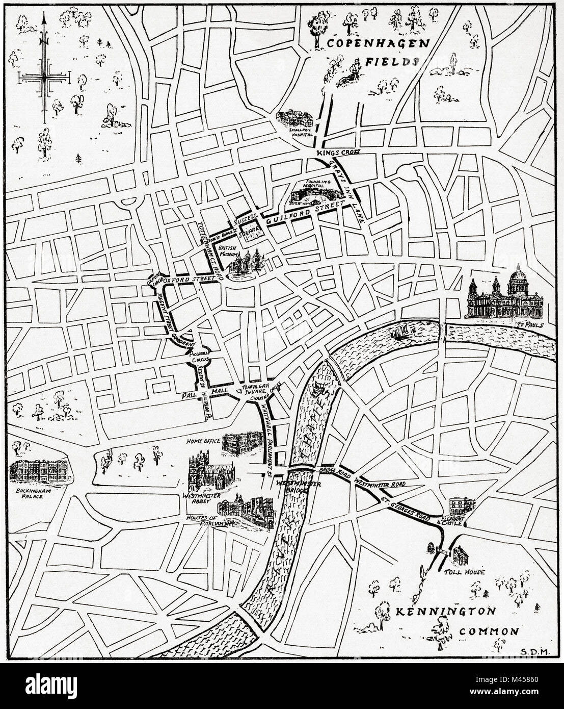 Map showing the route of the demonstration at Copenhagen Fields, London, England 21 April 1834 in protest against the deportation of the Tolpuddle Martyrs. The Tolpuddle Martyrs, a group of 19th-century Dorset agricultural labourers who were arrested for and convicted of swearing a secret oath as members of the Friendly Society of Agricultural Labourers, they were sentenced to penal transportation to Australia and Tasmania. From The Martyrs of Tolpuddle, published 1934. From The Martyrs of Tolpuddle, published 1934. Stock Photohttps://www.alamy.com/image-license-details/?v=1https://www.alamy.com/stock-photo-map-showing-the-route-of-the-demonstration-at-copenhagen-fields-london-174678504.html
RMM45860–Map showing the route of the demonstration at Copenhagen Fields, London, England 21 April 1834 in protest against the deportation of the Tolpuddle Martyrs. The Tolpuddle Martyrs, a group of 19th-century Dorset agricultural labourers who were arrested for and convicted of swearing a secret oath as members of the Friendly Society of Agricultural Labourers, they were sentenced to penal transportation to Australia and Tasmania. From The Martyrs of Tolpuddle, published 1934. From The Martyrs of Tolpuddle, published 1934.
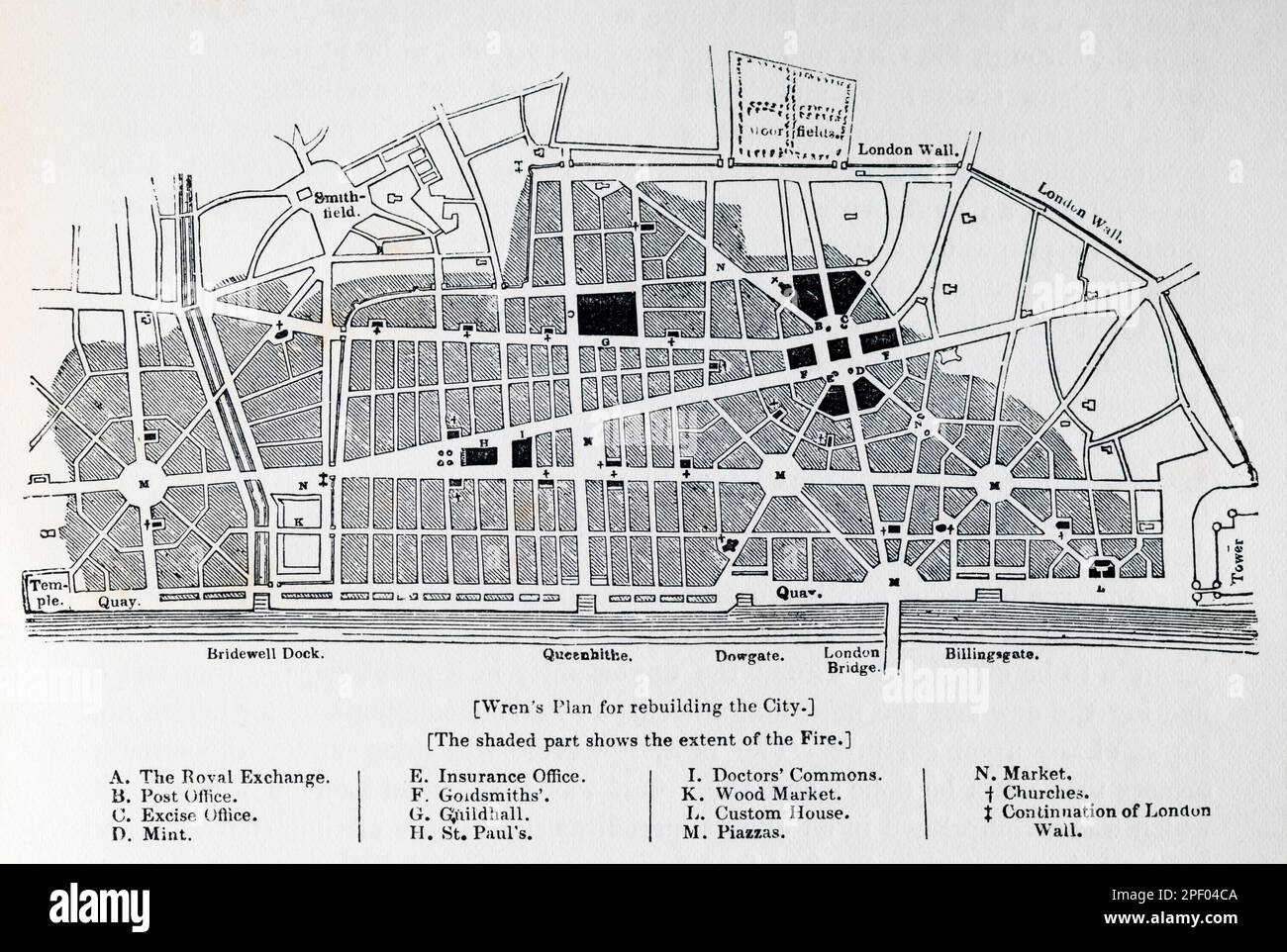 19th century engraving of Wren's Plan for rebuilding the City after the Great Fire. Stock Photohttps://www.alamy.com/image-license-details/?v=1https://www.alamy.com/19th-century-engraving-of-wrens-plan-for-rebuilding-the-city-after-the-great-fire-image542744730.html
RM2PF04CA–19th century engraving of Wren's Plan for rebuilding the City after the Great Fire.
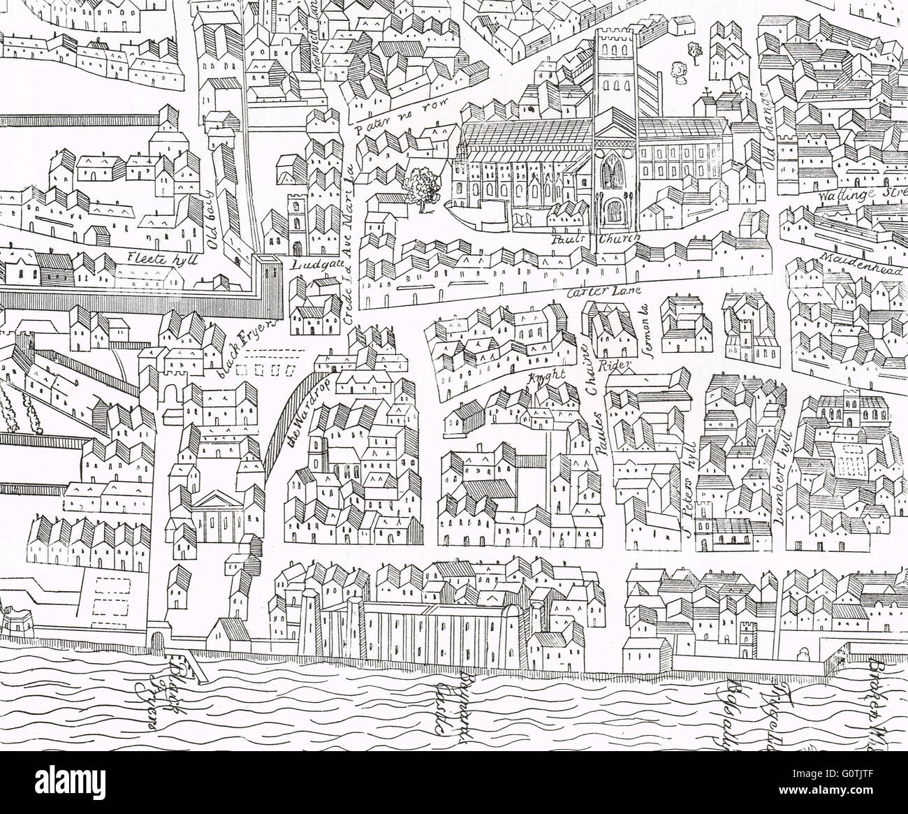 London around Old St Paul's in 1563 Stock Photohttps://www.alamy.com/image-license-details/?v=1https://www.alamy.com/stock-photo-london-around-old-st-pauls-in-1563-103803855.html
RMG0TJTF–London around Old St Paul's in 1563
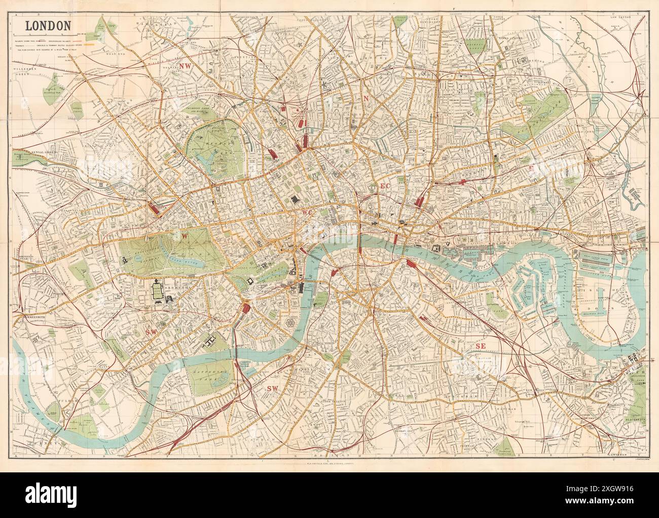 Map of London published by W.H. Smith & Son's showing central London circa 1885. Stock Photohttps://www.alamy.com/image-license-details/?v=1https://www.alamy.com/map-of-london-published-by-wh-smith-sons-showing-central-london-circa-1885-image612753266.html
RM2XGW916–Map of London published by W.H. Smith & Son's showing central London circa 1885.
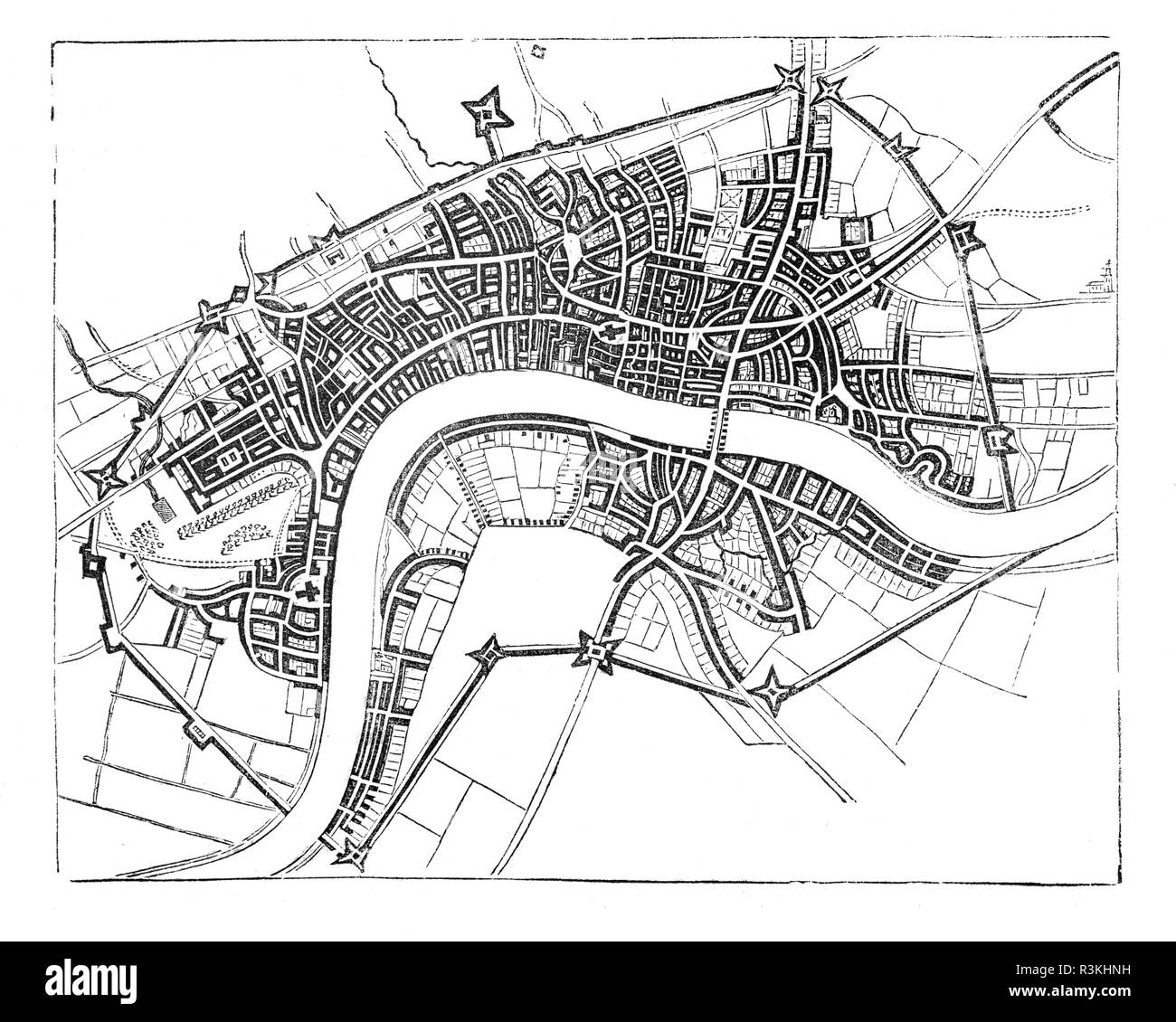 A map of mid-17th Century London showing the walls that surrounded the then small City, England. Stock Photohttps://www.alamy.com/image-license-details/?v=1https://www.alamy.com/a-map-of-mid-17th-century-london-showing-the-walls-that-surrounded-the-then-small-city-england-image226009773.html
RMR3KHNH–A map of mid-17th Century London showing the walls that surrounded the then small City, England.
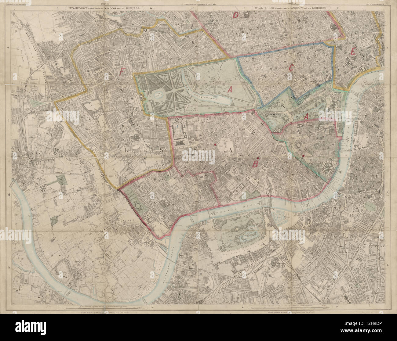 Stanford's Library map of London. Kensington Chelsea West End Battersea 1877 Stock Photohttps://www.alamy.com/image-license-details/?v=1https://www.alamy.com/stanfords-library-map-of-london-kensington-chelsea-west-end-battersea-1877-image242555090.html
RFT2H9DP–Stanford's Library map of London. Kensington Chelsea West End Battersea 1877
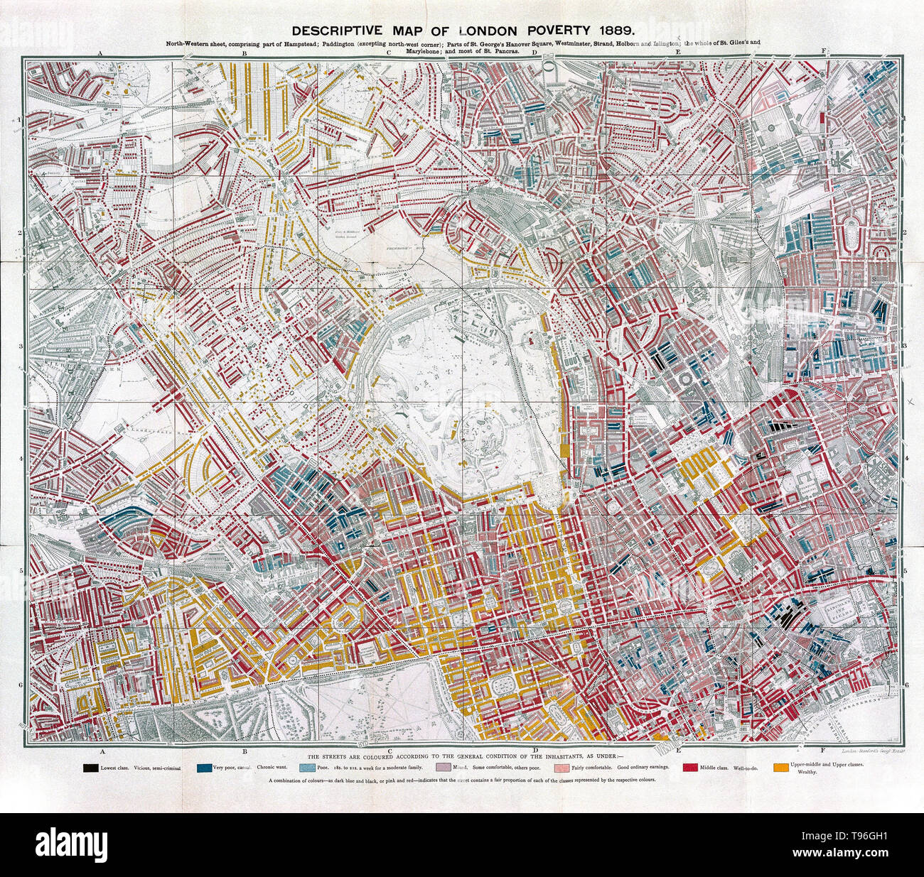 Descriptive map of London poverty, 1889 (north - western sheet). Color code: black (lowest class), dark blue (very poor), light blue (poor), mauve (mixed), light orange (fairly comfortable), red (middle class, orange (wealthy). A poverty map is a map which provides a detailed description of the spatial distribution of poverty and inequality within a country. Stock Photohttps://www.alamy.com/image-license-details/?v=1https://www.alamy.com/descriptive-map-of-london-poverty-1889-north-western-sheet-color-code-black-lowest-class-dark-blue-very-poor-light-blue-poor-mauve-mixed-light-orange-fairly-comfortable-red-middle-class-orange-wealthy-a-poverty-map-is-a-map-which-provides-a-detailed-description-of-the-spatial-distribution-of-poverty-and-inequality-within-a-country-image246621789.html
RMT96GH1–Descriptive map of London poverty, 1889 (north - western sheet). Color code: black (lowest class), dark blue (very poor), light blue (poor), mauve (mixed), light orange (fairly comfortable), red (middle class, orange (wealthy). A poverty map is a map which provides a detailed description of the spatial distribution of poverty and inequality within a country.
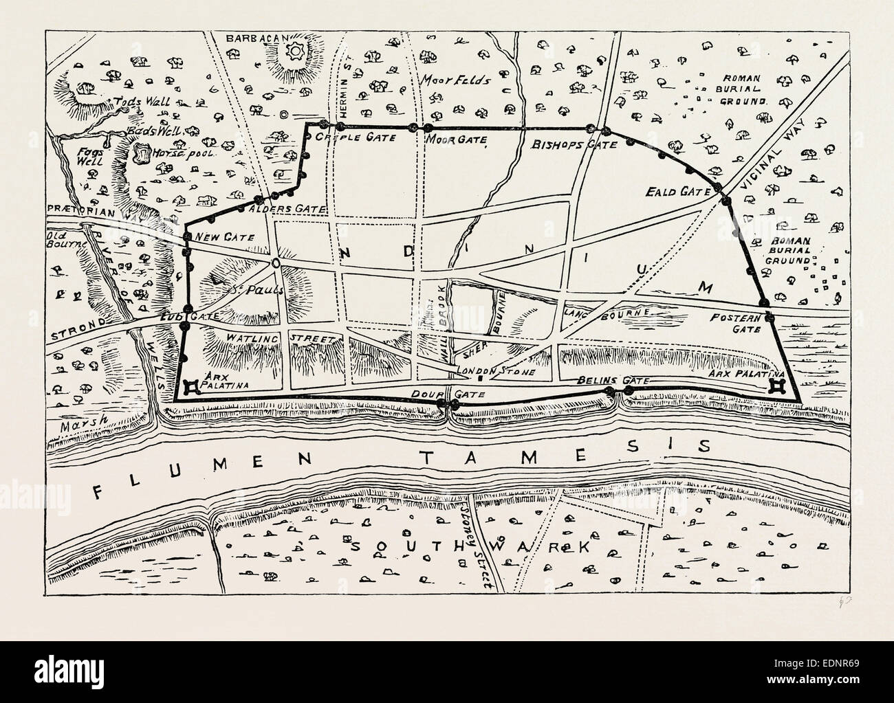 PLAN OF ROMAN LONDON, map, UK, 19th century Stock Photohttps://www.alamy.com/image-license-details/?v=1https://www.alamy.com/stock-photo-plan-of-roman-london-map-uk-19th-century-77311201.html
RMEDNR69–PLAN OF ROMAN LONDON, map, UK, 19th century
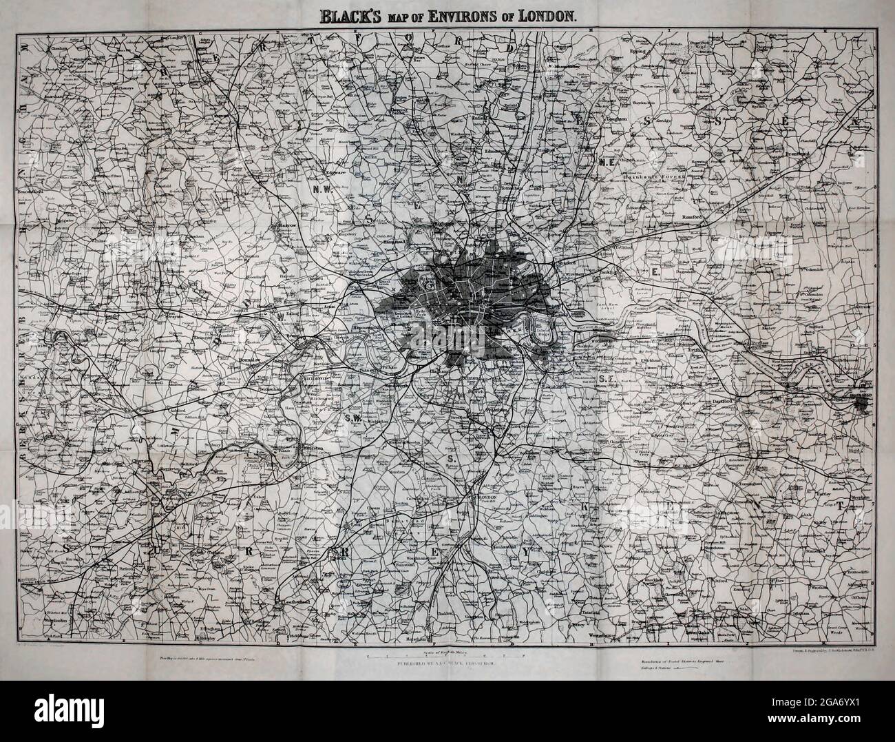 Black's Map of the Environs of London From the book ' London and its environs : a practical guide to the metropolis and its vicinity, illustrated by maps, plans and views ' by Adam and Charles Black Published in Edinburgh by A. & C. Black 1862 Stock Photohttps://www.alamy.com/image-license-details/?v=1https://www.alamy.com/blacks-map-of-the-environs-of-london-from-the-book-london-and-its-environs-a-practical-guide-to-the-metropolis-and-its-vicinity-illustrated-by-maps-plans-and-views-by-adam-and-charles-black-published-in-edinburgh-by-a-c-black-1862-image436559369.html
RM2GA6YX1–Black's Map of the Environs of London From the book ' London and its environs : a practical guide to the metropolis and its vicinity, illustrated by maps, plans and views ' by Adam and Charles Black Published in Edinburgh by A. & C. Black 1862
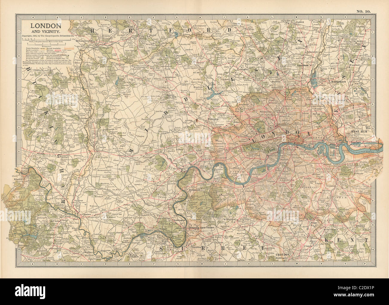 Map of London, England Stock Photohttps://www.alamy.com/image-license-details/?v=1https://www.alamy.com/stock-photo-map-of-london-england-35955858.html
RMC2DX1P–Map of London, England
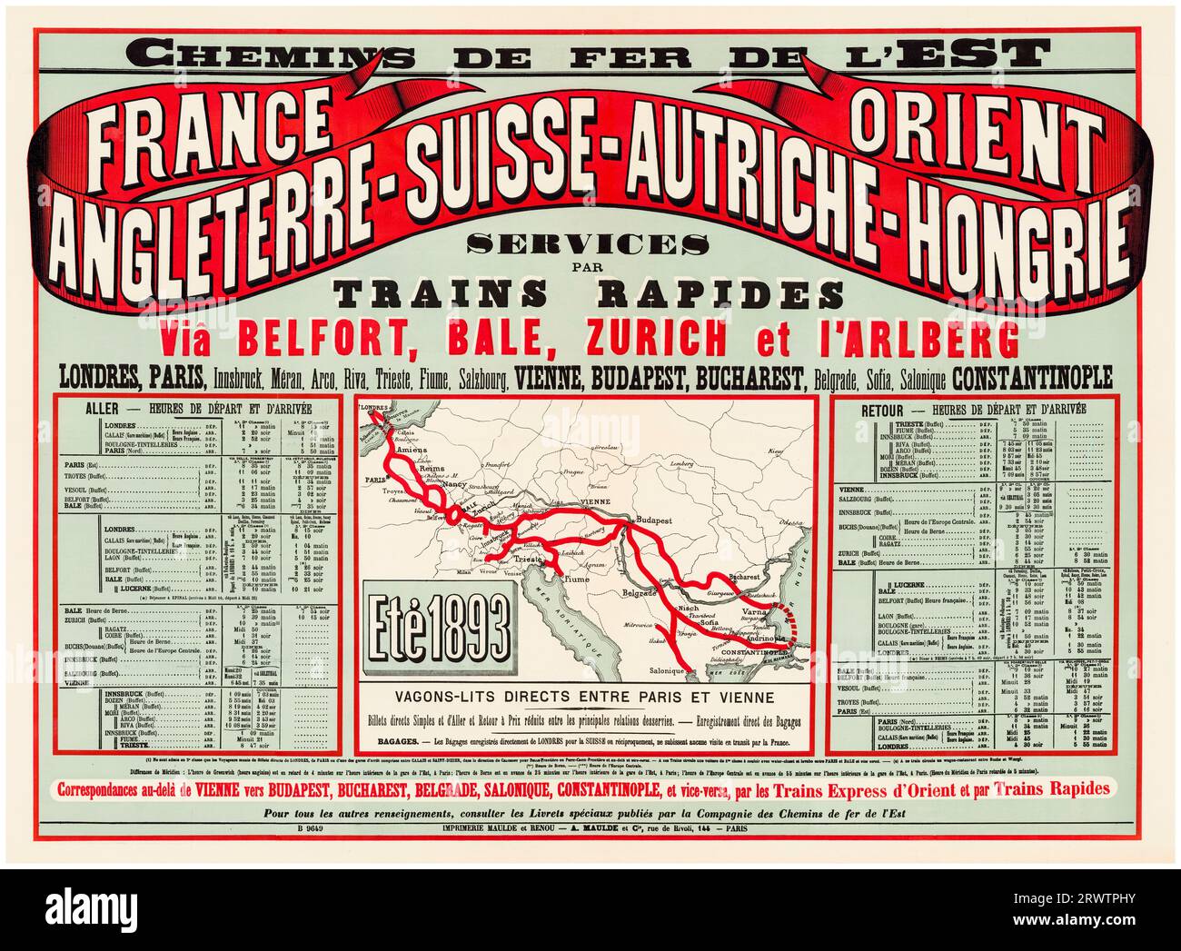 Chemins de Fer de l'Est (Eastern Railways), London to Constantinople (The Orient) via Vienna, Budapest, and Bucharest, timetable and route map for Summer 1893, French vintage travel poster, 1893 Stock Photohttps://www.alamy.com/image-license-details/?v=1https://www.alamy.com/chemins-de-fer-de-lest-eastern-railways-london-to-constantinople-the-orient-via-vienna-budapest-and-bucharest-timetable-and-route-map-for-summer-1893-french-vintage-travel-poster-1893-image566642775.html
RM2RWTPHY–Chemins de Fer de l'Est (Eastern Railways), London to Constantinople (The Orient) via Vienna, Budapest, and Bucharest, timetable and route map for Summer 1893, French vintage travel poster, 1893
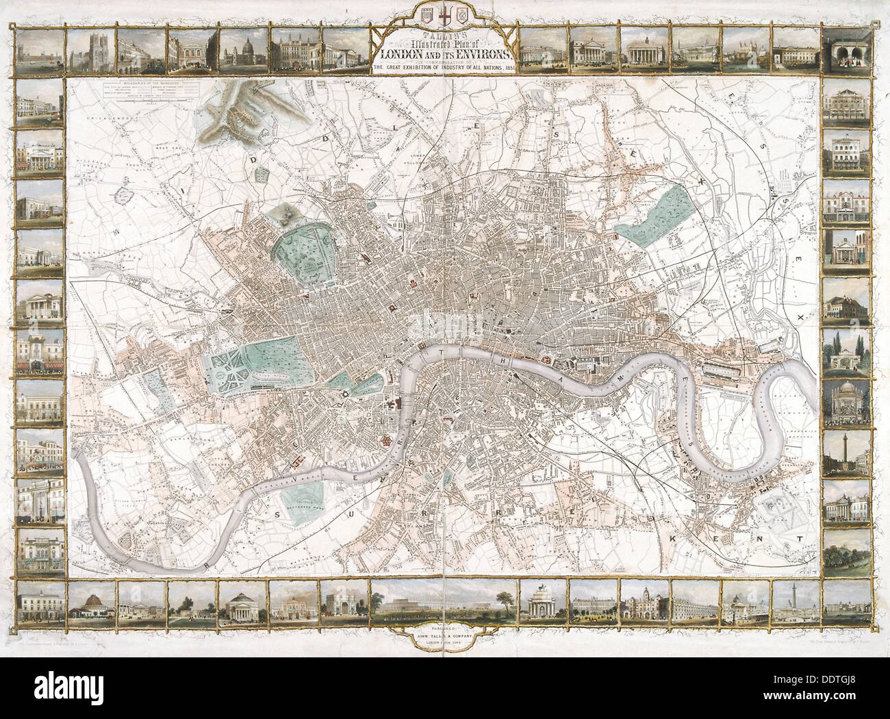 Map of London, 1851. Artist: H Lacey Stock Photohttps://www.alamy.com/image-license-details/?v=1https://www.alamy.com/map-of-london-1851-artist-h-lacey-image60161536.html
RMDDTGJ8–Map of London, 1851. Artist: H Lacey
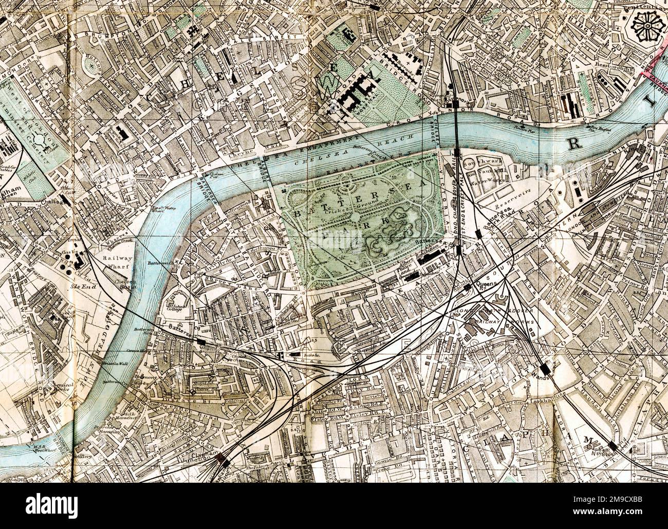 19th century Map of Battersea, London (Extract) Stock Photohttps://www.alamy.com/image-license-details/?v=1https://www.alamy.com/19th-century-map-of-battersea-london-extract-image504916703.html
RM2M9CXBB–19th century Map of Battersea, London (Extract)
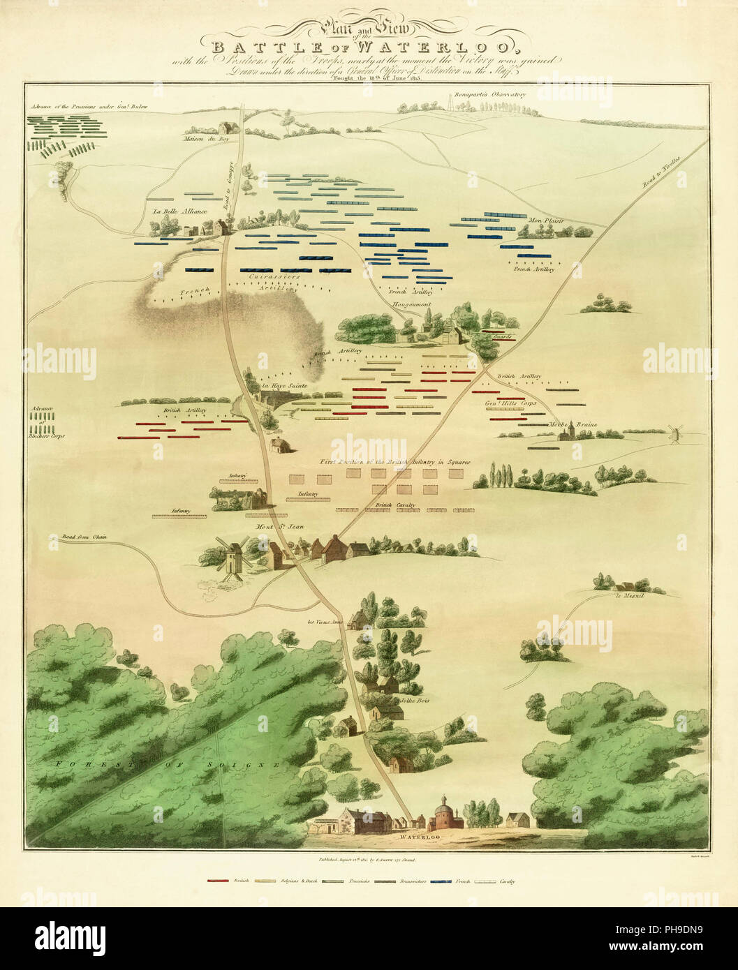 Souvenir Battle of Waterloo map, published in London and dated August 12, 1815, less than two months after the event. The neat, stylised grouping of the opposing forces belies the confusion and bloodiness of the battle. Stock Photohttps://www.alamy.com/image-license-details/?v=1https://www.alamy.com/souvenir-battle-of-waterloo-map-published-in-london-and-dated-august-12-1815-less-than-two-months-after-the-event-the-neat-stylised-grouping-of-the-opposing-forces-belies-the-confusion-and-bloodiness-of-the-battle-image217181925.html
RMPH9DN9–Souvenir Battle of Waterloo map, published in London and dated August 12, 1815, less than two months after the event. The neat, stylised grouping of the opposing forces belies the confusion and bloodiness of the battle.
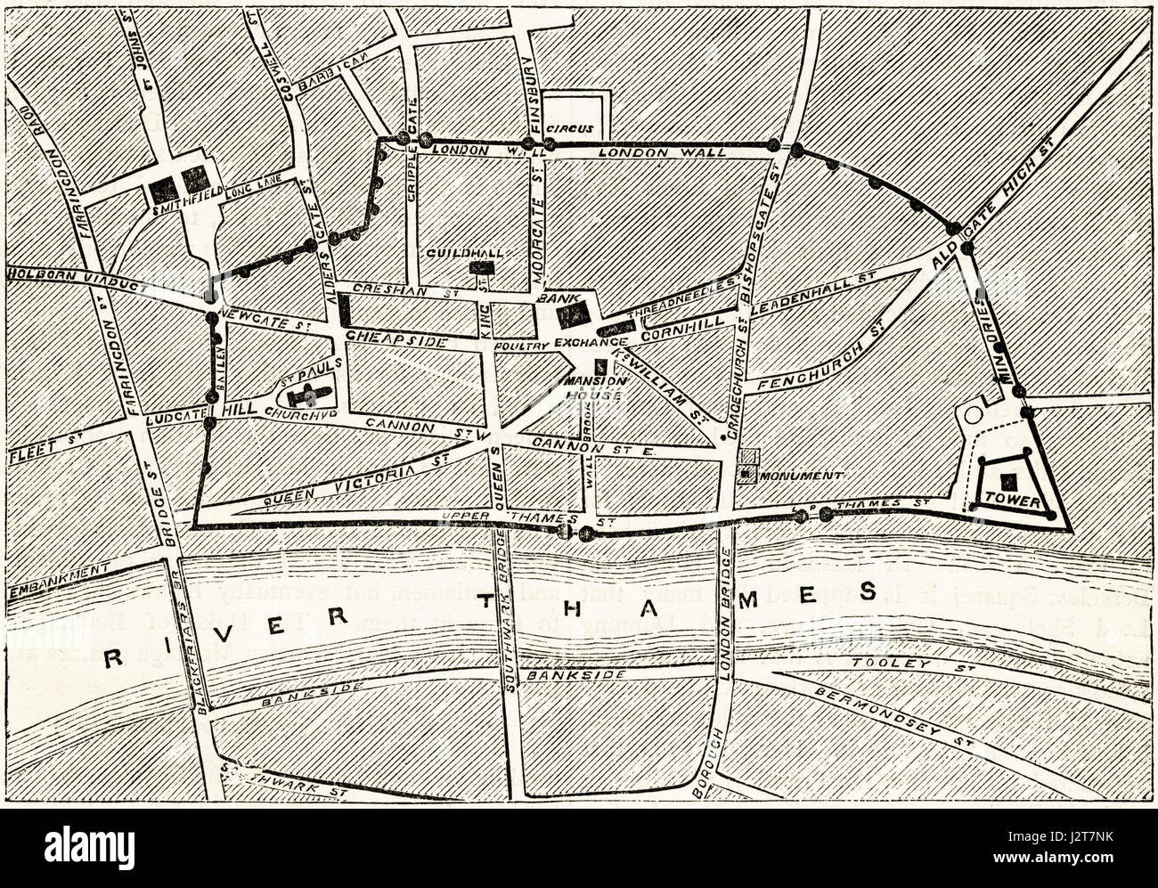 Map of Victorian London showing the ancient walls. Victorian engraving circa 1880. Stock Photohttps://www.alamy.com/image-license-details/?v=1https://www.alamy.com/stock-photo-map-of-victorian-london-showing-the-ancient-walls-victorian-engraving-139445199.html
RMJ2T7NK–Map of Victorian London showing the ancient walls. Victorian engraving circa 1880.
 19th century map of Africa from the 'Encyclopaedia Londinensis, or, Universal Dictionary of Arts, Sciences and Literature; Volume I. Edited by John Wilkes. Published in London, Great, Britain, in 1810. Stock Photohttps://www.alamy.com/image-license-details/?v=1https://www.alamy.com/19th-century-map-of-africa-from-the-encyclopaedia-londinensis-or-universal-dictionary-of-arts-sciences-and-literature-volume-i-edited-by-john-wilkes-published-in-london-great-britain-in-1810-image454450286.html
RF2HB9YYA–19th century map of Africa from the 'Encyclopaedia Londinensis, or, Universal Dictionary of Arts, Sciences and Literature; Volume I. Edited by John Wilkes. Published in London, Great, Britain, in 1810.
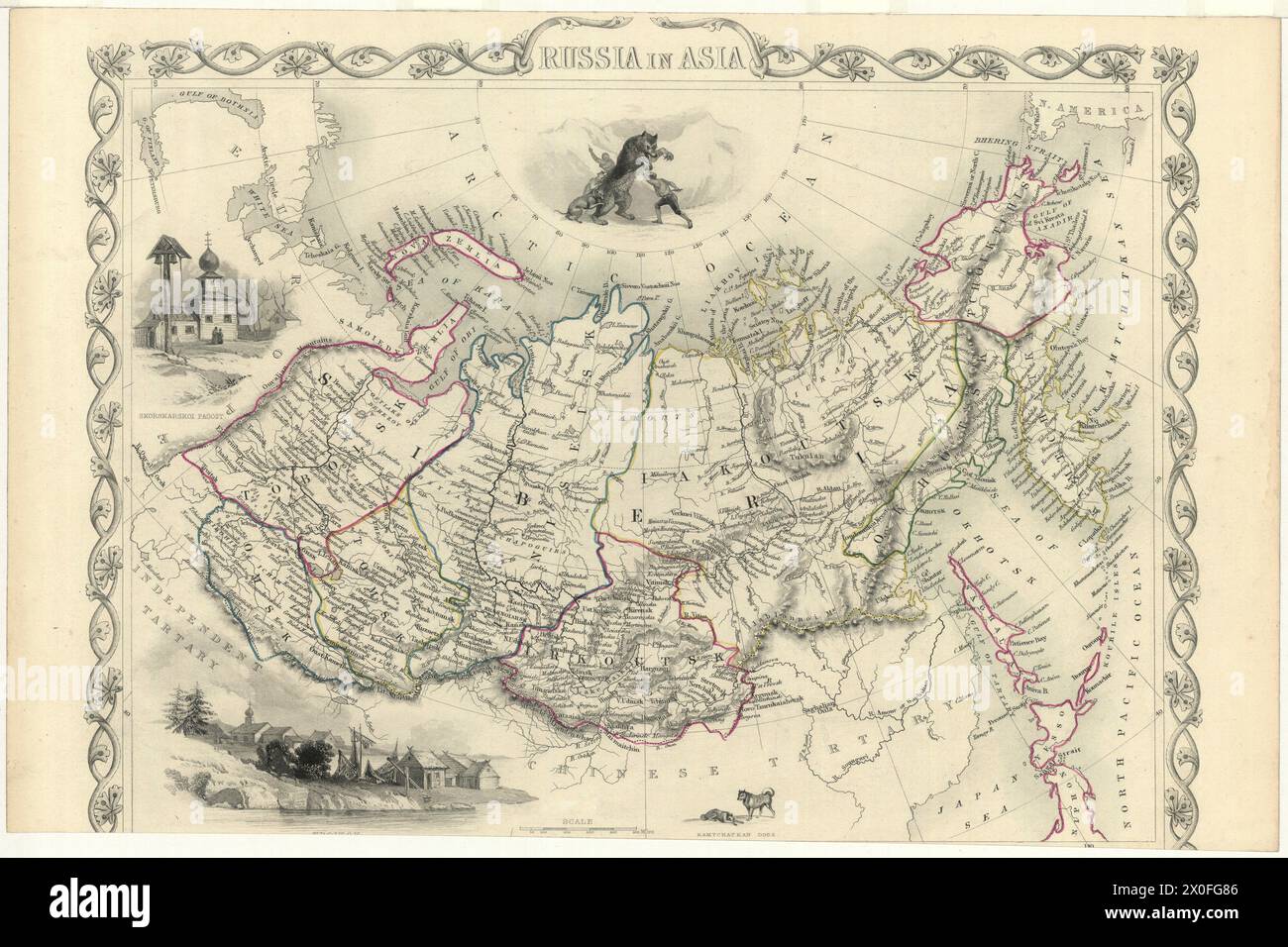 Vintage map titled Russia in Asia, London Printing and Publishing Company, post 1855 Stock Photohttps://www.alamy.com/image-license-details/?v=1https://www.alamy.com/vintage-map-titled-russia-in-asia-london-printing-and-publishing-company-post-1855-image602704934.html
RM2X0FG86–Vintage map titled Russia in Asia, London Printing and Publishing Company, post 1855
 A 19th century map of Auckland, New Zealand, showing its harbour and approaches, with distances in English miles Stock Photohttps://www.alamy.com/image-license-details/?v=1https://www.alamy.com/a-19th-century-map-of-auckland-new-zealand-showing-its-harbour-and-approaches-with-distances-in-english-miles-image466558928.html
RM2J31GJT–A 19th century map of Auckland, New Zealand, showing its harbour and approaches, with distances in English miles
![19th century map of Persia [Iran] Copperplate engraving From the Encyclopaedia Londinensis or, Universal dictionary of arts, sciences, and literature; Volume XIX; Edited by Wilkes, John. Published in London in 1823 Stock Photo 19th century map of Persia [Iran] Copperplate engraving From the Encyclopaedia Londinensis or, Universal dictionary of arts, sciences, and literature; Volume XIX; Edited by Wilkes, John. Published in London in 1823 Stock Photo](https://c8.alamy.com/comp/2CDEBC4/19th-century-map-of-persia-iran-copperplate-engraving-from-the-encyclopaedia-londinensis-or-universal-dictionary-of-arts-sciences-and-literature-volume-xix-edited-by-wilkes-john-published-in-london-in-1823-2CDEBC4.jpg) 19th century map of Persia [Iran] Copperplate engraving From the Encyclopaedia Londinensis or, Universal dictionary of arts, sciences, and literature; Volume XIX; Edited by Wilkes, John. Published in London in 1823 Stock Photohttps://www.alamy.com/image-license-details/?v=1https://www.alamy.com/19th-century-map-of-persia-iran-copperplate-engraving-from-the-encyclopaedia-londinensis-or-universal-dictionary-of-arts-sciences-and-literature-volume-xix-edited-by-wilkes-john-published-in-london-in-1823-image369724548.html
19th century map of Persia [Iran] Copperplate engraving From the Encyclopaedia Londinensis or, Universal dictionary of arts, sciences, and literature; Volume XIX; Edited by Wilkes, John. Published in London in 1823 Stock Photohttps://www.alamy.com/image-license-details/?v=1https://www.alamy.com/19th-century-map-of-persia-iran-copperplate-engraving-from-the-encyclopaedia-londinensis-or-universal-dictionary-of-arts-sciences-and-literature-volume-xix-edited-by-wilkes-john-published-in-london-in-1823-image369724548.htmlRF2CDEBC4–19th century map of Persia [Iran] Copperplate engraving From the Encyclopaedia Londinensis or, Universal dictionary of arts, sciences, and literature; Volume XIX; Edited by Wilkes, John. Published in London in 1823
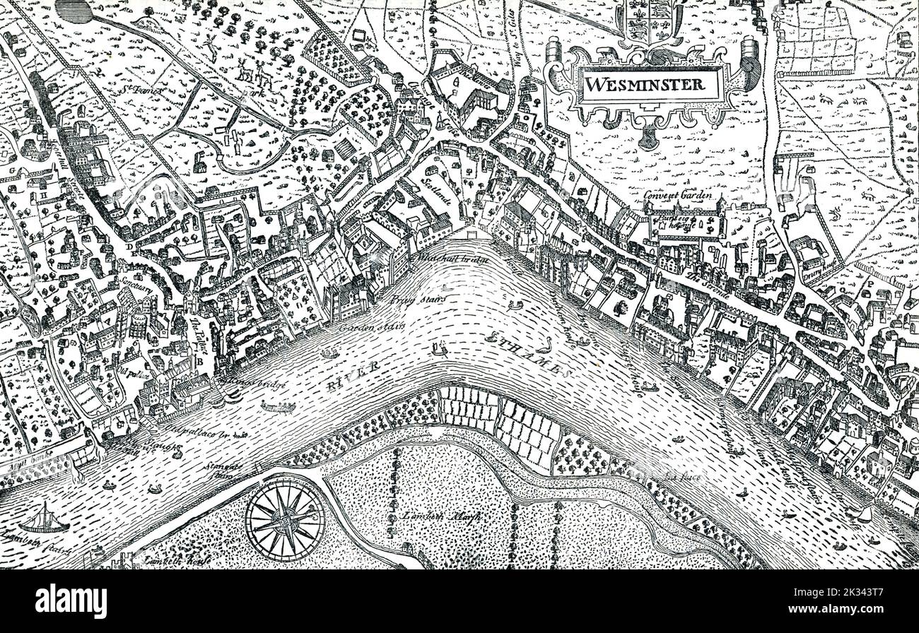 Undeveloped Westminster map in 16th Century London England. Heart of London including Whitehall and River Thames Stock Photohttps://www.alamy.com/image-license-details/?v=1https://www.alamy.com/undeveloped-westminster-map-in-16th-century-london-england-heart-of-london-including-whitehall-and-river-thames-image483825111.html
RF2K343T7–Undeveloped Westminster map in 16th Century London England. Heart of London including Whitehall and River Thames
 'Plan of the Wards and Parishes in Which the Guildhall of the City of London is Situated', 1886. Artist: Unknown Stock Photohttps://www.alamy.com/image-license-details/?v=1https://www.alamy.com/plan-of-the-wards-and-parishes-in-which-the-guildhall-of-the-city-of-london-is-situated-1886-artist-unknown-image262764060.html
RMW7DX6M–'Plan of the Wards and Parishes in Which the Guildhall of the City of London is Situated', 1886. Artist: Unknown
 Vintage Illustrated Map: Falkland Islands and Patagonia Drawn by J.Rapkin, with illustrations by H. Winkles. John Tallis. reissued by the London Printing & Publishing Company Stock Photohttps://www.alamy.com/image-license-details/?v=1https://www.alamy.com/vintage-illustrated-map-falkland-islands-and-patagonia-drawn-by-jrapkin-with-illustrations-by-h-winkles-john-tallis-reissued-by-the-london-printing-publishing-company-image600733937.html
RM2WW9P7D–Vintage Illustrated Map: Falkland Islands and Patagonia Drawn by J.Rapkin, with illustrations by H. Winkles. John Tallis. reissued by the London Printing & Publishing Company
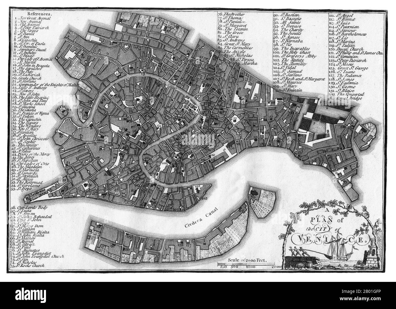 Italy/Venice: A map of Venice published by J. Stockdale, London, 1800. For centuries Venice was Europe’s prime trading partner with the Middle East and the Byzantine Empire in particular. Venetian naval and commercial power was unrivalled in Europe until it lost a series of wars to the Ottoman armies in the 15th century. The city lost some 50,000 people to the Black Death in 1575-1577, but remained a major manufacturing centre and port well into the 18th century. Stock Photohttps://www.alamy.com/image-license-details/?v=1https://www.alamy.com/italyvenice-a-map-of-venice-published-by-j-stockdale-london-1800-for-centuries-venice-was-europes-prime-trading-partner-with-the-middle-east-and-the-byzantine-empire-in-particular-venetian-naval-and-commercial-power-was-unrivalled-in-europe-until-it-lost-a-series-of-wars-to-the-ottoman-armies-in-the-15th-century-the-city-lost-some-50000-people-to-the-black-death-in-1575-1577-but-remained-a-major-manufacturing-centre-and-port-well-into-the-18th-century-image344242298.html
RM2B01GFP–Italy/Venice: A map of Venice published by J. Stockdale, London, 1800. For centuries Venice was Europe’s prime trading partner with the Middle East and the Byzantine Empire in particular. Venetian naval and commercial power was unrivalled in Europe until it lost a series of wars to the Ottoman armies in the 15th century. The city lost some 50,000 people to the Black Death in 1575-1577, but remained a major manufacturing centre and port well into the 18th century.
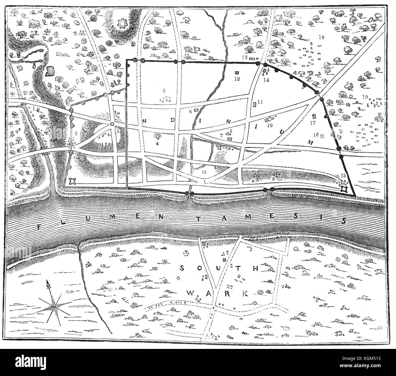 A plan of Londinium, or London, around AD 70, around which the Roman Walls can be seen. The small hill (marked No 3) is the eventual site of St Paul's Cathedral. Other nuimbers indicate places where Roman treasures and antiquities have been found. England. Stock Photohttps://www.alamy.com/image-license-details/?v=1https://www.alamy.com/stock-image-a-plan-of-londinium-or-london-around-ad-70-around-which-the-roman-165170799.html
RMKGM513–A plan of Londinium, or London, around AD 70, around which the Roman Walls can be seen. The small hill (marked No 3) is the eventual site of St Paul's Cathedral. Other nuimbers indicate places where Roman treasures and antiquities have been found. England.
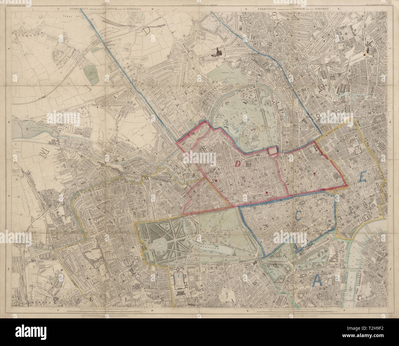 Stanford's Library map of London. Marylebone Notting Hill Camden Kensington 1877 Stock Photohttps://www.alamy.com/image-license-details/?v=1https://www.alamy.com/stanfords-library-map-of-london-marylebone-notting-hill-camden-kensington-1877-image242555126.html
RFT2H9F2–Stanford's Library map of London. Marylebone Notting Hill Camden Kensington 1877
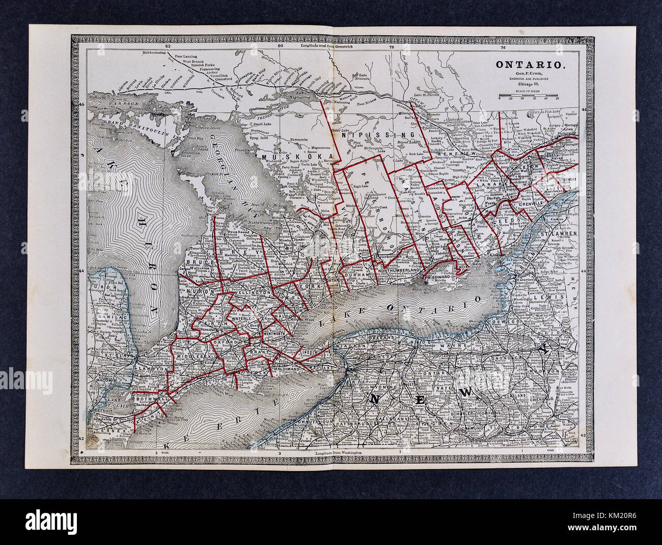 George Cram Antique Map from 1866 Atlas for Attorneys and Bankers: Ontario Canada - Toronto London Hamilton Windsor Stock Photohttps://www.alamy.com/image-license-details/?v=1https://www.alamy.com/stock-image-george-cram-antique-map-from-1866-atlas-for-attorneys-and-bankers-167230986.html
RFKM20R6–George Cram Antique Map from 1866 Atlas for Attorneys and Bankers: Ontario Canada - Toronto London Hamilton Windsor
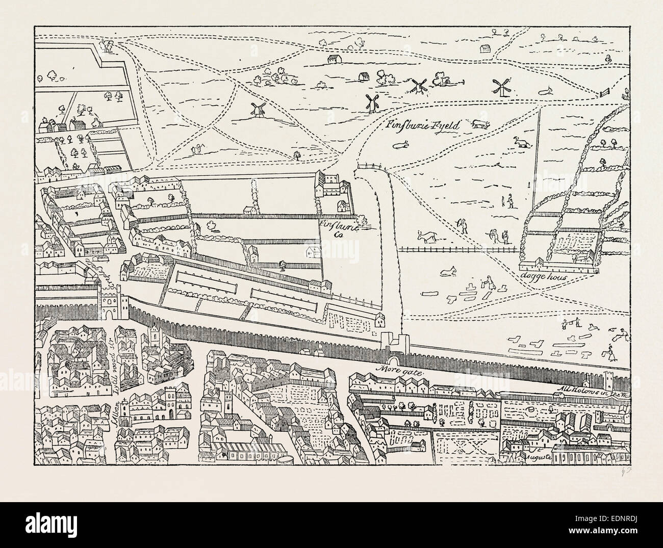 CRIPPLEGATE AND NEIGHBOURHOOD,map, London, UK, 19th century engraving Stock Photohttps://www.alamy.com/image-license-details/?v=1https://www.alamy.com/stock-photo-cripplegate-and-neighbourhoodmap-london-uk-19th-century-engraving-77311406.html
RMEDNRDJ–CRIPPLEGATE AND NEIGHBOURHOOD,map, London, UK, 19th century engraving
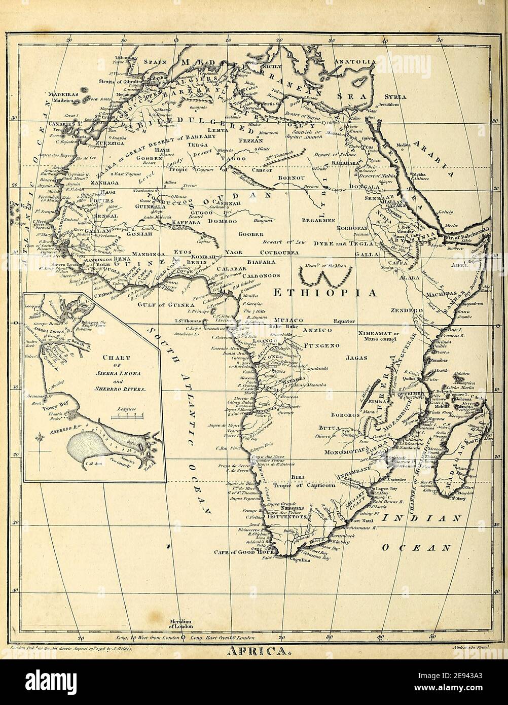 19th century map of Africa Copperplate engraving From the Encyclopaedia Londinensis or, Universal dictionary of arts, sciences, and literature; Volume I; Edited by Wilkes, John. Published in London in 1810 Stock Photohttps://www.alamy.com/image-license-details/?v=1https://www.alamy.com/19th-century-map-of-africa-copperplate-engraving-from-the-encyclopaedia-londinensis-or-universal-dictionary-of-arts-sciences-and-literature-volume-i-edited-by-wilkes-john-published-in-london-in-1810-image401460811.html
RF2E943A3–19th century map of Africa Copperplate engraving From the Encyclopaedia Londinensis or, Universal dictionary of arts, sciences, and literature; Volume I; Edited by Wilkes, John. Published in London in 1810
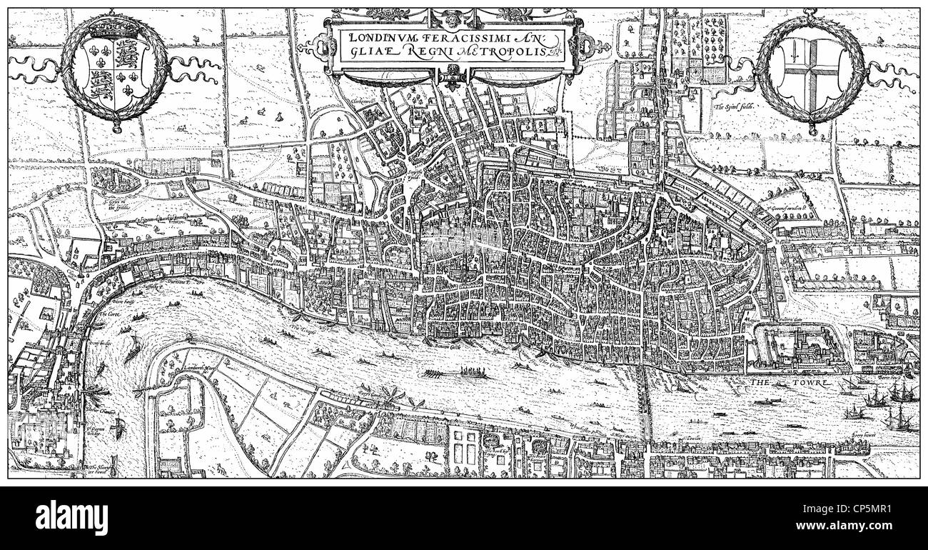 Historical drawing from the 19th century, map of London, England, 1575, Stock Photohttps://www.alamy.com/image-license-details/?v=1https://www.alamy.com/stock-photo-historical-drawing-from-the-19th-century-map-of-london-england-1575-48069253.html
RMCP5MR1–Historical drawing from the 19th century, map of London, England, 1575,
 city map from the year 1892: London Underground and train, Great Britain, digital improved reproduction of an original print from the year 1895 Stock Photohttps://www.alamy.com/image-license-details/?v=1https://www.alamy.com/stock-photo-city-map-from-the-year-1892-london-underground-and-train-great-britain-177058138.html
RFM81KCX–city map from the year 1892: London Underground and train, Great Britain, digital improved reproduction of an original print from the year 1895
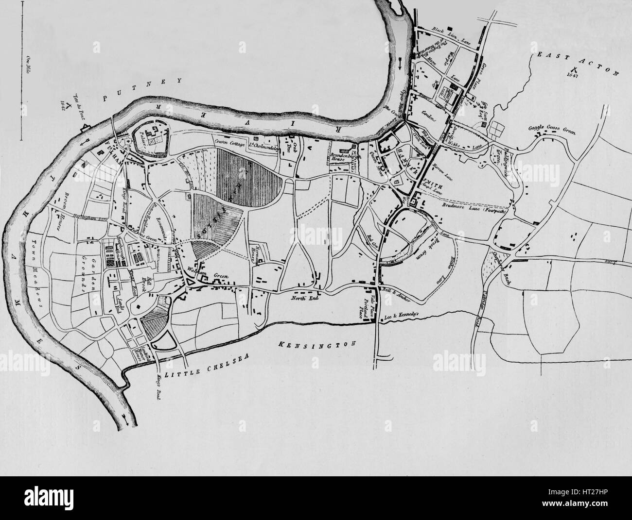 A map of Fulham in 1813 (1911). Artist: Unknown. Stock Photohttps://www.alamy.com/image-license-details/?v=1https://www.alamy.com/stock-photo-a-map-of-fulham-in-1813-1911-artist-unknown-135274210.html
RMHT27HP–A map of Fulham in 1813 (1911). Artist: Unknown.
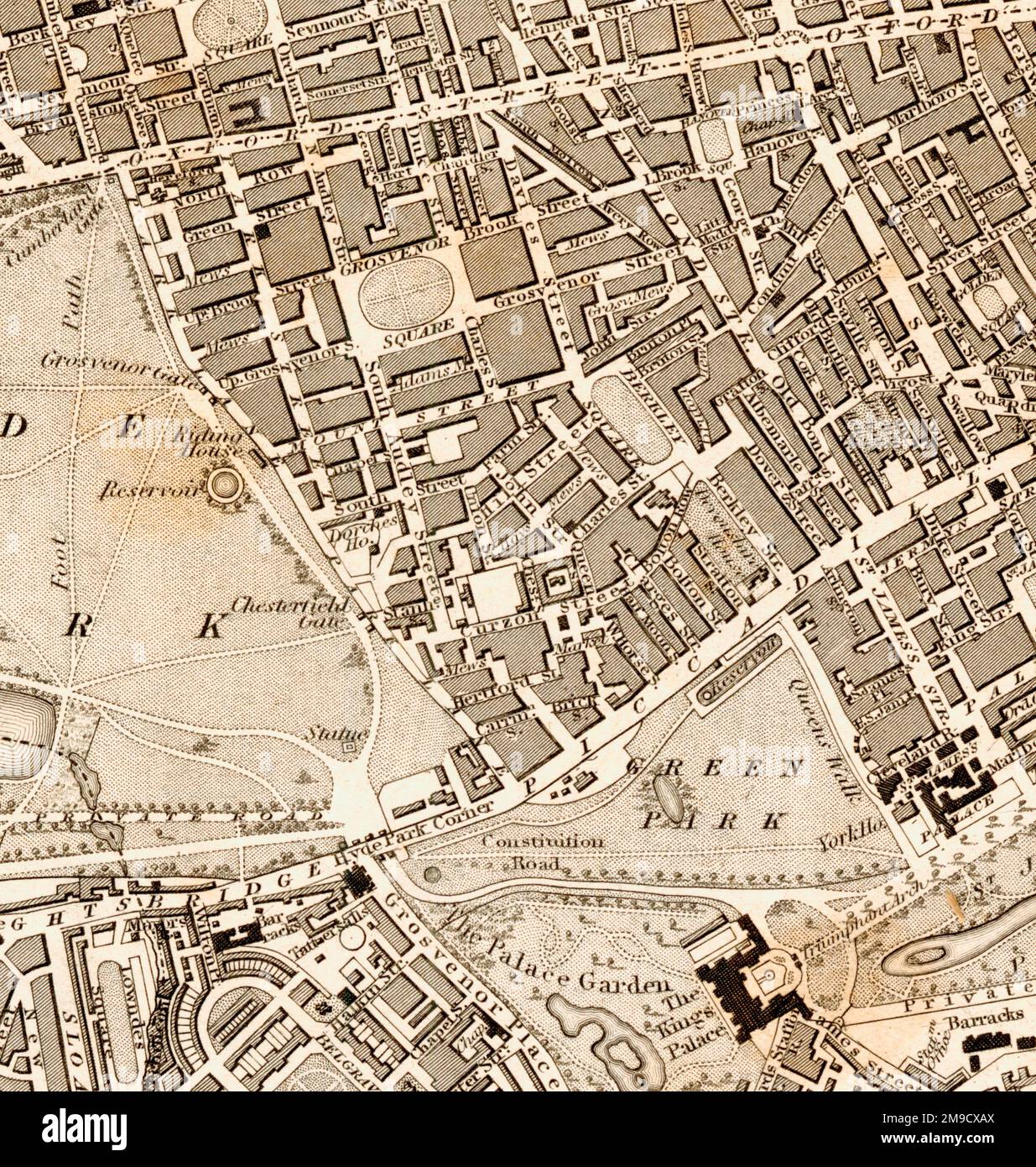 19th century street Map of Mayfair, London (Extract) Stock Photohttps://www.alamy.com/image-license-details/?v=1https://www.alamy.com/19th-century-street-map-of-mayfair-london-extract-image504916690.html
RM2M9CXAX–19th century street Map of Mayfair, London (Extract)
 19th century map showing the journeyings and encampments of the Israelites from Egypt to Canaan, through the desert of Arabia Petraea. Showing also the principal places in Egypt mentioned in the Holy Scriptures. Published for the Society for Promoting Christian Knowledge by Messrs. Rivington's, St.Paul's Church Yard, London, July 1814. Stock Photohttps://www.alamy.com/image-license-details/?v=1https://www.alamy.com/19th-century-map-showing-the-journeyings-and-encampments-of-the-israelites-from-egypt-to-canaan-through-the-desert-of-arabia-petraea-showing-also-the-principal-places-in-egypt-mentioned-in-the-holy-scriptures-published-for-the-society-for-promoting-christian-knowledge-by-messrs-rivingtons-stpauls-church-yard-london-july-1814-image607121279.html
RM2X7MNAR–19th century map showing the journeyings and encampments of the Israelites from Egypt to Canaan, through the desert of Arabia Petraea. Showing also the principal places in Egypt mentioned in the Holy Scriptures. Published for the Society for Promoting Christian Knowledge by Messrs. Rivington's, St.Paul's Church Yard, London, July 1814.
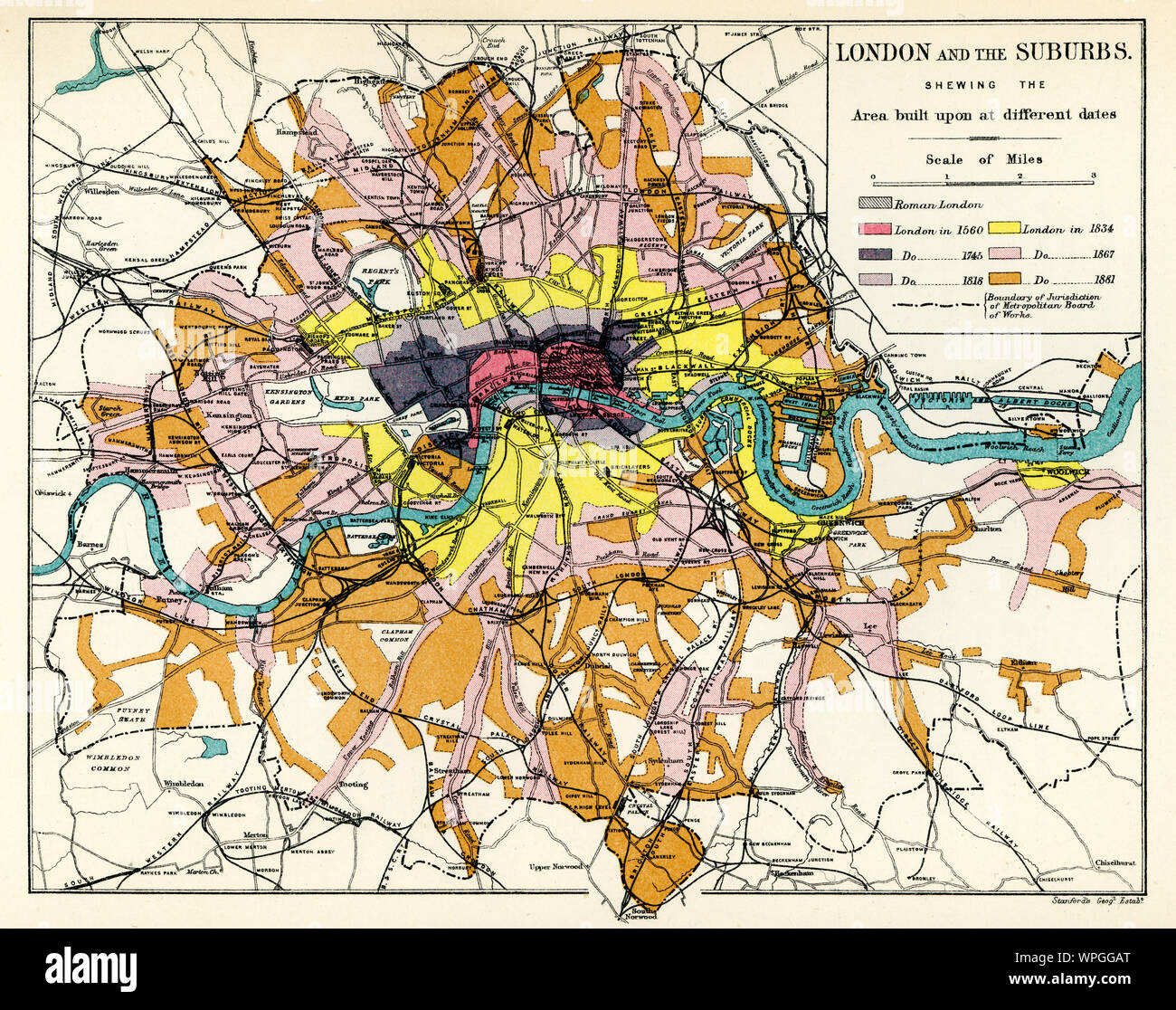 Map of London and the suburbs and when they were built, 19th Century Stock Photohttps://www.alamy.com/image-license-details/?v=1https://www.alamy.com/map-of-london-and-the-suburbs-and-when-they-were-built-19th-century-image272042032.html
RMWPGGAT–Map of London and the suburbs and when they were built, 19th Century
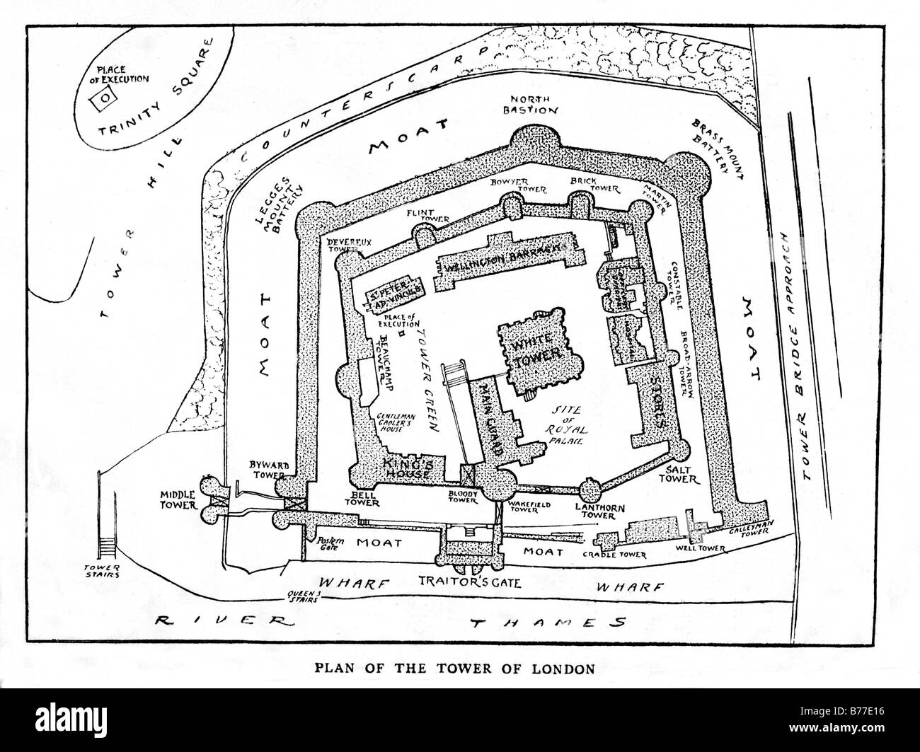 Tower of London 1885 plan of the layout of the London landmark as it was in Victorian times Stock Photohttps://www.alamy.com/image-license-details/?v=1https://www.alamy.com/stock-photo-tower-of-london-1885-plan-of-the-layout-of-the-london-landmark-as-21677634.html
RMB77E16–Tower of London 1885 plan of the layout of the London landmark as it was in Victorian times
 Vintage map of London and surroundings Stock Photohttps://www.alamy.com/image-license-details/?v=1https://www.alamy.com/stock-photo-vintage-map-of-london-and-surroundings-52260239.html
RFD10JD3–Vintage map of London and surroundings
 A 19th century engraving showing two types of maritime anchor in common usage. Martin's anchor (top) and Trotman's anchor - Martin's anchor won an International Exhibition's Prize medal in London in 1862 - The Trotman's anchor (patented 1852 by John Trotman) was considered the most successful anchor because it introduced a pivot at the centre of the crown Stock Photohttps://www.alamy.com/image-license-details/?v=1https://www.alamy.com/a-19th-century-engraving-showing-two-types-of-maritime-anchor-in-common-usage-martins-anchor-top-and-trotmans-anchor-martins-anchor-won-an-international-exhibitions-prize-medal-in-london-in-1862-the-trotmans-anchor-patented-1852-by-john-trotman-was-considered-the-most-successful-anchor-because-it-introduced-a-pivot-at-the-centre-of-the-crown-image465215829.html
RM2J0TBF1–A 19th century engraving showing two types of maritime anchor in common usage. Martin's anchor (top) and Trotman's anchor - Martin's anchor won an International Exhibition's Prize medal in London in 1862 - The Trotman's anchor (patented 1852 by John Trotman) was considered the most successful anchor because it introduced a pivot at the centre of the crown
RM2B0T74M–Ancient map of the west of the Island of Java from the 19th century manuscript 'Plantae Javanicae rariores, descriptae iconibusque illustratae, quas in insula Java, annis 1802-1818' (Java Plants, Description of plants on the island of Java) by Horsfield, Thomas, 1773-1859 Published in Latin in London in 1838
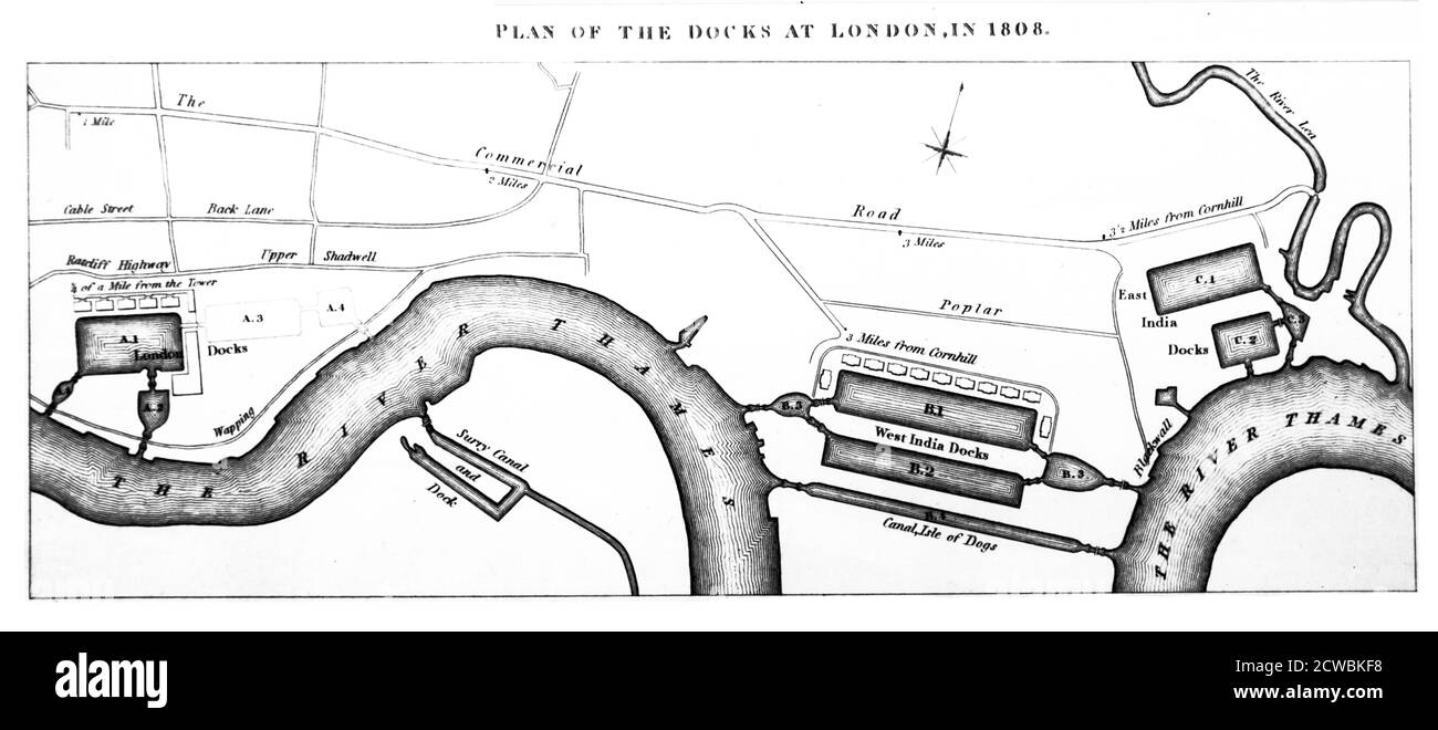 Engraving depicting a plan of the docks at London in 1808. Stock Photohttps://www.alamy.com/image-license-details/?v=1https://www.alamy.com/engraving-depicting-a-plan-of-the-docks-at-london-in-1808-image377040924.html
RM2CWBKF8–Engraving depicting a plan of the docks at London in 1808.
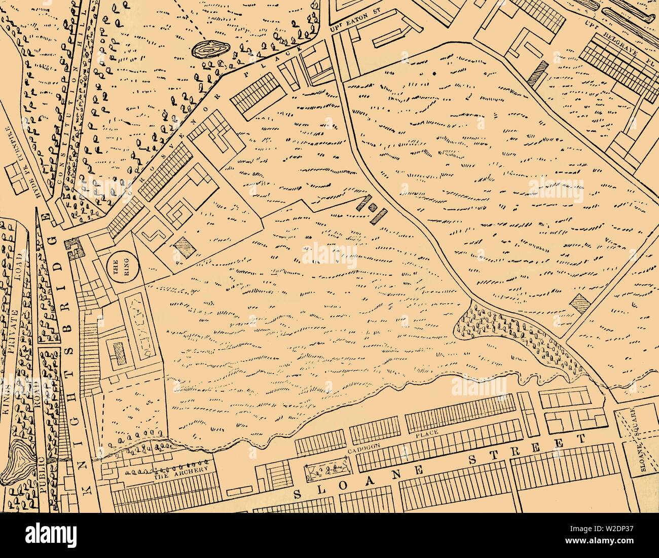 'Map of Belgravia, 1814', (c1876). Creator: Unknown. Stock Photohttps://www.alamy.com/image-license-details/?v=1https://www.alamy.com/map-of-belgravia-1814-c1876-creator-unknown-image259687547.html
RMW2DP37–'Map of Belgravia, 1814', (c1876). Creator: Unknown.
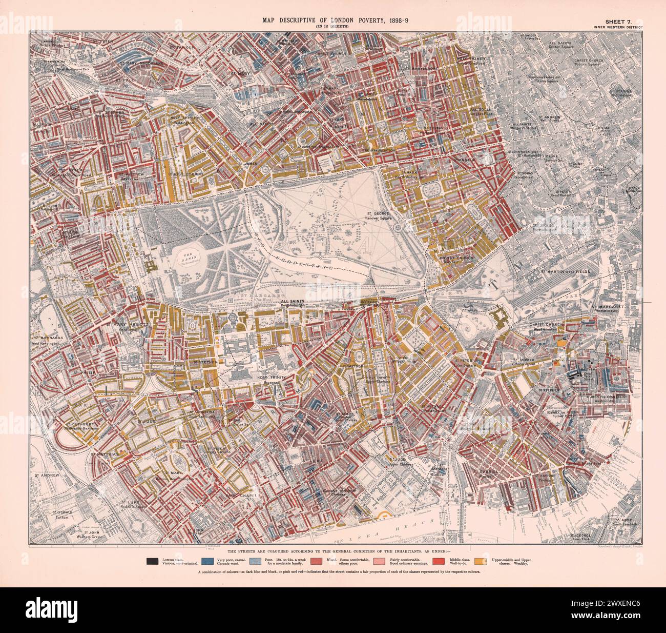 Printed Map Descriptive of London Poverty 1898-1899. Sheet 7. Inner Western District. Covering: Pimlico, Westminster, Brompton, Chelsea, Mayfair, Marylebone, Paddington, Bayswater, Notting Hill, Kensington, Knightsbridge, Pimlico and Belgravia. Stock Photohttps://www.alamy.com/image-license-details/?v=1https://www.alamy.com/printed-map-descriptive-of-london-poverty-1898-1899-sheet-7-inner-western-district-covering-pimlico-westminster-brompton-chelsea-mayfair-marylebone-paddington-bayswater-notting-hill-kensington-knightsbridge-pimlico-and-belgravia-image601457702.html
RM2WXENC6–Printed Map Descriptive of London Poverty 1898-1899. Sheet 7. Inner Western District. Covering: Pimlico, Westminster, Brompton, Chelsea, Mayfair, Marylebone, Paddington, Bayswater, Notting Hill, Kensington, Knightsbridge, Pimlico and Belgravia.
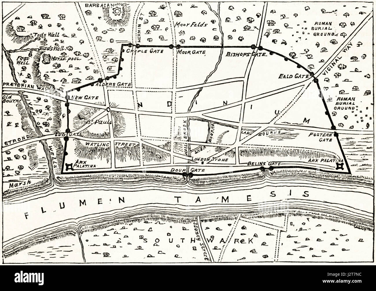 Map of Roman London showing the ancient walls. Victorian engraving circa 1880. Stock Photohttps://www.alamy.com/image-license-details/?v=1https://www.alamy.com/stock-photo-map-of-roman-london-showing-the-ancient-walls-victorian-engraving-139445192.html
RMJ2T7NC–Map of Roman London showing the ancient walls. Victorian engraving circa 1880.
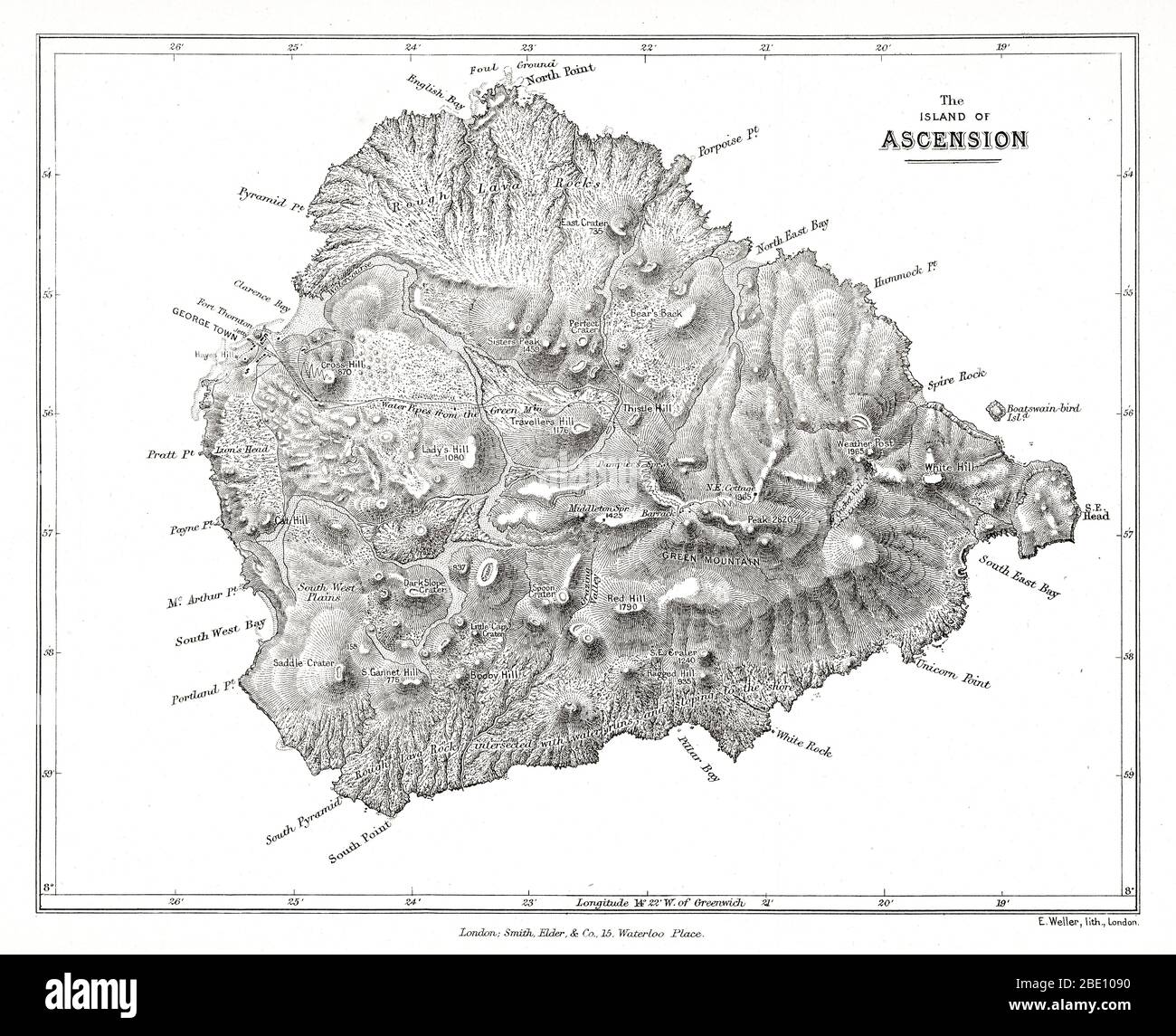 Map of the island of Ascension from Charles Darwin's Geological observations on the volcanic islands and parts of South America visited during the voyage of H.M.S. 'Beagle'. 2d edition. London: Smith Elder and Co., 1876. Ascension Island is an isolated volcanic island in the equatorial waters of the South Atlantic Ocean, around 1,600 kilometres (1,000 mi) from the coast of Africa and 2,250 kilometres (1,400 mi) from the coast of South America, which is roughly midway between the horn of South America and Africa. Stock Photohttps://www.alamy.com/image-license-details/?v=1https://www.alamy.com/map-of-the-island-of-ascension-from-charles-darwins-geological-observations-on-the-volcanic-islands-and-parts-of-south-america-visited-during-the-voyage-of-hms-beagle-2d-edition-london-smith-elder-and-co-1876-ascension-island-is-an-isolated-volcanic-island-in-the-equatorial-waters-of-the-south-atlantic-ocean-around-1600-kilometres-1000-mi-from-the-coast-of-africa-and-2250-kilometres-1400-mi-from-the-coast-of-south-america-which-is-roughly-midway-between-the-horn-of-south-america-and-africa-image352834748.html
RM2BE1090–Map of the island of Ascension from Charles Darwin's Geological observations on the volcanic islands and parts of South America visited during the voyage of H.M.S. 'Beagle'. 2d edition. London: Smith Elder and Co., 1876. Ascension Island is an isolated volcanic island in the equatorial waters of the South Atlantic Ocean, around 1,600 kilometres (1,000 mi) from the coast of Africa and 2,250 kilometres (1,400 mi) from the coast of South America, which is roughly midway between the horn of South America and Africa.
 LONDON South West:Kensington Chelsea Fulham Battersea.Town plan.BACON, 1883 map Stock Photohttps://www.alamy.com/image-license-details/?v=1https://www.alamy.com/stock-photo-london-south-westkensington-chelsea-fulham-batterseatown-planbacon-92899034.html
RFFB3WJJ–LONDON South West:Kensington Chelsea Fulham Battersea.Town plan.BACON, 1883 map
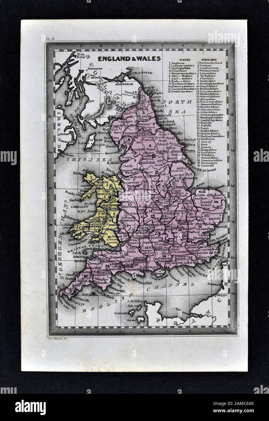 1834 Carey Map England Wales Great Britain United Kingdom UK London Liverpool Manchester Cornwall Oxford Ipswich Stock Photohttps://www.alamy.com/image-license-details/?v=1https://www.alamy.com/1834-carey-map-england-wales-great-britain-united-kingdom-uk-london-liverpool-manchester-cornwall-oxford-ipswich-image339558987.html
RF2AMC6XK–1834 Carey Map England Wales Great Britain United Kingdom UK London Liverpool Manchester Cornwall Oxford Ipswich
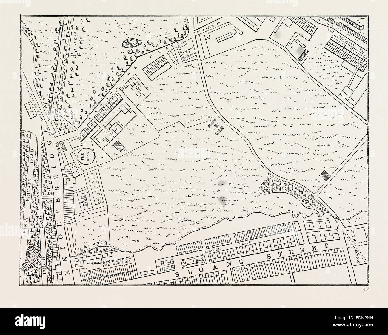 MAP OF BELGRAVIA, 1814. London, UK, 19th century engraving Stock Photohttps://www.alamy.com/image-license-details/?v=1https://www.alamy.com/stock-photo-map-of-belgravia-1814-london-uk-19th-century-engraving-77310845.html
RMEDNPNH–MAP OF BELGRAVIA, 1814. London, UK, 19th century engraving
 early 19th century map of Ireland Copperplate engraving From the Encyclopaedia Londinensis or, Universal dictionary of arts, sciences, and literature; Volume XI; Edited by Wilkes, John. Published in London in 1812 Stock Photohttps://www.alamy.com/image-license-details/?v=1https://www.alamy.com/early-19th-century-map-of-ireland-copperplate-engraving-from-the-encyclopaedia-londinensis-or-universal-dictionary-of-arts-sciences-and-literature-volume-xi-edited-by-wilkes-john-published-in-london-in-1812-image376261199.html
RF2CT44YY–early 19th century map of Ireland Copperplate engraving From the Encyclopaedia Londinensis or, Universal dictionary of arts, sciences, and literature; Volume XI; Edited by Wilkes, John. Published in London in 1812
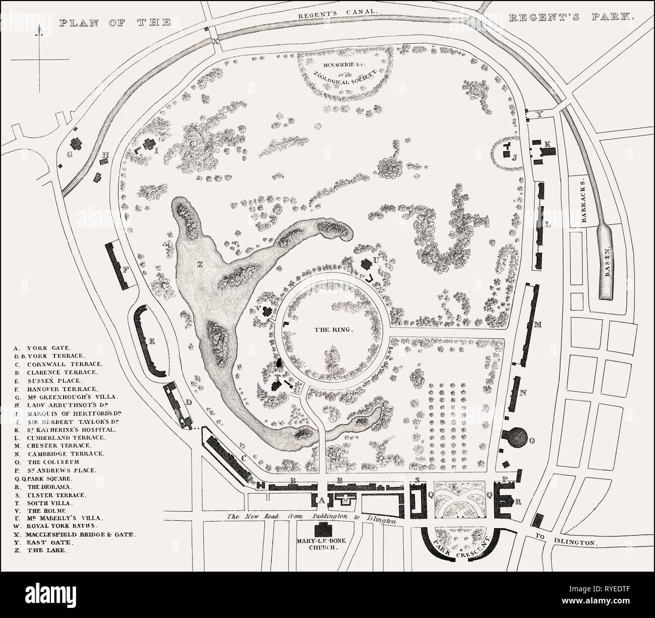 Plan of the Regent's Park, London, UK, illustration by Th. H. Shepherd, 1826 Stock Photohttps://www.alamy.com/image-license-details/?v=1https://www.alamy.com/plan-of-the-regents-park-london-uk-illustration-by-th-h-shepherd-1826-image240648703.html
RMRYEDTF–Plan of the Regent's Park, London, UK, illustration by Th. H. Shepherd, 1826
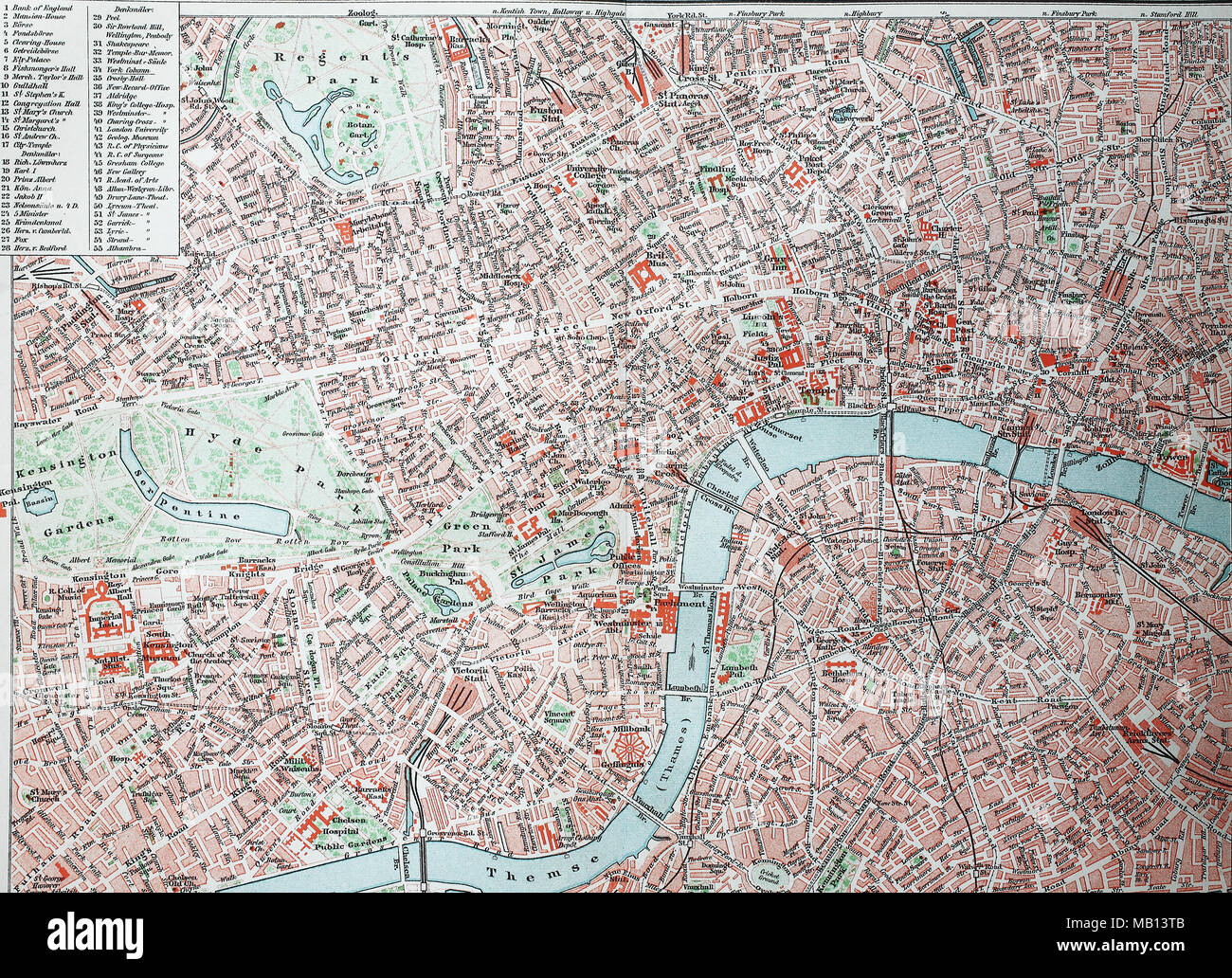 Stadtplan von London, City und Westend, England, 1895, city map of London, digital improved reproduction of an original print from the year 1895 Stock Photohttps://www.alamy.com/image-license-details/?v=1https://www.alamy.com/stadtplan-von-london-city-und-westend-england-1895-city-map-of-london-digital-improved-reproduction-of-an-original-print-from-the-year-1895-image178889883.html
RFMB13TB–Stadtplan von London, City und Westend, England, 1895, city map of London, digital improved reproduction of an original print from the year 1895
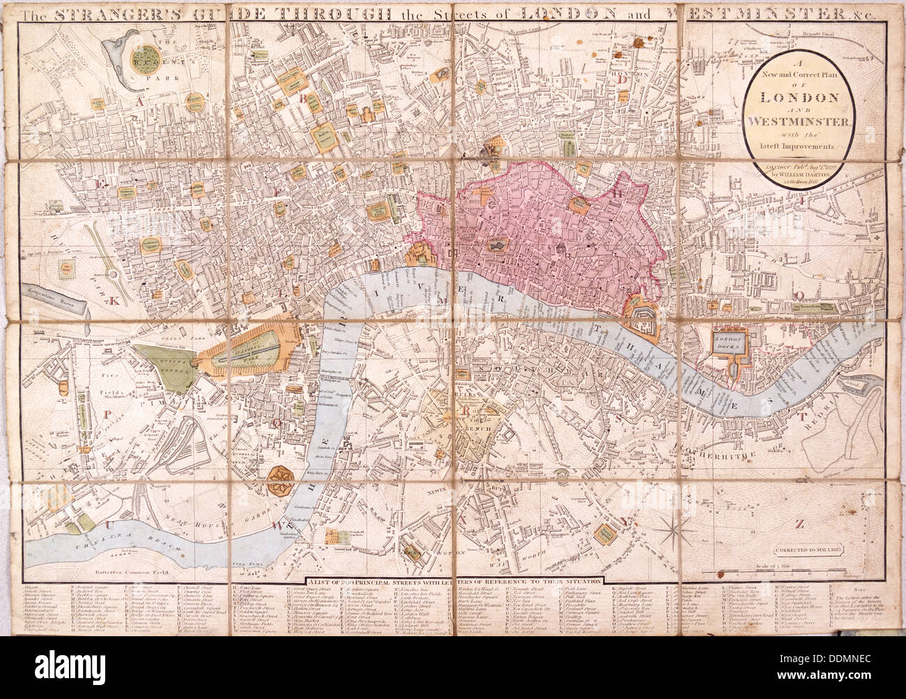 Map of London, 1823. Artist: Anon Stock Photohttps://www.alamy.com/image-license-details/?v=1https://www.alamy.com/map-of-london-1823-artist-anon-image60077540.html
RMDDMNEC–Map of London, 1823. Artist: Anon
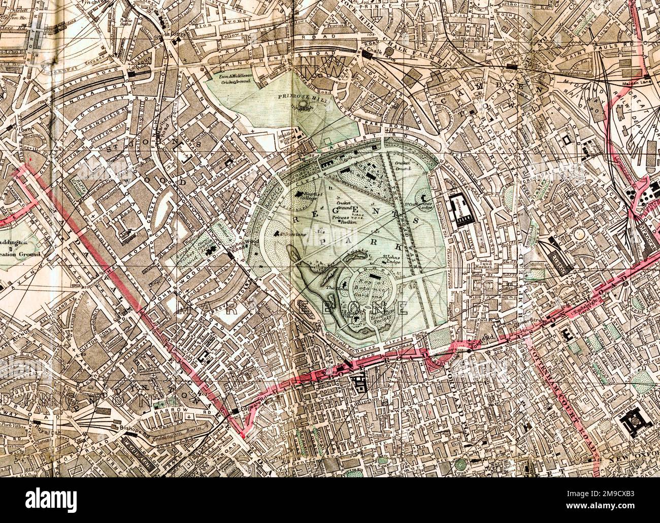 19th century Map of Regents Park, London (Extract) Stock Photohttps://www.alamy.com/image-license-details/?v=1https://www.alamy.com/19th-century-map-of-regents-park-london-extract-image504916695.html
RM2M9CXB3–19th century Map of Regents Park, London (Extract)
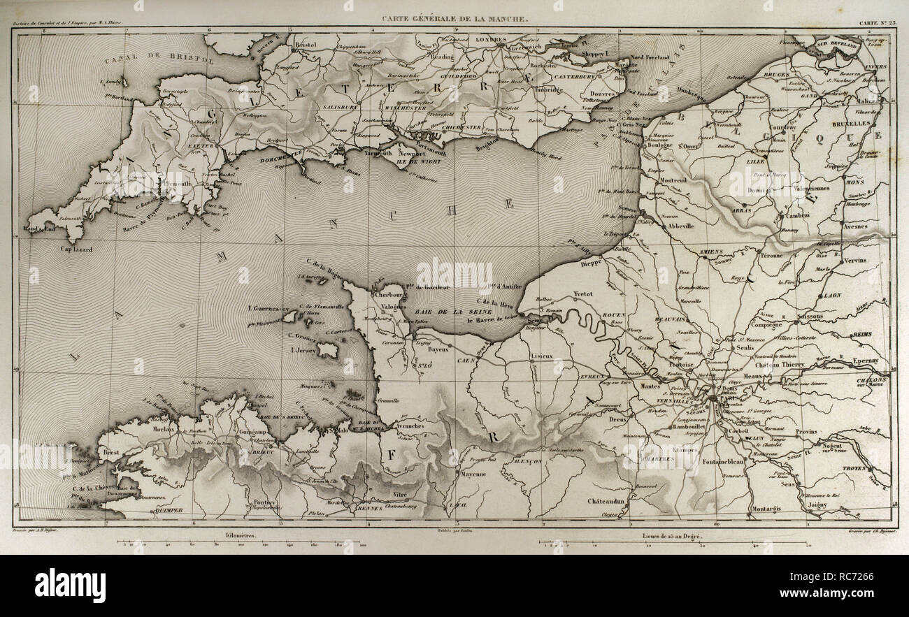 Napoleonic map. English Channel. Atlas de l'Histoire du Consulat et de l'Empire. History of the Consulate and the Empire of France under Napoleon by Marie Joseph Louis Adolphe Thiers (1797-1877). Drawings by Dufour, engravings by Dyonnet. Edited in Paris, 1864. Stock Photohttps://www.alamy.com/image-license-details/?v=1https://www.alamy.com/napoleonic-map-english-channel-atlas-de-lhistoire-du-consulat-et-de-lempire-history-of-the-consulate-and-the-empire-of-france-under-napoleon-by-marie-joseph-louis-adolphe-thiers-1797-1877-drawings-by-dufour-engravings-by-dyonnet-edited-in-paris-1864-image231266062.html
RMRC7266–Napoleonic map. English Channel. Atlas de l'Histoire du Consulat et de l'Empire. History of the Consulate and the Empire of France under Napoleon by Marie Joseph Louis Adolphe Thiers (1797-1877). Drawings by Dufour, engravings by Dyonnet. Edited in Paris, 1864.
 Map of England and Wales Stock Photohttps://www.alamy.com/image-license-details/?v=1https://www.alamy.com/stock-photo-map-of-england-and-wales-35955835.html
RMC2DX0Y–Map of England and Wales
RME7XE4F–Engraved illustrations of the Map of London, England from Iconographic Encyclopedia of Science, Literature and Art, Circa 1851
 Vintage city plan of London and area around it from 19th century. Maps are beautifully hand illustrated and engraved showing city at the time. Stock Photohttps://www.alamy.com/image-license-details/?v=1https://www.alamy.com/vintage-city-plan-of-london-and-area-around-it-from-19th-century-maps-are-beautifully-hand-illustrated-and-engraved-showing-city-at-the-time-image495095384.html
RF2KNDF60–Vintage city plan of London and area around it from 19th century. Maps are beautifully hand illustrated and engraved showing city at the time.
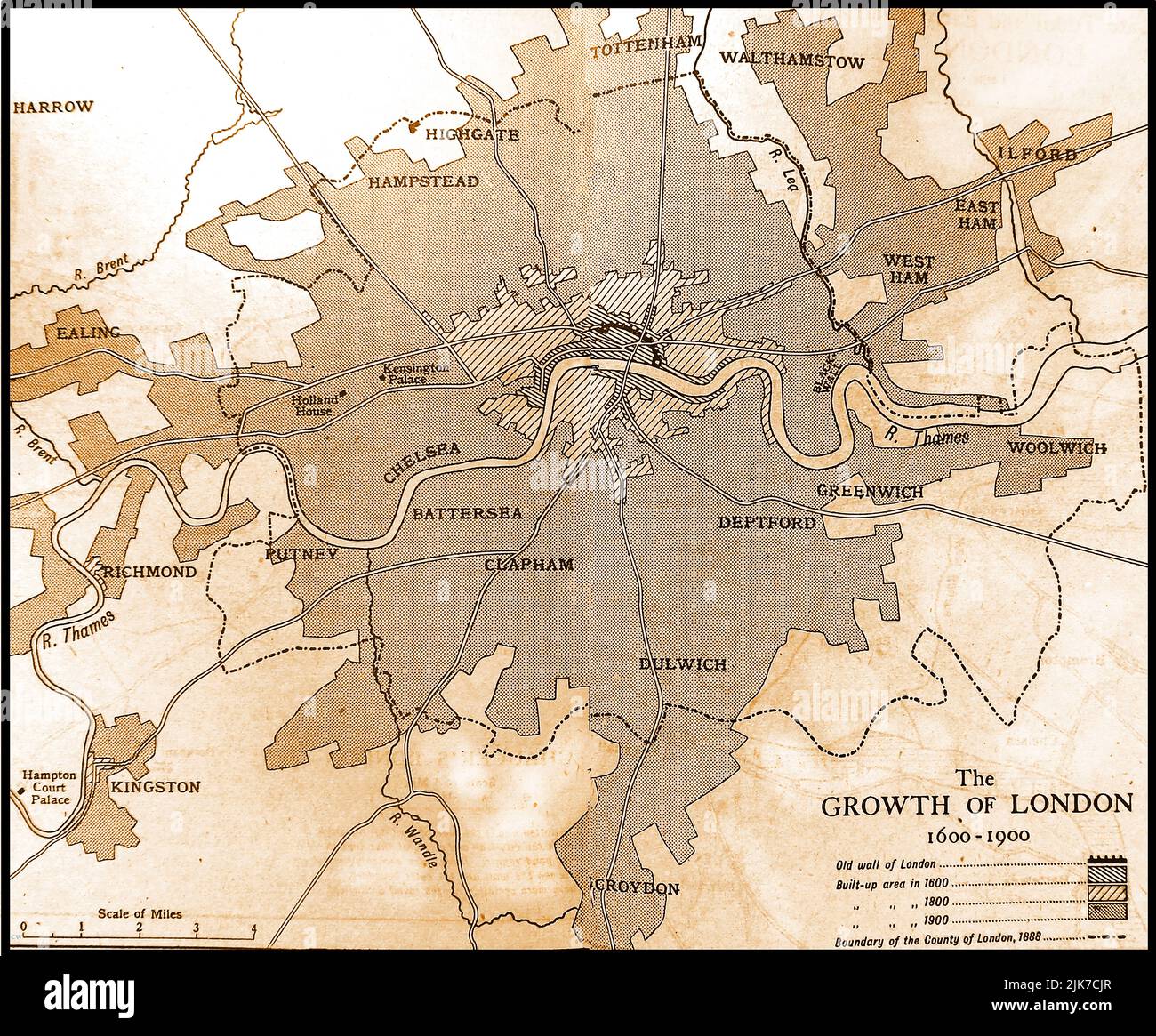 An old map showing the growth of the city of London 1600-1900 Stock Photohttps://www.alamy.com/image-license-details/?v=1https://www.alamy.com/an-old-map-showing-the-growth-of-the-city-of-london-1600-1900-image476521999.html
RM2JK7CJR–An old map showing the growth of the city of London 1600-1900
RM2B0T79G–Ancient map of the east of the Island of Java from the 19th century manuscript 'Plantae Javanicae rariores, descriptae iconibusque illustratae, quas in insula Java, annis 1802-1818' (Java Plants, Description of plants on the island of Java) by Horsfield, Thomas, 1773-1859 Published in Latin in London in 1838
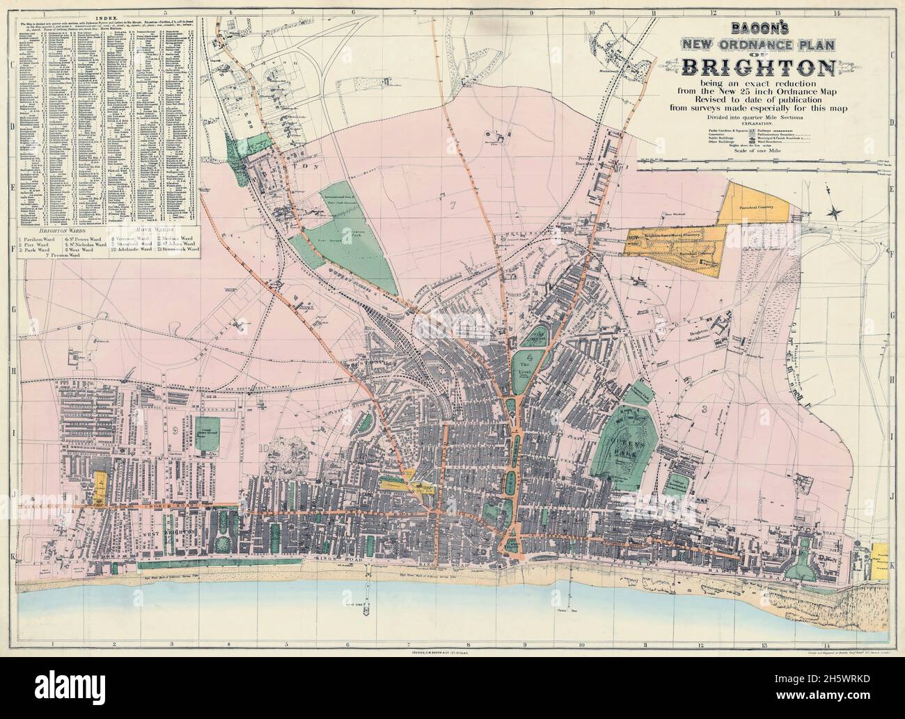 Map of Brighton and adjoining parts of Hove. Historical streetmap, Brighton, England, United Kingdom. BACON'S NEW ORDNANCE PLAN OF BRIGHTON. GW. Bacon (born US 1830, died UK 1922) was a prolific London based book and map publisher active in the mid to late 19th century. Bacon's firm G.W. Bacon and Co. produced a wide variety of maps and guides. Stock Photohttps://www.alamy.com/image-license-details/?v=1https://www.alamy.com/map-of-brighton-and-adjoining-parts-of-hove-historical-streetmap-brighton-england-united-kingdom-bacons-new-ordnance-plan-of-brighton-gw-bacon-born-us-1830-died-uk-1922-was-a-prolific-london-based-book-and-map-publisher-active-in-the-mid-to-late-19th-century-bacons-firm-gw-bacon-and-co-produced-a-wide-variety-of-maps-and-guides-image451110225.html
RM2H5WRKD–Map of Brighton and adjoining parts of Hove. Historical streetmap, Brighton, England, United Kingdom. BACON'S NEW ORDNANCE PLAN OF BRIGHTON. GW. Bacon (born US 1830, died UK 1922) was a prolific London based book and map publisher active in the mid to late 19th century. Bacon's firm G.W. Bacon and Co. produced a wide variety of maps and guides.
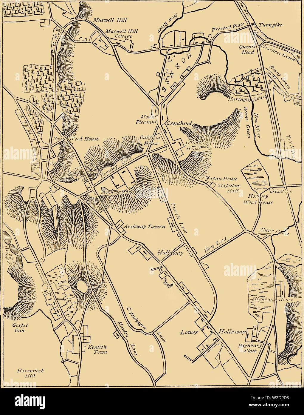 'Map of Hornsey and Neighbourhood in 1819', (c1876). Creator: Unknown. Stock Photohttps://www.alamy.com/image-license-details/?v=1https://www.alamy.com/map-of-hornsey-and-neighbourhood-in-1819-c1876-creator-unknown-image259687823.html
RMW2DPD3–'Map of Hornsey and Neighbourhood in 1819', (c1876). Creator: Unknown.
![Vintage Pictorial map depicting Russia as a bear and Tsar Alexander II. Includes illustrations of a flag and coat of arm. In Lancaster and Harvey's Geographical fun. London : Hodder and Stoughton, [1868 or 1869]. Stock Photo Vintage Pictorial map depicting Russia as a bear and Tsar Alexander II. Includes illustrations of a flag and coat of arm. In Lancaster and Harvey's Geographical fun. London : Hodder and Stoughton, [1868 or 1869]. Stock Photo](https://c8.alamy.com/comp/2WPBM0N/vintage-pictorial-map-depicting-russia-as-a-bear-and-tsar-alexander-ii-includes-illustrations-of-a-flag-and-coat-of-arm-in-lancaster-and-harveys-geographical-fun-london-hodder-and-stoughton-1868-or-1869-2WPBM0N.jpg) Vintage Pictorial map depicting Russia as a bear and Tsar Alexander II. Includes illustrations of a flag and coat of arm. In Lancaster and Harvey's Geographical fun. London : Hodder and Stoughton, [1868 or 1869]. Stock Photohttps://www.alamy.com/image-license-details/?v=1https://www.alamy.com/vintage-pictorial-map-depicting-russia-as-a-bear-and-tsar-alexander-ii-includes-illustrations-of-a-flag-and-coat-of-arm-in-lancaster-and-harveys-geographical-fun-london-hodder-and-stoughton-1868-or-1869-image598932117.html
Vintage Pictorial map depicting Russia as a bear and Tsar Alexander II. Includes illustrations of a flag and coat of arm. In Lancaster and Harvey's Geographical fun. London : Hodder and Stoughton, [1868 or 1869]. Stock Photohttps://www.alamy.com/image-license-details/?v=1https://www.alamy.com/vintage-pictorial-map-depicting-russia-as-a-bear-and-tsar-alexander-ii-includes-illustrations-of-a-flag-and-coat-of-arm-in-lancaster-and-harveys-geographical-fun-london-hodder-and-stoughton-1868-or-1869-image598932117.htmlRM2WPBM0N–Vintage Pictorial map depicting Russia as a bear and Tsar Alexander II. Includes illustrations of a flag and coat of arm. In Lancaster and Harvey's Geographical fun. London : Hodder and Stoughton, [1868 or 1869].
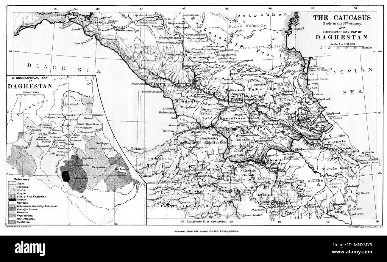 . English: The Caucasus. Early in the 18th (but judging from the map 19th) Century. With Etnographical map of Daghestan. Scale 1: 4 000 000 Türkçe: Kafkasya. 18. (fakat haritaya bakılırsa, gerçekte 19.) yüzyılın başlangıcı. Dağıstan'ın etnografik haritasıyla birlikte. Ölçek 1: 4 000 000 Русский: Кавказ. Начало 18-го (если судить по карте, в действительности 19-го) века. С этнографической картой Дагестана. Масштаб 1: 4 000 000 . 1908. English: The London Geographical Institute Türkçe: Londra Coğrafya Enstitüsü Русский: Лондонский Географический Институт 1170 The Caucasus. Early in the 18th Cent Stock Photohttps://www.alamy.com/image-license-details/?v=1https://www.alamy.com/english-the-caucasus-early-in-the-18th-but-judging-from-the-map-19th-century-with-etnographical-map-of-daghestan-scale-1-4-000-000-trke-kafkasya-18-fakat-haritaya-baklrsa-gerekte-19-yzyln-balangc-dastann-etnografik-haritasyla-birlikte-lek-1-4-000-000-18-19-1-4-000-000-1908-english-the-london-geographical-institute-trke-londra-corafya-enstits-1170-the-caucasus-early-in-the-18th-cent-image185598649.html
RMMNXMY5–. English: The Caucasus. Early in the 18th (but judging from the map 19th) Century. With Etnographical map of Daghestan. Scale 1: 4 000 000 Türkçe: Kafkasya. 18. (fakat haritaya bakılırsa, gerçekte 19.) yüzyılın başlangıcı. Dağıstan'ın etnografik haritasıyla birlikte. Ölçek 1: 4 000 000 Русский: Кавказ. Начало 18-го (если судить по карте, в действительности 19-го) века. С этнографической картой Дагестана. Масштаб 1: 4 000 000 . 1908. English: The London Geographical Institute Türkçe: Londra Coğrafya Enstitüsü Русский: Лондонский Географический Институт 1170 The Caucasus. Early in the 18th Cent
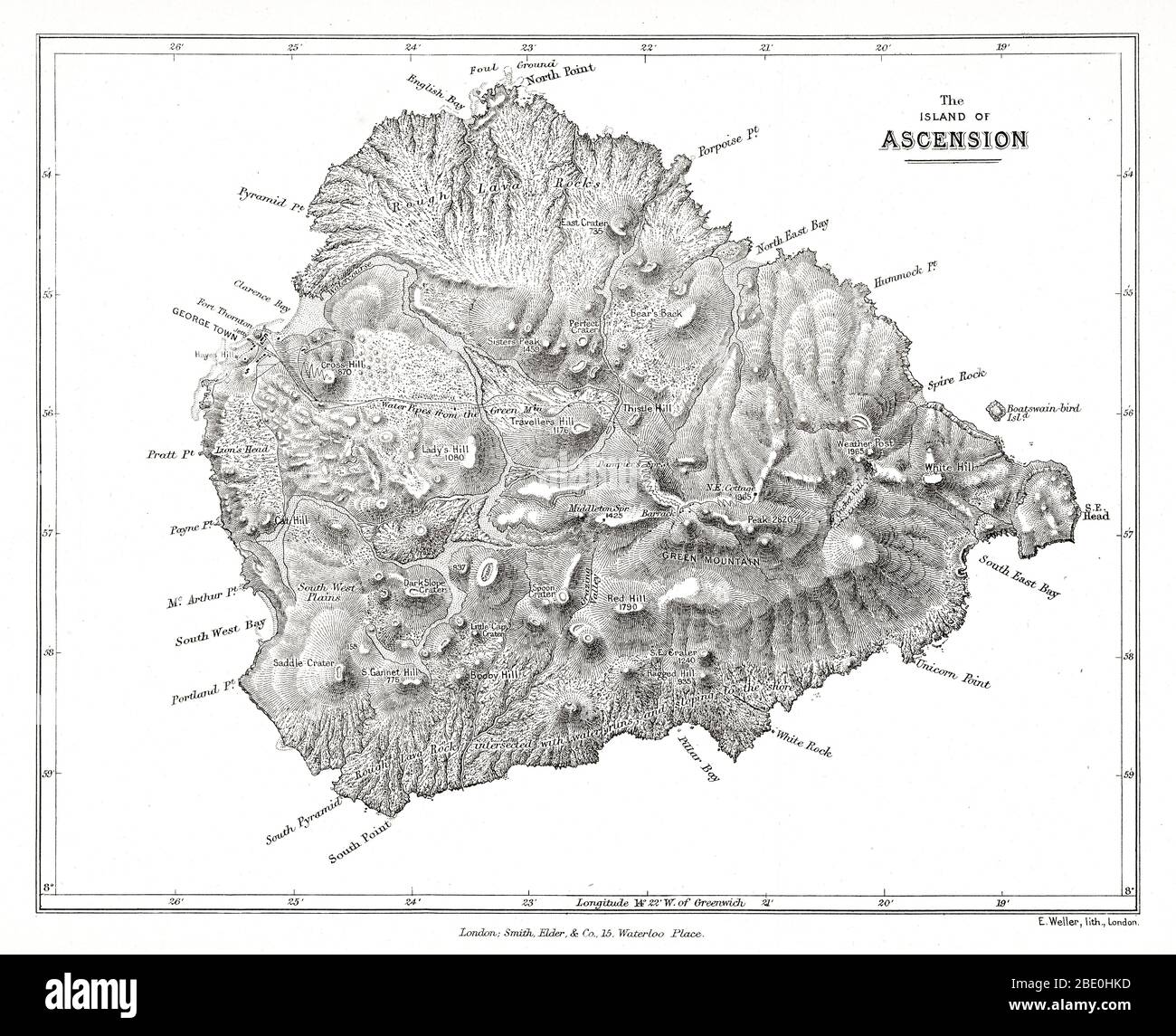 Map of the island of Ascension from Charles Darwin's Geological observations on the volcanic islands and parts of South America visited during the voyage of H.M.S. 'Beagle'. 2d edition. London: Smith Elder and Co., 1876. Ascension Island is an isolated volcanic island in the equatorial waters of the South Atlantic Ocean, around 1,600 kilometres (1,000 mi) from the coast of Africa and 2,250 kilometres (1,400 mi) from the coast of South America, which is roughly midway between the horn of South America and Africa. Stock Photohttps://www.alamy.com/image-license-details/?v=1https://www.alamy.com/map-of-the-island-of-ascension-from-charles-darwins-geological-observations-on-the-volcanic-islands-and-parts-of-south-america-visited-during-the-voyage-of-hms-beagle-2d-edition-london-smith-elder-and-co-1876-ascension-island-is-an-isolated-volcanic-island-in-the-equatorial-waters-of-the-south-atlantic-ocean-around-1600-kilometres-1000-mi-from-the-coast-of-africa-and-2250-kilometres-1400-mi-from-the-coast-of-south-america-which-is-roughly-midway-between-the-horn-of-south-america-and-africa-image352826417.html
RM2BE0HKD–Map of the island of Ascension from Charles Darwin's Geological observations on the volcanic islands and parts of South America visited during the voyage of H.M.S. 'Beagle'. 2d edition. London: Smith Elder and Co., 1876. Ascension Island is an isolated volcanic island in the equatorial waters of the South Atlantic Ocean, around 1,600 kilometres (1,000 mi) from the coast of Africa and 2,250 kilometres (1,400 mi) from the coast of South America, which is roughly midway between the horn of South America and Africa.
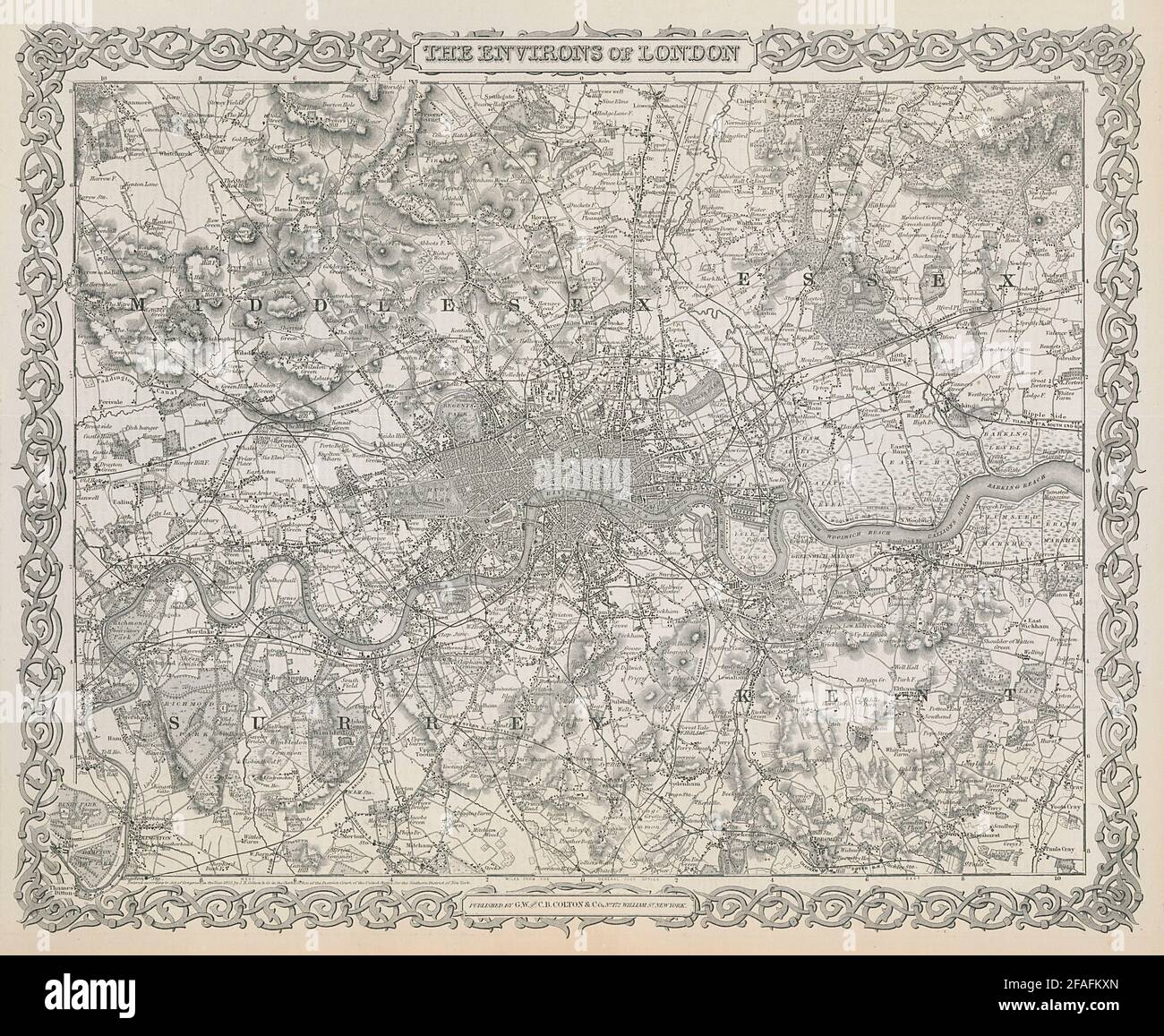 The environs of London. Decorative antique map. COLTON 1869 old Stock Photohttps://www.alamy.com/image-license-details/?v=1https://www.alamy.com/the-environs-of-london-decorative-antique-map-colton-1869-old-image419540317.html
RF2FAFKXN–The environs of London. Decorative antique map. COLTON 1869 old
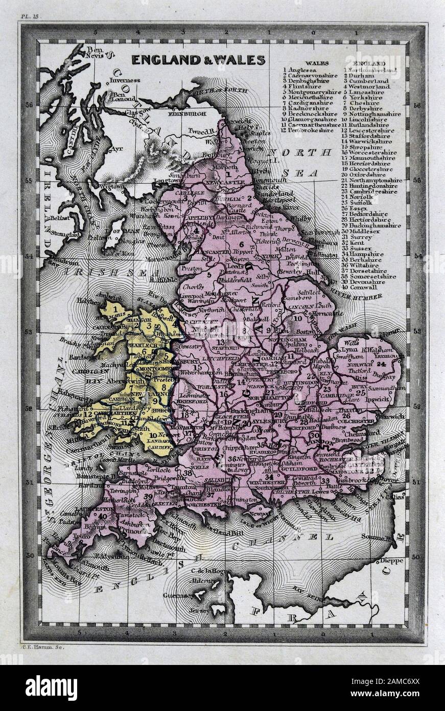 1834 Carey Map England Wales Great Britain United Kingdom UK London Liverpool Manchester Cornwall Oxford Ipswich Stock Photohttps://www.alamy.com/image-license-details/?v=1https://www.alamy.com/1834-carey-map-england-wales-great-britain-united-kingdom-uk-london-liverpool-manchester-cornwall-oxford-ipswich-image339558994.html
RF2AMC6XX–1834 Carey Map England Wales Great Britain United Kingdom UK London Liverpool Manchester Cornwall Oxford Ipswich
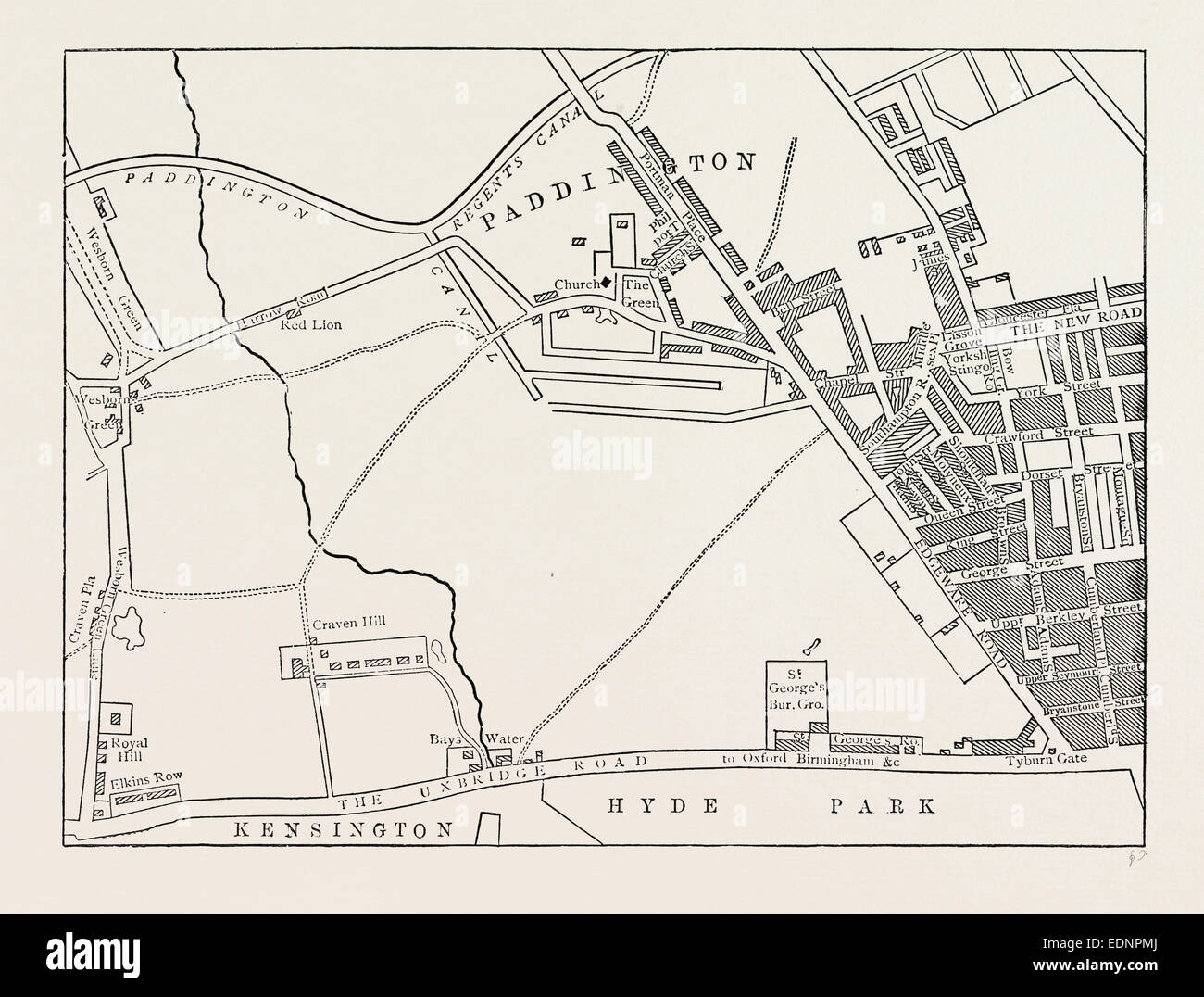 MAP OF PADDINGTON, IN 1815. London, UK, 19th century engraving Stock Photohttps://www.alamy.com/image-license-details/?v=1https://www.alamy.com/stock-photo-map-of-paddington-in-1815-london-uk-19th-century-engraving-77310818.html
RMEDNPMJ–MAP OF PADDINGTON, IN 1815. London, UK, 19th century engraving
![Early 19th century map of Kent [England] Copperplate engraving From the Encyclopaedia Londinensis or, Universal dictionary of arts, sciences, and literature; Volume XI; Edited by Wilkes, John. Published in London in 1812 Stock Photo Early 19th century map of Kent [England] Copperplate engraving From the Encyclopaedia Londinensis or, Universal dictionary of arts, sciences, and literature; Volume XI; Edited by Wilkes, John. Published in London in 1812 Stock Photo](https://c8.alamy.com/comp/2CT45CJ/early-19th-century-map-of-kent-england-copperplate-engraving-from-the-encyclopaedia-londinensis-or-universal-dictionary-of-arts-sciences-and-literature-volume-xi-edited-by-wilkes-john-published-in-london-in-1812-2CT45CJ.jpg) Early 19th century map of Kent [England] Copperplate engraving From the Encyclopaedia Londinensis or, Universal dictionary of arts, sciences, and literature; Volume XI; Edited by Wilkes, John. Published in London in 1812 Stock Photohttps://www.alamy.com/image-license-details/?v=1https://www.alamy.com/early-19th-century-map-of-kent-england-copperplate-engraving-from-the-encyclopaedia-londinensis-or-universal-dictionary-of-arts-sciences-and-literature-volume-xi-edited-by-wilkes-john-published-in-london-in-1812-image376261554.html
Early 19th century map of Kent [England] Copperplate engraving From the Encyclopaedia Londinensis or, Universal dictionary of arts, sciences, and literature; Volume XI; Edited by Wilkes, John. Published in London in 1812 Stock Photohttps://www.alamy.com/image-license-details/?v=1https://www.alamy.com/early-19th-century-map-of-kent-england-copperplate-engraving-from-the-encyclopaedia-londinensis-or-universal-dictionary-of-arts-sciences-and-literature-volume-xi-edited-by-wilkes-john-published-in-london-in-1812-image376261554.htmlRF2CT45CJ–Early 19th century map of Kent [England] Copperplate engraving From the Encyclopaedia Londinensis or, Universal dictionary of arts, sciences, and literature; Volume XI; Edited by Wilkes, John. Published in London in 1812
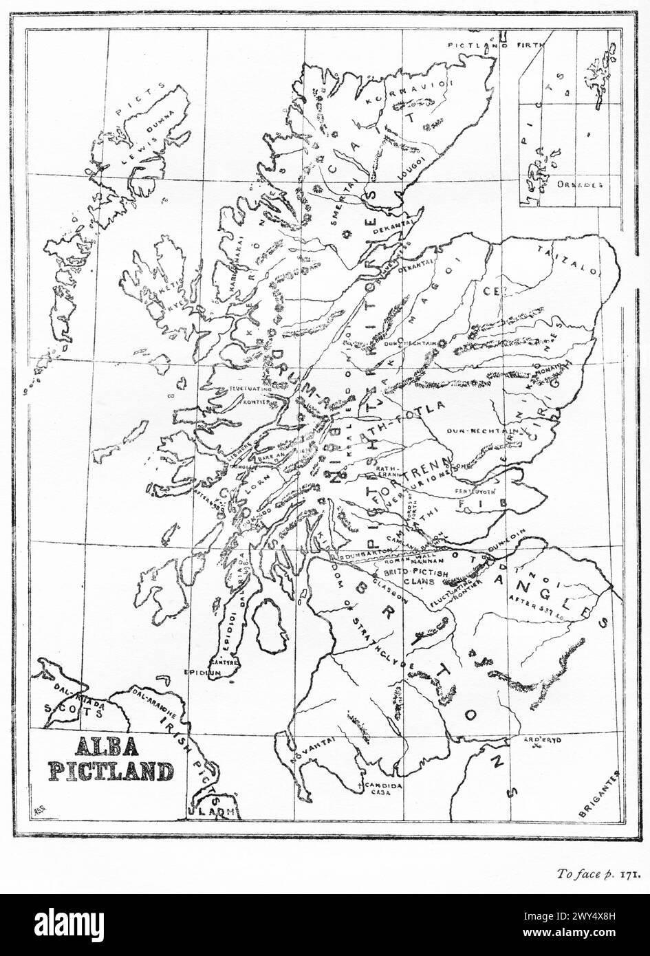 Map of Pictland or Scotland in the 6th Century, from The Pictish Nation by Archibald Scott, 1918 Stock Photohttps://www.alamy.com/image-license-details/?v=1https://www.alamy.com/map-of-pictland-or-scotland-in-the-6th-century-from-the-pictish-nation-by-archibald-scott-1918-image601856657.html
RM2WY4X8H–Map of Pictland or Scotland in the 6th Century, from The Pictish Nation by Archibald Scott, 1918
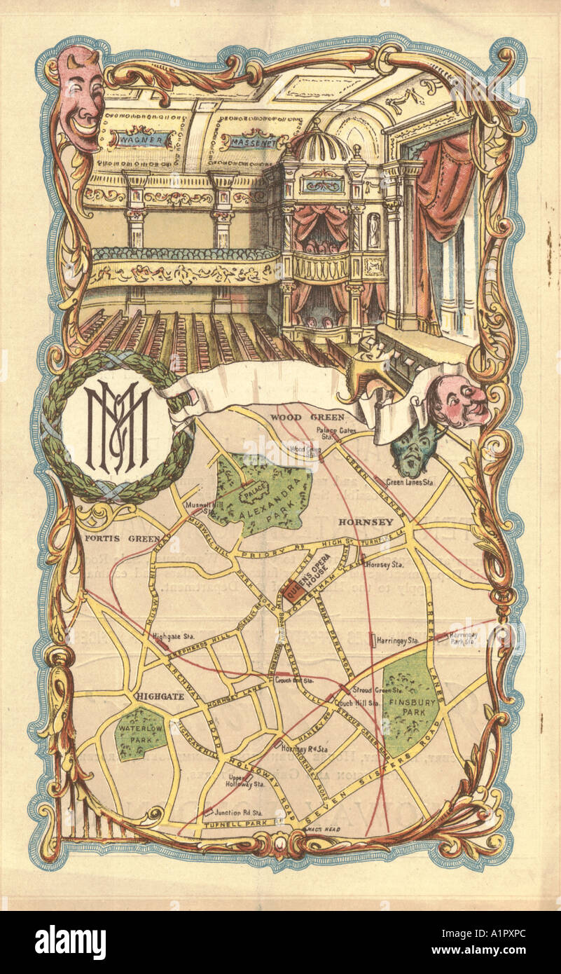 Queen's Opera House, London, programme cover showing interior and map circa 1885 Stock Photohttps://www.alamy.com/image-license-details/?v=1https://www.alamy.com/queens-opera-house-london-programme-cover-showing-interior-and-map-image5893611.html
RMA1PXPC–Queen's Opera House, London, programme cover showing interior and map circa 1885
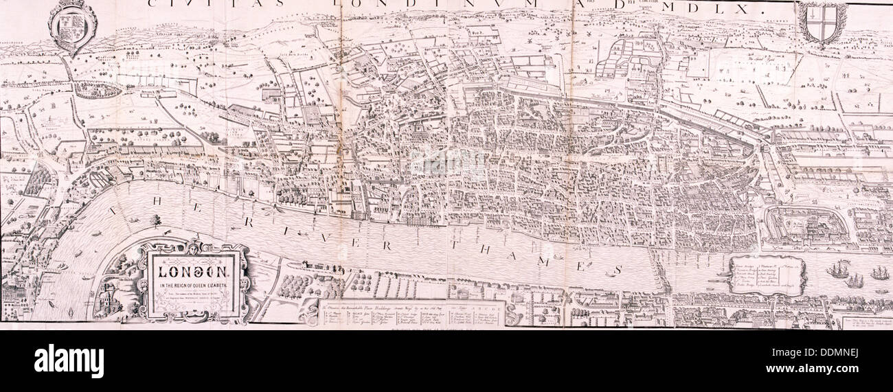 Map of London, c1560. Artist: Anon Stock Photohttps://www.alamy.com/image-license-details/?v=1https://www.alamy.com/map-of-london-c1560-artist-anon-image60077546.html
RMDDMNEJ–Map of London, c1560. Artist: Anon
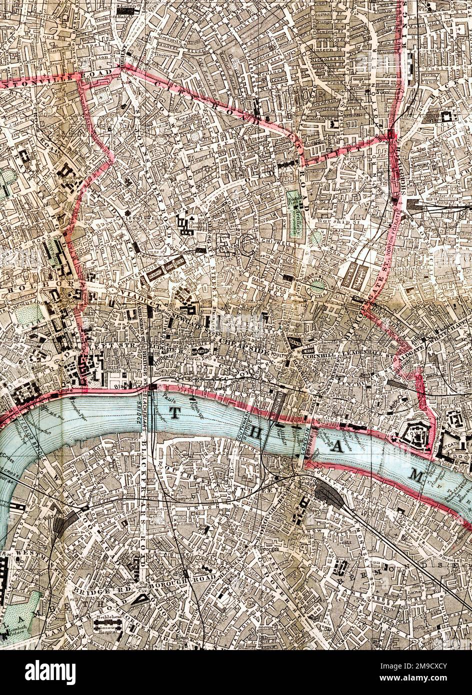 19th century Map of the City of London, Tower of London (Extract) Stock Photohttps://www.alamy.com/image-license-details/?v=1https://www.alamy.com/19th-century-map-of-the-city-of-london-tower-of-london-extract-image504916747.html
RM2M9CXCY–19th century Map of the City of London, Tower of London (Extract)
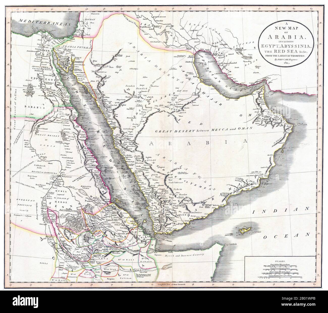 Middle East/East Africa: A New Map of Arabia, Egypt, Abyssinia and the Red Sea. Engraving by John Cary (c. 1754-1835), 1811. John Cary was an English cartographer. Cary served his apprenticeship as an engraver in London, before setting up his own business in the Strand in 1783. He soon gained a reputation for his maps and globes, his atlas, The New and Correct English Atlas published in 1787, becoming a standard reference work in England. In 1794 Cary was commissioned by the Postmaster General to survey England's roads. This resulted in Cary's New Itinerary (1798). Stock Photohttps://www.alamy.com/image-license-details/?v=1https://www.alamy.com/middle-easteast-africa-a-new-map-of-arabia-egypt-abyssinia-and-the-red-sea-engraving-by-john-cary-c-1754-1835-1811-john-cary-was-an-english-cartographer-cary-served-his-apprenticeship-as-an-engraver-in-london-before-setting-up-his-own-business-in-the-strand-in-1783-he-soon-gained-a-reputation-for-his-maps-and-globes-his-atlas-the-new-and-correct-english-atlas-published-in-1787-becoming-a-standard-reference-work-in-england-in-1794-cary-was-commissioned-by-the-postmaster-general-to-survey-englands-roads-this-resulted-in-carys-new-itinerary-1798-image344249539.html
RM2B01WPB–Middle East/East Africa: A New Map of Arabia, Egypt, Abyssinia and the Red Sea. Engraving by John Cary (c. 1754-1835), 1811. John Cary was an English cartographer. Cary served his apprenticeship as an engraver in London, before setting up his own business in the Strand in 1783. He soon gained a reputation for his maps and globes, his atlas, The New and Correct English Atlas published in 1787, becoming a standard reference work in England. In 1794 Cary was commissioned by the Postmaster General to survey England's roads. This resulted in Cary's New Itinerary (1798).
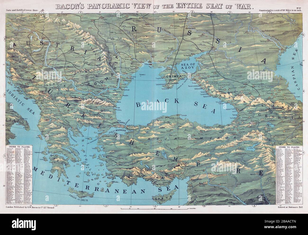 Map by an unknown cartographer published by G.W. Bacon, London, showing the theatre of the Crimean War, 1853 - 1856. Stock Photohttps://www.alamy.com/image-license-details/?v=1https://www.alamy.com/map-by-an-unknown-cartographer-published-by-gw-bacon-london-showing-the-theatre-of-the-crimean-war-1853-1856-image350583541.html
RM2BAACTN–Map by an unknown cartographer published by G.W. Bacon, London, showing the theatre of the Crimean War, 1853 - 1856.
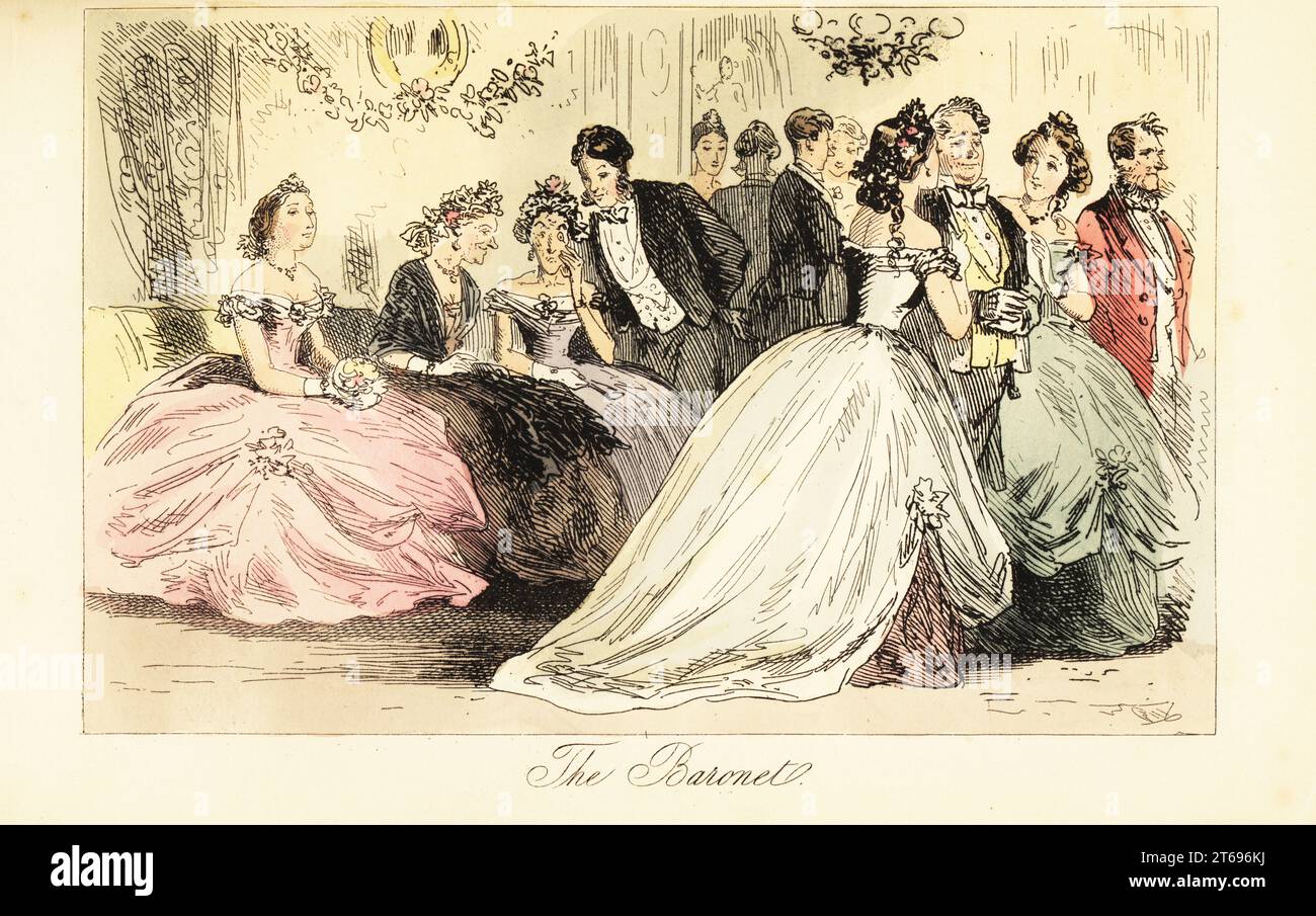 Arrival of aristocracy at a dance ball in a grand house, 19th century. Sir Roger Ferguson is accompanied by Lady de Tabby and Mrs Freezer in crinolines. A gentlemen whispers to two old ladies on a couch. The Baronet. Handcoloured steel engraving after an illustration by Hablot Knight Browne (Phiz) from Robert Smith Surtees Mr. Facey Romfords Hounds, Bradbury, Evans and Co., London, 1865. Stock Photohttps://www.alamy.com/image-license-details/?v=1https://www.alamy.com/arrival-of-aristocracy-at-a-dance-ball-in-a-grand-house-19th-century-sir-roger-ferguson-is-accompanied-by-lady-de-tabby-and-mrs-freezer-in-crinolines-a-gentlemen-whispers-to-two-old-ladies-on-a-couch-the-baronet-handcoloured-steel-engraving-after-an-illustration-by-hablot-knight-browne-phiz-from-robert-smith-surtees-mr-facey-romfords-hounds-bradbury-evans-and-co-london-1865-image571832902.html
RM2T696KJ–Arrival of aristocracy at a dance ball in a grand house, 19th century. Sir Roger Ferguson is accompanied by Lady de Tabby and Mrs Freezer in crinolines. A gentlemen whispers to two old ladies on a couch. The Baronet. Handcoloured steel engraving after an illustration by Hablot Knight Browne (Phiz) from Robert Smith Surtees Mr. Facey Romfords Hounds, Bradbury, Evans and Co., London, 1865.
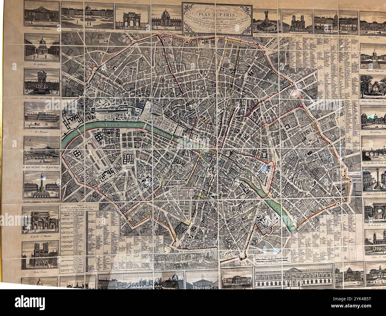 London, England, Detail, Old Paris Map on Display, (19th century art) shopping inside, Old SHop, 'Liberty', English Traditional Department Store Stock Photohttps://www.alamy.com/image-license-details/?v=1https://www.alamy.com/london-england-detail-old-paris-map-on-display-19th-century-art-shopping-inside-old-shop-liberty-english-traditional-department-store-image631348308.html
RM2YK4B5T–London, England, Detail, Old Paris Map on Display, (19th century art) shopping inside, Old SHop, 'Liberty', English Traditional Department Store
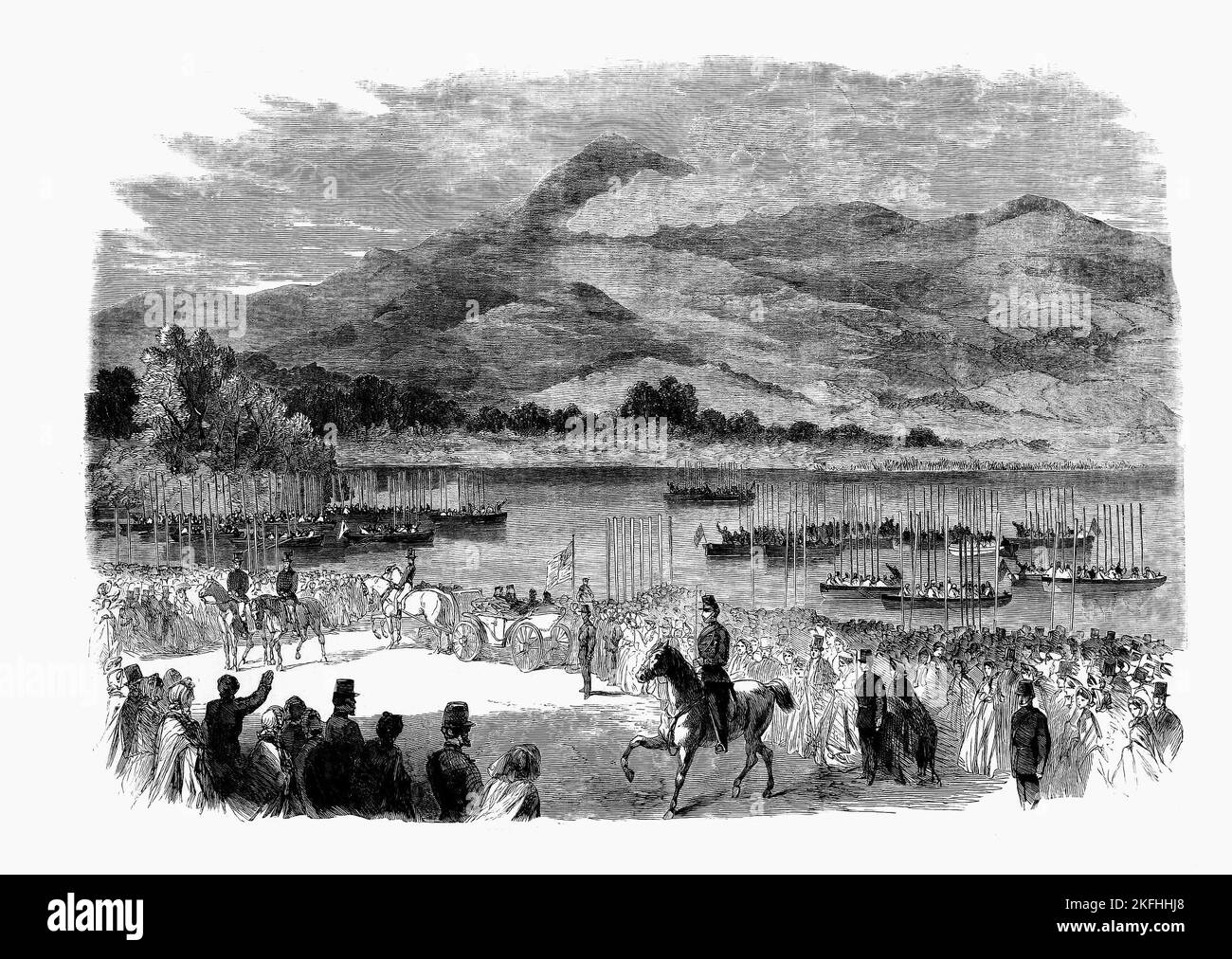 Queen Victoria at Ross Castle on the shores of Lough Leane in the (now) Killarney National Park, County Kerry, Ireland. The visit in 1861 was her first visit to the location and helped to put Killarney on the map as a tourist destination. Stock Photohttps://www.alamy.com/image-license-details/?v=1https://www.alamy.com/queen-victoria-at-ross-castle-on-the-shores-of-lough-leane-in-the-now-killarney-national-park-county-kerry-ireland-the-visit-in-1861-was-her-first-visit-to-the-location-and-helped-to-put-killarney-on-the-map-as-a-tourist-destination-image491497168.html
RM2KFHHJ8–Queen Victoria at Ross Castle on the shores of Lough Leane in the (now) Killarney National Park, County Kerry, Ireland. The visit in 1861 was her first visit to the location and helped to put Killarney on the map as a tourist destination.
 Ancient 19th century map of 'Modern' Palestine from the book Palestine illustrated by Sir Richard Temple, 1st Baronet, GCSI, CIE, PC, FRS (8 March 1826 – 15 March 1902) was an administrator in British India and a British politician. Published in London by W.H. Allen & Co. in 1888 Stock Photohttps://www.alamy.com/image-license-details/?v=1https://www.alamy.com/ancient-19th-century-map-of-modern-palestine-from-the-book-palestine-illustrated-by-sir-richard-temple-1st-baronet-gcsi-cie-pc-frs-8-march-1826-15-march-1902-was-an-administrator-in-british-india-and-a-british-politician-published-in-london-by-wh-allen-co-in-1888-image376644363.html
RM2CTNHMB–Ancient 19th century map of 'Modern' Palestine from the book Palestine illustrated by Sir Richard Temple, 1st Baronet, GCSI, CIE, PC, FRS (8 March 1826 – 15 March 1902) was an administrator in British India and a British politician. Published in London by W.H. Allen & Co. in 1888
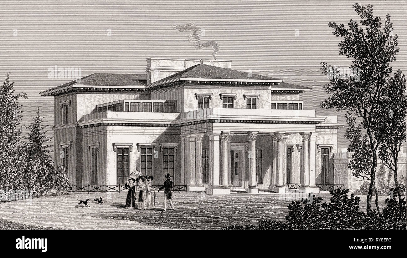 Villa in the Regent's Park, London, UK, illustration by Th. H. Shepherd, 1826 Stock Photohttps://www.alamy.com/image-license-details/?v=1https://www.alamy.com/villa-in-the-regents-park-london-uk-illustration-by-th-h-shepherd-1826-image240649236.html
RMRYEEFG–Villa in the Regent's Park, London, UK, illustration by Th. H. Shepherd, 1826
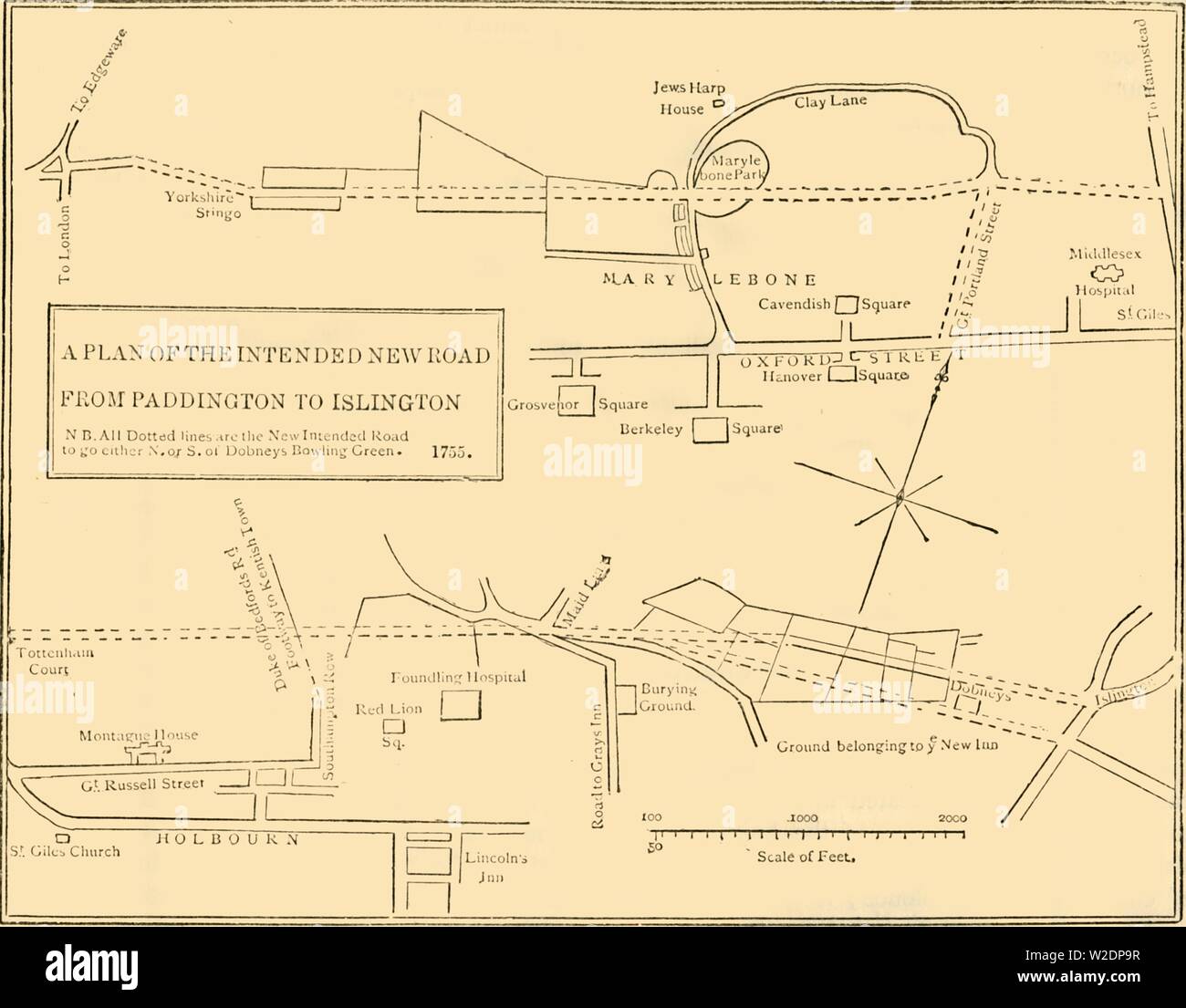 'Ground Plan of New Road from Islington to Edgware Road, 1755', (c1876). Creator: Unknown. Stock Photohttps://www.alamy.com/image-license-details/?v=1https://www.alamy.com/ground-plan-of-new-road-from-islington-to-edgware-road-1755-c1876-creator-unknown-image259687731.html
RMW2DP9R–'Ground Plan of New Road from Islington to Edgware Road, 1755', (c1876). Creator: Unknown.
![Vintage Pictorial map depicting Italy as a bear and Tsar Alexander II. Includes illustrations of a flag and coat of arm. In Lancaster and Harvey's Geographical fun. London : Hodder and Stoughton, [1868 or 1869]. Stock Photo Vintage Pictorial map depicting Italy as a bear and Tsar Alexander II. Includes illustrations of a flag and coat of arm. In Lancaster and Harvey's Geographical fun. London : Hodder and Stoughton, [1868 or 1869]. Stock Photo](https://c8.alamy.com/comp/2WPBM2K/vintage-pictorial-map-depicting-italy-as-a-bear-and-tsar-alexander-ii-includes-illustrations-of-a-flag-and-coat-of-arm-in-lancaster-and-harveys-geographical-fun-london-hodder-and-stoughton-1868-or-1869-2WPBM2K.jpg) Vintage Pictorial map depicting Italy as a bear and Tsar Alexander II. Includes illustrations of a flag and coat of arm. In Lancaster and Harvey's Geographical fun. London : Hodder and Stoughton, [1868 or 1869]. Stock Photohttps://www.alamy.com/image-license-details/?v=1https://www.alamy.com/vintage-pictorial-map-depicting-italy-as-a-bear-and-tsar-alexander-ii-includes-illustrations-of-a-flag-and-coat-of-arm-in-lancaster-and-harveys-geographical-fun-london-hodder-and-stoughton-1868-or-1869-image598932171.html
Vintage Pictorial map depicting Italy as a bear and Tsar Alexander II. Includes illustrations of a flag and coat of arm. In Lancaster and Harvey's Geographical fun. London : Hodder and Stoughton, [1868 or 1869]. Stock Photohttps://www.alamy.com/image-license-details/?v=1https://www.alamy.com/vintage-pictorial-map-depicting-italy-as-a-bear-and-tsar-alexander-ii-includes-illustrations-of-a-flag-and-coat-of-arm-in-lancaster-and-harveys-geographical-fun-london-hodder-and-stoughton-1868-or-1869-image598932171.htmlRM2WPBM2K–Vintage Pictorial map depicting Italy as a bear and Tsar Alexander II. Includes illustrations of a flag and coat of arm. In Lancaster and Harvey's Geographical fun. London : Hodder and Stoughton, [1868 or 1869].
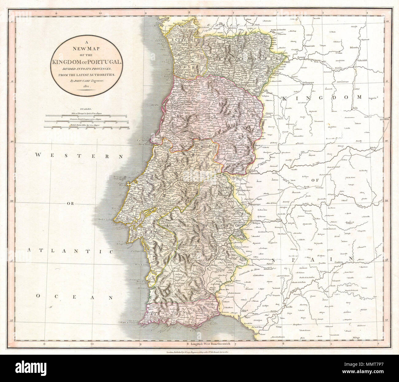 . English: This is a stunning 1811 map of Portugal by the important late 18th / early 19th century Edinburgh cartographer John Cary. Fully depicts the country and its various regions. The popular resort province of Algarve, is listed as its own Kingdom. Dated, London, April 21, 1811. A New Map of the Kingdom of Portugal. Divided into its Provinces. From the Latest Authorities.. 1811. 1811 Cary Map of the Kingdom of Portugal - Geographicus - Portugal-cary-1811 Stock Photohttps://www.alamy.com/image-license-details/?v=1https://www.alamy.com/english-this-is-a-stunning-1811-map-of-portugal-by-the-important-late-18th-early-19th-century-edinburgh-cartographer-john-cary-fully-depicts-the-country-and-its-various-regions-the-popular-resort-province-of-algarve-is-listed-as-its-own-kingdom-dated-london-april-21-1811-a-new-map-of-the-kingdom-of-portugal-divided-into-its-provinces-from-the-latest-authorities-1811-1811-cary-map-of-the-kingdom-of-portugal-geographicus-portugal-cary-1811-image184929759.html
RMMMT7P7–. English: This is a stunning 1811 map of Portugal by the important late 18th / early 19th century Edinburgh cartographer John Cary. Fully depicts the country and its various regions. The popular resort province of Algarve, is listed as its own Kingdom. Dated, London, April 21, 1811. A New Map of the Kingdom of Portugal. Divided into its Provinces. From the Latest Authorities.. 1811. 1811 Cary Map of the Kingdom of Portugal - Geographicus - Portugal-cary-1811
 Sir Francis Galton, FRS FRAI (1822–1911), was an English Victorian era polymath: a statistician, sociologist, psychologist, anthropologist, tropical explorer, geographer, inventor, meteorologist, proto-geneticist, psychometrician and a proponent of social Darwinism, eugenics and scientific racism. Stock Photohttps://www.alamy.com/image-license-details/?v=1https://www.alamy.com/sir-francis-galton-frs-frai-18221911-was-an-english-victorian-era-polymath-a-statistician-sociologist-psychologist-anthropologist-tropical-explorer-geographer-inventor-meteorologist-proto-geneticist-psychometrician-and-a-proponent-of-social-darwinism-eugenics-and-scientific-racism-image459830374.html
RM2HM329A–Sir Francis Galton, FRS FRAI (1822–1911), was an English Victorian era polymath: a statistician, sociologist, psychologist, anthropologist, tropical explorer, geographer, inventor, meteorologist, proto-geneticist, psychometrician and a proponent of social Darwinism, eugenics and scientific racism.
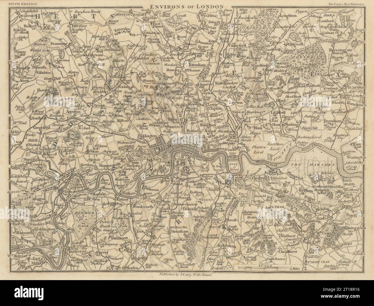 ENVIRONS OF LONDON by John CARY. Miniature antique map 1815 old Stock Photohttps://www.alamy.com/image-license-details/?v=1https://www.alamy.com/environs-of-london-by-john-cary-miniature-antique-map-1815-old-image568750482.html
RF2T18R16–ENVIRONS OF LONDON by John CARY. Miniature antique map 1815 old
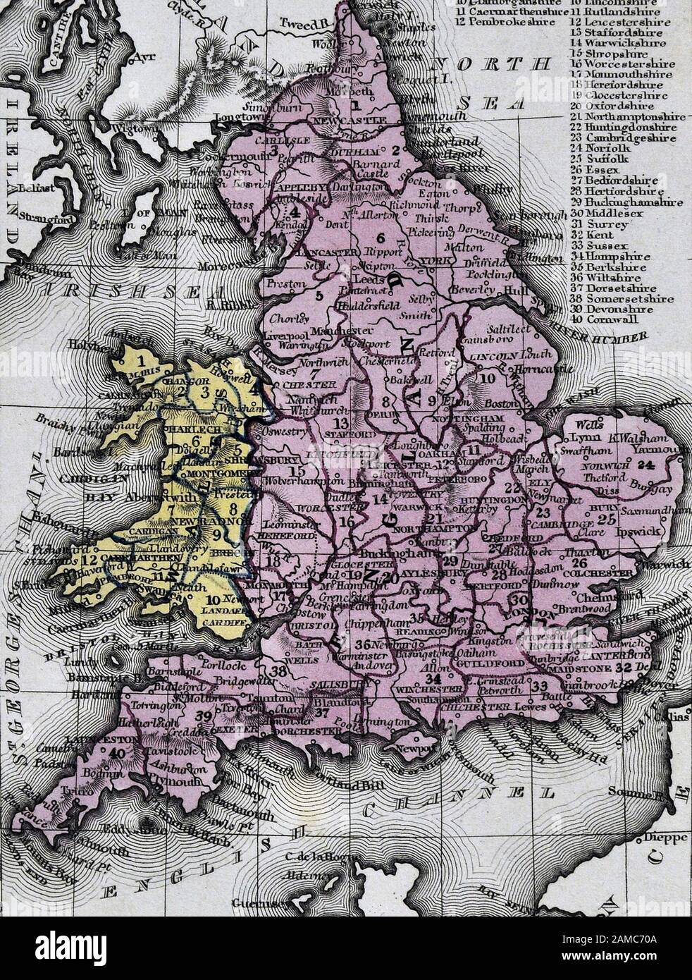 1834 Carey Map England Wales Great Britain United Kingdom UK London Liverpool Manchester Cornwall Oxford Ipswich Stock Photohttps://www.alamy.com/image-license-details/?v=1https://www.alamy.com/1834-carey-map-england-wales-great-britain-united-kingdom-uk-london-liverpool-manchester-cornwall-oxford-ipswich-image339559034.html
RF2AMC70A–1834 Carey Map England Wales Great Britain United Kingdom UK London Liverpool Manchester Cornwall Oxford Ipswich
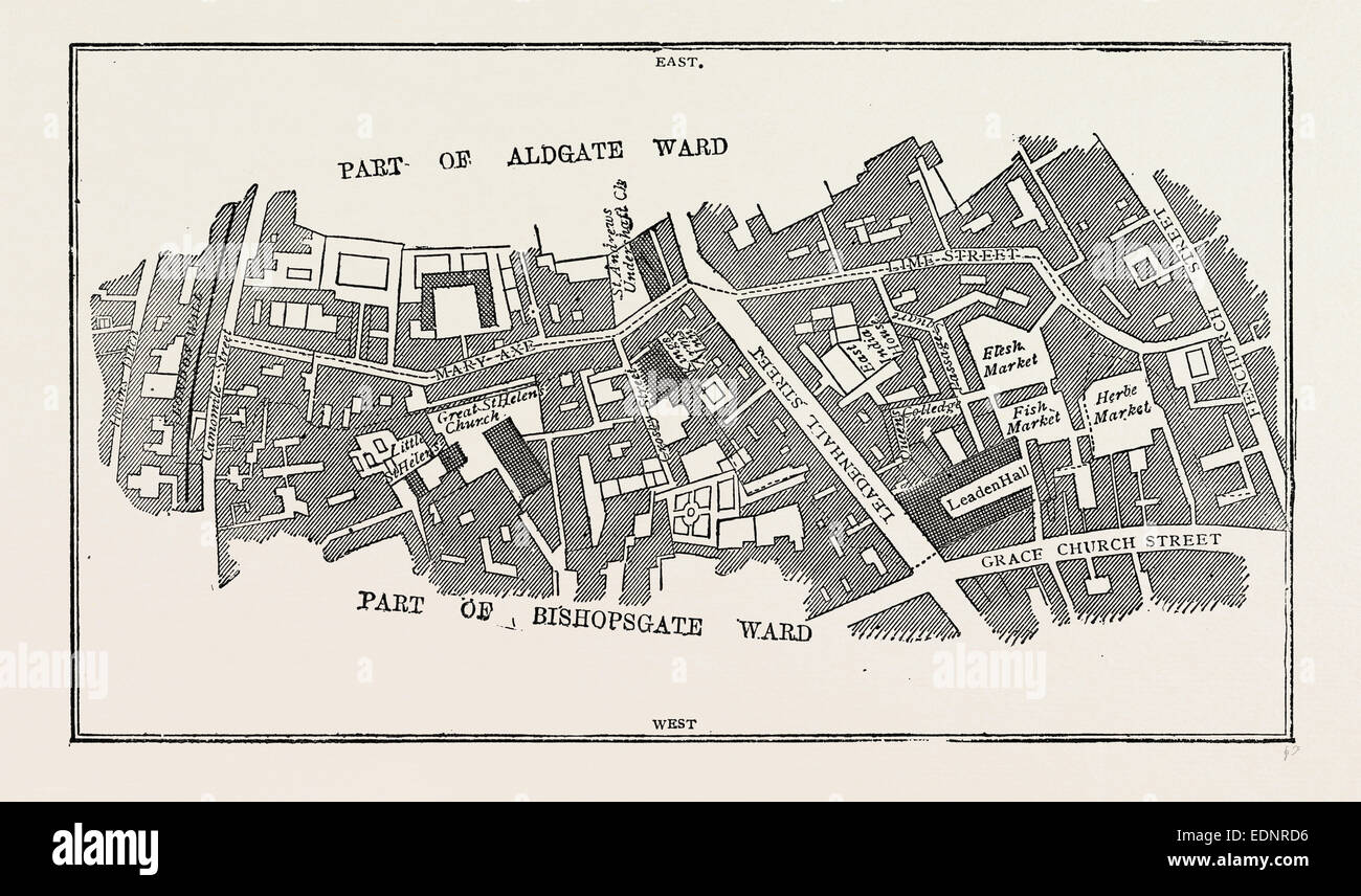 MAP LIME STREET WARD, London, UK, 19th century engraving Stock Photohttps://www.alamy.com/image-license-details/?v=1https://www.alamy.com/stock-photo-map-lime-street-ward-london-uk-19th-century-engraving-77311394.html
RMEDNRD6–MAP LIME STREET WARD, London, UK, 19th century engraving
 Ancient 19th Century map of Norfolk a county in East Anglia in England. Copperplate engraving From the Encyclopaedia Londinensis or, Universal dictionary of arts, sciences, and literature; Volume XVII; Edited by Wilkes, John. Published in London in 1820 Stock Photohttps://www.alamy.com/image-license-details/?v=1https://www.alamy.com/ancient-19th-century-map-of-norfolk-a-county-in-east-anglia-in-england-copperplate-engraving-from-the-encyclopaedia-londinensis-or-universal-dictionary-of-arts-sciences-and-literature-volume-xvii-edited-by-wilkes-john-published-in-london-in-1820-image383829416.html
RF2D8CX9C–Ancient 19th Century map of Norfolk a county in East Anglia in England. Copperplate engraving From the Encyclopaedia Londinensis or, Universal dictionary of arts, sciences, and literature; Volume XVII; Edited by Wilkes, John. Published in London in 1820