Quick filters:
Plan de 1864 Stock Photos and Images
 Monument to Eugène de Beauharnais, Duke of Leuchtenberg, Ground Plan, Leo von Klenze, 1784-1864, Drawing, Paper, Color, Ink, Drawn, Height 201 mm, Width 169 mm, Draftsmanship, Drawing, European, Modernity (1800 - 1914 Stock Photohttps://www.alamy.com/image-license-details/?v=1https://www.alamy.com/monument-to-eugne-de-beauharnais-duke-of-leuchtenberg-ground-plan-leo-von-klenze-1784-1864-drawing-paper-color-ink-drawn-height-201-mm-width-169-mm-draftsmanship-drawing-european-modernity-1800-1914-image573188963.html
RM2T8F0AB–Monument to Eugène de Beauharnais, Duke of Leuchtenberg, Ground Plan, Leo von Klenze, 1784-1864, Drawing, Paper, Color, Ink, Drawn, Height 201 mm, Width 169 mm, Draftsmanship, Drawing, European, Modernity (1800 - 1914
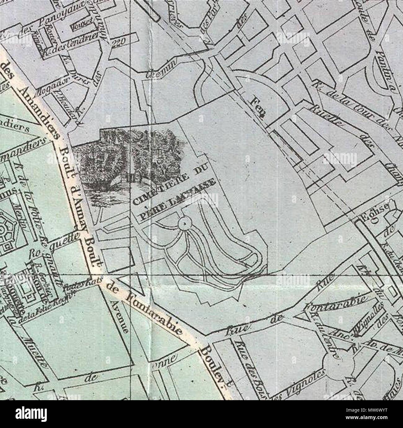 . Plan de Paris Illustre 1864. English: An extremely attractive map of Paris, France issued in 1864 by the Garnier Freres. Covers the old walled city of Paris and the immediate vicinity. Important buildings are shown in profile. All major streets are identified. Color coded according to arrondissements. The four corners are occupied by a street index. The Coat of Arms of Paris appears in the upper right and left quadrants. . 1864 (dated) 9 1864 Garnier Map of Pairs, France w-Monuments - Geographicus - Paris-garnier-1864 (cropped) Stock Photohttps://www.alamy.com/image-license-details/?v=1https://www.alamy.com/plan-de-paris-illustre-1864-english-an-extremely-attractive-map-of-paris-france-issued-in-1864-by-the-garnier-freres-covers-the-old-walled-city-of-paris-and-the-immediate-vicinity-important-buildings-are-shown-in-profile-all-major-streets-are-identified-color-coded-according-to-arrondissements-the-four-corners-are-occupied-by-a-street-index-the-coat-of-arms-of-paris-appears-in-the-upper-right-and-left-quadrants-1864-dated-9-1864-garnier-map-of-pairs-france-w-monuments-geographicus-paris-garnier-1864-cropped-image187622172.html
RMMW6WYT–. Plan de Paris Illustre 1864. English: An extremely attractive map of Paris, France issued in 1864 by the Garnier Freres. Covers the old walled city of Paris and the immediate vicinity. Important buildings are shown in profile. All major streets are identified. Color coded according to arrondissements. The four corners are occupied by a street index. The Coat of Arms of Paris appears in the upper right and left quadrants. . 1864 (dated) 9 1864 Garnier Map of Pairs, France w-Monuments - Geographicus - Paris-garnier-1864 (cropped)
 Monument to Eugène de Beauharnais, Duke of Leuchtenberg, Proposal for the Ground Plan, Leo von Klenze, 1784-1864, Drawing, Paper, Color, Ink, Color, Graphite, Drawn, Height 117 mm, Width 293 mm, Rückwand der Kirche, Figur des Herzogs, Figur der Geschichte, Trophäe , , Målangivelser, Draftsmanship, Drawing, European, Modernity (1800 - 1914 Stock Photohttps://www.alamy.com/image-license-details/?v=1https://www.alamy.com/monument-to-eugne-de-beauharnais-duke-of-leuchtenberg-proposal-for-the-ground-plan-leo-von-klenze-1784-1864-drawing-paper-color-ink-color-graphite-drawn-height-117-mm-width-293-mm-rckwand-der-kirche-figur-des-herzogs-figur-der-geschichte-trophe-mlangivelser-draftsmanship-drawing-european-modernity-1800-1914-image573191747.html
RM2T8F3WR–Monument to Eugène de Beauharnais, Duke of Leuchtenberg, Proposal for the Ground Plan, Leo von Klenze, 1784-1864, Drawing, Paper, Color, Ink, Color, Graphite, Drawn, Height 117 mm, Width 293 mm, Rückwand der Kirche, Figur des Herzogs, Figur der Geschichte, Trophäe , , Målangivelser, Draftsmanship, Drawing, European, Modernity (1800 - 1914
 Compagnie des Guides depuis 1864. Saint-Gervais-les-Bains. Haute-Savoie. France. Stock Photohttps://www.alamy.com/image-license-details/?v=1https://www.alamy.com/compagnie-des-guides-depuis-1864-saint-gervais-les-bains-haute-savoie-france-image328196481.html
RM2A1XHXW–Compagnie des Guides depuis 1864. Saint-Gervais-les-Bains. Haute-Savoie. France.
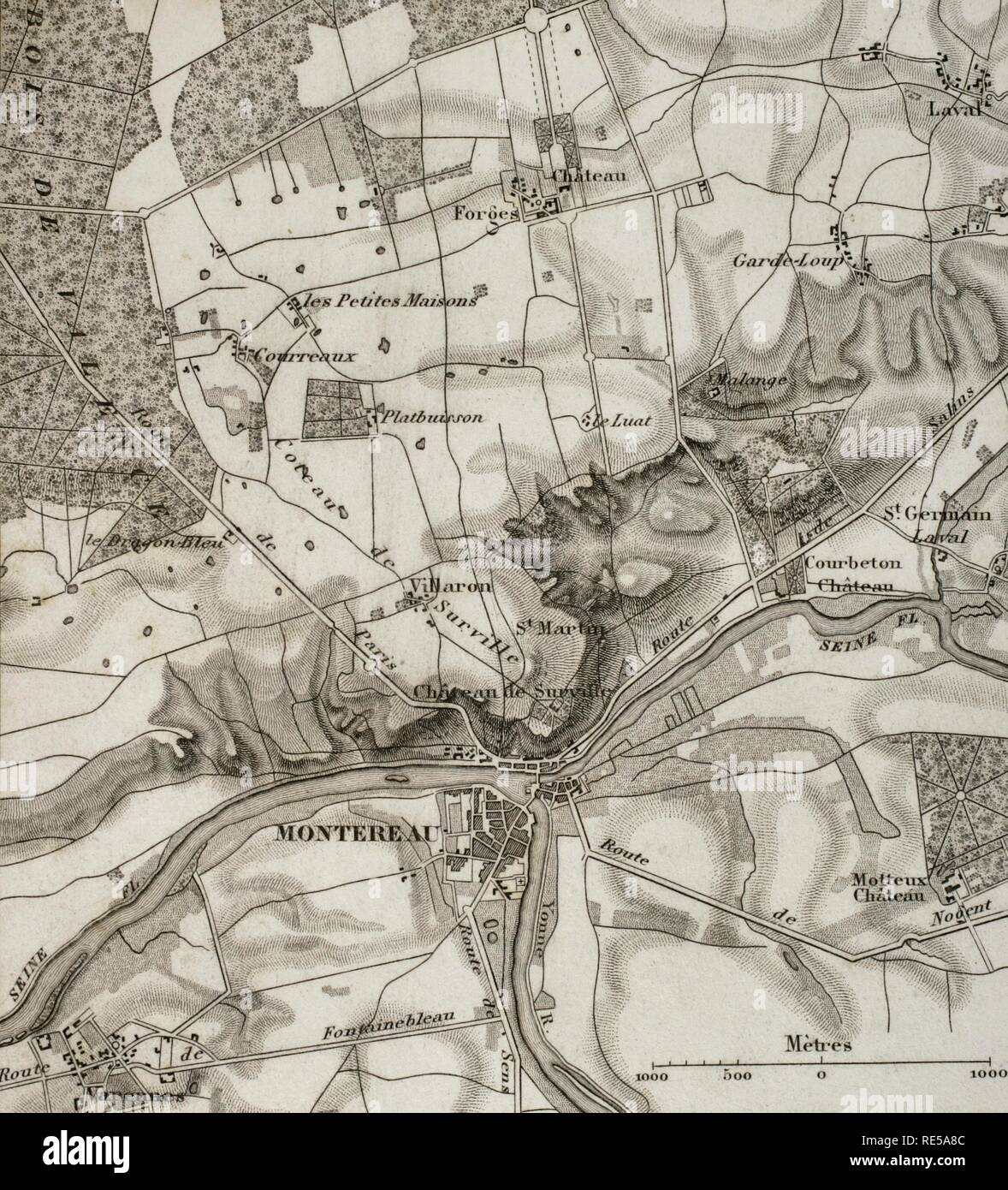 Napoleonic map. Surroundings of Montereau, France. Atlas de l'Histoire du Consulat et de l'Empire. History of the Consulate and the Empire of France under Napoleon by Marie Joseph Louis Adolphe Thiers (1797-1877). Drawings by Dufour, engravings by Dyonnet. Edited in Paris, 1864. Stock Photohttps://www.alamy.com/image-license-details/?v=1https://www.alamy.com/napoleonic-map-surroundings-of-montereau-france-atlas-de-lhistoire-du-consulat-et-de-lempire-history-of-the-consulate-and-the-empire-of-france-under-napoleon-by-marie-joseph-louis-adolphe-thiers-1797-1877-drawings-by-dufour-engravings-by-dyonnet-edited-in-paris-1864-image232457804.html
RMRE5A8C–Napoleonic map. Surroundings of Montereau, France. Atlas de l'Histoire du Consulat et de l'Empire. History of the Consulate and the Empire of France under Napoleon by Marie Joseph Louis Adolphe Thiers (1797-1877). Drawings by Dufour, engravings by Dyonnet. Edited in Paris, 1864.
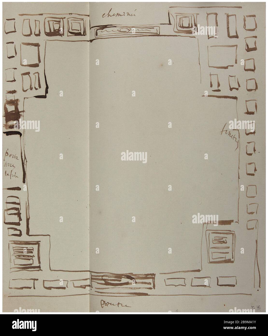 Plan Victor Hugo. 'Plan'. Plume et encre brune, papier vergé gris-bleuté à filigrane W C B&C° LONDON 1850. 1864. Paris, Maison de Victor Hugo. Stock Photohttps://www.alamy.com/image-license-details/?v=1https://www.alamy.com/plan-victor-hugo-plan-plume-et-encre-brune-papier-verg-gris-bleut-filigrane-w-c-bc-london-1850-1864-paris-maison-de-victor-hugo-image350186199.html
RM2B9MA1Y–Plan Victor Hugo. 'Plan'. Plume et encre brune, papier vergé gris-bleuté à filigrane W C B&C° LONDON 1850. 1864. Paris, Maison de Victor Hugo.
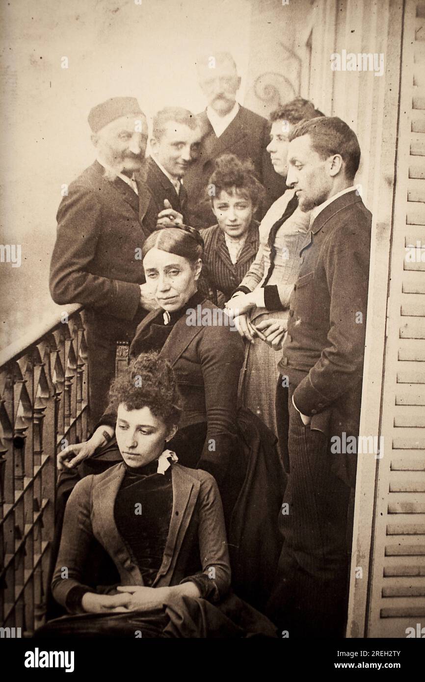 La famille Claudel, Jessie Lipscomb, Ferdinand de Massary et son pere sur le balcon de l'appartement du 31 boulevard de Port Royal. (Au premier plan: Louise (nee en 1866), derriere elle, madame Claudel (nee Louise Athanaise Cerveaux en 1840) et Camille (1864-1943). Autour d'elles, de gauche a droite, Louis Prosper Claudel (son pere, 1826-1913), Paul (son frere, 1868-1955), Alphonse de Massary (mort en 1874), Jessie Lipscomb (1861-1952) et Ferdinand (epoux de Louise, 1855-1896)). Photographie en 1887, par William Elborne (c.1858-1952). Musee des Beaux Arts de Poitiers (France). Stock Photohttps://www.alamy.com/image-license-details/?v=1https://www.alamy.com/la-famille-claudel-jessie-lipscomb-ferdinand-de-massary-et-son-pere-sur-le-balcon-de-lappartement-du-31-boulevard-de-port-royal-au-premier-plan-louise-nee-en-1866-derriere-elle-madame-claudel-nee-louise-athanaise-cerveaux-en-1840-et-camille-1864-1943-autour-delles-de-gauche-a-droite-louis-prosper-claudel-son-pere-1826-1913-paul-son-frere-1868-1955-alphonse-de-massary-mort-en-1874-jessie-lipscomb-1861-1952-et-ferdinand-epoux-de-louise-1855-1896-photographie-en-1887-par-william-elborne-c1858-1952-musee-des-beaux-arts-de-poitiers-france-image559712411.html
RM2REH2TY–La famille Claudel, Jessie Lipscomb, Ferdinand de Massary et son pere sur le balcon de l'appartement du 31 boulevard de Port Royal. (Au premier plan: Louise (nee en 1866), derriere elle, madame Claudel (nee Louise Athanaise Cerveaux en 1840) et Camille (1864-1943). Autour d'elles, de gauche a droite, Louis Prosper Claudel (son pere, 1826-1913), Paul (son frere, 1868-1955), Alphonse de Massary (mort en 1874), Jessie Lipscomb (1861-1952) et Ferdinand (epoux de Louise, 1855-1896)). Photographie en 1887, par William Elborne (c.1858-1952). Musee des Beaux Arts de Poitiers (France).
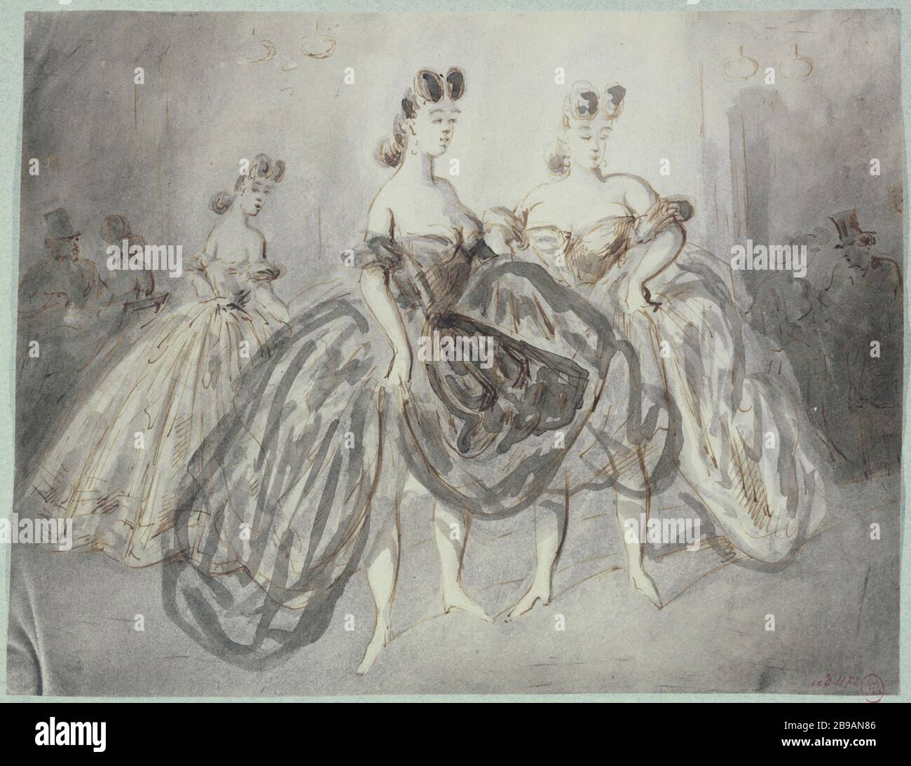 public house scene; three women in the foreground, in low-cut dress, in the background on the left, silhouettes of a woman and a man as well as the right, towards 1862-1864. Constantin Ernest Adolphe Hyacinthe Guys (1802-1892), dessinateur et peintre français. Scène de maison publique ; trois femmes au premier plan, en robe décolletée, à l'arrière plan sur la gauche, silhouettes d'une femme et d'un homme ainsi que sur la droite. Plume, encre brune, lavis de grisaille. 1862-1864. Paris, musée Carnavalet. Stock Photohttps://www.alamy.com/image-license-details/?v=1https://www.alamy.com/public-house-scene-three-women-in-the-foreground-in-low-cut-dress-in-the-background-on-the-left-silhouettes-of-a-woman-and-a-man-as-well-as-the-right-towards-1862-1864-constantin-ernest-adolphe-hyacinthe-guys-1802-1892-dessinateur-et-peintre-franais-scne-de-maison-publique-trois-femmes-au-premier-plan-en-robe-dcollete-larrire-plan-sur-la-gauche-silhouettes-dune-femme-et-dun-homme-ainsi-que-sur-la-droite-plume-encre-brune-lavis-de-grisaille-1862-1864-paris-muse-carnavalet-image349975478.html
RM2B9AN86–public house scene; three women in the foreground, in low-cut dress, in the background on the left, silhouettes of a woman and a man as well as the right, towards 1862-1864. Constantin Ernest Adolphe Hyacinthe Guys (1802-1892), dessinateur et peintre français. Scène de maison publique ; trois femmes au premier plan, en robe décolletée, à l'arrière plan sur la gauche, silhouettes d'une femme et d'un homme ainsi que sur la droite. Plume, encre brune, lavis de grisaille. 1862-1864. Paris, musée Carnavalet.
 Album Page, Notes Related to Campanile, Milan, verso: Plan of Tile Floor in Dianne de Poitiers' Bedroom, Chateau de Chaumont; Whitney Warren Jr. (American, 1864–1943); France; graphite on textured off-white wove paper tipped into binding with fabric; 31.6 x 24.9 cm (12 7/16 x 9 13/16 in.), irregular Stock Photohttps://www.alamy.com/image-license-details/?v=1https://www.alamy.com/album-page-notes-related-to-campanile-milan-verso-plan-of-tile-floor-in-dianne-de-poitiers-bedroom-chateau-de-chaumont-whitney-warren-jr-american-18641943-france-graphite-on-textured-off-white-wove-paper-tipped-into-binding-with-fabric-316-x-249-cm-12-716-x-9-1316-in-irregular-image546135304.html
RM2PMEH48–Album Page, Notes Related to Campanile, Milan, verso: Plan of Tile Floor in Dianne de Poitiers' Bedroom, Chateau de Chaumont; Whitney Warren Jr. (American, 1864–1943); France; graphite on textured off-white wove paper tipped into binding with fabric; 31.6 x 24.9 cm (12 7/16 x 9 13/16 in.), irregular
 View of Paris from the heights of Passy / Salon 1864 / View from the Top of the Boulevard Delessert / The house in the foreground belongs to the Beethoven Street. View of a painting of Paris Passy heights on the side of the Beethoven Street, 16th arrondisseme Michelez, Charles Louis. Vue de Paris des hauteurs de Passy / Salon 1864 / Vue prise du Haut du Boulevard Delessert / La maison du premier plan appartient à la rue Beethoven. 'Vue d'un tableau représentant Paris des hauteurs de Passy du côté de la rue Beethoven, 16ème arrondissement, Paris'. Tirage au gélatino-bromure d’argent. 1864-1864. Stock Photohttps://www.alamy.com/image-license-details/?v=1https://www.alamy.com/view-of-paris-from-the-heights-of-passy-salon-1864-view-from-the-top-of-the-boulevard-delessert-the-house-in-the-foreground-belongs-to-the-beethoven-street-view-of-a-painting-of-paris-passy-heights-on-the-side-of-the-beethoven-street-16th-arrondisseme-michelez-charles-louis-vue-de-paris-des-hauteurs-de-passy-salon-1864-vue-prise-du-haut-du-boulevard-delessert-la-maison-du-premier-plan-appartient-la-rue-beethoven-vue-dun-tableau-reprsentant-paris-des-hauteurs-de-passy-du-ct-de-la-rue-beethoven-16me-arrondissement-paris-tirage-au-glatino-bromure-dargent-1864-1864-image349816829.html
RM2B93EX5–View of Paris from the heights of Passy / Salon 1864 / View from the Top of the Boulevard Delessert / The house in the foreground belongs to the Beethoven Street. View of a painting of Paris Passy heights on the side of the Beethoven Street, 16th arrondisseme Michelez, Charles Louis. Vue de Paris des hauteurs de Passy / Salon 1864 / Vue prise du Haut du Boulevard Delessert / La maison du premier plan appartient à la rue Beethoven. 'Vue d'un tableau représentant Paris des hauteurs de Passy du côté de la rue Beethoven, 16ème arrondissement, Paris'. Tirage au gélatino-bromure d’argent. 1864-1864.
 Victor Hugo. 'Plan'. Brown feather and ink, gray-blue-blue laid paper W C B & C ° London 1850. 1864. Paris, Maison de Victor Hugo. 74628-7 Interior decoration, drawing, interior, 19th XIXth 19th 19th19e 19 Center Stock Photohttps://www.alamy.com/image-license-details/?v=1https://www.alamy.com/victor-hugo-plan-brown-feather-and-ink-gray-blue-blue-laid-paper-w-c-b-c-london-1850-1864-paris-maison-de-victor-hugo-74628-7-interior-decoration-drawing-interior-19th-xixth-19th-19th19e-19-center-image596785195.html
RM2WJWWGY–Victor Hugo. 'Plan'. Brown feather and ink, gray-blue-blue laid paper W C B & C ° London 1850. 1864. Paris, Maison de Victor Hugo. 74628-7 Interior decoration, drawing, interior, 19th XIXth 19th 19th19e 19 Center
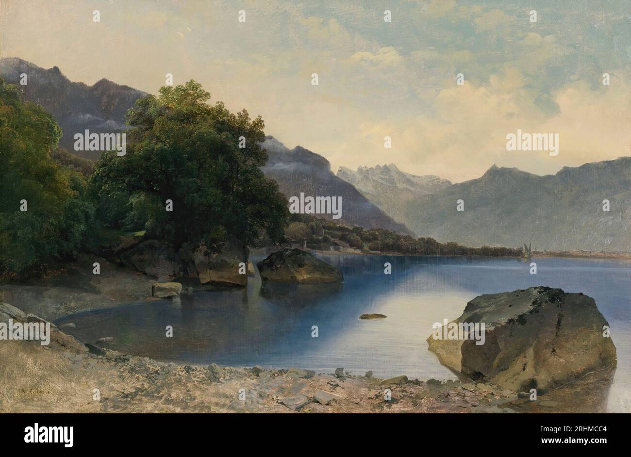 Alexandre Calame (Swiss, 1810-1864) - Petite Baie du Lac Léman près de Chillon, les dents du Midi en Arrière-plan Stock Photohttps://www.alamy.com/image-license-details/?v=1https://www.alamy.com/alexandre-calame-swiss-1810-1864-petite-baie-du-lac-lman-prs-de-chillon-les-dents-du-midi-en-arrire-plan-image561629716.html
RF2RHMCC4–Alexandre Calame (Swiss, 1810-1864) - Petite Baie du Lac Léman près de Chillon, les dents du Midi en Arrière-plan
 Figurative plan of the armament of the Citadel of Antwerp on November 30, 1832, 1864 print Map of the Citadel of Antwerp with the armament present there on November 30, 1832. At the bottom in five columns De Legenda 1-55. Netherlands paper plan architecture. fortress Citadel of Antwerp (19th century) Stock Photohttps://www.alamy.com/image-license-details/?v=1https://www.alamy.com/figurative-plan-of-the-armament-of-the-citadel-of-antwerp-on-november-30-1832-1864-print-map-of-the-citadel-of-antwerp-with-the-armament-present-there-on-november-30-1832-at-the-bottom-in-five-columns-de-legenda-1-55-netherlands-paper-plan-architecture-fortress-citadel-of-antwerp-19th-century-image595198801.html
RM2WG9J41–Figurative plan of the armament of the Citadel of Antwerp on November 30, 1832, 1864 print Map of the Citadel of Antwerp with the armament present there on November 30, 1832. At the bottom in five columns De Legenda 1-55. Netherlands paper plan architecture. fortress Citadel of Antwerp (19th century)
 Sketch for the Denon pavilion at the Louvre: the four artistic ages of France - presenting the plans for the château of Fontainebleau to Francis I, c.1864. Stock Photohttps://www.alamy.com/image-license-details/?v=1https://www.alamy.com/sketch-for-the-denon-pavilion-at-the-louvre-the-four-artistic-ages-of-france-presenting-the-plans-for-the-chxe2teau-of-fontainebleau-to-francis-i-c1864-image485275712.html
RM2K5E63C–Sketch for the Denon pavilion at the Louvre: the four artistic ages of France - presenting the plans for the château of Fontainebleau to Francis I, c.1864.
![Plan de Paris et de son enceinte, 1864. [1864?] Undated. Getty copy inscribed on p. [2] of cover with date 14 July 1864 (and price 4 francs). Title and imprint in top margin. Scale bar of 2000 meters at foot. Arrondissements, railroads, and proposed thoroughfares hand colored. The folded plan mounted on p. [2] of a pasteboard cover, stamped in blind and gilt. Scale approximately 1:15,000. Stock Photo Plan de Paris et de son enceinte, 1864. [1864?] Undated. Getty copy inscribed on p. [2] of cover with date 14 July 1864 (and price 4 francs). Title and imprint in top margin. Scale bar of 2000 meters at foot. Arrondissements, railroads, and proposed thoroughfares hand colored. The folded plan mounted on p. [2] of a pasteboard cover, stamped in blind and gilt. Scale approximately 1:15,000. Stock Photo](https://c8.alamy.com/comp/2WTEPMG/plan-de-paris-et-de-son-enceinte-1864-1864-undated-getty-copy-inscribed-on-p-2-of-cover-with-date-14-july-1864-and-price-4-francs-title-and-imprint-in-top-margin-scale-bar-of-2000-meters-at-foot-arrondissements-railroads-and-proposed-thoroughfares-hand-colored-the-folded-plan-mounted-on-p-2-of-a-pasteboard-cover-stamped-in-blind-and-gilt-scale-approximately-115000-2WTEPMG.jpg) Plan de Paris et de son enceinte, 1864. [1864?] Undated. Getty copy inscribed on p. [2] of cover with date 14 July 1864 (and price 4 francs). Title and imprint in top margin. Scale bar of 2000 meters at foot. Arrondissements, railroads, and proposed thoroughfares hand colored. The folded plan mounted on p. [2] of a pasteboard cover, stamped in blind and gilt. Scale approximately 1:15,000. Stock Photohttps://www.alamy.com/image-license-details/?v=1https://www.alamy.com/plan-de-paris-et-de-son-enceinte-1864-1864-undated-getty-copy-inscribed-on-p-2-of-cover-with-date-14-july-1864-and-price-4-francs-title-and-imprint-in-top-margin-scale-bar-of-2000-meters-at-foot-arrondissements-railroads-and-proposed-thoroughfares-hand-colored-the-folded-plan-mounted-on-p-2-of-a-pasteboard-cover-stamped-in-blind-and-gilt-scale-approximately-115000-image600229408.html
Plan de Paris et de son enceinte, 1864. [1864?] Undated. Getty copy inscribed on p. [2] of cover with date 14 July 1864 (and price 4 francs). Title and imprint in top margin. Scale bar of 2000 meters at foot. Arrondissements, railroads, and proposed thoroughfares hand colored. The folded plan mounted on p. [2] of a pasteboard cover, stamped in blind and gilt. Scale approximately 1:15,000. Stock Photohttps://www.alamy.com/image-license-details/?v=1https://www.alamy.com/plan-de-paris-et-de-son-enceinte-1864-1864-undated-getty-copy-inscribed-on-p-2-of-cover-with-date-14-july-1864-and-price-4-francs-title-and-imprint-in-top-margin-scale-bar-of-2000-meters-at-foot-arrondissements-railroads-and-proposed-thoroughfares-hand-colored-the-folded-plan-mounted-on-p-2-of-a-pasteboard-cover-stamped-in-blind-and-gilt-scale-approximately-115000-image600229408.htmlRM2WTEPMG–Plan de Paris et de son enceinte, 1864. [1864?] Undated. Getty copy inscribed on p. [2] of cover with date 14 July 1864 (and price 4 francs). Title and imprint in top margin. Scale bar of 2000 meters at foot. Arrondissements, railroads, and proposed thoroughfares hand colored. The folded plan mounted on p. [2] of a pasteboard cover, stamped in blind and gilt. Scale approximately 1:15,000.
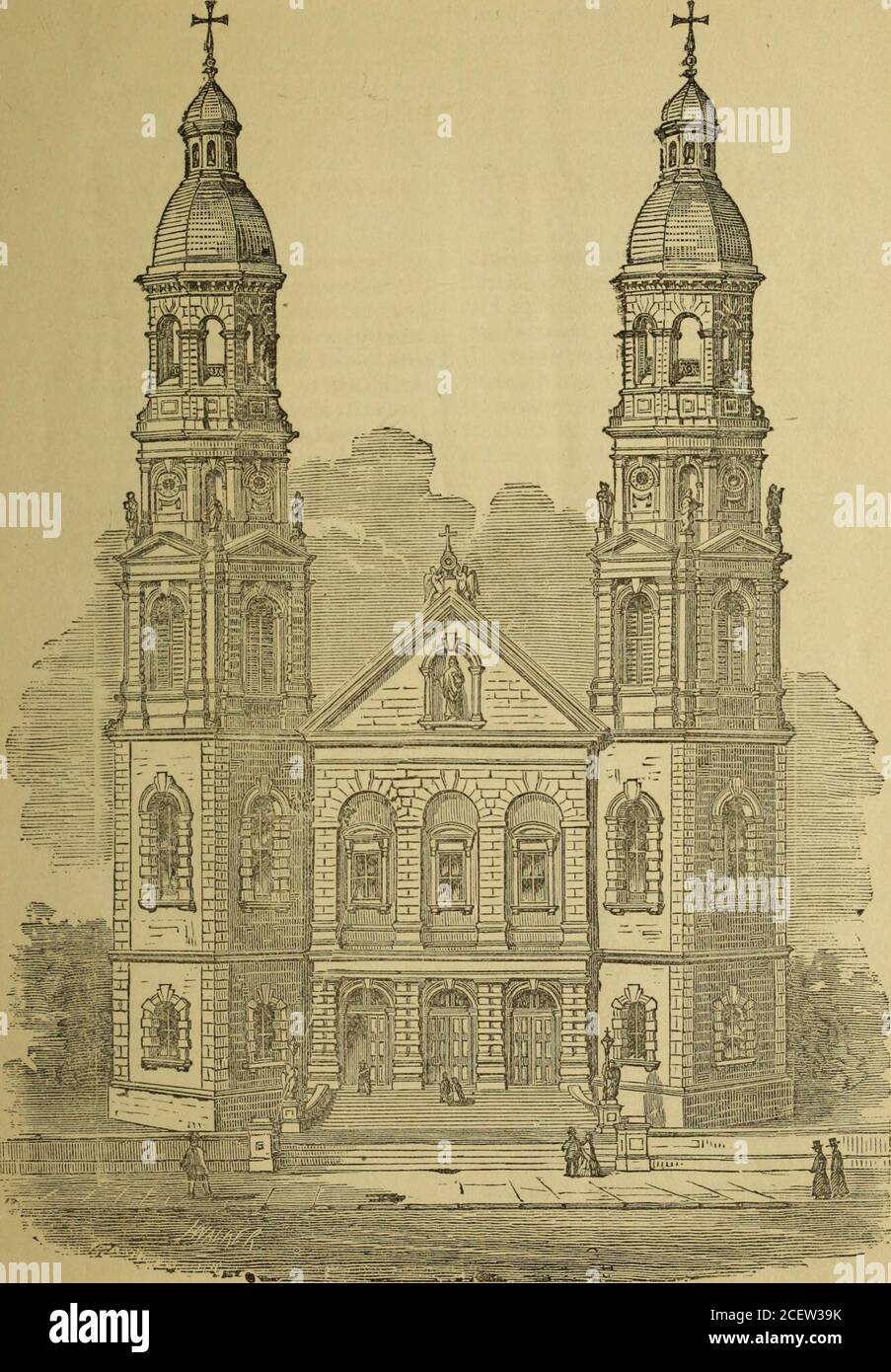 . College Ste. Marie et Eglise du Gesu. dertook the work ;on St. Josephs day, 1864, (March 19),they began to prepare the site and afew weeks later building operationswere commenced. The plan of the church was furnished by that well known architect,Mr. Keely, of Brooklyn, N. Y. It isundoubtedly a high work of art, de-signed in imitation of the Churchof the Gesu, one of the finest Ba-silics of Rome. The Church was blessed and openedfor worship on the 3rd December,1865 (St. Francis Xavier day). Theservices on week days are at thesame hours as those of the other citychurches; on Sundays and Holyda Stock Photohttps://www.alamy.com/image-license-details/?v=1https://www.alamy.com/college-ste-marie-et-eglise-du-gesu-dertook-the-work-on-st-josephs-day-1864-march-19they-began-to-prepare-the-site-and-afew-weeks-later-building-operationswere-commenced-the-plan-of-the-church-was-furnished-by-that-well-known-architectmr-keely-of-brooklyn-n-y-it-isundoubtedly-a-high-work-of-art-de-signed-in-imitation-of-the-churchof-the-gesu-one-of-the-finest-ba-silics-of-rome-the-church-was-blessed-and-openedfor-worship-on-the-3rd-december1865-st-francis-xavier-day-theservices-on-week-days-are-at-thesame-hours-as-those-of-the-other-citychurches-on-sundays-and-holyda-image370574335.html
RM2CEW39K–. College Ste. Marie et Eglise du Gesu. dertook the work ;on St. Josephs day, 1864, (March 19),they began to prepare the site and afew weeks later building operationswere commenced. The plan of the church was furnished by that well known architect,Mr. Keely, of Brooklyn, N. Y. It isundoubtedly a high work of art, de-signed in imitation of the Churchof the Gesu, one of the finest Ba-silics of Rome. The Church was blessed and openedfor worship on the 3rd December,1865 (St. Francis Xavier day). Theservices on week days are at thesame hours as those of the other citychurches; on Sundays and Holyda
![Nouveau plan complet illustré de la ville de Paris en 1876, divisé en 20 arrondissements / dressé par A. Vuillemin ; gravé par Ch. Dyonnet, 1876. Vuillemin, A. (Alexandre), 1812-, cartographer. [1876] Not in Vallée, who lists 11 editions between 1864 and 1892 (L. Vallée, Catalogue des plans de Paris, 3161-1371). Inset maps of Paris area at upper left (scale 1:300,000), 'Agrandissements de Paris' at upper right. Two vignettes at bottom margin depict assemblages of various monuments and buildings. Ruled in 267 squares for a separate street index, not included with present copy. Arrondissements, Stock Photo Nouveau plan complet illustré de la ville de Paris en 1876, divisé en 20 arrondissements / dressé par A. Vuillemin ; gravé par Ch. Dyonnet, 1876. Vuillemin, A. (Alexandre), 1812-, cartographer. [1876] Not in Vallée, who lists 11 editions between 1864 and 1892 (L. Vallée, Catalogue des plans de Paris, 3161-1371). Inset maps of Paris area at upper left (scale 1:300,000), 'Agrandissements de Paris' at upper right. Two vignettes at bottom margin depict assemblages of various monuments and buildings. Ruled in 267 squares for a separate street index, not included with present copy. Arrondissements, Stock Photo](https://c8.alamy.com/comp/2WTDYBH/nouveau-plan-complet-illustr-de-la-ville-de-paris-en-1876-divis-en-20-arrondissements-dress-par-a-vuillemin-grav-par-ch-dyonnet-1876-vuillemin-a-alexandre-1812-cartographer-1876-not-in-valle-who-lists-11-editions-between-1864-and-1892-l-valle-catalogue-des-plans-de-paris-3161-1371-inset-maps-of-paris-area-at-upper-left-scale-1300000-agrandissements-de-paris-at-upper-right-two-vignettes-at-bottom-margin-depict-assemblages-of-various-monuments-and-buildings-ruled-in-267-squares-for-a-separate-street-index-not-included-with-present-copy-arrondissements-2WTDYBH.jpg) Nouveau plan complet illustré de la ville de Paris en 1876, divisé en 20 arrondissements / dressé par A. Vuillemin ; gravé par Ch. Dyonnet, 1876. Vuillemin, A. (Alexandre), 1812-, cartographer. [1876] Not in Vallée, who lists 11 editions between 1864 and 1892 (L. Vallée, Catalogue des plans de Paris, 3161-1371). Inset maps of Paris area at upper left (scale 1:300,000), 'Agrandissements de Paris' at upper right. Two vignettes at bottom margin depict assemblages of various monuments and buildings. Ruled in 267 squares for a separate street index, not included with present copy. Arrondissements, Stock Photohttps://www.alamy.com/image-license-details/?v=1https://www.alamy.com/nouveau-plan-complet-illustr-de-la-ville-de-paris-en-1876-divis-en-20-arrondissements-dress-par-a-vuillemin-grav-par-ch-dyonnet-1876-vuillemin-a-alexandre-1812-cartographer-1876-not-in-valle-who-lists-11-editions-between-1864-and-1892-l-valle-catalogue-des-plans-de-paris-3161-1371-inset-maps-of-paris-area-at-upper-left-scale-1300000-agrandissements-de-paris-at-upper-right-two-vignettes-at-bottom-margin-depict-assemblages-of-various-monuments-and-buildings-ruled-in-267-squares-for-a-separate-street-index-not-included-with-present-copy-arrondissements-image600211125.html
Nouveau plan complet illustré de la ville de Paris en 1876, divisé en 20 arrondissements / dressé par A. Vuillemin ; gravé par Ch. Dyonnet, 1876. Vuillemin, A. (Alexandre), 1812-, cartographer. [1876] Not in Vallée, who lists 11 editions between 1864 and 1892 (L. Vallée, Catalogue des plans de Paris, 3161-1371). Inset maps of Paris area at upper left (scale 1:300,000), 'Agrandissements de Paris' at upper right. Two vignettes at bottom margin depict assemblages of various monuments and buildings. Ruled in 267 squares for a separate street index, not included with present copy. Arrondissements, Stock Photohttps://www.alamy.com/image-license-details/?v=1https://www.alamy.com/nouveau-plan-complet-illustr-de-la-ville-de-paris-en-1876-divis-en-20-arrondissements-dress-par-a-vuillemin-grav-par-ch-dyonnet-1876-vuillemin-a-alexandre-1812-cartographer-1876-not-in-valle-who-lists-11-editions-between-1864-and-1892-l-valle-catalogue-des-plans-de-paris-3161-1371-inset-maps-of-paris-area-at-upper-left-scale-1300000-agrandissements-de-paris-at-upper-right-two-vignettes-at-bottom-margin-depict-assemblages-of-various-monuments-and-buildings-ruled-in-267-squares-for-a-separate-street-index-not-included-with-present-copy-arrondissements-image600211125.htmlRM2WTDYBH–Nouveau plan complet illustré de la ville de Paris en 1876, divisé en 20 arrondissements / dressé par A. Vuillemin ; gravé par Ch. Dyonnet, 1876. Vuillemin, A. (Alexandre), 1812-, cartographer. [1876] Not in Vallée, who lists 11 editions between 1864 and 1892 (L. Vallée, Catalogue des plans de Paris, 3161-1371). Inset maps of Paris area at upper left (scale 1:300,000), 'Agrandissements de Paris' at upper right. Two vignettes at bottom margin depict assemblages of various monuments and buildings. Ruled in 267 squares for a separate street index, not included with present copy. Arrondissements,
![Nouveau plan complet illustré de la ville de Paris en 1865, divisé en 20 arrondissements / dressé par A. Vuillemin ; gravé par Ch. Dyonnet, 1865. Vuillemin, A. (Alexandre), 1812-, cartographer. [1865] Not in Vallée, who lists 11 editions between 1864 and 1892 (L. Vallée, Catalogue des plans de Paris, 3161-1371). Inset map of Paris area at upper left; scale not given, but 1:300,000 according to later editions. Inset 'Agrandissements de Paris' at upper right. Two vignettes at bottom margin represent assemblages of various monuments and buildings. Ruled in 267 squares for a separate street index, Stock Photo Nouveau plan complet illustré de la ville de Paris en 1865, divisé en 20 arrondissements / dressé par A. Vuillemin ; gravé par Ch. Dyonnet, 1865. Vuillemin, A. (Alexandre), 1812-, cartographer. [1865] Not in Vallée, who lists 11 editions between 1864 and 1892 (L. Vallée, Catalogue des plans de Paris, 3161-1371). Inset map of Paris area at upper left; scale not given, but 1:300,000 according to later editions. Inset 'Agrandissements de Paris' at upper right. Two vignettes at bottom margin represent assemblages of various monuments and buildings. Ruled in 267 squares for a separate street index, Stock Photo](https://c8.alamy.com/comp/2WTFEBB/nouveau-plan-complet-illustr-de-la-ville-de-paris-en-1865-divis-en-20-arrondissements-dress-par-a-vuillemin-grav-par-ch-dyonnet-1865-vuillemin-a-alexandre-1812-cartographer-1865-not-in-valle-who-lists-11-editions-between-1864-and-1892-l-valle-catalogue-des-plans-de-paris-3161-1371-inset-map-of-paris-area-at-upper-left-scale-not-given-but-1300000-according-to-later-editions-inset-agrandissements-de-paris-at-upper-right-two-vignettes-at-bottom-margin-represent-assemblages-of-various-monuments-and-buildings-ruled-in-267-squares-for-a-separate-street-index-2WTFEBB.jpg) Nouveau plan complet illustré de la ville de Paris en 1865, divisé en 20 arrondissements / dressé par A. Vuillemin ; gravé par Ch. Dyonnet, 1865. Vuillemin, A. (Alexandre), 1812-, cartographer. [1865] Not in Vallée, who lists 11 editions between 1864 and 1892 (L. Vallée, Catalogue des plans de Paris, 3161-1371). Inset map of Paris area at upper left; scale not given, but 1:300,000 according to later editions. Inset 'Agrandissements de Paris' at upper right. Two vignettes at bottom margin represent assemblages of various monuments and buildings. Ruled in 267 squares for a separate street index, Stock Photohttps://www.alamy.com/image-license-details/?v=1https://www.alamy.com/nouveau-plan-complet-illustr-de-la-ville-de-paris-en-1865-divis-en-20-arrondissements-dress-par-a-vuillemin-grav-par-ch-dyonnet-1865-vuillemin-a-alexandre-1812-cartographer-1865-not-in-valle-who-lists-11-editions-between-1864-and-1892-l-valle-catalogue-des-plans-de-paris-3161-1371-inset-map-of-paris-area-at-upper-left-scale-not-given-but-1300000-according-to-later-editions-inset-agrandissements-de-paris-at-upper-right-two-vignettes-at-bottom-margin-represent-assemblages-of-various-monuments-and-buildings-ruled-in-267-squares-for-a-separate-street-index-image600244831.html
Nouveau plan complet illustré de la ville de Paris en 1865, divisé en 20 arrondissements / dressé par A. Vuillemin ; gravé par Ch. Dyonnet, 1865. Vuillemin, A. (Alexandre), 1812-, cartographer. [1865] Not in Vallée, who lists 11 editions between 1864 and 1892 (L. Vallée, Catalogue des plans de Paris, 3161-1371). Inset map of Paris area at upper left; scale not given, but 1:300,000 according to later editions. Inset 'Agrandissements de Paris' at upper right. Two vignettes at bottom margin represent assemblages of various monuments and buildings. Ruled in 267 squares for a separate street index, Stock Photohttps://www.alamy.com/image-license-details/?v=1https://www.alamy.com/nouveau-plan-complet-illustr-de-la-ville-de-paris-en-1865-divis-en-20-arrondissements-dress-par-a-vuillemin-grav-par-ch-dyonnet-1865-vuillemin-a-alexandre-1812-cartographer-1865-not-in-valle-who-lists-11-editions-between-1864-and-1892-l-valle-catalogue-des-plans-de-paris-3161-1371-inset-map-of-paris-area-at-upper-left-scale-not-given-but-1300000-according-to-later-editions-inset-agrandissements-de-paris-at-upper-right-two-vignettes-at-bottom-margin-represent-assemblages-of-various-monuments-and-buildings-ruled-in-267-squares-for-a-separate-street-index-image600244831.htmlRM2WTFEBB–Nouveau plan complet illustré de la ville de Paris en 1865, divisé en 20 arrondissements / dressé par A. Vuillemin ; gravé par Ch. Dyonnet, 1865. Vuillemin, A. (Alexandre), 1812-, cartographer. [1865] Not in Vallée, who lists 11 editions between 1864 and 1892 (L. Vallée, Catalogue des plans de Paris, 3161-1371). Inset map of Paris area at upper left; scale not given, but 1:300,000 according to later editions. Inset 'Agrandissements de Paris' at upper right. Two vignettes at bottom margin represent assemblages of various monuments and buildings. Ruled in 267 squares for a separate street index,
 . Plan de Paris Illustre 1864. English: An extremely attractive map of Paris, France issued in 1864 by the Garnier Freres. Covers the old walled city of Paris and the immediate vicinity. Important buildings are shown in profile. All major streets are identified. Color coded according to arrondissements. The four corners are occupied by a street index. The Coat of Arms of Paris appears in the upper right and left quadrants. . 1864 (dated) 8 1864 Garnier Map of Pairs, France w-Monuments - Geographicus - Paris-garnier-1864 Stock Photohttps://www.alamy.com/image-license-details/?v=1https://www.alamy.com/plan-de-paris-illustre-1864-english-an-extremely-attractive-map-of-paris-france-issued-in-1864-by-the-garnier-freres-covers-the-old-walled-city-of-paris-and-the-immediate-vicinity-important-buildings-are-shown-in-profile-all-major-streets-are-identified-color-coded-according-to-arrondissements-the-four-corners-are-occupied-by-a-street-index-the-coat-of-arms-of-paris-appears-in-the-upper-right-and-left-quadrants-1864-dated-8-1864-garnier-map-of-pairs-france-w-monuments-geographicus-paris-garnier-1864-image188898174.html
RMMY91FA–. Plan de Paris Illustre 1864. English: An extremely attractive map of Paris, France issued in 1864 by the Garnier Freres. Covers the old walled city of Paris and the immediate vicinity. Important buildings are shown in profile. All major streets are identified. Color coded according to arrondissements. The four corners are occupied by a street index. The Coat of Arms of Paris appears in the upper right and left quadrants. . 1864 (dated) 8 1864 Garnier Map of Pairs, France w-Monuments - Geographicus - Paris-garnier-1864
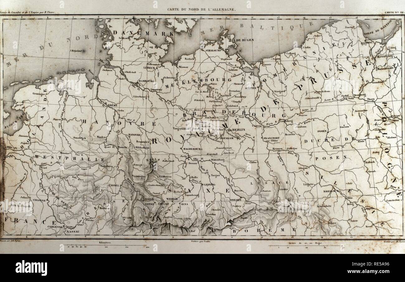 Map of north Germany. Atlas de l'Histoire du Consulat et de l'Empire. History of the Consulate and the Empire of France under Napoleon by Marie Joseph Louis Adolphe Thiers (1797-1877). Drawings by Dufour, engravings by Dyonnet. Edited in Paris, 1864. Stock Photohttps://www.alamy.com/image-license-details/?v=1https://www.alamy.com/map-of-north-germany-atlas-de-lhistoire-du-consulat-et-de-lempire-history-of-the-consulate-and-the-empire-of-france-under-napoleon-by-marie-joseph-louis-adolphe-thiers-1797-1877-drawings-by-dufour-engravings-by-dyonnet-edited-in-paris-1864-image232457826.html
RMRE5A96–Map of north Germany. Atlas de l'Histoire du Consulat et de l'Empire. History of the Consulate and the Empire of France under Napoleon by Marie Joseph Louis Adolphe Thiers (1797-1877). Drawings by Dufour, engravings by Dyonnet. Edited in Paris, 1864.
 . Plan de Paris Illustre 1864. English: An extremely attractive map of Paris, France issued in 1864 by the Garnier Freres. Covers the old walled city of Paris and the immediate vicinity. Important buildings are shown in profile. All major streets are identified. Color coded according to arrondissements. The four corners are occupied by a street index. The Coat of Arms of Paris appears in the upper right and left quadrants. . 1864 (dated) 9 1864 Garnier Map of Pairs, France w-Monuments - Geographicus - Paris-garnier-1864 (cropped) Stock Photohttps://www.alamy.com/image-license-details/?v=1https://www.alamy.com/plan-de-paris-illustre-1864-english-an-extremely-attractive-map-of-paris-france-issued-in-1864-by-the-garnier-freres-covers-the-old-walled-city-of-paris-and-the-immediate-vicinity-important-buildings-are-shown-in-profile-all-major-streets-are-identified-color-coded-according-to-arrondissements-the-four-corners-are-occupied-by-a-street-index-the-coat-of-arms-of-paris-appears-in-the-upper-right-and-left-quadrants-1864-dated-9-1864-garnier-map-of-pairs-france-w-monuments-geographicus-paris-garnier-1864-cropped-image188134630.html
RMMX27HX–. Plan de Paris Illustre 1864. English: An extremely attractive map of Paris, France issued in 1864 by the Garnier Freres. Covers the old walled city of Paris and the immediate vicinity. Important buildings are shown in profile. All major streets are identified. Color coded according to arrondissements. The four corners are occupied by a street index. The Coat of Arms of Paris appears in the upper right and left quadrants. . 1864 (dated) 9 1864 Garnier Map of Pairs, France w-Monuments - Geographicus - Paris-garnier-1864 (cropped)
 Map of Austria and Moravia. Atlas de l'Histoire du Consulat et de l'Empire. History of the Consulate and the Empire of France under Napoleon by Marie Joseph Louis Adolphe Thiers (1797-1877). Drawings by Dufour, engravings by Dyonnet. Edited in Paris, 1864. Stock Photohttps://www.alamy.com/image-license-details/?v=1https://www.alamy.com/map-of-austria-and-moravia-atlas-de-lhistoire-du-consulat-et-de-lempire-history-of-the-consulate-and-the-empire-of-france-under-napoleon-by-marie-joseph-louis-adolphe-thiers-1797-1877-drawings-by-dufour-engravings-by-dyonnet-edited-in-paris-1864-image232457768.html
RMRE5A74–Map of Austria and Moravia. Atlas de l'Histoire du Consulat et de l'Empire. History of the Consulate and the Empire of France under Napoleon by Marie Joseph Louis Adolphe Thiers (1797-1877). Drawings by Dufour, engravings by Dyonnet. Edited in Paris, 1864.
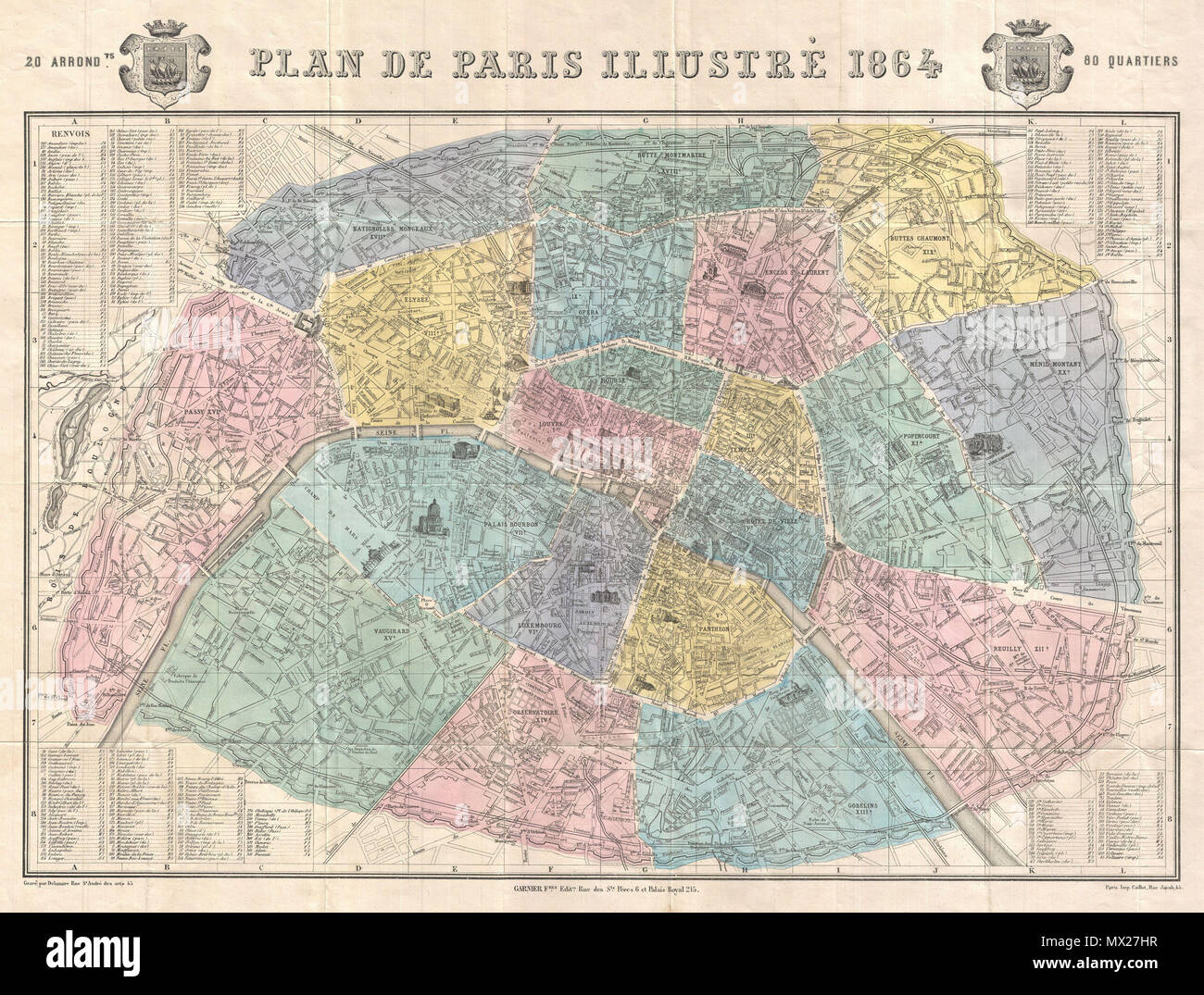 . Plan de Paris Illustre 1864. English: An extremely attractive map of Paris, France issued in 1864 by the Garnier Freres. Covers the old walled city of Paris and the immediate vicinity. Important buildings are shown in profile. All major streets are identified. Color coded according to arrondissements. The four corners are occupied by a street index. The Coat of Arms of Paris appears in the upper right and left quadrants. . 1864 (dated) 9 1864 Garnier Map of Pairs, France w-Monuments - Geographicus - Paris-garnier-1864 Stock Photohttps://www.alamy.com/image-license-details/?v=1https://www.alamy.com/plan-de-paris-illustre-1864-english-an-extremely-attractive-map-of-paris-france-issued-in-1864-by-the-garnier-freres-covers-the-old-walled-city-of-paris-and-the-immediate-vicinity-important-buildings-are-shown-in-profile-all-major-streets-are-identified-color-coded-according-to-arrondissements-the-four-corners-are-occupied-by-a-street-index-the-coat-of-arms-of-paris-appears-in-the-upper-right-and-left-quadrants-1864-dated-9-1864-garnier-map-of-pairs-france-w-monuments-geographicus-paris-garnier-1864-image188134627.html
RMMX27HR–. Plan de Paris Illustre 1864. English: An extremely attractive map of Paris, France issued in 1864 by the Garnier Freres. Covers the old walled city of Paris and the immediate vicinity. Important buildings are shown in profile. All major streets are identified. Color coded according to arrondissements. The four corners are occupied by a street index. The Coat of Arms of Paris appears in the upper right and left quadrants. . 1864 (dated) 9 1864 Garnier Map of Pairs, France w-Monuments - Geographicus - Paris-garnier-1864
 General map of Germany. Atlas de l'Histoire du Consulat et de l'Empire. History of the Consulate and the Empire of France under Napoleon by Marie Joseph Louis Adolphe Thiers (1797-1877). Drawings by Dufour, engravings by Dyonnet. Edited in Paris, 1864. Stock Photohttps://www.alamy.com/image-license-details/?v=1https://www.alamy.com/general-map-of-germany-atlas-de-lhistoire-du-consulat-et-de-lempire-history-of-the-consulate-and-the-empire-of-france-under-napoleon-by-marie-joseph-louis-adolphe-thiers-1797-1877-drawings-by-dufour-engravings-by-dyonnet-edited-in-paris-1864-image232457721.html
RMRE5A5D–General map of Germany. Atlas de l'Histoire du Consulat et de l'Empire. History of the Consulate and the Empire of France under Napoleon by Marie Joseph Louis Adolphe Thiers (1797-1877). Drawings by Dufour, engravings by Dyonnet. Edited in Paris, 1864.
 . Plan de Paris Illustre 1864. English: An extremely attractive map of Paris, France issued in 1864 by the Garnier Freres. Covers the old walled city of Paris and the immediate vicinity. Important buildings are shown in profile. All major streets are identified. Color coded according to arrondissements. The four corners are occupied by a street index. The Coat of Arms of Paris appears in the upper right and left quadrants. . 1864 (dated) 8 1864 Garnier Map of Pairs, France w-Monuments - Geographicus - Paris-garnier-1864 (cropped) Stock Photohttps://www.alamy.com/image-license-details/?v=1https://www.alamy.com/plan-de-paris-illustre-1864-english-an-extremely-attractive-map-of-paris-france-issued-in-1864-by-the-garnier-freres-covers-the-old-walled-city-of-paris-and-the-immediate-vicinity-important-buildings-are-shown-in-profile-all-major-streets-are-identified-color-coded-according-to-arrondissements-the-four-corners-are-occupied-by-a-street-index-the-coat-of-arms-of-paris-appears-in-the-upper-right-and-left-quadrants-1864-dated-8-1864-garnier-map-of-pairs-france-w-monuments-geographicus-paris-garnier-1864-cropped-image188898173.html
RMMY91F9–. Plan de Paris Illustre 1864. English: An extremely attractive map of Paris, France issued in 1864 by the Garnier Freres. Covers the old walled city of Paris and the immediate vicinity. Important buildings are shown in profile. All major streets are identified. Color coded according to arrondissements. The four corners are occupied by a street index. The Coat of Arms of Paris appears in the upper right and left quadrants. . 1864 (dated) 8 1864 Garnier Map of Pairs, France w-Monuments - Geographicus - Paris-garnier-1864 (cropped)
 Napoleonic map. Brienne, surroundings of the city. France. Atlas de l'Histoire du Consulat et de l'Empire. History of the Consulate and the Empire of France under Napoleon by Marie Joseph Louis Adolphe Thiers (1797-1877). Drawings by Dufour, engravings by Dyonnet. Edited in Paris, 1864. Stock Photohttps://www.alamy.com/image-license-details/?v=1https://www.alamy.com/napoleonic-map-brienne-surroundings-of-the-city-france-atlas-de-lhistoire-du-consulat-et-de-lempire-history-of-the-consulate-and-the-empire-of-france-under-napoleon-by-marie-joseph-louis-adolphe-thiers-1797-1877-drawings-by-dufour-engravings-by-dyonnet-edited-in-paris-1864-image232457833.html
RMRE5A9D–Napoleonic map. Brienne, surroundings of the city. France. Atlas de l'Histoire du Consulat et de l'Empire. History of the Consulate and the Empire of France under Napoleon by Marie Joseph Louis Adolphe Thiers (1797-1877). Drawings by Dufour, engravings by Dyonnet. Edited in Paris, 1864.
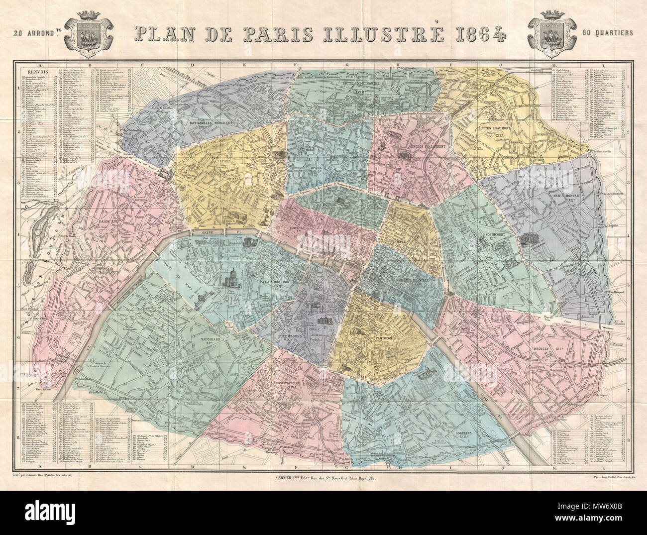 . Plan de Paris Illustre 1864. English: An extremely attractive map of Paris, France issued in 1864 by the Garnier Freres. Covers the old walled city of Paris and the immediate vicinity. Important buildings are shown in profile. All major streets are identified. Color coded according to arrondissements. The four corners are occupied by a street index. The Coat of Arms of Paris appears in the upper right and left quadrants. . 1864 (dated) 9 1864 Garnier Map of Pairs, France w-Monuments - Geographicus - Paris-garnier-1864 Stock Photohttps://www.alamy.com/image-license-details/?v=1https://www.alamy.com/plan-de-paris-illustre-1864-english-an-extremely-attractive-map-of-paris-france-issued-in-1864-by-the-garnier-freres-covers-the-old-walled-city-of-paris-and-the-immediate-vicinity-important-buildings-are-shown-in-profile-all-major-streets-are-identified-color-coded-according-to-arrondissements-the-four-corners-are-occupied-by-a-street-index-the-coat-of-arms-of-paris-appears-in-the-upper-right-and-left-quadrants-1864-dated-9-1864-garnier-map-of-pairs-france-w-monuments-geographicus-paris-garnier-1864-image187622187.html
RMMW6X0B–. Plan de Paris Illustre 1864. English: An extremely attractive map of Paris, France issued in 1864 by the Garnier Freres. Covers the old walled city of Paris and the immediate vicinity. Important buildings are shown in profile. All major streets are identified. Color coded according to arrondissements. The four corners are occupied by a street index. The Coat of Arms of Paris appears in the upper right and left quadrants. . 1864 (dated) 9 1864 Garnier Map of Pairs, France w-Monuments - Geographicus - Paris-garnier-1864
 Napoleonic map. Surroundings of Paris. France. Atlas de l'Histoire du Consulat et de l'Empire. History of the Consulate and the Empire of France under Napoleon by Marie Joseph Louis Adolphe Thiers (1797-1877). Drawings by Dufour, engravings by Dyonnet. Edited in Paris, 1864. Stock Photohttps://www.alamy.com/image-license-details/?v=1https://www.alamy.com/napoleonic-map-surroundings-of-paris-france-atlas-de-lhistoire-du-consulat-et-de-lempire-history-of-the-consulate-and-the-empire-of-france-under-napoleon-by-marie-joseph-louis-adolphe-thiers-1797-1877-drawings-by-dufour-engravings-by-dyonnet-edited-in-paris-1864-image232457727.html
RMRE5A5K–Napoleonic map. Surroundings of Paris. France. Atlas de l'Histoire du Consulat et de l'Empire. History of the Consulate and the Empire of France under Napoleon by Marie Joseph Louis Adolphe Thiers (1797-1877). Drawings by Dufour, engravings by Dyonnet. Edited in Paris, 1864.
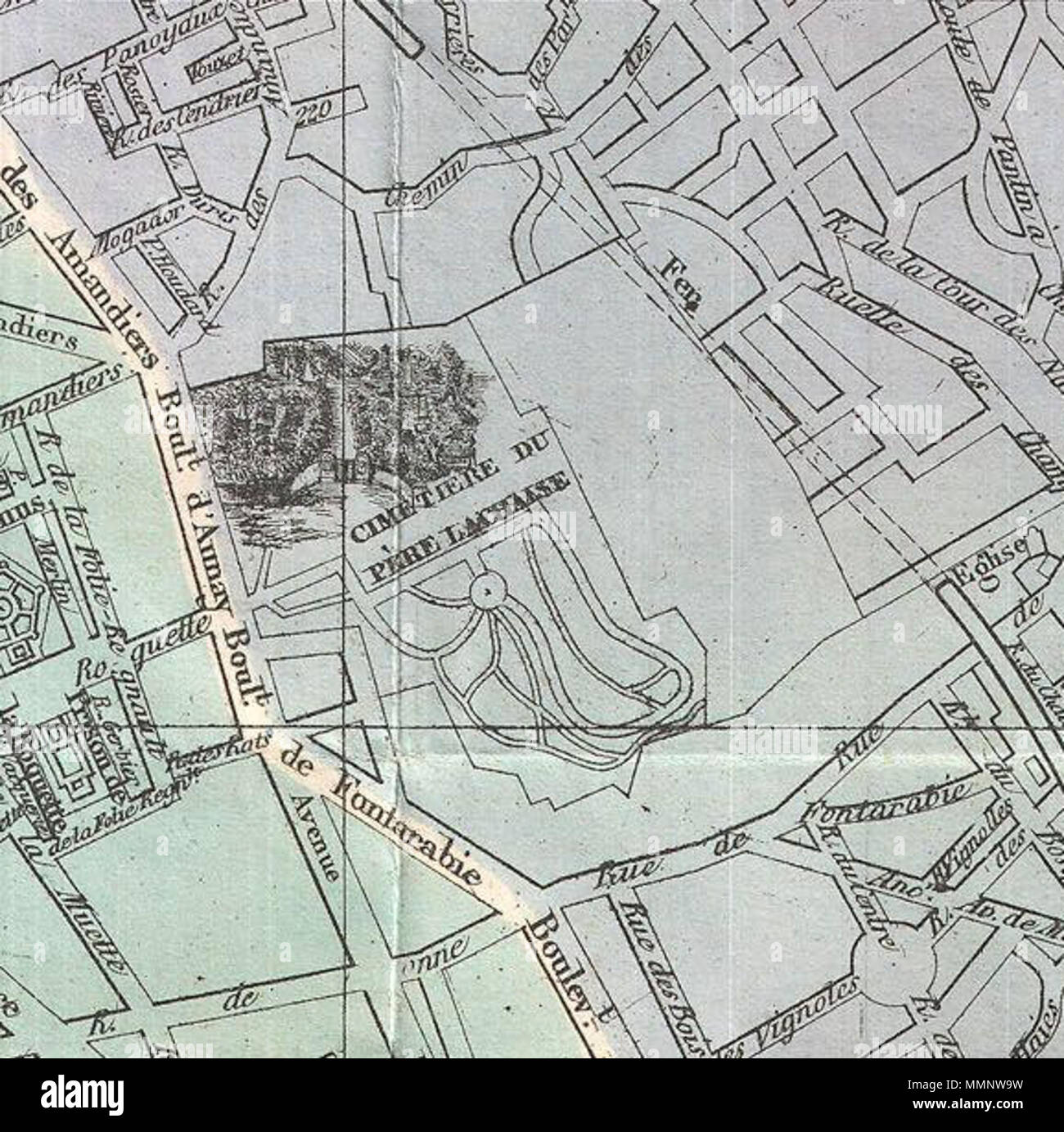 . English: An extremely attractive map of Paris, France issued in 1864 by the Garnier Freres. Covers the old walled city of Paris and the immediate vicinity. Important buildings are shown in profile. All major streets are identified. Color coded according to arrondissements. The four corners are occupied by a street index. The Coat of Arms of Paris appears in the upper right and left quadrants. Plan de Paris Illustre 1864.. 1864 (dated). 9 1864 Garnier Map of Pairs, France w-Monuments - Geographicus - Paris-garnier-1864 (cropped) Stock Photohttps://www.alamy.com/image-license-details/?v=1https://www.alamy.com/english-an-extremely-attractive-map-of-paris-france-issued-in-1864-by-the-garnier-freres-covers-the-old-walled-city-of-paris-and-the-immediate-vicinity-important-buildings-are-shown-in-profile-all-major-streets-are-identified-color-coded-according-to-arrondissements-the-four-corners-are-occupied-by-a-street-index-the-coat-of-arms-of-paris-appears-in-the-upper-right-and-left-quadrants-plan-de-paris-illustre-1864-1864-dated-9-1864-garnier-map-of-pairs-france-w-monuments-geographicus-paris-garnier-1864-cropped-image184877669.html
RMMMNW9W–. English: An extremely attractive map of Paris, France issued in 1864 by the Garnier Freres. Covers the old walled city of Paris and the immediate vicinity. Important buildings are shown in profile. All major streets are identified. Color coded according to arrondissements. The four corners are occupied by a street index. The Coat of Arms of Paris appears in the upper right and left quadrants. Plan de Paris Illustre 1864.. 1864 (dated). 9 1864 Garnier Map of Pairs, France w-Monuments - Geographicus - Paris-garnier-1864 (cropped)
 Map of Franconia and Saxony (Germany). Atlas de l'Histoire du Consulat et de l'Empire. History of the Consulate and the Empire of France under Napoleon by Marie Joseph Louis Adolphe Thiers (1797-1877). Drawings by Dufour, engravings by Dyonnet. Edited in Paris, 1864. Stock Photohttps://www.alamy.com/image-license-details/?v=1https://www.alamy.com/map-of-franconia-and-saxony-germany-atlas-de-lhistoire-du-consulat-et-de-lempire-history-of-the-consulate-and-the-empire-of-france-under-napoleon-by-marie-joseph-louis-adolphe-thiers-1797-1877-drawings-by-dufour-engravings-by-dyonnet-edited-in-paris-1864-image232457699.html
RMRE5A4K–Map of Franconia and Saxony (Germany). Atlas de l'Histoire du Consulat et de l'Empire. History of the Consulate and the Empire of France under Napoleon by Marie Joseph Louis Adolphe Thiers (1797-1877). Drawings by Dufour, engravings by Dyonnet. Edited in Paris, 1864.
 . English: An extremely attractive map of Paris, France issued in 1864 by the Garnier Freres. Covers the old walled city of Paris and the immediate vicinity. Important buildings are shown in profile. All major streets are identified. Color coded according to arrondissements. The four corners are occupied by a street index. The Coat of Arms of Paris appears in the upper right and left quadrants. Plan de Paris Illustre 1864.. 1864 (dated). 9 1864 Garnier Map of Pairs, France w-Monuments - Geographicus - Paris-garnier-1864 Stock Photohttps://www.alamy.com/image-license-details/?v=1https://www.alamy.com/english-an-extremely-attractive-map-of-paris-france-issued-in-1864-by-the-garnier-freres-covers-the-old-walled-city-of-paris-and-the-immediate-vicinity-important-buildings-are-shown-in-profile-all-major-streets-are-identified-color-coded-according-to-arrondissements-the-four-corners-are-occupied-by-a-street-index-the-coat-of-arms-of-paris-appears-in-the-upper-right-and-left-quadrants-plan-de-paris-illustre-1864-1864-dated-9-1864-garnier-map-of-pairs-france-w-monuments-geographicus-paris-garnier-1864-image184877672.html
RMMMNWA0–. English: An extremely attractive map of Paris, France issued in 1864 by the Garnier Freres. Covers the old walled city of Paris and the immediate vicinity. Important buildings are shown in profile. All major streets are identified. Color coded according to arrondissements. The four corners are occupied by a street index. The Coat of Arms of Paris appears in the upper right and left quadrants. Plan de Paris Illustre 1864.. 1864 (dated). 9 1864 Garnier Map of Pairs, France w-Monuments - Geographicus - Paris-garnier-1864
 Napoleonic map. Surroundings of Vienna, Austria. Atlas de l'Histoire du Consulat et de l'Empire. Consulate and the Empire of France under Napoleon by Marie Joseph Louis Adolphe Thiers (1797-1877). Drawings by Dufour, engravings by Dyonnet. Edited in Paris, 1864. Stock Photohttps://www.alamy.com/image-license-details/?v=1https://www.alamy.com/napoleonic-map-surroundings-of-vienna-austria-atlas-de-lhistoire-du-consulat-et-de-lempire-consulate-and-the-empire-of-france-under-napoleon-by-marie-joseph-louis-adolphe-thiers-1797-1877-drawings-by-dufour-engravings-by-dyonnet-edited-in-paris-1864-image232457827.html
RMRE5A97–Napoleonic map. Surroundings of Vienna, Austria. Atlas de l'Histoire du Consulat et de l'Empire. Consulate and the Empire of France under Napoleon by Marie Joseph Louis Adolphe Thiers (1797-1877). Drawings by Dufour, engravings by Dyonnet. Edited in Paris, 1864.
 N/A. English: Orphanage, The Hague, plan ground floor. 1863-1864 (construction) Nederlands: Weeshuis van de Nederduits-hervormde gemeente, Den Haag, plattegrond begane grond. 1863-1864 (bouw). 1869 (publication). Elie Saraber (1808–1878) Description Dutch architect Date of birth/death 4 August 1808 19 January 1878 Location of birth/death The Hague The Hague Work location The Hague (1848-1850), Lisse Authority control : Q17351479 BPN:83511968 RKD:366838 446 Diakonie-weeshuis Den Haag plan ground floor Stock Photohttps://www.alamy.com/image-license-details/?v=1https://www.alamy.com/na-english-orphanage-the-hague-plan-ground-floor-1863-1864-construction-nederlands-weeshuis-van-de-nederduits-hervormde-gemeente-den-haag-plattegrond-begane-grond-1863-1864-bouw-1869-publication-elie-saraber-18081878-description-dutch-architect-date-of-birthdeath-4-august-1808-19-january-1878-location-of-birthdeath-the-hague-the-hague-work-location-the-hague-1848-1850-lisse-authority-control-q17351479-bpn83511968-rkd366838-446-diakonie-weeshuis-den-haag-plan-ground-floor-image209971012.html
RMP5H04M–N/A. English: Orphanage, The Hague, plan ground floor. 1863-1864 (construction) Nederlands: Weeshuis van de Nederduits-hervormde gemeente, Den Haag, plattegrond begane grond. 1863-1864 (bouw). 1869 (publication). Elie Saraber (1808–1878) Description Dutch architect Date of birth/death 4 August 1808 19 January 1878 Location of birth/death The Hague The Hague Work location The Hague (1848-1850), Lisse Authority control : Q17351479 BPN:83511968 RKD:366838 446 Diakonie-weeshuis Den Haag plan ground floor
 Napoleonic map. Eastern France. Detail of the surroundings of Paris. Atlas de l'Histoire du Consulat et de l'Empire. History of the Consulate and the Empire of France under Napoleon by Marie Joseph Louis Adolphe Thiers (1797-1877). Drawings by Dufour, engravings by Dyonnet. Edited in Paris, 1864. Stock Photohttps://www.alamy.com/image-license-details/?v=1https://www.alamy.com/napoleonic-map-eastern-france-detail-of-the-surroundings-of-paris-atlas-de-lhistoire-du-consulat-et-de-lempire-history-of-the-consulate-and-the-empire-of-france-under-napoleon-by-marie-joseph-louis-adolphe-thiers-1797-1877-drawings-by-dufour-engravings-by-dyonnet-edited-in-paris-1864-image232457718.html
RMRE5A5A–Napoleonic map. Eastern France. Detail of the surroundings of Paris. Atlas de l'Histoire du Consulat et de l'Empire. History of the Consulate and the Empire of France under Napoleon by Marie Joseph Louis Adolphe Thiers (1797-1877). Drawings by Dufour, engravings by Dyonnet. Edited in Paris, 1864.
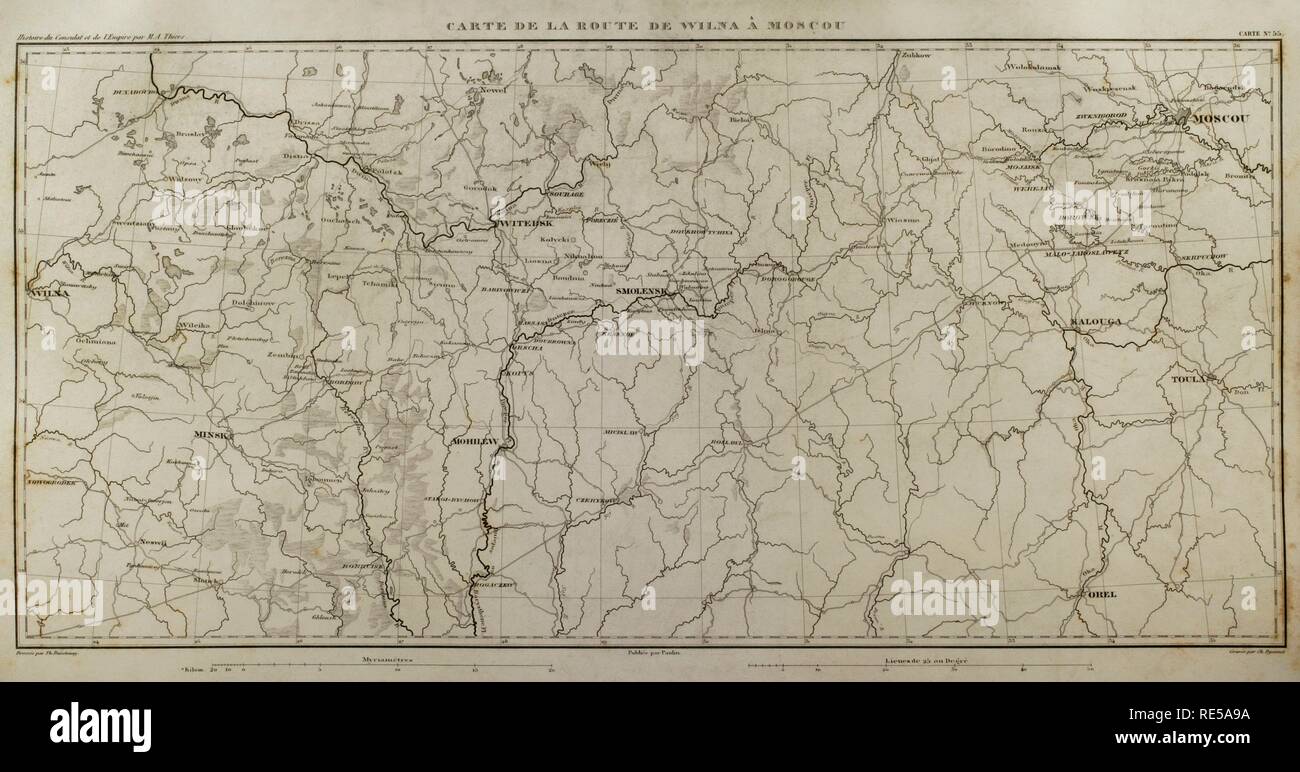 Napoleonic map. Route from Vilnius to Moscow. Atlas de l'Histoire du Consulat et de l'Empire. History of the Consulate and the Empire of France under Napoleon by Marie Joseph Louis Adolphe Thiers (1797-1877). Drawings by Dufour, engravings by Dyonnet. Edited in Paris, 1864. Stock Photohttps://www.alamy.com/image-license-details/?v=1https://www.alamy.com/napoleonic-map-route-from-vilnius-to-moscow-atlas-de-lhistoire-du-consulat-et-de-lempire-history-of-the-consulate-and-the-empire-of-france-under-napoleon-by-marie-joseph-louis-adolphe-thiers-1797-1877-drawings-by-dufour-engravings-by-dyonnet-edited-in-paris-1864-image232457830.html
RMRE5A9A–Napoleonic map. Route from Vilnius to Moscow. Atlas de l'Histoire du Consulat et de l'Empire. History of the Consulate and the Empire of France under Napoleon by Marie Joseph Louis Adolphe Thiers (1797-1877). Drawings by Dufour, engravings by Dyonnet. Edited in Paris, 1864.
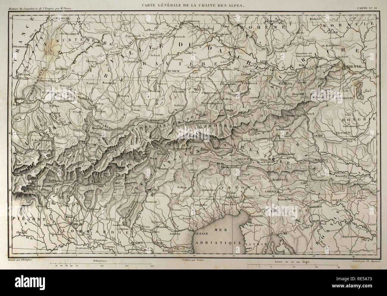 Map of mountain range of the Alps. Atlas de l'Histoire du Consulat et de l'Empire. History of the Consulate and the Empire of France under Napoleon by Marie Joseph Louis Adolphe Thiers (1797-1877). Drawings by Dufour, engravings by Dyonnet. Edited in Paris, 1864. Stock Photohttps://www.alamy.com/image-license-details/?v=1https://www.alamy.com/map-of-mountain-range-of-the-alps-atlas-de-lhistoire-du-consulat-et-de-lempire-history-of-the-consulate-and-the-empire-of-france-under-napoleon-by-marie-joseph-louis-adolphe-thiers-1797-1877-drawings-by-dufour-engravings-by-dyonnet-edited-in-paris-1864-image232457767.html
RMRE5A73–Map of mountain range of the Alps. Atlas de l'Histoire du Consulat et de l'Empire. History of the Consulate and the Empire of France under Napoleon by Marie Joseph Louis Adolphe Thiers (1797-1877). Drawings by Dufour, engravings by Dyonnet. Edited in Paris, 1864.
 Napoleonic map. Eastern France. Atlas de l'Histoire du Consulat et de l'Empire. History of the Consulate and the Empire of France under Napoleon by Marie Joseph Louis Adolphe Thiers (1797-1877). Drawings by Dufour, engravings by Dyonnet. Edited in Paris, 1864. Stock Photohttps://www.alamy.com/image-license-details/?v=1https://www.alamy.com/napoleonic-map-eastern-france-atlas-de-lhistoire-du-consulat-et-de-lempire-history-of-the-consulate-and-the-empire-of-france-under-napoleon-by-marie-joseph-louis-adolphe-thiers-1797-1877-drawings-by-dufour-engravings-by-dyonnet-edited-in-paris-1864-image232457698.html
RMRE5A4J–Napoleonic map. Eastern France. Atlas de l'Histoire du Consulat et de l'Empire. History of the Consulate and the Empire of France under Napoleon by Marie Joseph Louis Adolphe Thiers (1797-1877). Drawings by Dufour, engravings by Dyonnet. Edited in Paris, 1864.
 Napoleonic map of European Russia. Atlas de l'Histoire du Consulat et de l'Empire. History of the Consulate and the Empire of France under Napoleon by Marie Joseph Louis Adolphe Thiers (1797-1877). Drawings by Dufour, engravings by Dyonnet. Edited in Paris, 1864. Stock Photohttps://www.alamy.com/image-license-details/?v=1https://www.alamy.com/napoleonic-map-of-european-russia-atlas-de-lhistoire-du-consulat-et-de-lempire-history-of-the-consulate-and-the-empire-of-france-under-napoleon-by-marie-joseph-louis-adolphe-thiers-1797-1877-drawings-by-dufour-engravings-by-dyonnet-edited-in-paris-1864-image232457760.html
RMRE5A6T–Napoleonic map of European Russia. Atlas de l'Histoire du Consulat et de l'Empire. History of the Consulate and the Empire of France under Napoleon by Marie Joseph Louis Adolphe Thiers (1797-1877). Drawings by Dufour, engravings by Dyonnet. Edited in Paris, 1864.
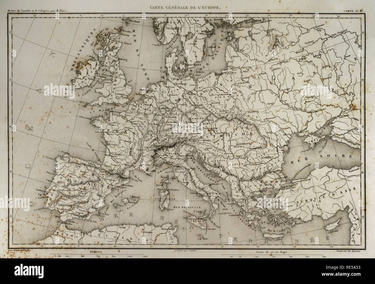 General map of Europe. Atlas de l'Histoire du Consulat et de l'Empire. History of the Consulate and the Empire of France under Napoleon by Marie Joseph Louis Adolphe Thiers (1797-1877). Drawings by Dufour, engravings by Dyonnet. Edited in Paris, 1864. Stock Photohttps://www.alamy.com/image-license-details/?v=1https://www.alamy.com/general-map-of-europe-atlas-de-lhistoire-du-consulat-et-de-lempire-history-of-the-consulate-and-the-empire-of-france-under-napoleon-by-marie-joseph-louis-adolphe-thiers-1797-1877-drawings-by-dufour-engravings-by-dyonnet-edited-in-paris-1864-image232457711.html
RMRE5A53–General map of Europe. Atlas de l'Histoire du Consulat et de l'Empire. History of the Consulate and the Empire of France under Napoleon by Marie Joseph Louis Adolphe Thiers (1797-1877). Drawings by Dufour, engravings by Dyonnet. Edited in Paris, 1864.
 Map of the territory between the river Rhine and the Danube. Atlas de l'Histoire du Consulat et de l'Empire. History of the Consulate and the Empire of France under Napoleon by Marie Joseph Louis Adolphe Thiers (1797-1877). Drawings by Dufour, engravings by Dyonnet. Edited in Paris, 1864. Stock Photohttps://www.alamy.com/image-license-details/?v=1https://www.alamy.com/map-of-the-territory-between-the-river-rhine-and-the-danube-atlas-de-lhistoire-du-consulat-et-de-lempire-history-of-the-consulate-and-the-empire-of-france-under-napoleon-by-marie-joseph-louis-adolphe-thiers-1797-1877-drawings-by-dufour-engravings-by-dyonnet-edited-in-paris-1864-image232457832.html
RMRE5A9C–Map of the territory between the river Rhine and the Danube. Atlas de l'Histoire du Consulat et de l'Empire. History of the Consulate and the Empire of France under Napoleon by Marie Joseph Louis Adolphe Thiers (1797-1877). Drawings by Dufour, engravings by Dyonnet. Edited in Paris, 1864.
 Napoleonic map. City of Moscow. Atlas de l'Histoire du Consulat et de l'Empire. History of the Consulate and the Empire of France under Napoleon by Marie Joseph Louis Adolphe Thiers (1797-1877). Drawings by Dufour, engravings by Dyonnet. Edited in Paris, 1864. Stock Photohttps://www.alamy.com/image-license-details/?v=1https://www.alamy.com/napoleonic-map-city-of-moscow-atlas-de-lhistoire-du-consulat-et-de-lempire-history-of-the-consulate-and-the-empire-of-france-under-napoleon-by-marie-joseph-louis-adolphe-thiers-1797-1877-drawings-by-dufour-engravings-by-dyonnet-edited-in-paris-1864-image232457752.html
RMRE5A6G–Napoleonic map. City of Moscow. Atlas de l'Histoire du Consulat et de l'Empire. History of the Consulate and the Empire of France under Napoleon by Marie Joseph Louis Adolphe Thiers (1797-1877). Drawings by Dufour, engravings by Dyonnet. Edited in Paris, 1864.
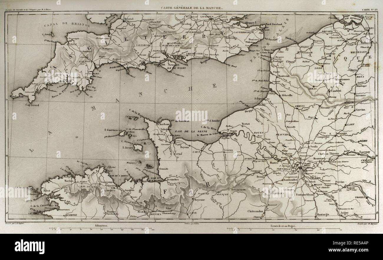 Napoleonic map. English Channel. Atlas de l'Histoire du Consulat et de l'Empire. History of the Consulate and the Empire of France under Napoleon by Marie Joseph Louis Adolphe Thiers (1797-1877). Drawings by Dufour, engravings by Dyonnet. Edited in Paris, 1864. Stock Photohttps://www.alamy.com/image-license-details/?v=1https://www.alamy.com/napoleonic-map-english-channel-atlas-de-lhistoire-du-consulat-et-de-lempire-history-of-the-consulate-and-the-empire-of-france-under-napoleon-by-marie-joseph-louis-adolphe-thiers-1797-1877-drawings-by-dufour-engravings-by-dyonnet-edited-in-paris-1864-image232457702.html
RMRE5A4P–Napoleonic map. English Channel. Atlas de l'Histoire du Consulat et de l'Empire. History of the Consulate and the Empire of France under Napoleon by Marie Joseph Louis Adolphe Thiers (1797-1877). Drawings by Dufour, engravings by Dyonnet. Edited in Paris, 1864.
 Napoleonic map. East Prussia and Poland. Atlas de l'Histoire du Consulat et de l'Empire. History of the Consulate and the Empire of France under Napoleon by Marie Joseph Louis Adolphe Thiers (1797-1877). Drawings by Dufour, engravings by Dyonnet. Edited in Paris, 1864. Stock Photohttps://www.alamy.com/image-license-details/?v=1https://www.alamy.com/napoleonic-map-east-prussia-and-poland-atlas-de-lhistoire-du-consulat-et-de-lempire-history-of-the-consulate-and-the-empire-of-france-under-napoleon-by-marie-joseph-louis-adolphe-thiers-1797-1877-drawings-by-dufour-engravings-by-dyonnet-edited-in-paris-1864-image232457765.html
RMRE5A71–Napoleonic map. East Prussia and Poland. Atlas de l'Histoire du Consulat et de l'Empire. History of the Consulate and the Empire of France under Napoleon by Marie Joseph Louis Adolphe Thiers (1797-1877). Drawings by Dufour, engravings by Dyonnet. Edited in Paris, 1864.
 Napoleonic map. Territory between the Danube and Isar rivers, from Regensburg to Landshut (Germany). Atlas de l'Histoire du Consulat et de l'Empire. History of the Consulate and the Empire of France under Napoleon by Marie Joseph Louis Adolphe Thiers (1797-1877). Drawings by Dufour, engravings by Dyonnet. Edited in Paris, 1864. Stock Photohttps://www.alamy.com/image-license-details/?v=1https://www.alamy.com/napoleonic-map-territory-between-the-danube-and-isar-rivers-from-regensburg-to-landshut-germany-atlas-de-lhistoire-du-consulat-et-de-lempire-history-of-the-consulate-and-the-empire-of-france-under-napoleon-by-marie-joseph-louis-adolphe-thiers-1797-1877-drawings-by-dufour-engravings-by-dyonnet-edited-in-paris-1864-image232457763.html
RMRE5A6Y–Napoleonic map. Territory between the Danube and Isar rivers, from Regensburg to Landshut (Germany). Atlas de l'Histoire du Consulat et de l'Empire. History of the Consulate and the Empire of France under Napoleon by Marie Joseph Louis Adolphe Thiers (1797-1877). Drawings by Dufour, engravings by Dyonnet. Edited in Paris, 1864.
 Napoleonic map. City of Gdansk and its surroundings (current Poland). Atlas de l'Histoire du Consulat et de l'Empire. History of the Consulate and the Empire of France under Napoleon by Marie Joseph Louis Adolphe Thiers (1797-1877). Drawings by Dufour, engravings by Dyonnet. Edited in Paris, 1864. Stock Photohttps://www.alamy.com/image-license-details/?v=1https://www.alamy.com/napoleonic-map-city-of-gdansk-and-its-surroundings-current-poland-atlas-de-lhistoire-du-consulat-et-de-lempire-history-of-the-consulate-and-the-empire-of-france-under-napoleon-by-marie-joseph-louis-adolphe-thiers-1797-1877-drawings-by-dufour-engravings-by-dyonnet-edited-in-paris-1864-image232457726.html
RMRE5A5J–Napoleonic map. City of Gdansk and its surroundings (current Poland). Atlas de l'Histoire du Consulat et de l'Empire. History of the Consulate and the Empire of France under Napoleon by Marie Joseph Louis Adolphe Thiers (1797-1877). Drawings by Dufour, engravings by Dyonnet. Edited in Paris, 1864.
 Napoleonic map. City of Smolensk, Russia. It was destroyed during the invasion of Napoleon I. Atlas de l'Histoire du Consulat et de l'Empire. History of the Consulate and the Empire of France under Napoleon by Marie Joseph Louis Adolphe Thiers (1797-1877). Drawings by Dufour, engravings by Dyonnet. Edited in Paris, 1864. Stock Photohttps://www.alamy.com/image-license-details/?v=1https://www.alamy.com/napoleonic-map-city-of-smolensk-russia-it-was-destroyed-during-the-invasion-of-napoleon-i-atlas-de-lhistoire-du-consulat-et-de-lempire-history-of-the-consulate-and-the-empire-of-france-under-napoleon-by-marie-joseph-louis-adolphe-thiers-1797-1877-drawings-by-dufour-engravings-by-dyonnet-edited-in-paris-1864-image232457716.html
RMRE5A58–Napoleonic map. City of Smolensk, Russia. It was destroyed during the invasion of Napoleon I. Atlas de l'Histoire du Consulat et de l'Empire. History of the Consulate and the Empire of France under Napoleon by Marie Joseph Louis Adolphe Thiers (1797-1877). Drawings by Dufour, engravings by Dyonnet. Edited in Paris, 1864.
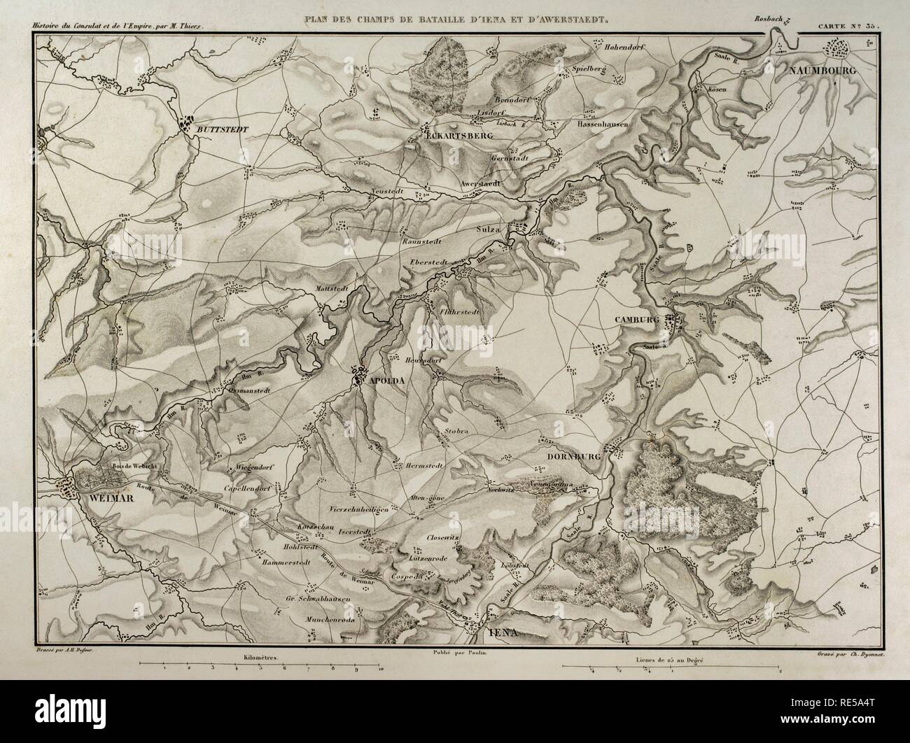 Napoleonic map. Battlefields of the Battle of Jena-Auerstedt (14th October 1806). Atlas de l'Histoire du Consulat et de l'Empire. History of the Consulate and the Empire of France under Napoleon by Marie Joseph Louis Adolphe Thiers (1797-1877). Drawings by Dufour, engravings by Dyonnet. Edited in Paris, 1864. Stock Photohttps://www.alamy.com/image-license-details/?v=1https://www.alamy.com/napoleonic-map-battlefields-of-the-battle-of-jena-auerstedt-14th-october-1806-atlas-de-lhistoire-du-consulat-et-de-lempire-history-of-the-consulate-and-the-empire-of-france-under-napoleon-by-marie-joseph-louis-adolphe-thiers-1797-1877-drawings-by-dufour-engravings-by-dyonnet-edited-in-paris-1864-image232457704.html
RMRE5A4T–Napoleonic map. Battlefields of the Battle of Jena-Auerstedt (14th October 1806). Atlas de l'Histoire du Consulat et de l'Empire. History of the Consulate and the Empire of France under Napoleon by Marie Joseph Louis Adolphe Thiers (1797-1877). Drawings by Dufour, engravings by Dyonnet. Edited in Paris, 1864.
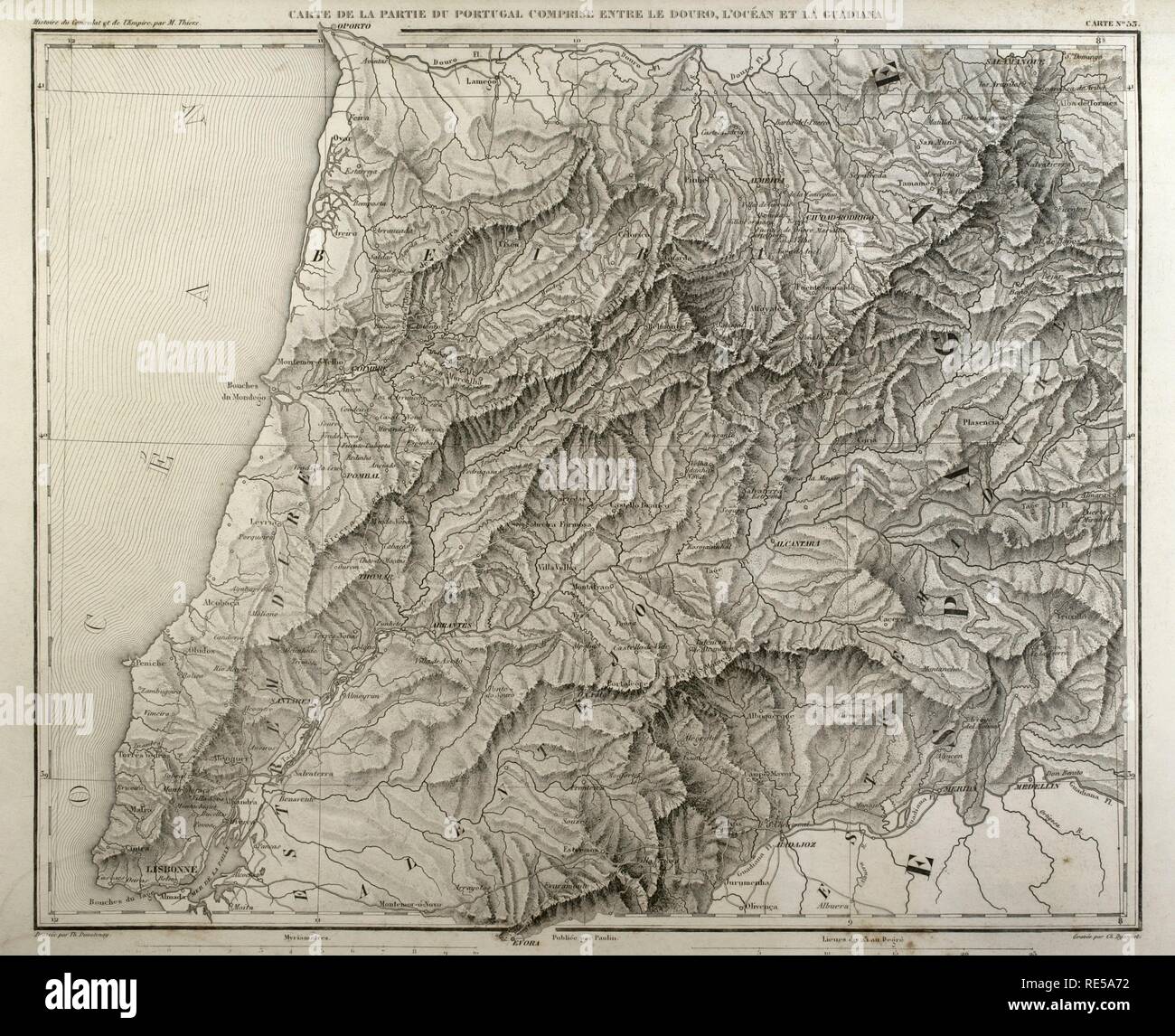 Napoleonic map. Portugal, detail of the territory between the Douro river, Atlantic Ocean and Guadiana river. Atlas de l'Histoire du Consulat et de l'Empire. History of the Consulate and the Empire of France under Napoleon by Marie Joseph Louis Adolphe Thiers (1797-1877). Drawings by Dufour, engravings by Dyonnet. Edited in Paris, 1864. Stock Photohttps://www.alamy.com/image-license-details/?v=1https://www.alamy.com/napoleonic-map-portugal-detail-of-the-territory-between-the-douro-river-atlantic-ocean-and-guadiana-river-atlas-de-lhistoire-du-consulat-et-de-lempire-history-of-the-consulate-and-the-empire-of-france-under-napoleon-by-marie-joseph-louis-adolphe-thiers-1797-1877-drawings-by-dufour-engravings-by-dyonnet-edited-in-paris-1864-image232457766.html
RMRE5A72–Napoleonic map. Portugal, detail of the territory between the Douro river, Atlantic Ocean and Guadiana river. Atlas de l'Histoire du Consulat et de l'Empire. History of the Consulate and the Empire of France under Napoleon by Marie Joseph Louis Adolphe Thiers (1797-1877). Drawings by Dufour, engravings by Dyonnet. Edited in Paris, 1864.
 Napoleonic map. European Russia, detail. Area of the Baltic Sea and the territory of Duchy of Warsaw. Atlas de l'Histoire du Consulat et de l'Empire. History of the Consulate and the Empire of France under Napoleon by Marie Joseph Louis Adolphe Thiers (1797-1877). Drawings by Dufour, engravings by Dyonnet. Edited in Paris, 1864. Stock Photohttps://www.alamy.com/image-license-details/?v=1https://www.alamy.com/napoleonic-map-european-russia-detail-area-of-the-baltic-sea-and-the-territory-of-duchy-of-warsaw-atlas-de-lhistoire-du-consulat-et-de-lempire-history-of-the-consulate-and-the-empire-of-france-under-napoleon-by-marie-joseph-louis-adolphe-thiers-1797-1877-drawings-by-dufour-engravings-by-dyonnet-edited-in-paris-1864-image232457800.html
RMRE5A88–Napoleonic map. European Russia, detail. Area of the Baltic Sea and the territory of Duchy of Warsaw. Atlas de l'Histoire du Consulat et de l'Empire. History of the Consulate and the Empire of France under Napoleon by Marie Joseph Louis Adolphe Thiers (1797-1877). Drawings by Dufour, engravings by Dyonnet. Edited in Paris, 1864.
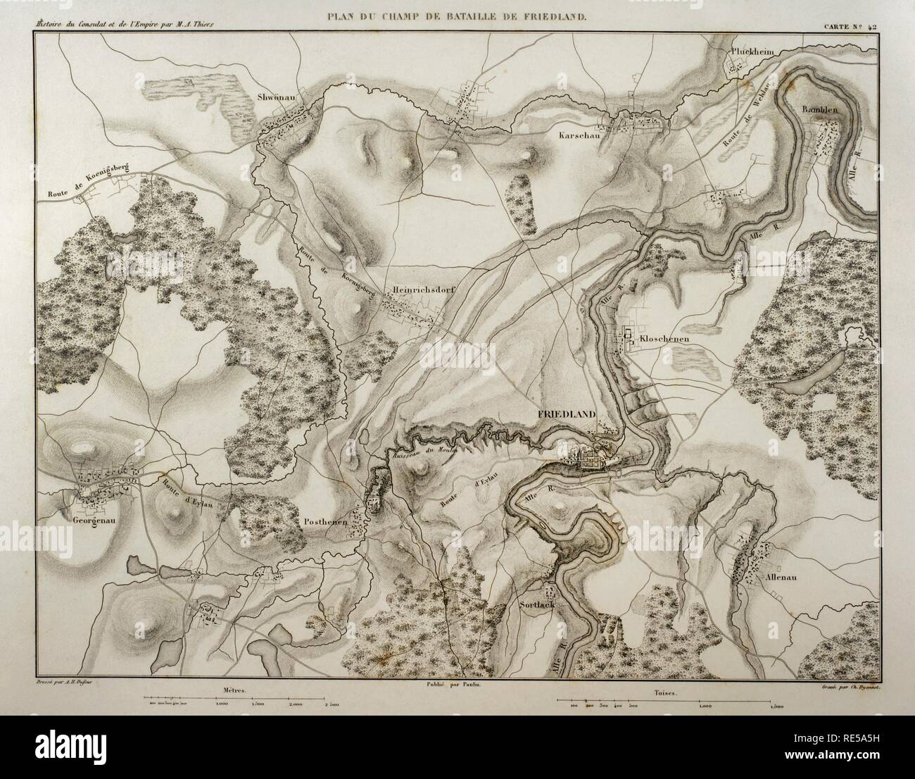 Napoleonic map. Battlefield in Friendland (ancient Prussia, now Russia). 14 June, 1807. North Germany. Atlas de l'Histoire du Consulat et de l'Empire. History of the Consulate and the Empire of France under Napoleon by Marie Joseph Louis Adolphe Thiers (1797-1877). Drawings by Dufour, engravings by Dyonnet. Edited in Paris, 1864. Stock Photohttps://www.alamy.com/image-license-details/?v=1https://www.alamy.com/napoleonic-map-battlefield-in-friendland-ancient-prussia-now-russia-14-june-1807-north-germany-atlas-de-lhistoire-du-consulat-et-de-lempire-history-of-the-consulate-and-the-empire-of-france-under-napoleon-by-marie-joseph-louis-adolphe-thiers-1797-1877-drawings-by-dufour-engravings-by-dyonnet-edited-in-paris-1864-image232457725.html
RMRE5A5H–Napoleonic map. Battlefield in Friendland (ancient Prussia, now Russia). 14 June, 1807. North Germany. Atlas de l'Histoire du Consulat et de l'Empire. History of the Consulate and the Empire of France under Napoleon by Marie Joseph Louis Adolphe Thiers (1797-1877). Drawings by Dufour, engravings by Dyonnet. Edited in Paris, 1864.
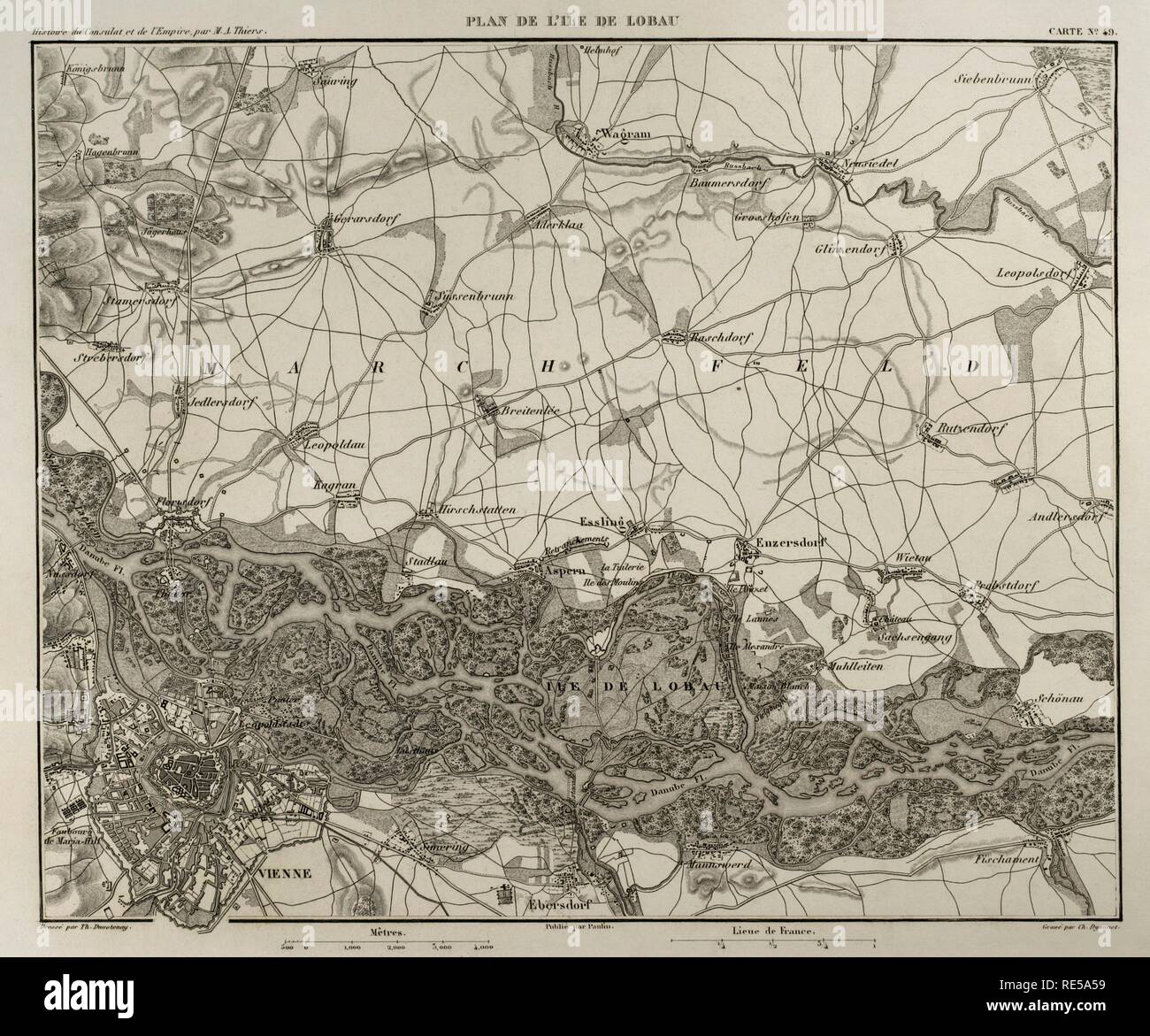 Napoleonic map. Island of Lobau (near Vienna, Austria). Battles were fought on this area during the Napoleonic Wars between Austria and France. Atlas de l'Histoire du Consulat et de l'Empire. History of the Consulate and the Empire of France under Napoleon by Marie Joseph Louis Adolphe Thiers (1797-1877). Drawings by Dufour, engravings by Dyonnet. Edited in Paris, 1864. Stock Photohttps://www.alamy.com/image-license-details/?v=1https://www.alamy.com/napoleonic-map-island-of-lobau-near-vienna-austria-battles-were-fought-on-this-area-during-the-napoleonic-wars-between-austria-and-france-atlas-de-lhistoire-du-consulat-et-de-lempire-history-of-the-consulate-and-the-empire-of-france-under-napoleon-by-marie-joseph-louis-adolphe-thiers-1797-1877-drawings-by-dufour-engravings-by-dyonnet-edited-in-paris-1864-image232457717.html
RMRE5A59–Napoleonic map. Island of Lobau (near Vienna, Austria). Battles were fought on this area during the Napoleonic Wars between Austria and France. Atlas de l'Histoire du Consulat et de l'Empire. History of the Consulate and the Empire of France under Napoleon by Marie Joseph Louis Adolphe Thiers (1797-1877). Drawings by Dufour, engravings by Dyonnet. Edited in Paris, 1864.
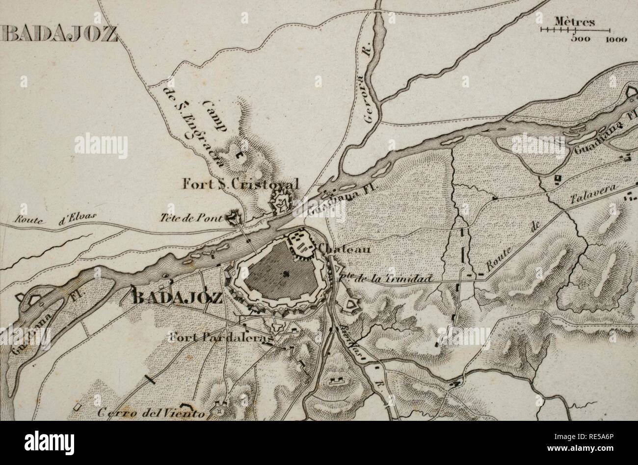 Napoleonic map. City of Badajoz, Extremadura, Spain. Peninsular War. Badajoz was sieged four times between 1811 and 1812 (Napoleonic Wars). Atlas de l'Histoire du Consulat et de l'Empire History of the Consulate and the Empire of France under Napoleon by Marie Joseph Louis Adolphe Thiers (1797-1877). Drawings by Dufour, engravings by Dyonnet. Edited in Paris, 1864. Stock Photohttps://www.alamy.com/image-license-details/?v=1https://www.alamy.com/napoleonic-map-city-of-badajoz-extremadura-spain-peninsular-war-badajoz-was-sieged-four-times-between-1811-and-1812-napoleonic-wars-atlas-de-lhistoire-du-consulat-et-de-lempire-history-of-the-consulate-and-the-empire-of-france-under-napoleon-by-marie-joseph-louis-adolphe-thiers-1797-1877-drawings-by-dufour-engravings-by-dyonnet-edited-in-paris-1864-image232457758.html
RMRE5A6P–Napoleonic map. City of Badajoz, Extremadura, Spain. Peninsular War. Badajoz was sieged four times between 1811 and 1812 (Napoleonic Wars). Atlas de l'Histoire du Consulat et de l'Empire History of the Consulate and the Empire of France under Napoleon by Marie Joseph Louis Adolphe Thiers (1797-1877). Drawings by Dufour, engravings by Dyonnet. Edited in Paris, 1864.
 Napoleonic map. Ciudad Rodrigo (province of Salamanca, Castile and Leon, Spain). During the Peninsulan War the city was besieged twice, 1810 and 1812. Atlas de l'Histoire du Consulat et de l'Empire. History of the Consulate and the Empire of France under Napoleon by Marie Joseph Louis Adolphe Thiers (1797-1877). Drawings by Dufour, engravings by Dyonnet. Edited in Paris, 1864. Stock Photohttps://www.alamy.com/image-license-details/?v=1https://www.alamy.com/napoleonic-map-ciudad-rodrigo-province-of-salamanca-castile-and-leon-spain-during-the-peninsulan-war-the-city-was-besieged-twice-1810-and-1812-atlas-de-lhistoire-du-consulat-et-de-lempire-history-of-the-consulate-and-the-empire-of-france-under-napoleon-by-marie-joseph-louis-adolphe-thiers-1797-1877-drawings-by-dufour-engravings-by-dyonnet-edited-in-paris-1864-image232457850.html
RMRE5AA2–Napoleonic map. Ciudad Rodrigo (province of Salamanca, Castile and Leon, Spain). During the Peninsulan War the city was besieged twice, 1810 and 1812. Atlas de l'Histoire du Consulat et de l'Empire. History of the Consulate and the Empire of France under Napoleon by Marie Joseph Louis Adolphe Thiers (1797-1877). Drawings by Dufour, engravings by Dyonnet. Edited in Paris, 1864.
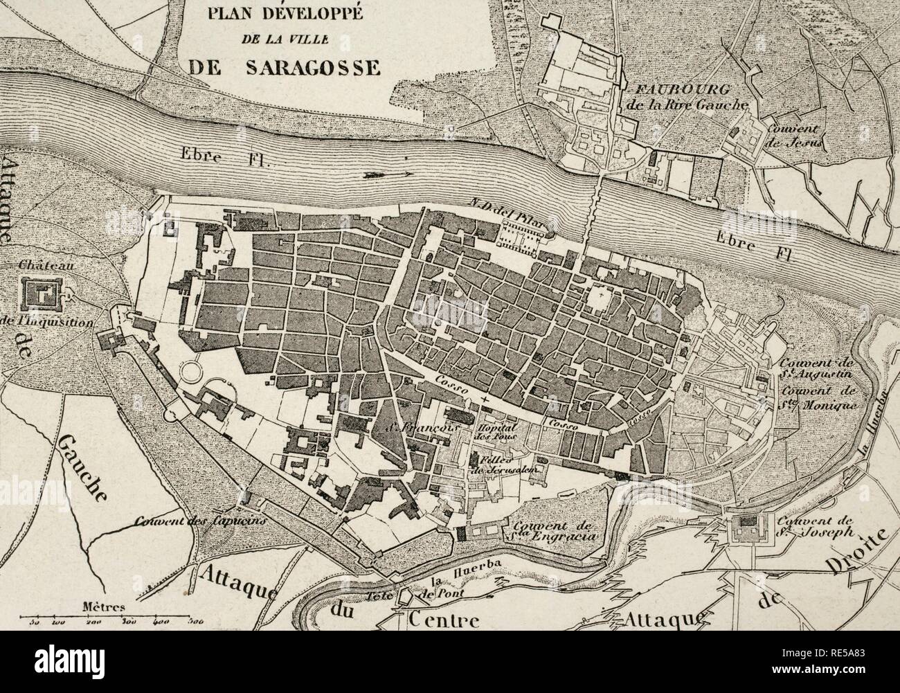 Napoleonic map.City of Saragossa, Aragon, Spain. Edited in 1864. During the War of Spanish Independence, the city suffered two sieges, 1808 and 1809. Atlas de l'Histoire du Consulat et de l'Empire. History of the Consulate and the Empire of France under Napoleon by Marie Joseph Louis Adolphe Thiers (1797-1877). Drawings by Dufour, engravings by Dyonnet. Edited in Paris, 1864. Stock Photohttps://www.alamy.com/image-license-details/?v=1https://www.alamy.com/napoleonic-mapcity-of-saragossa-aragon-spain-edited-in-1864-during-the-war-of-spanish-independence-the-city-suffered-two-sieges-1808-and-1809-atlas-de-lhistoire-du-consulat-et-de-lempire-history-of-the-consulate-and-the-empire-of-france-under-napoleon-by-marie-joseph-louis-adolphe-thiers-1797-1877-drawings-by-dufour-engravings-by-dyonnet-edited-in-paris-1864-image232457795.html
RMRE5A83–Napoleonic map.City of Saragossa, Aragon, Spain. Edited in 1864. During the War of Spanish Independence, the city suffered two sieges, 1808 and 1809. Atlas de l'Histoire du Consulat et de l'Empire. History of the Consulate and the Empire of France under Napoleon by Marie Joseph Louis Adolphe Thiers (1797-1877). Drawings by Dufour, engravings by Dyonnet. Edited in Paris, 1864.
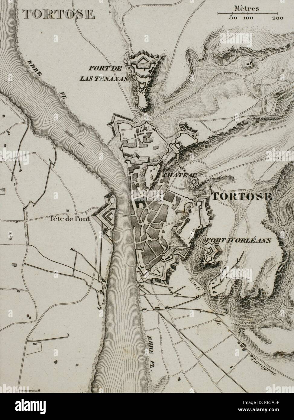 Napoleonic map. City of Tortosa (Catalonia, Spain). French troops sieged the town in December 1810. Peninsular War, part of the Napoleonic Wars. Atlas de l'Histoire du Consulat et de l'Empire. History of the Consulate and the Empire of France under Napoleon by Marie Joseph Louis Adolphe Thiers (1797-1877). Drawings by Dufour, engravings by Dyonnet. Edited in Paris, 1864. Stock Photohttps://www.alamy.com/image-license-details/?v=1https://www.alamy.com/napoleonic-map-city-of-tortosa-catalonia-spain-french-troops-sieged-the-town-in-december-1810-peninsular-war-part-of-the-napoleonic-wars-atlas-de-lhistoire-du-consulat-et-de-lempire-history-of-the-consulate-and-the-empire-of-france-under-napoleon-by-marie-joseph-louis-adolphe-thiers-1797-1877-drawings-by-dufour-engravings-by-dyonnet-edited-in-paris-1864-image232457723.html
RMRE5A5F–Napoleonic map. City of Tortosa (Catalonia, Spain). French troops sieged the town in December 1810. Peninsular War, part of the Napoleonic Wars. Atlas de l'Histoire du Consulat et de l'Empire. History of the Consulate and the Empire of France under Napoleon by Marie Joseph Louis Adolphe Thiers (1797-1877). Drawings by Dufour, engravings by Dyonnet. Edited in Paris, 1864.
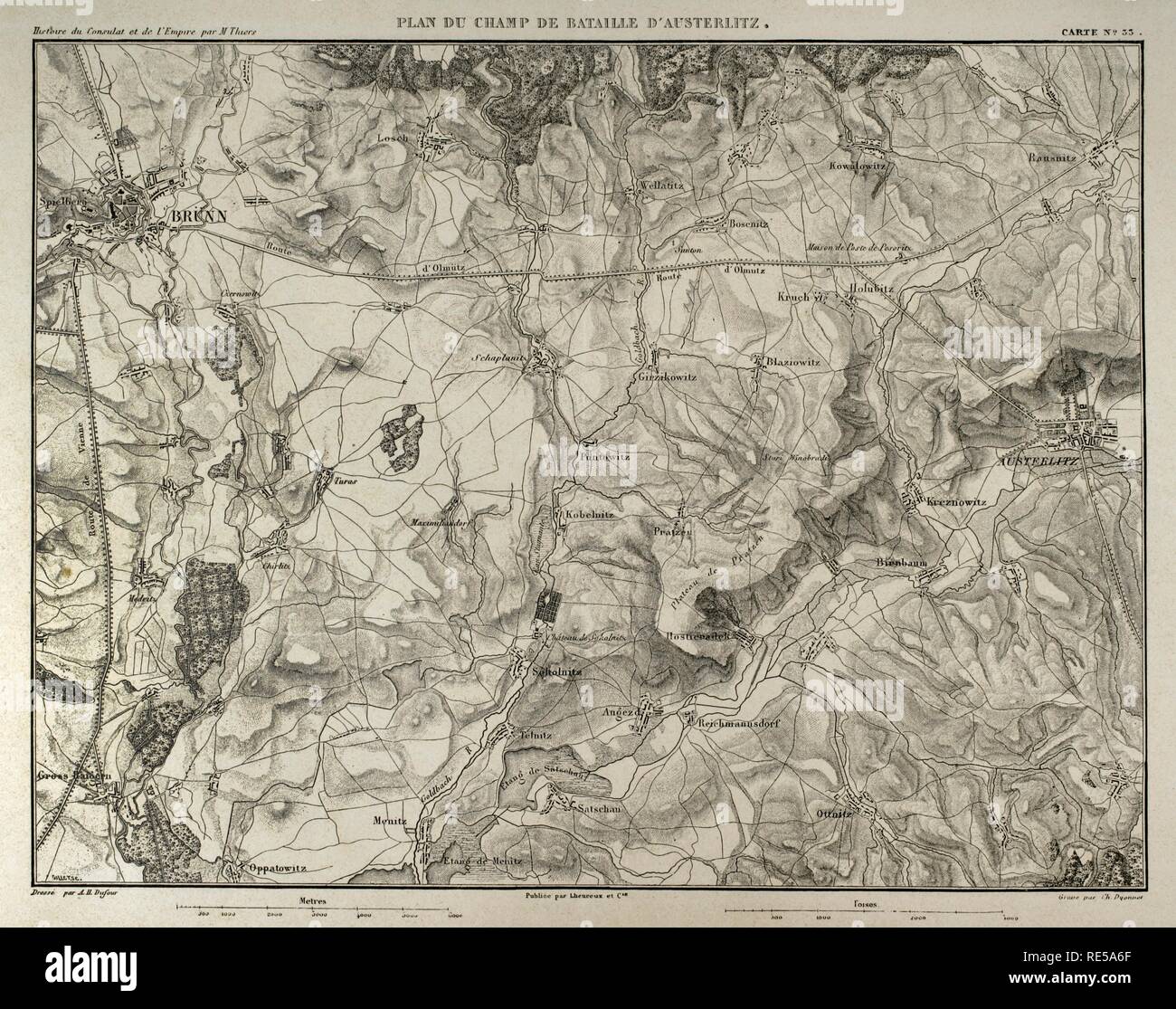 Napoleonic map. Battle of Austerlitz or Battle of the Three Emperors (2nd December 1805). Part of War of the Third Coalition (Napoleonic Wars). French Victory. Atlas de l'Histoire du Consulat et de l'Empire. History of the Consulate and the Empire of France under Napoleon by Marie Joseph Louis Adolphe Thiers (1797-1877). Drawings by Dufour, engravings by Dyonnet. Edited in Paris, 1864. Stock Photohttps://www.alamy.com/image-license-details/?v=1https://www.alamy.com/napoleonic-map-battle-of-austerlitz-or-battle-of-the-three-emperors-2nd-december-1805-part-of-war-of-the-third-coalition-napoleonic-wars-french-victory-atlas-de-lhistoire-du-consulat-et-de-lempire-history-of-the-consulate-and-the-empire-of-france-under-napoleon-by-marie-joseph-louis-adolphe-thiers-1797-1877-drawings-by-dufour-engravings-by-dyonnet-edited-in-paris-1864-image232457751.html
RMRE5A6F–Napoleonic map. Battle of Austerlitz or Battle of the Three Emperors (2nd December 1805). Part of War of the Third Coalition (Napoleonic Wars). French Victory. Atlas de l'Histoire du Consulat et de l'Empire. History of the Consulate and the Empire of France under Napoleon by Marie Joseph Louis Adolphe Thiers (1797-1877). Drawings by Dufour, engravings by Dyonnet. Edited in Paris, 1864.
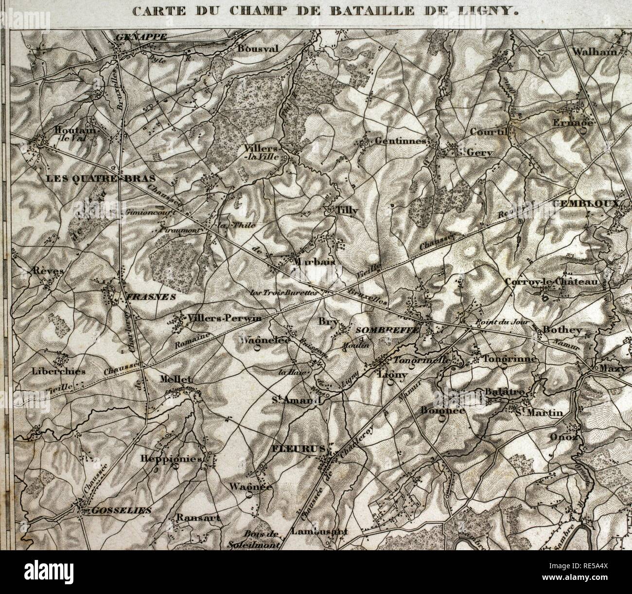 Map of the battlefield of Ligny, Belgium (16 June 1815). Part of the Waterloo Campaign. Commanders: France (Napoleon I), Prussia (Gebhard von Blucher). It was the last victory of Napoleon Bonaparte. Atlas de l'Histoire du Consulat et de l'Empire. History of the Consulate and the Empire of France under Napoleon by Marie Joseph Louis Adolphe Thiers (1797-1877). Drawings by Dufour, engravings by Dyonnet. Edited in Paris, 1864. Stock Photohttps://www.alamy.com/image-license-details/?v=1https://www.alamy.com/map-of-the-battlefield-of-ligny-belgium-16-june-1815-part-of-the-waterloo-campaign-commanders-france-napoleon-i-prussia-gebhard-von-blucher-it-was-the-last-victory-of-napoleon-bonaparte-atlas-de-lhistoire-du-consulat-et-de-lempire-history-of-the-consulate-and-the-empire-of-france-under-napoleon-by-marie-joseph-louis-adolphe-thiers-1797-1877-drawings-by-dufour-engravings-by-dyonnet-edited-in-paris-1864-image232457706.html
RMRE5A4X–Map of the battlefield of Ligny, Belgium (16 June 1815). Part of the Waterloo Campaign. Commanders: France (Napoleon I), Prussia (Gebhard von Blucher). It was the last victory of Napoleon Bonaparte. Atlas de l'Histoire du Consulat et de l'Empire. History of the Consulate and the Empire of France under Napoleon by Marie Joseph Louis Adolphe Thiers (1797-1877). Drawings by Dufour, engravings by Dyonnet. Edited in Paris, 1864.
 Napoleonic map. Battlefield of Bautzen (20-21 May 1813). A combined Russian-Prussian army was pushed back by Napoleon I. French victory. Atlas de l'Histoire du Consulat et de l'Empire. History of the Consulate and the Empire of France under Napoleon by Marie Joseph Louis Adolphe Thiers (1797-1877). Drawings by Dufour, engravings by Dyonnet. Edited in Paris, 1864. Stock Photohttps://www.alamy.com/image-license-details/?v=1https://www.alamy.com/napoleonic-map-battlefield-of-bautzen-20-21-may-1813-a-combined-russian-prussian-army-was-pushed-back-by-napoleon-i-french-victory-atlas-de-lhistoire-du-consulat-et-de-lempire-history-of-the-consulate-and-the-empire-of-france-under-napoleon-by-marie-joseph-louis-adolphe-thiers-1797-1877-drawings-by-dufour-engravings-by-dyonnet-edited-in-paris-1864-image232457754.html
RMRE5A6J–Napoleonic map. Battlefield of Bautzen (20-21 May 1813). A combined Russian-Prussian army was pushed back by Napoleon I. French victory. Atlas de l'Histoire du Consulat et de l'Empire. History of the Consulate and the Empire of France under Napoleon by Marie Joseph Louis Adolphe Thiers (1797-1877). Drawings by Dufour, engravings by Dyonnet. Edited in Paris, 1864.
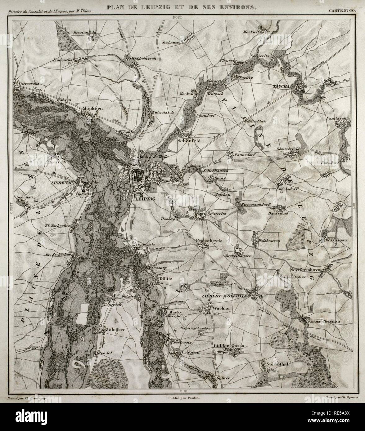 Napoleonic map. City of Leipzig, Saxony, Germany. The Battle of the Nations or Battle of Leipzig took place in 1813, In the context of the Napoleonic wars, being the first French defeat. Atlas de l'Histoire du Consulat et de l'Empire. History of the Consulate and the Empire of France under Napoleon by Marie Joseph Louis Adolphe Thiers (1797-1877). Drawings by Dufour, engravings by Dyonnet. Edited in Paris, 1864. Stock Photohttps://www.alamy.com/image-license-details/?v=1https://www.alamy.com/napoleonic-map-city-of-leipzig-saxony-germany-the-battle-of-the-nations-or-battle-of-leipzig-took-place-in-1813-in-the-context-of-the-napoleonic-wars-being-the-first-french-defeat-atlas-de-lhistoire-du-consulat-et-de-lempire-history-of-the-consulate-and-the-empire-of-france-under-napoleon-by-marie-joseph-louis-adolphe-thiers-1797-1877-drawings-by-dufour-engravings-by-dyonnet-edited-in-paris-1864-image232457818.html
RMRE5A8X–Napoleonic map. City of Leipzig, Saxony, Germany. The Battle of the Nations or Battle of Leipzig took place in 1813, In the context of the Napoleonic wars, being the first French defeat. Atlas de l'Histoire du Consulat et de l'Empire. History of the Consulate and the Empire of France under Napoleon by Marie Joseph Louis Adolphe Thiers (1797-1877). Drawings by Dufour, engravings by Dyonnet. Edited in Paris, 1864.
 Napoleonic map. City of Lleida (Catalonia, Spain). During The Peninsular War (Napoleonic Wars) the city of Lerida was besieged on 13 May, 1810 by the French army. French victory. Atlas de l'Histoire du Consulat et de l'Empire. History of the Consulate and the Empire of France under Napoleon by Marie Joseph Louis Adolphe Thiers (1797-1877). Drawings by Dufour, engravings by Dyonnet. Edited in Paris, 1864. Stock Photohttps://www.alamy.com/image-license-details/?v=1https://www.alamy.com/napoleonic-map-city-of-lleida-catalonia-spain-during-the-peninsular-war-napoleonic-wars-the-city-of-lerida-was-besieged-on-13-may-1810-by-the-french-army-french-victory-atlas-de-lhistoire-du-consulat-et-de-lempire-history-of-the-consulate-and-the-empire-of-france-under-napoleon-by-marie-joseph-louis-adolphe-thiers-1797-1877-drawings-by-dufour-engravings-by-dyonnet-edited-in-paris-1864-image232457796.html
RMRE5A84–Napoleonic map. City of Lleida (Catalonia, Spain). During The Peninsular War (Napoleonic Wars) the city of Lerida was besieged on 13 May, 1810 by the French army. French victory. Atlas de l'Histoire du Consulat et de l'Empire. History of the Consulate and the Empire of France under Napoleon by Marie Joseph Louis Adolphe Thiers (1797-1877). Drawings by Dufour, engravings by Dyonnet. Edited in Paris, 1864.
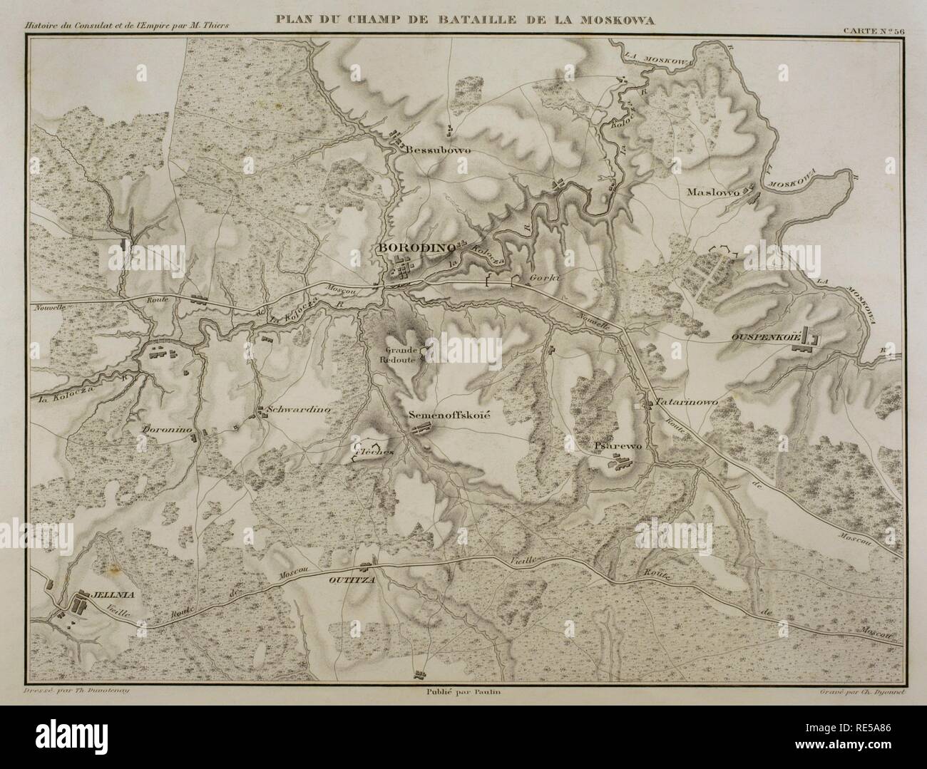 Napoleonic map. Battle of Borodino, 7 September 1812, during the French invasion of Russia. Battlefield. Napoleonic Wars. Confrontation between French and Russian armies. French tactical victory. Atlas de l'Histoire du Consulat et de l'Empire. History of the Consulate and the Empire of France under Napoleon by Marie Joseph Louis Adolphe Thiers (1797-1877). Drawings by Dufour, engravings by Dyonnet. Edited in Paris, 1864. Stock Photohttps://www.alamy.com/image-license-details/?v=1https://www.alamy.com/napoleonic-map-battle-of-borodino-7-september-1812-during-the-french-invasion-of-russia-battlefield-napoleonic-wars-confrontation-between-french-and-russian-armies-french-tactical-victory-atlas-de-lhistoire-du-consulat-et-de-lempire-history-of-the-consulate-and-the-empire-of-france-under-napoleon-by-marie-joseph-louis-adolphe-thiers-1797-1877-drawings-by-dufour-engravings-by-dyonnet-edited-in-paris-1864-image232457798.html
RMRE5A86–Napoleonic map. Battle of Borodino, 7 September 1812, during the French invasion of Russia. Battlefield. Napoleonic Wars. Confrontation between French and Russian armies. French tactical victory. Atlas de l'Histoire du Consulat et de l'Empire. History of the Consulate and the Empire of France under Napoleon by Marie Joseph Louis Adolphe Thiers (1797-1877). Drawings by Dufour, engravings by Dyonnet. Edited in Paris, 1864.
 Map of the surroundings of Alessandria della Paglia and the plain of Marengo (Italian Piedmont). In this area took place the Battle of Marengo in 1800, during the War of the Second Coalition, between French and Austrian troops. Atlas de l'Histoire du Consulat et de l'Empire. History of the Consulate and the Empire of France under Napoleon by Marie Joseph Louis Adolphe Thiers (1797-1877). Drawings by Dufour, engravings by Dyonnet. Edited in Paris, 1864. Stock Photohttps://www.alamy.com/image-license-details/?v=1https://www.alamy.com/map-of-the-surroundings-of-alessandria-della-paglia-and-the-plain-of-marengo-italian-piedmont-in-this-area-took-place-the-battle-of-marengo-in-1800-during-the-war-of-the-second-coalition-between-french-and-austrian-troops-atlas-de-lhistoire-du-consulat-et-de-lempire-history-of-the-consulate-and-the-empire-of-france-under-napoleon-by-marie-joseph-louis-adolphe-thiers-1797-1877-drawings-by-dufour-engravings-by-dyonnet-edited-in-paris-1864-image232457802.html
RMRE5A8A–Map of the surroundings of Alessandria della Paglia and the plain of Marengo (Italian Piedmont). In this area took place the Battle of Marengo in 1800, during the War of the Second Coalition, between French and Austrian troops. Atlas de l'Histoire du Consulat et de l'Empire. History of the Consulate and the Empire of France under Napoleon by Marie Joseph Louis Adolphe Thiers (1797-1877). Drawings by Dufour, engravings by Dyonnet. Edited in Paris, 1864.
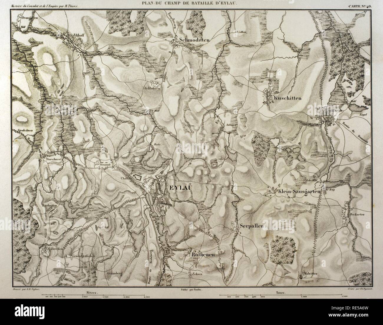 Map of battlefield of Eylau (ancient Prussian now Russia). 7th and 8 th February 1807. Belligerents: French Empire and Russian Empire. It was a part of the War of the Fourth Coalition, in the context of Napoleonic Wars. Atlas de l'Histoire du Consulat et de l'Empire. History of the Consulate and the Empire of France under Napoleon by Marie Joseph Louis Adolphe Thiers (1797-1877). Drawings by Dufour, engravings by Dyonnet. Edited in Paris, 1864. Stock Photohttps://www.alamy.com/image-license-details/?v=1https://www.alamy.com/map-of-battlefield-of-eylau-ancient-prussian-now-russia-7th-and-8-th-february-1807-belligerents-french-empire-and-russian-empire-it-was-a-part-of-the-war-of-the-fourth-coalition-in-the-context-of-napoleonic-wars-atlas-de-lhistoire-du-consulat-et-de-lempire-history-of-the-consulate-and-the-empire-of-france-under-napoleon-by-marie-joseph-louis-adolphe-thiers-1797-1877-drawings-by-dufour-engravings-by-dyonnet-edited-in-paris-1864-image232457761.html
RMRE5A6W–Map of battlefield of Eylau (ancient Prussian now Russia). 7th and 8 th February 1807. Belligerents: French Empire and Russian Empire. It was a part of the War of the Fourth Coalition, in the context of Napoleonic Wars. Atlas de l'Histoire du Consulat et de l'Empire. History of the Consulate and the Empire of France under Napoleon by Marie Joseph Louis Adolphe Thiers (1797-1877). Drawings by Dufour, engravings by Dyonnet. Edited in Paris, 1864.
 Napoleonic map. Banks of the Berezina river (Belarus). Battle of Berezina. It took place from 26 to 29 November 1812, between the French army of Napoleon, retreating after his invasion of Russia and crossing the Berezina (near Borisov, Belarus) and the Russian troops. Atlas de l'Histoire du Consulat et de l'Empire. History of the Consulate and the Empire of France under Napoleon by Marie Joseph Louis Adolphe Thiers (1797-1877). Drawings by Dufour, engravings by Dyonnet. Edited in Paris, 1864. Stock Photohttps://www.alamy.com/image-license-details/?v=1https://www.alamy.com/napoleonic-map-banks-of-the-berezina-river-belarus-battle-of-berezina-it-took-place-from-26-to-29-november-1812-between-the-french-army-of-napoleon-retreating-after-his-invasion-of-russia-and-crossing-the-berezina-near-borisov-belarus-and-the-russian-troops-atlas-de-lhistoire-du-consulat-et-de-lempire-history-of-the-consulate-and-the-empire-of-france-under-napoleon-by-marie-joseph-louis-adolphe-thiers-1797-1877-drawings-by-dufour-engravings-by-dyonnet-edited-in-paris-1864-image232457709.html
RMRE5A51–Napoleonic map. Banks of the Berezina river (Belarus). Battle of Berezina. It took place from 26 to 29 November 1812, between the French army of Napoleon, retreating after his invasion of Russia and crossing the Berezina (near Borisov, Belarus) and the Russian troops. Atlas de l'Histoire du Consulat et de l'Empire. History of the Consulate and the Empire of France under Napoleon by Marie Joseph Louis Adolphe Thiers (1797-1877). Drawings by Dufour, engravings by Dyonnet. Edited in Paris, 1864.
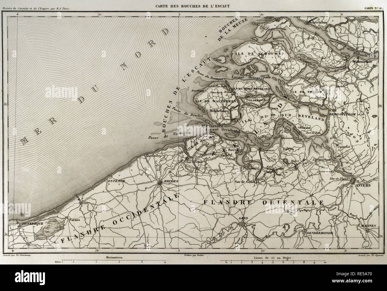 Napoleonic map. Mouth of Scheldt river (Bouches-de-L'Escaut). It was a department of the First French Empire which was formed in 1810, when the Kingdom of Holland was annexed by France. (Netherlands). Scheldt is an European river which born in France, crosses Belgium and empties into the North Sea forming an estuary. Atlas de l'Histoire du Consulat et de l'Empire. History of the Consulate and the Empire of France under Napoleon by Marie Joseph Louis Adolphe Thiers (1797-1877). Drawings by Dufour, engravings by Dyonnet. Edited in Paris, 1864. Stock Photohttps://www.alamy.com/image-license-details/?v=1https://www.alamy.com/napoleonic-map-mouth-of-scheldt-river-bouches-de-lescaut-it-was-a-department-of-the-first-french-empire-which-was-formed-in-1810-when-the-kingdom-of-holland-was-annexed-by-france-netherlands-scheldt-is-an-european-river-which-born-in-france-crosses-belgium-and-empties-into-the-north-sea-forming-an-estuary-atlas-de-lhistoire-du-consulat-et-de-lempire-history-of-the-consulate-and-the-empire-of-france-under-napoleon-by-marie-joseph-louis-adolphe-thiers-1797-1877-drawings-by-dufour-engravings-by-dyonnet-edited-in-paris-1864-image232457764.html
RMRE5A70–Napoleonic map. Mouth of Scheldt river (Bouches-de-L'Escaut). It was a department of the First French Empire which was formed in 1810, when the Kingdom of Holland was annexed by France. (Netherlands). Scheldt is an European river which born in France, crosses Belgium and empties into the North Sea forming an estuary. Atlas de l'Histoire du Consulat et de l'Empire. History of the Consulate and the Empire of France under Napoleon by Marie Joseph Louis Adolphe Thiers (1797-1877). Drawings by Dufour, engravings by Dyonnet. Edited in Paris, 1864.
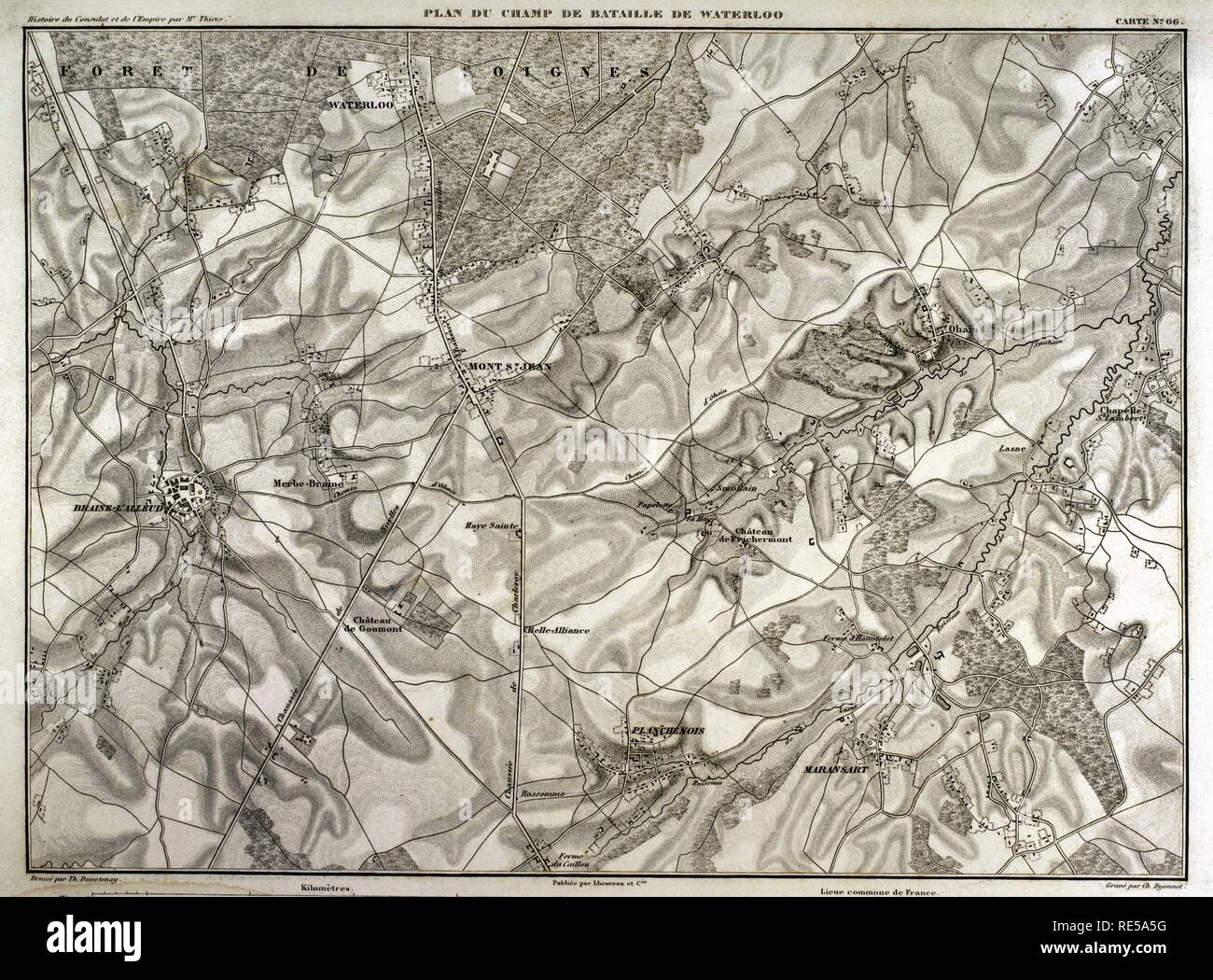 Napoleonic map. Battlefield of Waterloo (current territory of Belgium) where the battle took place on June 18, 1815. Confrontation between French troops (led by Napoleon I) and British, Dutch and German troops (led by the Duke of Wellington) and the Prussian army (directed by Gebhard von Blucher). Victory of the Seventh Coalition. Atlas de l'Histoire du Consulat et de l'Empire. History of the Consulate and the Empire of France under Napoleon by Marie Joseph Louis Adolphe Thiers (1797-1877). Drawings by Dufour, engravings by Dyonnet. Edited in Paris, 1864. Stock Photohttps://www.alamy.com/image-license-details/?v=1https://www.alamy.com/napoleonic-map-battlefield-of-waterloo-current-territory-of-belgium-where-the-battle-took-place-on-june-18-1815-confrontation-between-french-troops-led-by-napoleon-i-and-british-dutch-and-german-troops-led-by-the-duke-of-wellington-and-the-prussian-army-directed-by-gebhard-von-blucher-victory-of-the-seventh-coalition-atlas-de-lhistoire-du-consulat-et-de-lempire-history-of-the-consulate-and-the-empire-of-france-under-napoleon-by-marie-joseph-louis-adolphe-thiers-1797-1877-drawings-by-dufour-engravings-by-dyonnet-edited-in-paris-1864-image232457724.html
RMRE5A5G–Napoleonic map. Battlefield of Waterloo (current territory of Belgium) where the battle took place on June 18, 1815. Confrontation between French troops (led by Napoleon I) and British, Dutch and German troops (led by the Duke of Wellington) and the Prussian army (directed by Gebhard von Blucher). Victory of the Seventh Coalition. Atlas de l'Histoire du Consulat et de l'Empire. History of the Consulate and the Empire of France under Napoleon by Marie Joseph Louis Adolphe Thiers (1797-1877). Drawings by Dufour, engravings by Dyonnet. Edited in Paris, 1864.
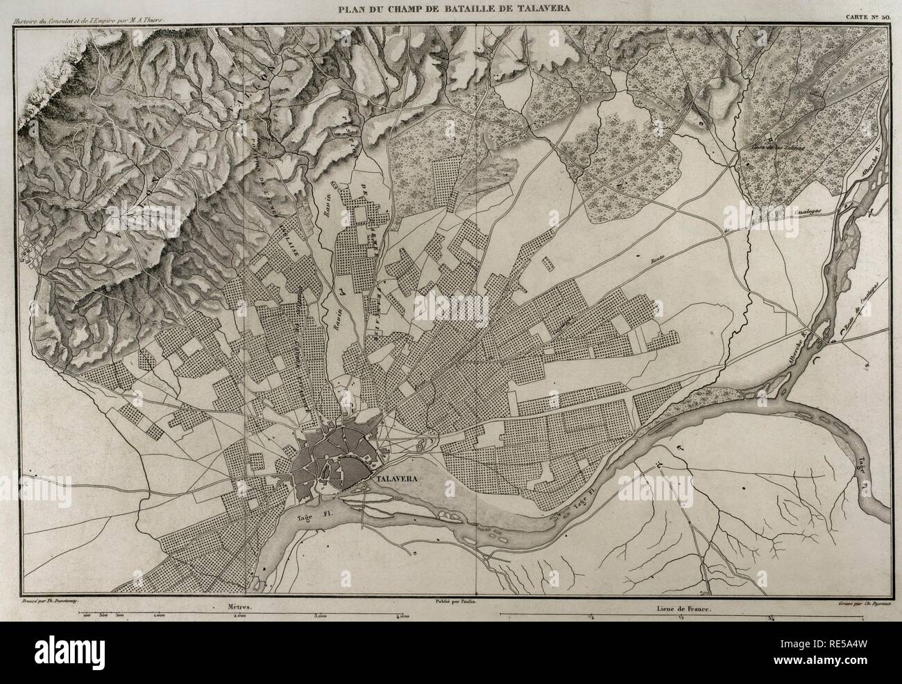 Napoleonic map. Battlefield of Talavera (Talavera de la Reina, province of Toledo, Castile-La Mancha, Spain). The Peninsular War. The Battle of Talavera, 27th-28th July 1809. It tooks place outside the town between the French army against allied forces (United Kingdom and Spain). Atlas de l'Histoire du Consulat et de l'Empire. History of the Consulate and the Empire of France under Napoleon by Marie Joseph Louis Adolphe Thiers (1797-1877). Drawings by Dufour, engravings by Dyonnet. Edited in Paris, 1864. Stock Photohttps://www.alamy.com/image-license-details/?v=1https://www.alamy.com/napoleonic-map-battlefield-of-talavera-talavera-de-la-reina-province-of-toledo-castile-la-mancha-spain-the-peninsular-war-the-battle-of-talavera-27th-28th-july-1809-it-tooks-place-outside-the-town-between-the-french-army-against-allied-forces-united-kingdom-and-spain-atlas-de-lhistoire-du-consulat-et-de-lempire-history-of-the-consulate-and-the-empire-of-france-under-napoleon-by-marie-joseph-louis-adolphe-thiers-1797-1877-drawings-by-dufour-engravings-by-dyonnet-edited-in-paris-1864-image232457705.html
RMRE5A4W–Napoleonic map. Battlefield of Talavera (Talavera de la Reina, province of Toledo, Castile-La Mancha, Spain). The Peninsular War. The Battle of Talavera, 27th-28th July 1809. It tooks place outside the town between the French army against allied forces (United Kingdom and Spain). Atlas de l'Histoire du Consulat et de l'Empire. History of the Consulate and the Empire of France under Napoleon by Marie Joseph Louis Adolphe Thiers (1797-1877). Drawings by Dufour, engravings by Dyonnet. Edited in Paris, 1864.
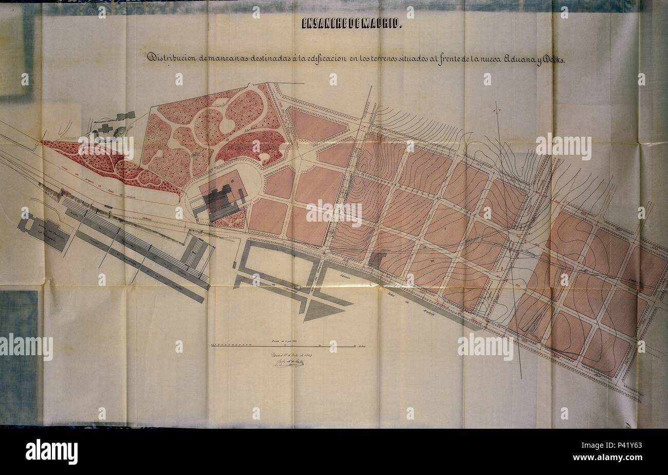 PLANO DE ZONA DE MADRID SIG 10-84-91 19/7/1864. Author: Carlos María de Castro (1810-1893). Location: ARCHIVO HISTORICO DE LA VILLA, SPAIN. Stock Photohttps://www.alamy.com/image-license-details/?v=1https://www.alamy.com/plano-de-zona-de-madrid-sig-10-84-91-1971864-author-carlos-mara-de-castro-1810-1893-location-archivo-historico-de-la-villa-spain-image209026331.html
RMP41Y63–PLANO DE ZONA DE MADRID SIG 10-84-91 19/7/1864. Author: Carlos María de Castro (1810-1893). Location: ARCHIVO HISTORICO DE LA VILLA, SPAIN.
 PLANO DE ZONA DE MADRID SIG 10-84-91 19/7/1864 (DET 69915). Author: Carlos María de Castro (1810-1893). Location: ARCHIVO HISTORICO DE LA VILLA, SPAIN. Stock Photohttps://www.alamy.com/image-license-details/?v=1https://www.alamy.com/plano-de-zona-de-madrid-sig-10-84-91-1971864-det-69915-author-carlos-mara-de-castro-1810-1893-location-archivo-historico-de-la-villa-spain-image209026320.html
RMP41Y5M–PLANO DE ZONA DE MADRID SIG 10-84-91 19/7/1864 (DET 69915). Author: Carlos María de Castro (1810-1893). Location: ARCHIVO HISTORICO DE LA VILLA, SPAIN.
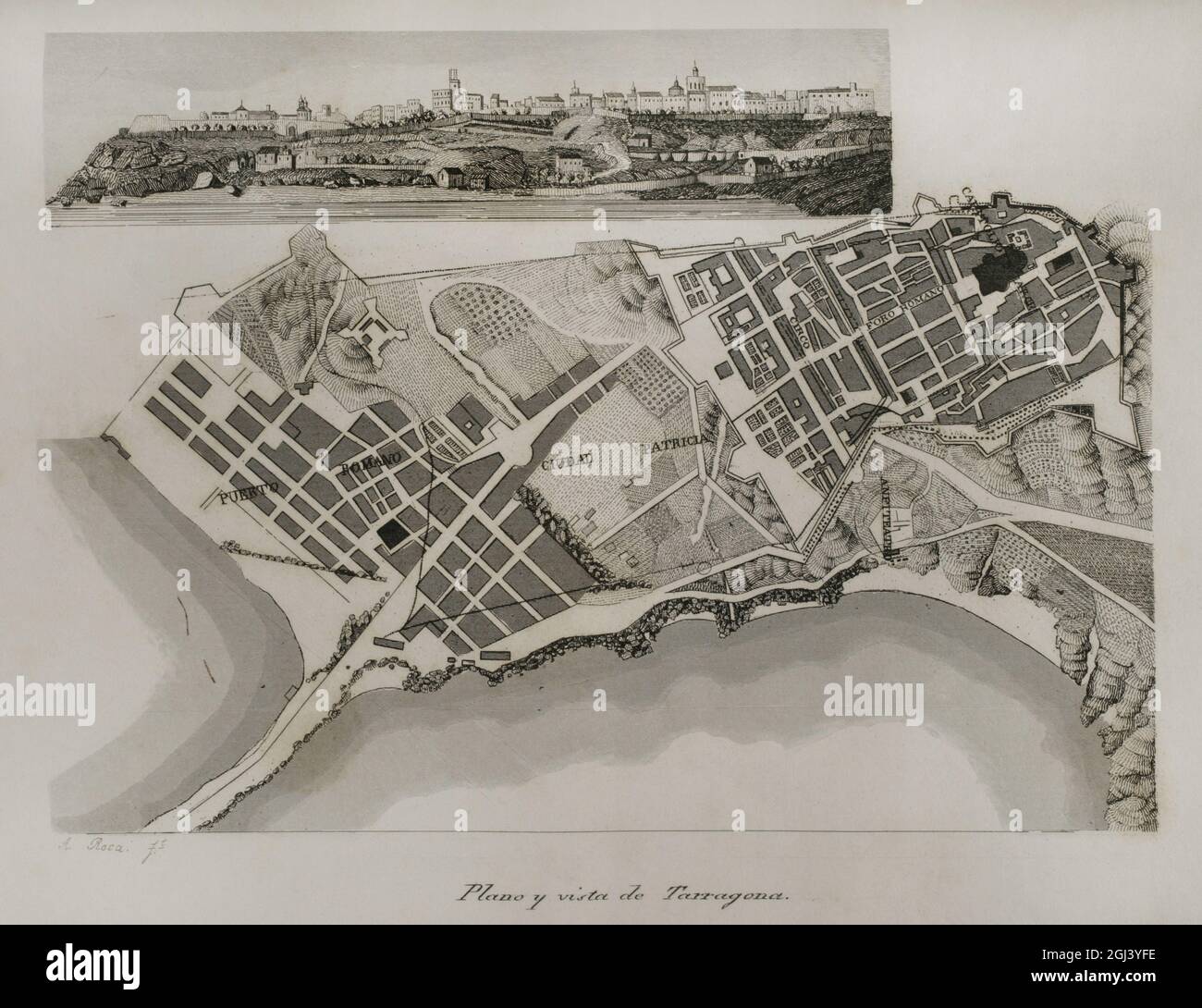 Spain, Catalonia. Map of the city of Tarragona. Engraving by Antonio Roca. Las Glorias Nacionales. Volume I, Madrid-Barcelona edition, 1852. Author: Antonio Roca Sallent (1814-1864). Spanish engraver. Stock Photohttps://www.alamy.com/image-license-details/?v=1https://www.alamy.com/spain-catalonia-map-of-the-city-of-tarragona-engraving-by-antonio-roca-las-glorias-nacionales-volume-i-madrid-barcelona-edition-1852-author-antonio-roca-sallent-1814-1864-spanish-engraver-image441410466.html
RM2GJ3YFE–Spain, Catalonia. Map of the city of Tarragona. Engraving by Antonio Roca. Las Glorias Nacionales. Volume I, Madrid-Barcelona edition, 1852. Author: Antonio Roca Sallent (1814-1864). Spanish engraver.
 Ancient Age. A Roman camp at the time of the Roman invasion of Spain. Engraving by Antonio Roca. Las Glorias Nacionales. Volume I, Madrid-Barcelona edition, 1852. Author: Antonio Roca Sallent (1814-1864). Spanish engraver. Stock Photohttps://www.alamy.com/image-license-details/?v=1https://www.alamy.com/ancient-age-a-roman-camp-at-the-time-of-the-roman-invasion-of-spain-engraving-by-antonio-roca-las-glorias-nacionales-volume-i-madrid-barcelona-edition-1852-author-antonio-roca-sallent-1814-1864-spanish-engraver-image441410469.html
RM2GJ3YFH–Ancient Age. A Roman camp at the time of the Roman invasion of Spain. Engraving by Antonio Roca. Las Glorias Nacionales. Volume I, Madrid-Barcelona edition, 1852. Author: Antonio Roca Sallent (1814-1864). Spanish engraver.
 Napoleonic map. Siege of Tarragona (Catalonia, Spain). Tarragona was besieged from 5 May to 29 June 1811. Troops belonging to the French Army of Aragon, commanded by General Suchet, fought against a Spanish garrison led by Lieutenant General Juan Senen de Contreras. A British naval squadron commanded by Admiral Edward Codrington harassed the French besiegers with cannon fire. The city was assaulted and occupied. The Peninsular War. Atlas de l'Histoire du Consulat et de l'Empire. History of the Consulate and the Empire of France under Napoleon by Marie Joseph Louis Adolphe Thiers (1797-1877). D Stock Photohttps://www.alamy.com/image-license-details/?v=1https://www.alamy.com/napoleonic-map-siege-of-tarragona-catalonia-spain-tarragona-was-besieged-from-5-may-to-29-june-1811-troops-belonging-to-the-french-army-of-aragon-commanded-by-general-suchet-fought-against-a-spanish-garrison-led-by-lieutenant-general-juan-senen-de-contreras-a-british-naval-squadron-commanded-by-admiral-edward-codrington-harassed-the-french-besiegers-with-cannon-fire-the-city-was-assaulted-and-occupied-the-peninsular-war-atlas-de-lhistoire-du-consulat-et-de-lempire-history-of-the-consulate-and-the-empire-of-france-under-napoleon-by-marie-joseph-louis-adolphe-thiers-1797-1877-d-image232457794.html
RMRE5A82–Napoleonic map. Siege of Tarragona (Catalonia, Spain). Tarragona was besieged from 5 May to 29 June 1811. Troops belonging to the French Army of Aragon, commanded by General Suchet, fought against a Spanish garrison led by Lieutenant General Juan Senen de Contreras. A British naval squadron commanded by Admiral Edward Codrington harassed the French besiegers with cannon fire. The city was assaulted and occupied. The Peninsular War. Atlas de l'Histoire du Consulat et de l'Empire. History of the Consulate and the Empire of France under Napoleon by Marie Joseph Louis Adolphe Thiers (1797-1877). D